Aussie Group Flights Team - Nav Exercise: Avalon to Warrnambool via the 12 Apostles

Welcome to another VFR event, where we fly from Avalon(YMAV) to Warrnambool(YWBL) in search of the 12 Apostles. We will land at Apollo Bay for our 10 minute break. In this event we will use the actual VFR maps that pilots use to navigate along the route. Your aircraft will be the lowly C152 and all you need is some fuel, a stop watch and some charts (which I will provide).

We will fly in REAL weather and I will issue the required amended headings to account for the prevailing winds as reported prior to the event.

Route: AV TQY ANG LORN APO Cape Otway Gellibrand Lower POMP PBH WBL
Alt: A025 (2,500’)

IMG_7243

Details to follow. Hope you can join us.

PLEASE NOTE: THIS INFORMATION IS FOR FLIGHT SIMULATION USE ONLY.

Regards, Paul

ATTENTION Aussie Flight Group Participants …

Group Flight: 2022-04-08T10:00:00Z

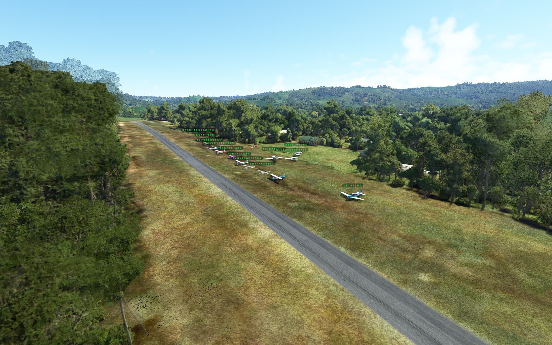
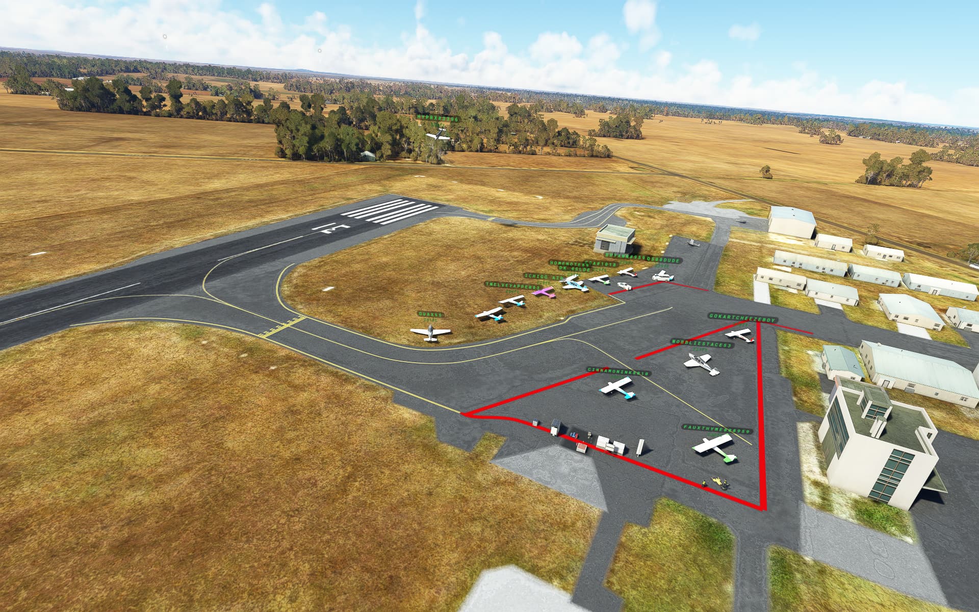
As there are no parking positions at the departure airport, please spawn and move off to allow others to spawn.

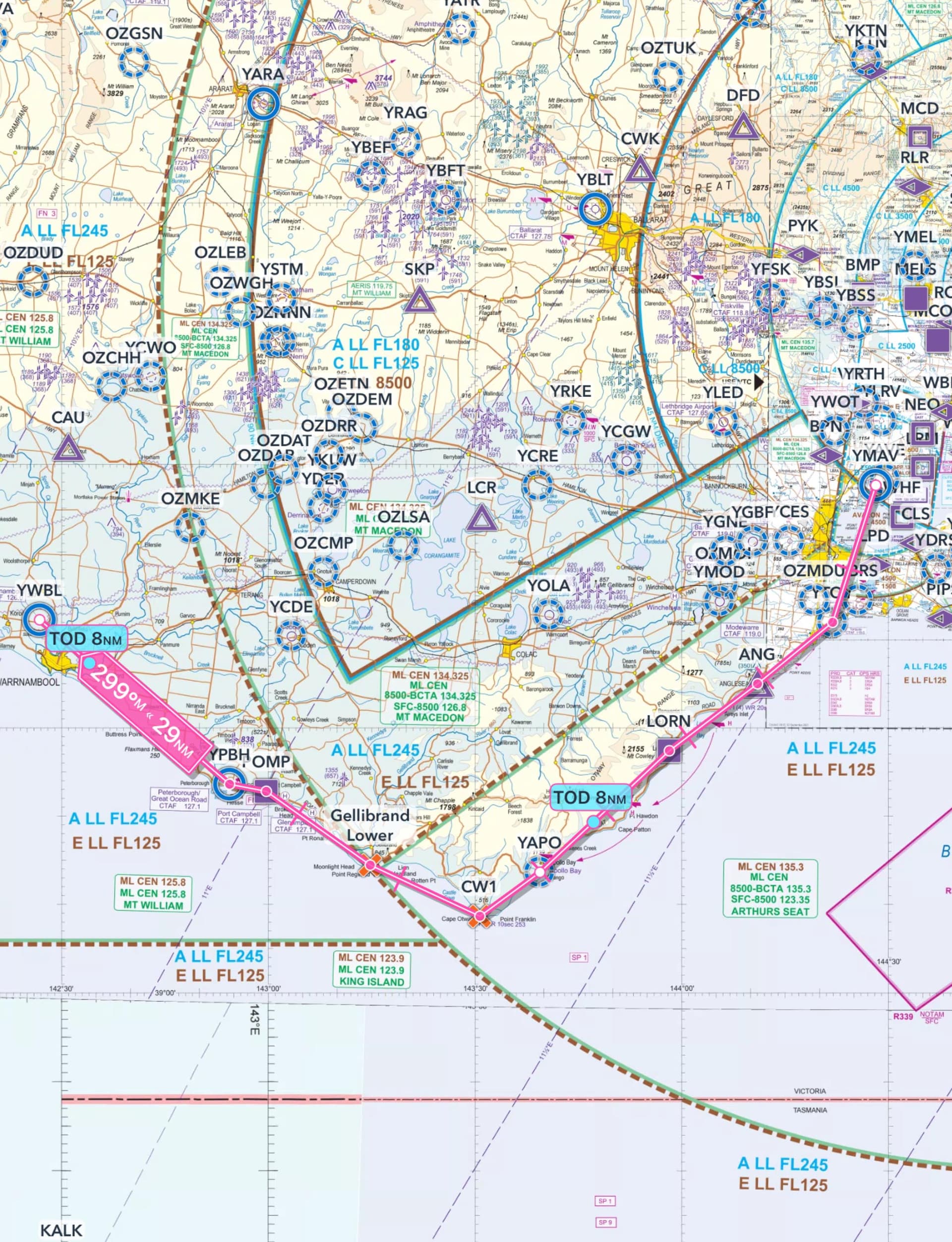
Route: AV TQY ANG LORN APO Cape Otway Gellibrand Lower POMP PBH WBL.

What to look out for on the Charts.

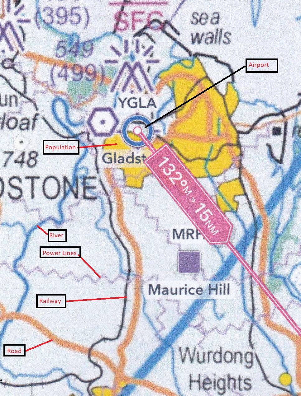
Note the indication for Roads, Rivers, Railways, High Tension Power Lines, Airports and built up population areas.

Note: When determining your position on the chart, don’t rely on one point of reference to suggest your position. Where possible pick up to three visual references, if available, to determine your position.

Altitude: The route can be flown up to 2,500’ to be clear of terrain.

Airport details:
Avalon(YMAV)
Elev: 33’
RW 18/36 Asphalt

Torquay(YTQY)
Elev: 30’
RW 18/36 Grass
RW 09/27 Grass

Apollo Bay(YAPO)
Elev: 38’
RW 09/27 Asphalt

Peterborough(YPBH)
Elev: unknown
RW 09/27 unknown

Warrnambool(YWBL)
Elev: 231’
RW 13/31 Bituminous
RW 04/22 Dirt

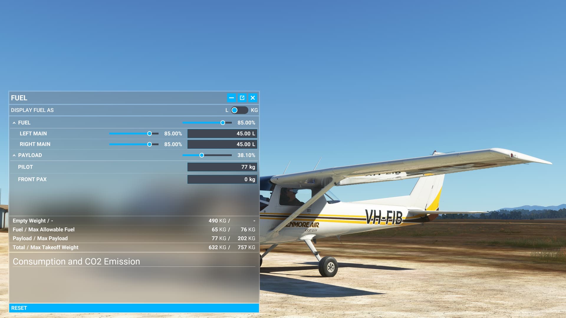
C152 as the Asobo version has no autopilot or GPS equipment. Also, fying at 100knots, you can use the predetermined times and vectors for the wind (to be issued just prior to the event for best accuracy).

We will land at Apollo Bay(YAPO) for a 10 minute break.

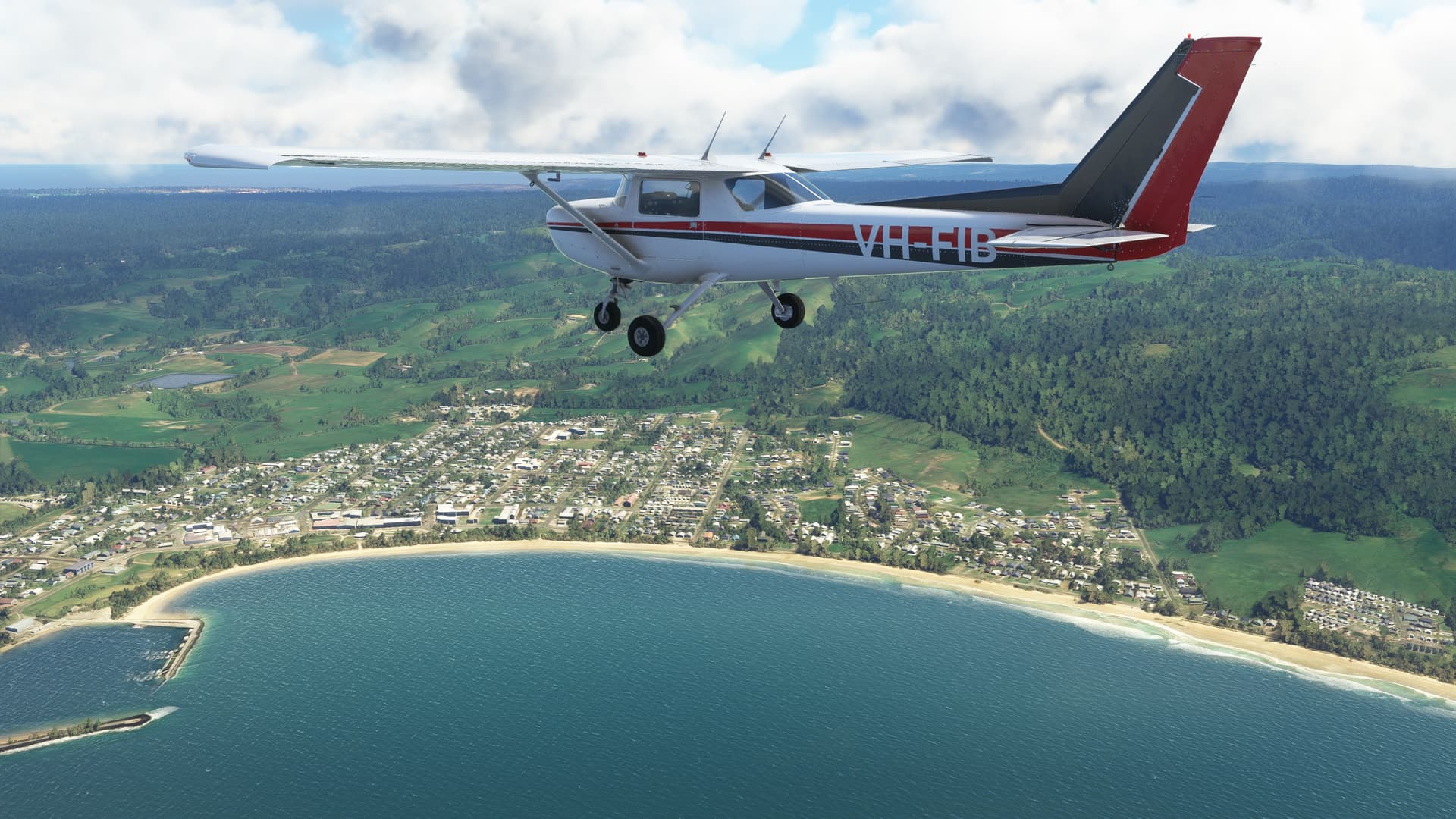
IMPORTANT: In the interest of keeping it REAL, please refrain from selecting inappropriate aircraft, like airliners. This only detracts from the immersion of the flight.

Seeing Aircraft Correctly: You need to do two things to ensure you can see the other pilots in the event and see them in the aircraft they selected.

Select the same server: To do this, proceed as follows:

From the Welcome Screen, click on your Username (top right)
From the list of servers, under Servers, select WEST USA

Turn off Generic Planes: To do this, proceed as follows:

From the Welcome Screen, click on OPTIONS
Click on GENERAL
With TRAFFIC selected, scroll down to the last option and set USE GENERIC PLANE MODELS to OFF

Turning off Crash/Damage:

Select Options/Assistance
Expand Failure & Damage
Disable Crash Damage
Disable Aircraft Stress Damage
Disable Engine Stress Damage
Accept the changes

Voice Room: My personal Discord server is used for voice comms. If you haven’t already joined my server, click on the below link to request access. I will set you up as a Member so you can access the server. Ensure you do this prior to the flight, as latecomers will need to wait for the next event.

Link to join the Voice Room: Aussie Group Flights Team - On-line Flying
Note: this link is only valid for 7 days from posting.

Weather/Time: We will set the time to 8am. This will allow us to fly in daylight and choose REAL weather so that the winds are correct.

From the World Map view, click on Flight Conditions (upper right of screen)
Click on All Players, Live Traffic, Custom
Under Weather and Time, select Live Weather and move the time slide bar to show 8:00am. 
Click Close and Fly from the World Map view.

We can start departing from 10:00z. There will be no need for official radio calls. Lets just have some fun taking in the scenery and the social aspects of the event.

Turning on Points of Interest

Select Options/Assistance
Expand POI
Set Landmark Markers to ON
Set City Markers to ON
Set Airport Markers to ON
Accept the changes

Turning on Name Tags (This will assist you in following the group if you get disoriented):

Select Options/GeneralTraffic
Set Show Traffic Nameplates to On
Accept the settings

Still confused, check out the multiplayer video tutorial from SimHangar Flight Simulation: MSFS | MULTIPLAYER | How To Guide | Everything You Need To Know | Fly in events coming soon. - YouTube

Let me know if there’s anything else that I’ve missed that you need to know.,

Regards, Paul

Use CLEAR OFF checks …

A common check throughout the flight that pilots use are the CLEAR OFF checks.

C ompass/Heading
L ogs updated
E ngine instruments, Oil temps and pressure
A ltitude
R adios

O rientation (do you know where you are? can you confirm your position using multiple references?
F uel and tank selection
F orced landing locations

These are typically done after TOC, every 10 minutes, at waypoints and at TOD.

In the Sim, you can press the D key to realign the Direction Indicator to the Magnetic Compass.

Before the event, I will issue a flight card that you can use to determine:

Waypoints in the plan
Distance to waypoints
Wind impacting the flight - speed and direction
Heading based on the wind direction
Ground Speed based on wind
Time based on ground speed
Fuel remaining at each leg

Fuel planning for the trip.

Weight and Balance information (assuming certain loadings).

Please ensure you select the Asobo C152 and load the plane as per the below picture:

We are navigating with Dead Reckoning, so you will need a stopwatch to time your legs. If you don’t have one handy, MSFS provides one for you.

From the floating menu, select the NavLog option.

This provides a handy stopwatch for timing your legs.

For those of you interested in using the JP Logistics Mod for the C152, you can get it here: JPLogistics C152 Enhancement Mod » Microsoft Flight Simulator

NOTE: EXAMPLE ONLY …

Below is a sample of the Flight Card information for Flight Plan and Fuel. There is also a Weight and Balance sheet based on the typical empty weight of a C152 and how we are loading it.

I just want to give you time to absorb the detail so it isn’t too confusing at the event.

Plan

The first column shows the waypoints as shown on the VFR Maps.
LSALT: This is the Lowest Safe Altitude. Which involves reviewing 10nm either side of Track and noting the highest elevations. Then finally adding 1,000’.

ALT: The planned cruising altitude based on observing the ODD +500’ for travelling East and EVEN+500’ for travelling West.

TAS: This is the True Airspeed for the C152

TRK: This is the direct track to the next waypoint.

WIND: This is the reported wind for the area of the waypoint, reported in Direction and Speed.

HDG: This is the adjusted heading to track, based on the reported winds. THIS IS THE HEADING YOU FOLLOW FOR THE EVENT.

GS: This is the calculated Ground Speed, based on the reported winds.

DIST: This is the distance to the next waypoint.

ETI: This is the time to the next waypoint, based on the calculated ground speed. THIS IS WHAT YOU USE TO TIME WITH THE STOP WATCH.

EET: This is the elapsed time during the route to each of the waypoint.

ETA: This is the Estimated Time based on when we planned to take off.

FR: This is the remaining fuel based on a starting amount of 90 ltrs (see the fuel sheet for details of usage along the route).

90: This is the fuel figure at the start of our flight - 90 lts. The amount of fuel at our landing airport is also listed for reference.

REV: This allows us to enter revised fuel figures along the route.

ATA: This is the Actual Time you record when reaching the waypoint. Example if we took off at 0900z and it took you 19 minutes to get to the first waypoint, you would enter 0919.

These are the only fields that are important for the event.

I will issue the Flight Card, with all this information once I get up to date weather just prior to the event.

Event reminder …

1 Like

Mid-Flight Break

Mid-Flight Break

Hey guys, do you have an updated discord link? One above not working

Sorry you weren’t able to get in. Use this one and I’ll set you up for next time.