Hello,
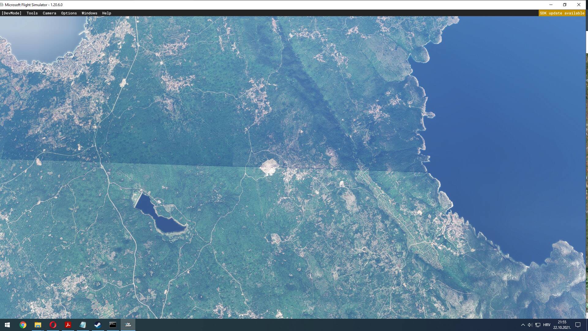
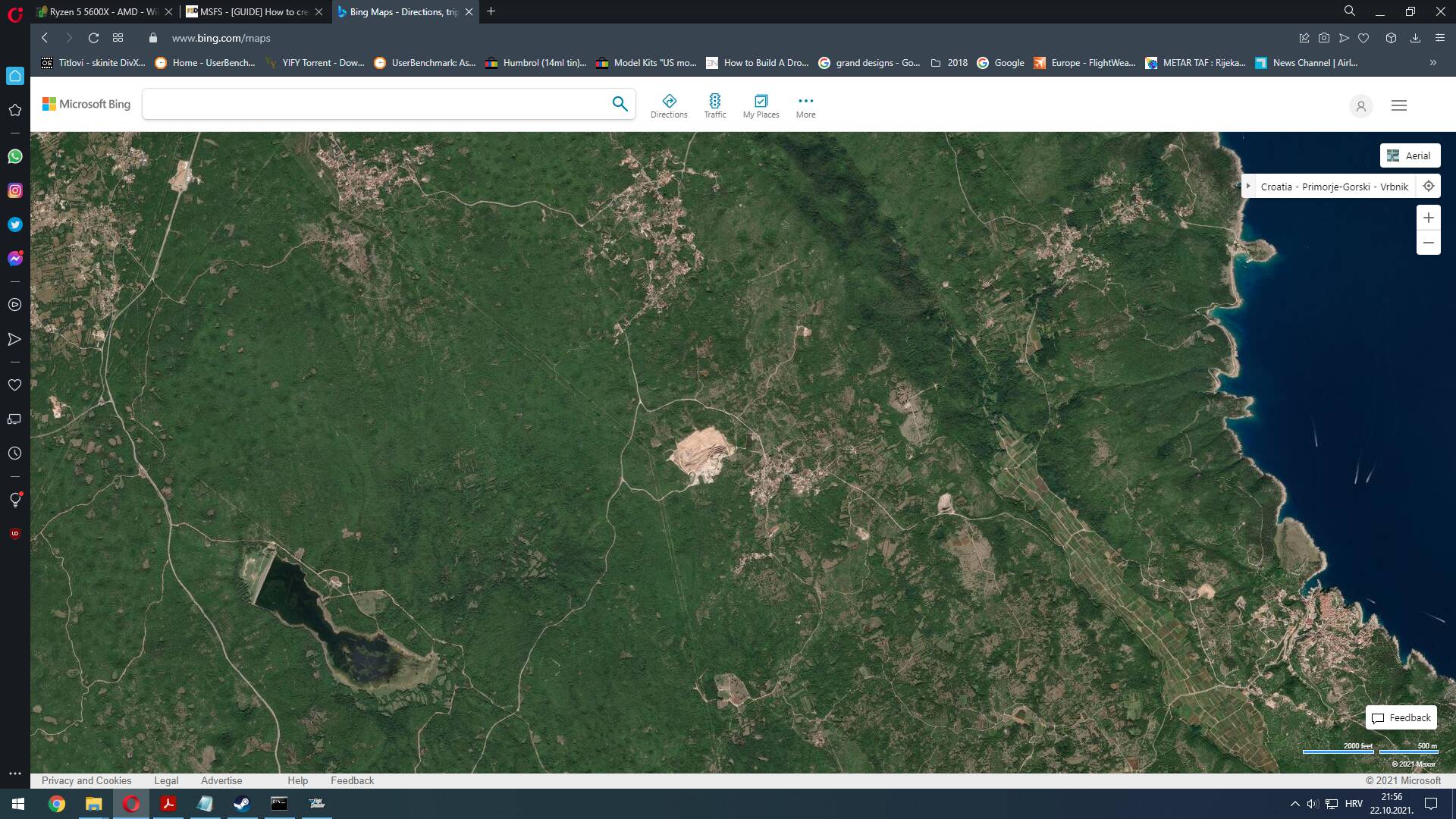
I have been trying to compile and add new satellite imagery for one area known to me (Island Krk, Croatia) but with every try, I still get the same problem. DIrectly over N45°05´24´´ parallel, I get this line, even though I added new imagery north and south of it. Imagery is downloaded with Ortho4XP, Bing maps, and then georeferenced with qGIS (done in some other areas without any problem). I repeated those steps many times but every time same result. Just to mention, on Bing maps, no line is visible, everthing looks okey, this only appears in MSFS with this imagery work. Please help.
Thank you
I suspect this might be the border between two tiles, and only the southern tile is actually showing. This is an issue with MSFS cgls, for some reason. You may see too compiled folders each containing a .cgl file.
I sorted this by having two AssetGroups, one for each tile. You’ll know which belongs to which by the first 3 digits of the images you use to build the cgl.
I’m not sure why this works, the end result looks the same file-wise, but it certainly works for me.
Thank You for Your reply. Can You please describe more how can i do that to try to resolve this problem. Thank You!
F
I can set out the steps I took, but I can’t guarantee that it’ll work for you, as I don’t know why it works for me, or why a normal build doesn’t work.
First, you need to determine whether the fix applied to your project. As I said previously, this was an issue with the border between tiles, so you need to know whether your scenery crosses a border. To check this, you’d look at your project’s aerial images which it uses to build the CGL file. These are normally png files, and the filenames are 16-digit numbers made up of digits 0 to 3. If you sort these aphabetically (which will sort them numerically) you can then check to see if there’s a problem tile border in there.
The first three digits define the tile we’re interested in. So if we check the first and last filename’s first three digits and they are different, then they cross a border.
To fix this, I added another CGL AssetGroup to the PackageDefinitions XML file, just changing the location of the source files:
	<AssetGroup Name="NZMSaerial">
		<Type>CGL</Type>
		<Flags>
			<FSXCompatibility>false</FSXCompatibility>
		</Flags>
		<AssetDir>PackageSources\CGL\</AssetDir>
		<OutputDir>CGL\</OutputDir>
	</AssetGroup>
	<AssetGroup Name="NZMSaerial2">
		<Type>CGL</Type>
		<Flags>
			<FSXCompatibility>false</FSXCompatibility>
		</Flags>
		<AssetDir>PackageSources\CGL2\</AssetDir>
		<OutputDir>CGL\</OutputDir>
	</AssetGroup>
I created the new folder structure to match (CGL2). Then I sorted each tile defined by the first three digits into their own AssetGroup folders. This was just a cut/paste from one folder into the other. So each CGL AssetGroup folder includes images with the same first three digits.
For me, there was a single border, but you may have more than two, so you’d need a separate AssetGroup for each.
Then build it, and hopefully it’ll work!
1 Like