Dear devs,
I’m aware that not all airports can come with premium quality, but I believe Naha airport in Okinawa could use a bit of basic work while we wait for third-parties to take a stab at it.
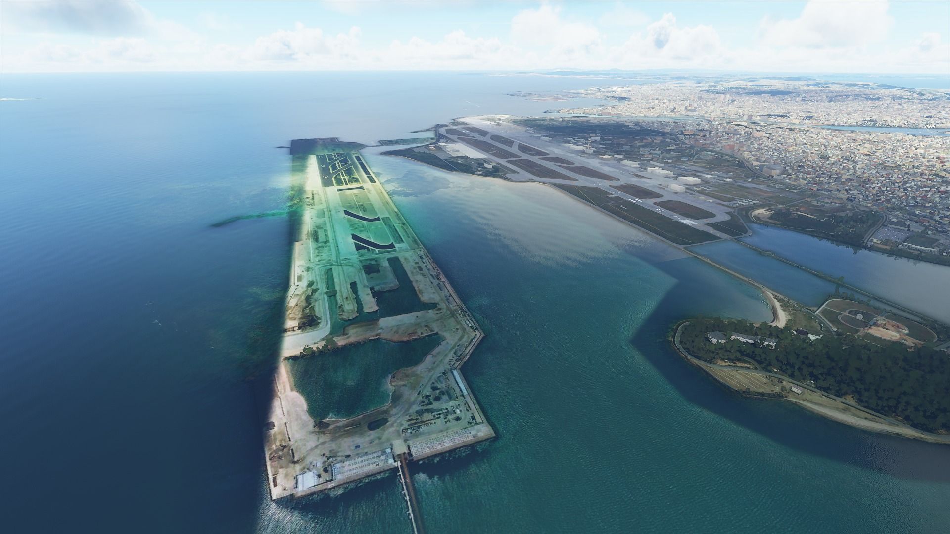
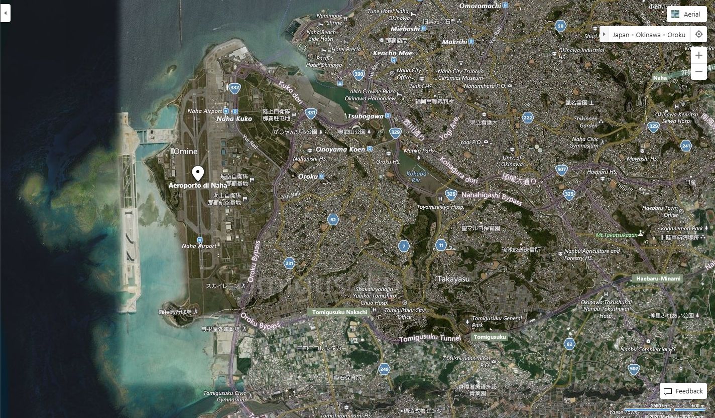
I can certainly understand small bush strip and secondary airports missing or only partly reproduced by Naha is the seventh busiest airport in Japan, and a common destination among simmers who enjoy that region.
In MSFS Naha has only one runway, while in reality, it has two. While its second runway was opened only in March 2020 (alongside a new terminal), its construction on a reclaimed island that runs parallel to the coast has begun in 2014.
I imagine it has been missed due to the street layout map on bing maps completely missing the reclaimed island and the runway (must be very outdated) and the aerial version of the map has only part if it. I guess the part toward the sea was not updated in the past six years.
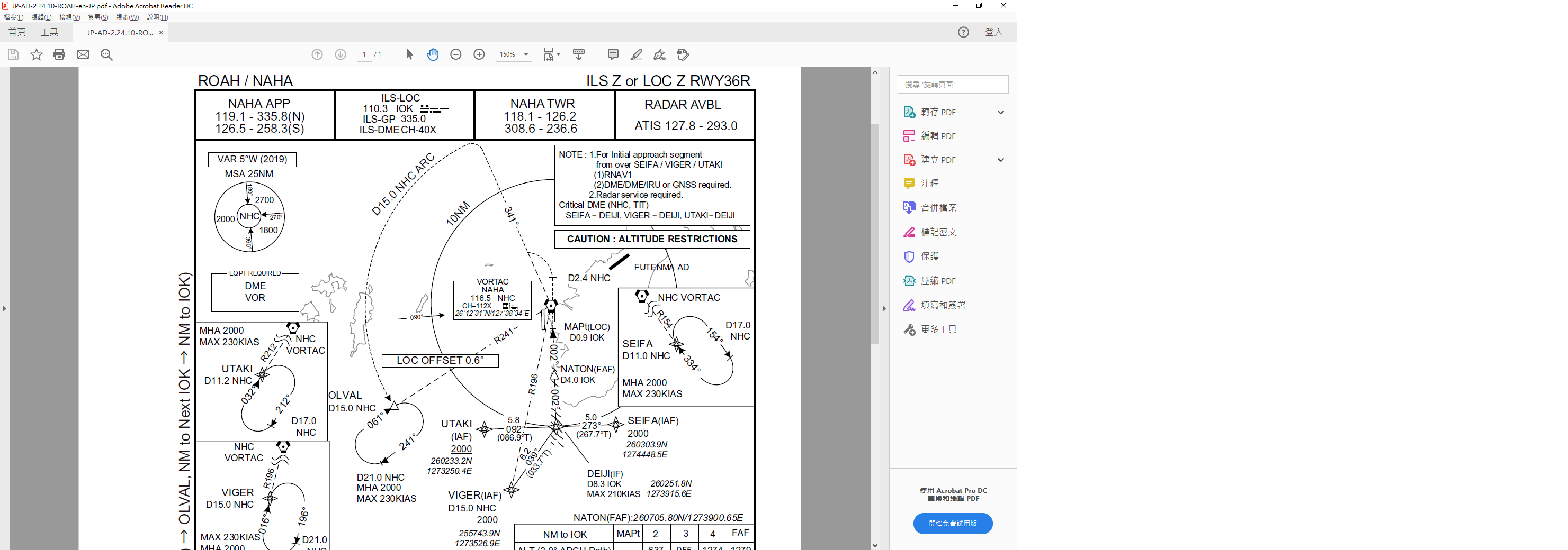
On top of that, the landing aids are rough. I imagine that’s due to the map being low-quality.
The RNAV to Runway 18 (/which would be 18 L), which is also the only IFR landing aid on that runway is super-wonky and extremely weird. I tested it mostly with an a320, but it has you drop to 500 feet right as you touch the second to last marker of the approach, way before the glidescope should ever engage. It then has you fly on an unnaturally shallow descent nearly touching the waves with the landing gear for the whole rest of the approach. I imagine that’d be very dangerous and super-scary for the passengers.
On top of that, unless manually corrected, it has you land way, way early, at the very beginning of the blast pad.
The Rnav on 36 (which would be 36 R) isn’t as wonky (the glidescope angle is correct), but it still makes you land early between the blast pad and the threshold.
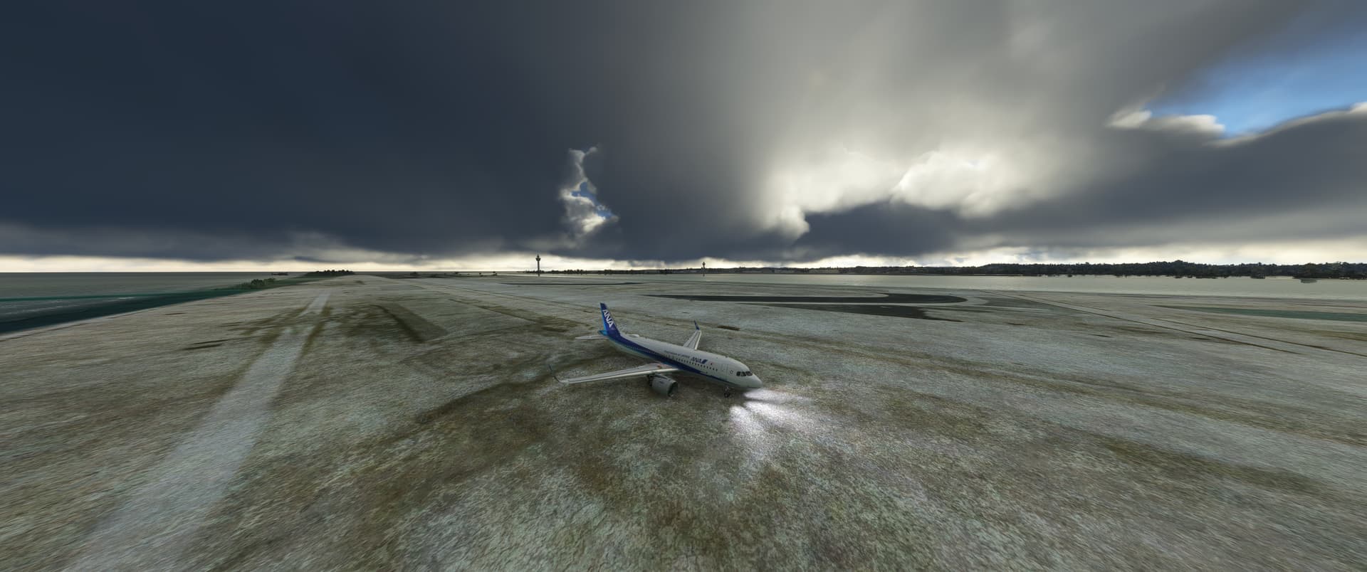
The ILS on Runway 36 is correct in its depth and glidescope, but it’s weirdly shifted to the left. I tested it multiple times, always resulting into the strange alignment you can see below.
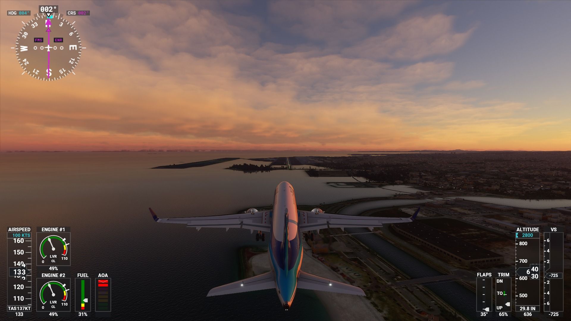
I would not be surprised if this was due to the fact that the runway is marked 36, but as you can see on the map, its orientation is not 360°, but 001° If you look at the picture, the nose of my aircraft is aiming at the other end of the runway and not at the one I need to land on.
Can we please get some fixes underway? ![]() That’d be much appreciated.
That’d be much appreciated.