[COMPLETE] I-95 Cross-Country: Miami FL to Houlton ME

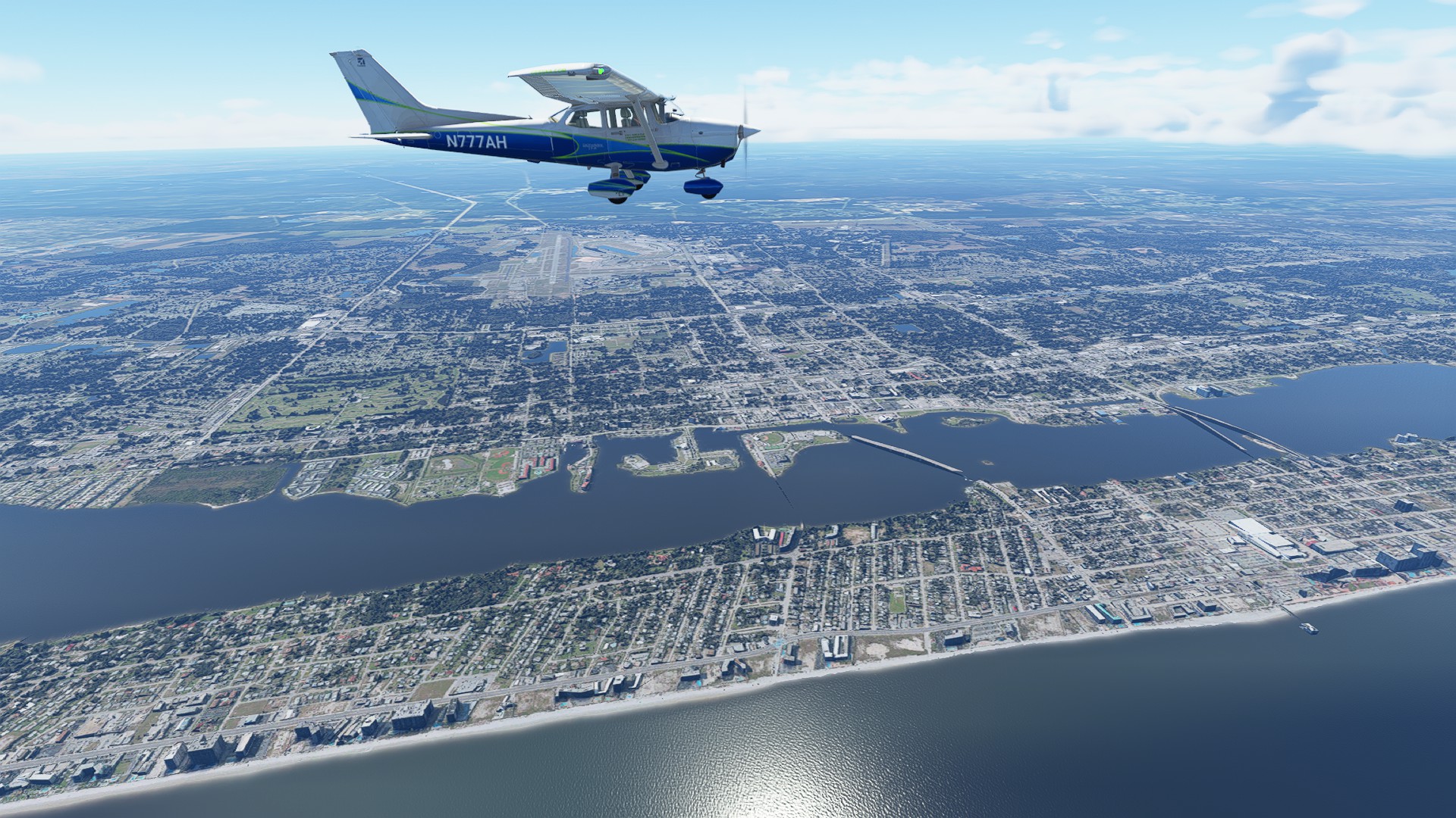
I’m trying a different cross-country - heading South to North, from sizzling Miami to cool Houlton, right next to the Canadian border. I-95 takes you through fifteen states, mixing in lush rural and sprawling urban areas of the Eastern Seaboard.

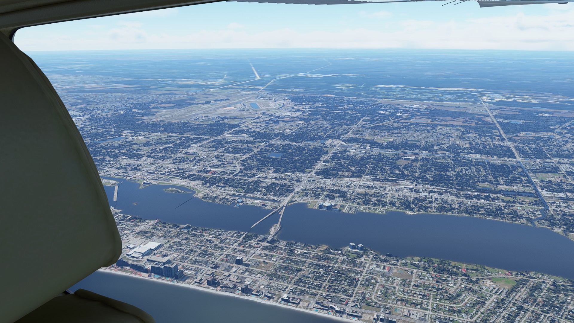
I’ve posted more in-cockpit photos to better simulate a real-world experience. I will be taking exterior shots as well.

Leg 1: Opa-Locka Executive (Miami FL) to Space Coast Regional (Titusville FL)
Leg 2: Space Coast Regional (Titusville FL) to Fernandina Beach Municipal (Fernandina Beach FL)
Leg 3: Fernandina Beach Municipal ( Feranandina Beach FL) to Lowcountry Regional (Walterboro SC)
Leg 4: Lowcountry Regional (Walterboro SC) to Lumberton Regional (Lumberton NC)
Leg 5: Lumberton Regional (Lumberton NC) to Halifax-Northampton Regional (Halifax NC)
Leg 6: Halifax-Northampton Regional (Halifax NC) to Martin State (Baltimore MD)
Leg 7: Martin State (Baltimore MD) to Linden (Linden NJ)
Leg 8: Linden (Linden NJ) to Westerly State (Westerly RI)
Leg 9: Westerly State (Westerly RI) to Biddeford Municipal (Biddeford ME)
Leg 10: Biddeford Municipal (Biddeford ME) to Pittsfield Municipal (Pittsfield ME)
Leg 11: Pittsfield Muncipal (Pittsfield ME) to Houlton International (Houlton ME)

3 Likes

Leg 1: Opa-Locka Executive (Miami FL) to Space Coast Regional (Titusville FL)

Departing Opa-Locka with the Miami City skyline prominent on the horizon:

Passing over the BB&T Arena and Sawgrass Expressway - this part of Florida is defined by the mix of heavy urbanization and clear demarcations to preserve both water and wildlife areas:

Lake Okeechobee, the primary source of freshwater for most of South Florida, with one of the many cross-connected canals feeding into the eastern coast:

Melbourne FL International Airport off to starboard:

The south end of the Space Coast region, which includes the famous Cape Canaveral and the launch pads for the US Space Program:

Good arrival at R36, Space Coast Regional:

4 Likes

Leg 2: Space Coast Regional (Titusville FL) to Fernandina Beach Municipal (Fernandina Beach FL)

We continue up the Atlantic side of Florida, passing by Daytona Beach and the Space Coast - 131 nm 01:03:00 enroute.

Departing Space Coast Regional and circling around FPL’s Indian River Generating Station:

Outside the COP window, Titusville in the foreground, Merritt Island Causeway and easily visible in the back, the massive 15,000’ Shuttle Landing Strip. Beyond that are the NASA launch pads:

I-95 rolling past Titusville:

A Daytona Trifecta - the International Airport, the world-famous Speedway and the ever popular Spring Break Beach Destination:

Abeam of Palm Beach, and keeping one eye on the storm line which remains west of I-95, off our flight path:

Abeam historic St. Augustine, and the reason we’re a bit off-shore; avoiding getting too close to the airspace around Naval Station Mayport:

We’re staying away from that stormline, so we’re curving around to the North and passing directly over Fernandina Beach to land:

Leg 3: Fernandina Beach Municipal ( Feranandina Beach FL) to Lowcountry Regional (Walterboro SC)

Good hop and we dodged most of the bad weather while passing some of the gorgeous Georgia and South Carolina coastline - 145 nm, 01:26:00 enroute.

Blustery day even from the ramp:

Just north of Fernandina Beach is Georgia’s Cumberland Island National Seashore:

Very nice houses facing the Atlantic on McKinnon St. Simons Island:

Why it’s called the Low Country - a mix of fresh and saltwater reservations and wilderness with small settlements:

Added another 1,000’ to stay above a scattered cloudbase, as we catch a brief glimpse of Savannah GA:

Crossing over into SC, we fly over Pritchardville and catch a view of the exclusive Hilton Head island in the mid-horizon:

We dogleg west to stay out of Marine Corps Air Station Beaufort’s airspace, located across the Broad River:

A nice shot of the Cessna JT-A - just because :grinning_face_with_smiling_eyes:

Declaring pop-up IFR as ASOS is reporting low viz at Lowcountry Regional, we turn into the approach for R17 (ATC insisting R23 even though the wind was from the south):

Passing over Colleton County High School on approach, and the field is indeed slightly obscured:

2 Likes

Leg 4: Lowcountry Regional (Walterboro SC) to Lumberton Regional (Lumberton NC)

This trip took longer because of all the altitude changes to try and stay VFR. IRL and in certain circumstances in the sim, a pop-up IFR could have been filed, but I was passing through multiple Approach sectors and the option never appeared. The weather was closing in at Lumberton and winds aloft had me hook around to the east for an RNAV arrival - 138 nm 01:36:00 enroute.

Departing Lowcountry:

Mucho lightning! :grinning_face_with_smiling_eyes:

Visual checkpoint - passing Lake Moultrie - you can see the canal that passes under SC45 and connects to the larger Lake Marion; Moultrie eventually empties itself into Charleston harbor and the Atlantic passing by famous Fort Sumter:

Checkpoint - The Pee Dee River - no chuckling please:

Weather’s closing in around me, this is about the time I started going low to stay VFR:

Made it to Lumberton with clear conditions - passing over the city and I-95:

1 Like

Leg 5: Lumberton Regional (Lumberton NC) to Halifax-Northampton Regional (Halifax NC)

We filed IFR in advance knowing the weather was unstable across the intended route - a good plan as it turned out - 129 nm, 01:20:00 enroute.

Departing Lumberton:

The weather starts to close in almost immediately:

A glimpse of eastern Fayetteville through a break in the cloud base:

We take a couple of doglegs to avoid Military Operating Areas used by both Fayetteville and Seymour-Johnson Airbase - not sure if they’re flying today because it’s pouring over SJ:

Up and down we go, looking for a stable cruise altitude - not too many choices given the size of the storm front:

Raleigh’s getting a soaking:

Sometimes, timing is everything - the front starts to break up about three-quarters of the way down the route:

But we’re still IMC heading down to the approach altitude:

We enter a nice clear patch and arrive neatly at Halifax-Northampton:

Leg 6: Halifax-Northampton Regional (Halifax NC) to Martin State (Baltimore MD)

Disclaimer: this particular flight plan is totally unrealistic once we pass over Fort A.P. Hill - there is no way a light GA is allowed to fly over the most vital parts of Washington DC (including the White House), but I couldn’t resist - after all, it’s a sim, and part of the experience is being able to do and see things you couldn’t in real life. The alternative was to thread my way past multiple restricted airspaces and I still couldn’t reasonably trace I-95 as it joined around the eastern end of the Beltway.

'Nuff said. A nice ride up and over the National Capitol Region with arrival around Monument City (Baltimore) - 197 nm 01:36:00 enroute.

Departing Halifax-Northampton using a nice Burgundy livery for the Cessna JT-A:

Passing over Roanoake Rapids City:

Checkpoint - Emporia VA:

Fort A.P. Hill and the associated airfield (KAPH):

Approaching the Lower Potomac River:

Outside the PIC window - the famous US Marine Corps Amphibious Base at Little Creek - from left to right, the airbase, naval facilities and the “creek” itself is bisected by the wing strut:

Approaching DC - Alexandria suburb, framed between the door pillar and the starboard wing strut:

A wide-angle view of DC - prominently off the port-side nose is Ronald Reagan International Airport. The set of buildings to the west of the field is the Crystal City district full of high rises, shopping and business offices - many are accessible from underground connectors to ease ground level traffic. Directly off the nose across the Potomac is the District of Columbia - the Washington Monument is very visible, and before that, the unique shape of the Pentagon.

Nice obliques of the DC area - many of the major monuments and landmarks are easily seen from cruise altitude:

Leaving the Capitol in our wake, we approach Baltimore-Washington International (KBWI) on the way to Monument City:

Baltimore and the Inner Harbor:

The Francis Scott Key Bridge:

Passing White Marsh Mall - that’s I-95 bisecting the near horizon from left to right, on approach into Martin State:

1 Like

Leg 7: Martin State (Baltimore MD) to Linden (Linden NJ)

The weather fell apart towards the end of this leg, but not heavy precipitation. To remain visual with much of I-95, we had to bounce up and down between 4,000 and 2,000’ AGL. Things got a little tricky as Linden doesn’t have an IAP, so we headed down IMC hoping we could make visual with the field and circle around to the preferred runway end. We covered 127 nm in 01:06:00 thanks to a tail-wind.

Departing Martin State - really love this Burgundy trim, it looks very sharp:

Passing over the US Army’s Aberdeen Proving Grounds and the attached airfield:

Havre De Grace off to port, with the Amtrak rail line passing over the Susquehanna River:

New Castle Airport (KILG) off to starboard, then the City of WIlmington:

Marcus Hook Docks and the Commodore Barry Bridge crossing the Delaware:

Philadelphia International (KPHL) and the City of Brotherly Love in the distance:

COP has good views of the Philly skyline and the multiple bridges crossing the Schuylkill River:

The Walt Whitman and Benjamin Franklin bridges connecting Philly to Camden NJ:

The Betsy Ross and Tacony-Palmyra Bridges, with Palmyra just over the Delaware on the NJ side:

The cloudbase is getting thicker as we pass over the Trenton-Morrisville Bridge and Trenton NJ:

Linden is somewhere under that thickening cloudbase, so we dial in the ILS-A approach which takes us a couple miles off RWY09 end - ASOS indicates 3SM in heavy rain, so we’re taking a chance we can remain at pattern altitude and break out the field:

And we luck out again - the cloud base clears out just around 1100’ AGL, we can see the runway thresholds blinking in the distance, disconnect AP and turn to the west to enter the circuit:

Good offset downwind and turning base over Pralls Creek with the Linden Generating Station in the foreground and Goethals Bridge / I-278 in the near horizon:

Good rollout and on glideslope, stabilized a little short, but log another safe arrival:

1 Like

I really love these posts, the commentary along with the screenshots makes them so much more interesting to follow. It really seems like our posting style is quite similar, doing almost identically styled adventures at the same time!

Oh and I certainly see what you mean about the RW weather playing havoc with your plans now :grimacing:

1 Like

Thank you, very kind. I enjoyed your trip reports on your cross-country as well. It’s always fun to learn new things about places I’ve never been to before - I find using Little Nav Map as a virtual sectional helps me to see what’s along the way and what might be within LOS, as well as worthy of a slight divert from the current plan.

1 Like

Agreed, I run Little Nav Map full screen on a second monitor as well, although usually with the Google Maps terrain overlay. For the next leg on my transcontinental that goes through Chicago’s airspace, I’ll try and decipher the USA style sectional charts. They’re marked up quite differently from what I’m used to seeing down under!

1 Like

I learn something new every day - a Google Maps overlay - I’ll have to check it out! Is there an updated place to pull that from please? I found a January 2019 post in Avsim but there might be something more recent?

Thats the best thing about these forums right? I’ve discovered so many addons that I would have otherwise been oblivious to!

The Avsim thread links to the same dropbox drive that I downloaded the LNP Google Maps overlay from. It contains a small data folder that you drop into the root Little Navmap folder and it will give you the ability to source from Google Maps (standard/terrain/satelittle) in the overlay drop downs next time you run the software. It’s particularly useful for overseas flying where the placenames are not written in the English language alphabet characters!

1 Like

Leg 8: Linden (Linden NJ) to Westerly State (Westerly RI)

As is always the case in congested airspace around supermetropolis areas like New York City, a humble GA pilot has to weave their way through multiple restricted areas while trying to keep up a reasonable speed of advance. The first third of the trip was a winding route up the Hudson and between major airport approach lanes (JFK, LaGuardia, Teterboro, Newark), all while trying to stay parallel to I-95.

Departing Linden, and we easily see the distinct skyline of Manhattan to the North. We pass over tank farms and the Outerbridge Crossing south of Bayonne.

Heading up the Hudson, everyone on the COP side gets a great view of Manhattan:

We pass the length of Manhattan Island, then turn East over Yonkers to access Long Island Sound while staying clear of La Guardia and Westchester County airspace:

Now running parallel to the Connecticut coastline, we pass the major urban centers on the way to the Ocean State - Stamford, Norwalk, Bridgeport, New Haven:

Just before New London and the CT-RI border, we turn out again into L.I. Sound to set up for an RNAV RWY7 arrival at KWST:

Leg 9: Westerly State (Westerly RI) to Biddeford Municipal (Biddeford ME)

From the tiniest state in New England to the largest, we make a long trek following the interstate through the heart of historic colonial America.

Departing Westerly State, if you blink, you’ll miss seeing Rhode Island as the joke goes. We catch a glimpse of the state capitol Providence, as well as a close call with an airliner:

State Capitols are the order of the day - we pass over the famous city of Boston, the town of Newburyport and as we cross over into New Hampshire, the city of Portsmouth and it’s airport:

We cross into the great state of Maine just before Kennebunkport and arrive at sleepy Biddeford Municipal:

Leg 10: Biddeford Municipal (Biddeford ME) to Pittsfield Municipal (Pittsfield ME)

A straightforward run up the coastline of Maine, we’re a leg away from our final destination.

Departing Biddeford, we pass over Portsmouth ME and the International Airport:

We dogleg a bit more east at around Waterville, to set up for an approach into Pittsfield:

Passing over Unity Pond, a good arrival at RWY36:

Leg 11: Pittsfield Muncipal (Pittsfield ME) to Houlton International (Houlton ME)

Topic author’s note: I misplaced where I had put the screenshots for this segment, hence the long delay in posting from Leg 10.

The last push to the Canadian Border!

Departing Pittsfield:

Bangor International out of the COP window:

Picking up I-95N again near Orono and the U of Maine Campus:

Good thing I had filed IFR, the forecast had mixed cloud densities at low altitudes:


Obsurcation getting thicker:

Dialed up the approach to RNAV 05


Runway in sight; just beyond is the Canadian border. What a trip!

1 Like

Total flight time?

Roughly about 25-30 hours with weather diverts and wandering.

3 Likes