Have you used Developer Mode?
Only for fps and quickly changing aircraft PC Specs:
Ryzen 3600, RTX 2070 Aircraft:
Tested on Cessna 172, Cessna 152, Diamond DA62, but it’s probably every aircraft Area of the World / Flight Plan:
Everywhere Airport (If applicable):
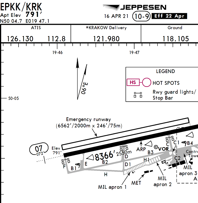
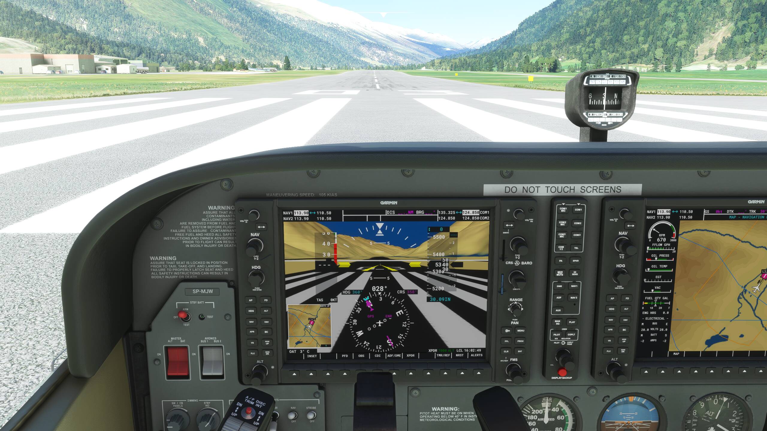
Tested on KTEX, KASE, LSZS, EPKK Feedback/Bug Description:
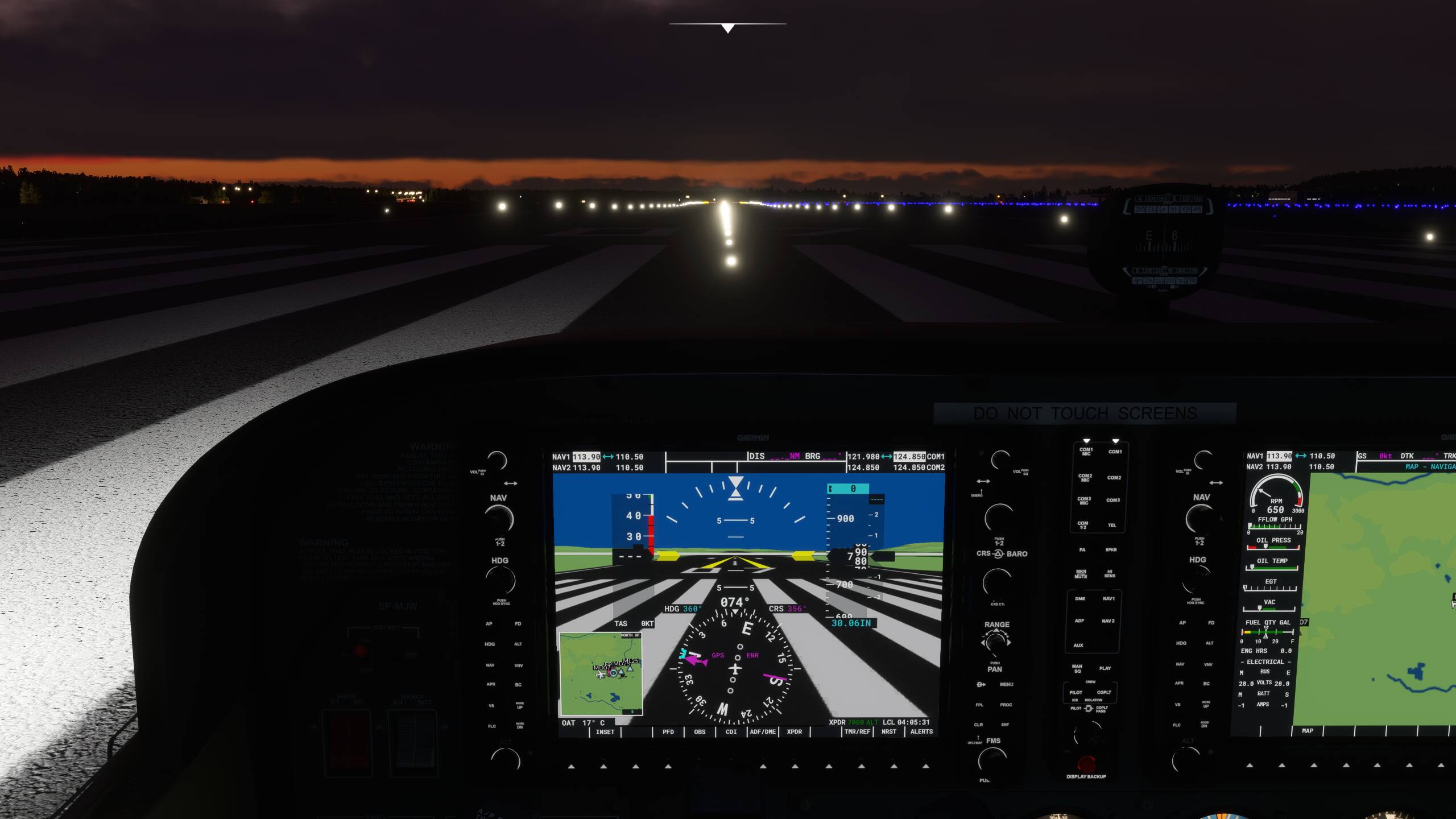
At higher altitudes the instruments show much lower altitude than it should be. I press ‘B’ to the get the current altimiter and then I crosscheck it with the metar, it’s correct.
Example airports:
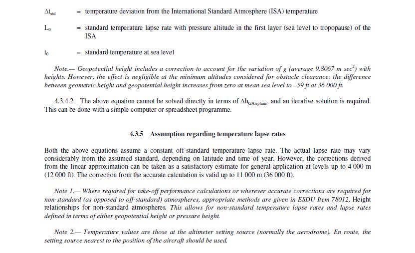
KTEX RW9: Charts show 9038ft at threshold, in sim 8035ft
Also because of this bug I was actually too high on the rnav approach for RW9 at KTEX. I was at the final fix at the correct altitude (13000ft) and the rnav “glideslope” was below me. Also visually I could see that I was too high and the PAPIs also showed all white. Normally there should be ~4000ft difference between the final fix and runway threshold, but because of this bug it was somehow actually ~5000ft difference. This may be related to this issue: https://forums.flightsimulator.com/t/new-density-altitude-calculations-doesnt-seem-apply-across-the-sim/415632
[ ] Multiplayer session or [x] solo flight Weather settings:
Live 3rd party addons you were using at the time:
Navigraph when flying the approach into KTEX, then I cleared the Community folder and the problem with altitude was still there. Server: [ ] East USA [ ] North Europe [ ] West USA [x] West Europe [ ] SE Asia
Although they still don’t have the correct pressure vs alt relationship in this build yet, what you are seeing is “approximately” correct for the situation you are showing in your KTEX runway 9 example. (I didn’t check the rest of them.) You can blame the live weather temperature bug for this one. At the 26 C air temperature at KTEX, that would be ISA+28.9 C!
This build incorporates altimeter error due to temperature. At higher than ISA temp, the altimeter will show a lower altitude than you are actually at. At colder temps, it’s the reverse, which is a bigger safety issue because you will be closer to terrain than indicated by the altimeter. The higher the elevation (like KTEX)and the higher the temperature deviation from standard, the larger the error.
The reason for this is that altimeters use a standard calibration curve of height vs pressure. You can shift that curve up or down by changing the baro setting to account for non-ISA pressures, but the slope of that curve remains the same. At different temperatures, the air density is different, so the relationship between pressure vs height changes. And that leads to an error in what the altimeter reports.
With the same pressure at KTEX as shown in your screenshot at ISA temp, there is no error (other than instrument error) and the altimeter is consistent with your expectations:
Setting the correct QNH should still result in an altimeter showing aerodrome elevation when on the ground as QNH is calculated using ISA. No matter the temperature, with QNH set the altimeter should always read elevation. So this might be an unintended consequence of the new temperature effect on altitude…
Where does the in-sim QNH come from? Is it directly from the METAR or is it calculated somehow? This might be a serious issue.
Yes, of course, you’re right. The temperature “effect” should only affect the height above the altimeter setting source, so above the airfield elevation.
Seems like the temperature effect is applied to the aircraft altitude rather than the height above altimeter setting source!
I’m wondering now if at 1000 ft above an airport with an elevation 10.000 ft (example), does it apply the error over the full 11.000 ft??? It does seem so looking at the wrong elevation at correct altimeter setting in the examples above.
Anybody able to give this a try at a high elevation aerodrome? Maybe first correct the altimeter setting to show correct aerodrome elevation whenever changing the temperature, then slew to 200 ft radio height above the runway at non-standard temperature and note the temperature error?
Correct altimeter reading can be calculated with this (remove .pln from the file name before use):
Looking at the screenshots posted I think we can confirm what you said before.
According one of the screenshots:
Aerodrome elevation: 9070 ft
Indicated altitude: 8035 ft
Temperature at aerodrome level: +26C degrees
Which means ISA deviation: +29C
Temperature at MSL would be: +44C
Using MSL as the “altimeter setting source” and using the official formula to calculate the true altitude results in an indicated altitude of 8216 ft.
Using the rule of thumb (4 ft per 1000 ft per 1C ISA deviation) → 4 * 9.07 * 29 = 1052.12, 9070 - 1052.12 = 8017.88 ft which is awfully close to the indicated 8035 ft.
So two major flaws here:
First of all mean sea level is used as the “altimeter setting source” instead of the aerodrome level. The temperature error is not applied to the height above the aerodrome but rather the height above mean sea level.
Second, instead of using the correct equation they seem to use a rule of thumb of 4 ft per 1000 ft per 1C deviation which is not even allowed to be used in the real world below -15C so unsuitable to calculate the extremes of the temperature envelope.
You nailed it. This is the most serious part of the altitude errors in the preview edition. Total misconception on how temperature effects should be implemented.
Lets hope or pray they will fix this before release as it would cause a lot of complaints otherwise from people being high or low on their approaches and what not……….
It would help if someone could post some screenshots at some high elevation airport with correct QNH (hit “B” after making changes) for the following conditions:
ISA (standard temperature and pressure)
ISA +20 at standard pressure
ISA -20 at standard pressure
ISA temperature at lower than standard pressure
ISA temperature with higher than standard pressure
And then the same list with 29.92 set so we can see the effect on pressure altitude also.
Maybe we can figure out what is going on here by having the effect of temperature and pressure separated.
Best to do it with simvar watcher showing pressure altitude, indicated altitude, radio height, plane altitude, ambient temperature and pressure, and baro setting. I’m out of town right now and can’t get to it until Tuesday. If no one has done by then, I will do it.
That’s not good at all! Temperature should not have an effect on the altimeter reading when on ground.
ISA
I assume this 6460 ft is actually correct so in standard atmosphere correct field elevation is shown
ISA +20
Rule of thumb: 5943 ft
Official equation: 6032 ft
Indicated altitude: 5940 ft
Note that in both cases I’m calculating with sea level being the altimeter setting source which is totally wrong, the rule of thumb seems to match better with what we are seeing but either way we should not be seeing any effect of temperature at ground level, so both are wrong. Its just to figure out how things are (incorrectly) calculated in MSFS.
ISA -20
Rule of thumb: 6977 ft
Official equation: 6954 ft
Indicated altitude: 6970 ft
For me it proves they are not using an exact equation but rather a “stupid” rule of thumb which again, is not allowed to be used below -15C in real life (neither is it accurate at high temperature but at least on the safe side). Which is weird, if you can program the sim to work with this rule of thumb you can also program it to work with the official formula as it has the same variables…
Non-standard Pressure
Altimeter seems to respond to non-standard QNH normally, i.e. reading aerodrome elevation.
Asobo
Temperature error shall only be applied to the height above altimeter setting source (aerodrome level). Below the ground there is no air to “shrink” or “expand” with temperature and cause the pressure levels to move closer together (temperature below ISA) or move further apart (temperature above ISA). Temperature error = 0 at ground level, the altimeter shall always read aerodrome level with the correct QNH set no matter the temperature. Also please use the official equation and not this 4 ft per 1000 ft per 1C deviation rule of thumb, at high ISA deviations the difference is substantial. There is a reason why in the real world its not allowed to use this rule of thumb below -15C.
I guess this could all be solved by changing the way QNH is calculated to “reset” those errors, but then the QNH wouldn’t line-up anymore with the real world METAR for high elevation airfields?
Ok, so with the “new” QNH set after changing the QNH in the weather menu the indicated altitude is correct? But for non-standard temperature with correct QNH set it is still off, correct?
 Required
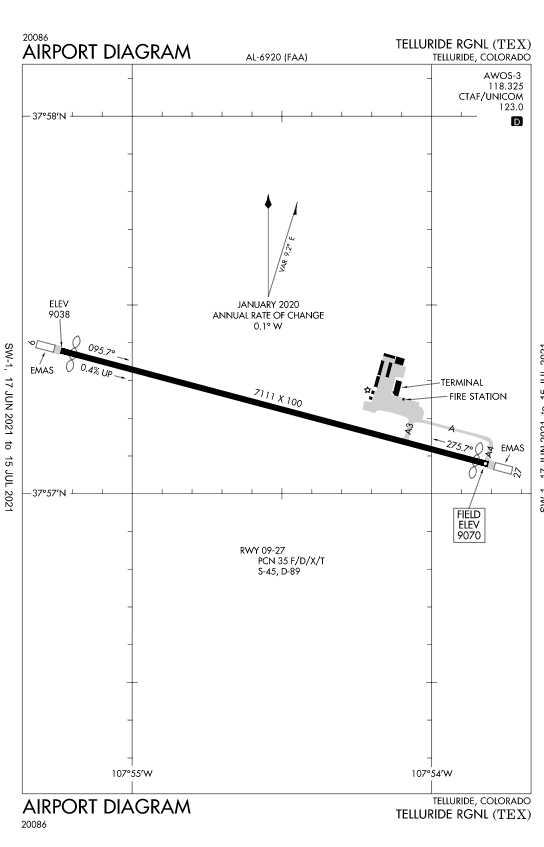


 Optional
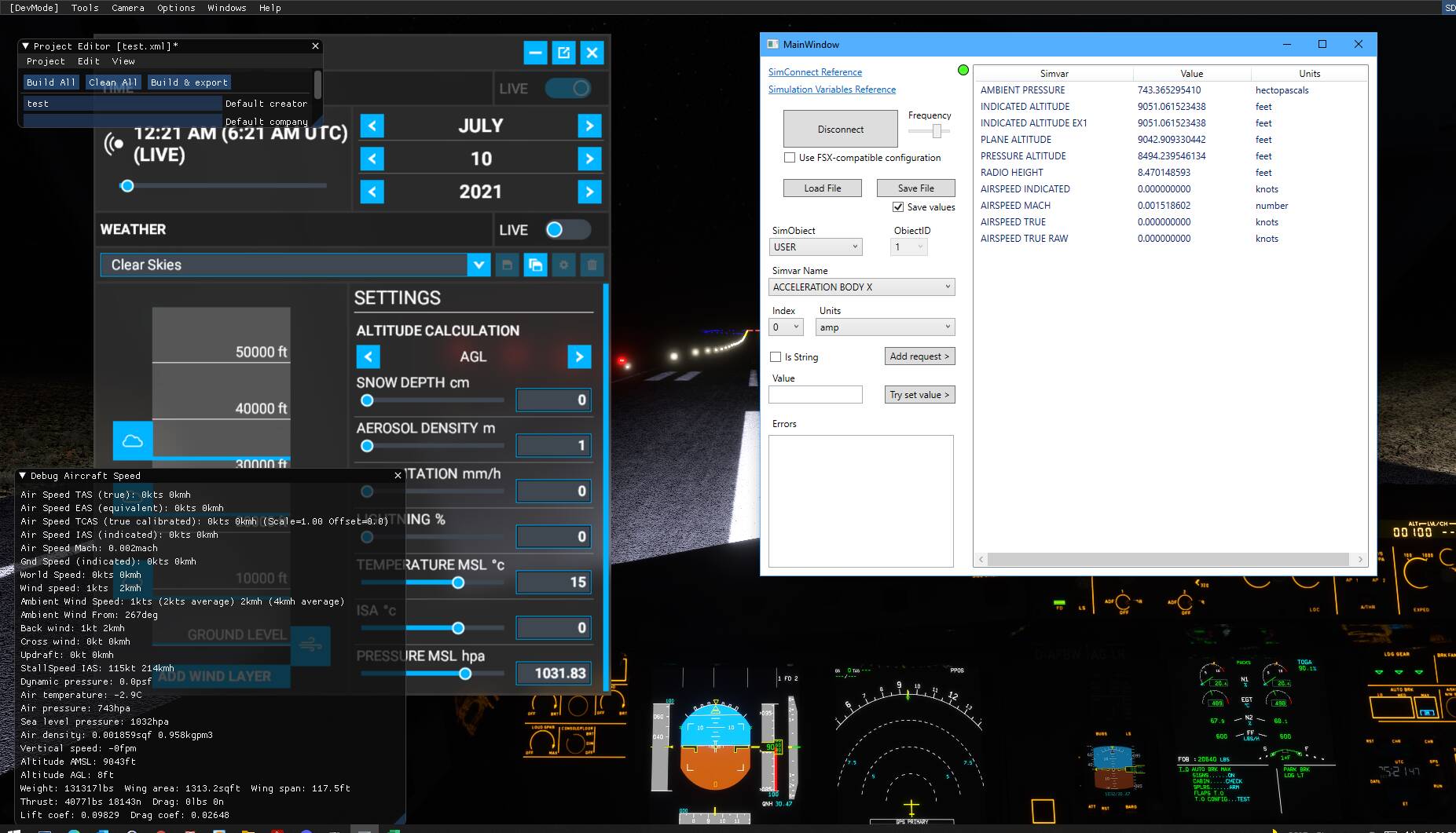
 .
.