No need to add it manually. LNM 2.6 already does this. You either have to select a departure procedure or set the runway as starting point (Ctrl+Shift+D or in the toolbar).
Saving and loading of the parking position like it is doable with FSX or P3D does not work yet. MSFS ignores it.
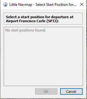
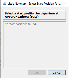
Thanks for the clarification, the only reason I thought this wasn’t yet implemented is because I always get the following message when using the select start position button. Am I doing something wrong?
Just guessing: You are using Navigraph only mode? (MSFS) in brackets in LNM window title?
This means you are looking at Navigraph data only. Runways are probably filled white.
Choose “Use Navigraph for Navaids and Procedures” in the scenery library menu. This is the default and will show MSFS airports and navaids from the Navigraph database.
You can use Navigraph, LNM and load the pln in the sim and have an accurate flight with all waypoints.
Requires the Navigraph beta:
Little Nav Map beta 2.6 has the capability to export as PLN files which will load fine in MSFS without showing all the navpoints as user points and include SIDs, Stars and Approaches marked as such in the planning screen. (Some may have noticed this when not using the in Sim planner)
I used Charts to create a flight from RKSS to RPLL, exported from Charts as a P3D/FSX PLN file, loaded that into LNM to get the nav points. All that needs to be done is set your gate, load up your SIDs, Stars and approaches via Little Nav Map (The navpoints are there you just have to tell LNM that they are SIDs, Stars and Approaches so it can mark them as such for export) and then export as a MSFS PLN file.
It will now load all points into MSFS via planning map as entered except for the gate but that will not cause a reshuffling of the plan. Now the moving map on Charts will have an accurate routing.
Cheers Alex. But rather than blather on, here is a post I made in another thread that says it all:
Independent software dev’s - large and small - should be encouraged to do what they do.
They are often innovative and good at developing quirky, niche products. This leads to more choice.
However some software dev’s are charging silly money for their products.
Add-on prices should be proportionate. Simply put:
There can be NO justification for charging more for a software add-on than the price of the simulator it was designed to run on.
Call me an old romantic [iv’e been called much worse] but I love the notion of the small team /one man [woman] developer who beaver’s away into the night to produce an add-on because he or she is, too, an enthusiast.
Good examples of this are the likes of Alex [of Little Navmap fame] or Pete Dowson [of the mighty FSUIPC]. These products have been developed, improved and supported for many years. These products are real simulator enhancements. And these products are proportionally priced or donation based.
Looks nice and I now used it a few times on a few flights. One thing I cannot find and not seeing in the manual is how do I stop it from auto-zooming me when I set my own zoom while still using the ‘center aircraft’ on map feature? It seem it tries to change my zoom level after I set it. It zooms me in when I try to keep map zoom out and when I do want to zoom in on a map wile flying, it keeps zomming me out.
Need a way to let me set my own zoom level and have it not change it while still using ‘center aircraft’ aspect.
Installed this yesterday. One of the best add ons for any sim I’ve ever seen, outstanding work!
I’m still learning the UI. I tried a LNM plan from Sitka to Juneau. My Crafter got 30,000’ on the altitude for all waypoints (4, including take off and landing).I couldn’t work out how to set the altitudes, the UI button for Alt didn’t work. So I did the plan in MSFS planner and loaded that into LNM. The altitudes were correct, 12000 at TOC.
I guess I need to read the manual!
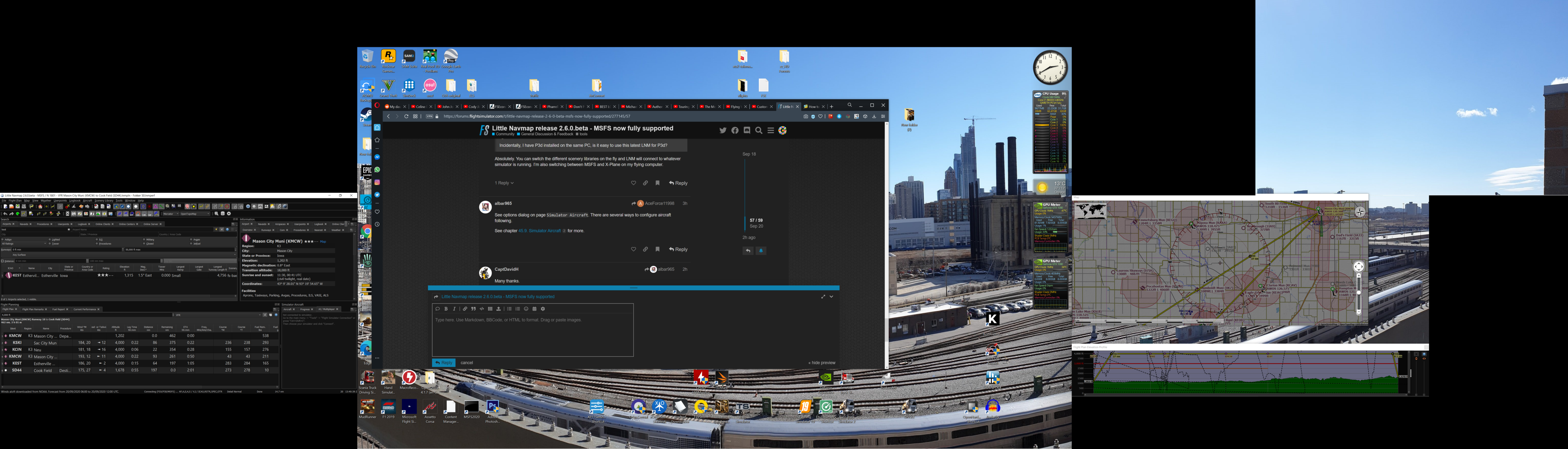
Incidentally, I have P3d installed on the same PC, is it easy to use this latest LNM for P3d?
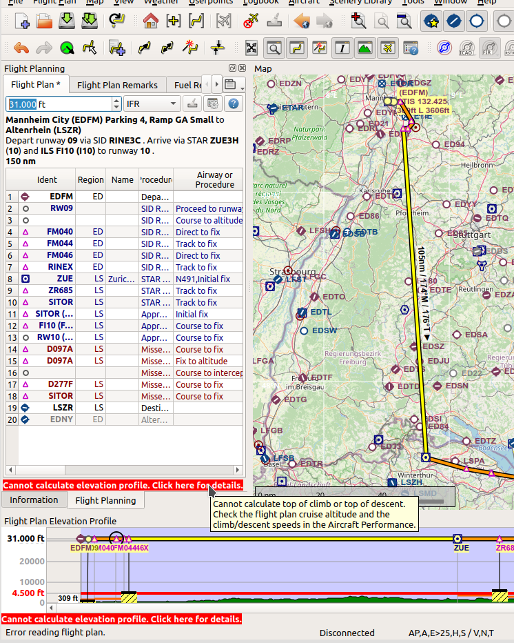
I suppose something with aircraft performance file (default “new” is normally good enough) was not right. LNM flattens the plan in the profile if this is the case. If LNM cannot calculate the cruise profile it will print a red message below the flight plan. Click this message and it will give more information. Example below for a too high cruise altitude.
Look at the tutorials in the help menu. There is one which shows how to create your own aircraft performance file with one flight.
Or download one here: www.littlenavmap.org/downloads/Aircraft Performance
Absolutely. You can switch the different scenery libraries on the fly and LNM will connect to whatever simulator is running. I’m also switching between MSFS and X-Plane on my flying computer.
I think if I was in the aircraft day on the runway, LNM would read my position and altitude(25’) and provide a correct starting position. More things to discover.
I See there is a ready made profile for the G36 project. I’ll try that one.
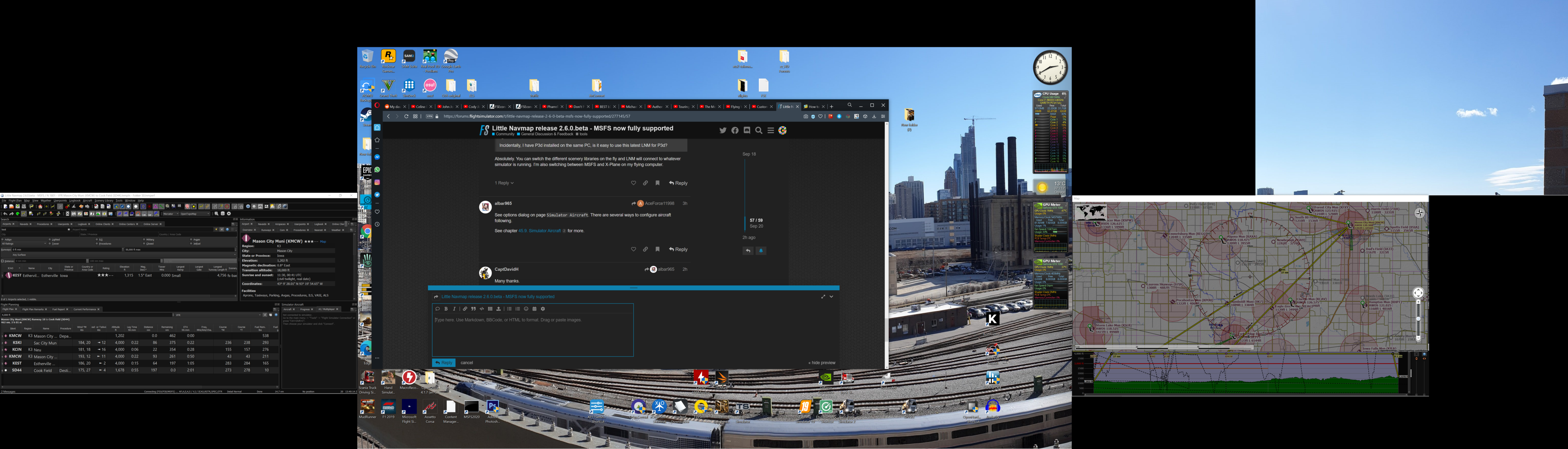
Hi, first off, thank you for the update to your fantastic software. After updating, I am having a slightly annoying window positioning issue. I position the windows as show in the first pic (I have 4 screens, so the shot looks a bit daft…) But after saving position & app state, I close LNM and restart it and the map window doesn’t return to the saved position. I have tried various combinations, including just having the map window on the right hand screen, both completely occupying the screen and partially. Also, if I select fullscreen map (while map popped out) the main app window goes completely blank (save for the top menu bar), I’m not sure if it’s supposed to be used this way or not, but thought I’d mention it.