I don’t think the clouds I was referring to are supposed to depict fog, smog, or smoke. I’m talking about clouds like this:
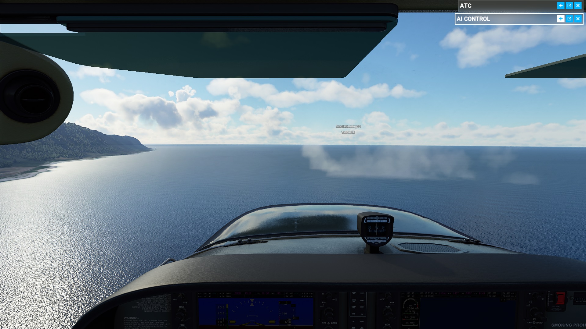
In case it’s not clear from the screenshot: the clouds are sitting on the water, the cloud base is at sea level or below.
Also, of course, there is no rain, but lightning, while the METAR of the next large airport (PHNL, about 20 nm from the location of the screenshot) reports showers in the vicinity (VCSH), but no thunderstorms.
Also, please consider giving this post your vote:
EDIT: Updated description. It seems that every single mountain/hill in the terrain yields a drastic “wave turbulence” and downdraft effect that can disrupt flights cruising some 20-30k feet above it… This happens despite these flights occurring in zones without close-proximity to clouds or clear-air-turbulence, so it’s clearly some wonky mechanic that has been put in, where the “wave turbulence” effect extends up way too high. But let’s pretend for a moment that the wave turbulence effect was…