There have been many useful posts about this topic from community members in various weather related threads time and again but I believe this topic deserves a separate thread of it’s own since it’s such an important and most ignored aspect of MSFS’s weather system ever since it launched.
The weather system currently doesn’t contain any haze or visibility blocking elements outside the METAR station’s vicinity. Even when it tries to create some haze by matching METAR reported data, there’s an arbitrarily fixed ceiling of around 3000ft AGL which by itself is unrealistic and since it doesn’t extend beyond a fixed radius around weather station, it looks weird like a white patch around airport from high altitudes which atleast for me is just unacceptable for a flight sim in today’s day and age.
Following posts could be relevant for this topic
Advanced weather engines like Xenviro already have intelligent ways to simulate proper aerial perspective of haze due to atmospheric scattering as it appears from high altitudes. They seem to do it by interpolating METAR data from the airports across the wider geographic region which also helps in simulating reasonably accurate conditions even for the airports that don’t have NOAA weather station. So it’s not something that’s unachievable or has never been done before.
This should also serve as a reminder to Asobo that absence of proper haze and visibility simulation according to regional parameters can’t go unnoticed and unacknowledged for as long as they want. It’s been 2 years that this sim has been there and I think there should be some explanation about what plans do they have for weather system since they locked it down in the beginning ruling out any third party alternatives. And I don’t care if some people want clear and colorful surroundings in live weather all the time since that is far from realistic.
As I’ve said in other topics, it’s completely incomprehensible me too that this problem has been so neglected by the developers and no progress has been made in 2 years.
It is a feature that fundamentally affects flight and its absence is visually illusion destroying.
NOTHING justifies neglecting to introduce correct visibility into the simulator:
The weather engine can do it.
The necessary data are available (Meteoblue)
In an earlier Q&A, it was only said that visibility effects are expected to be available by the end of 2022.
The last Sim Update for the year 2022 is Sim Update 11, which has no reference to this in the release notes…
I agree with the OP. Its weird flying around in good visibility in places like India where visibility is not great usually and then when approaching the destination city the low vis finally starts to show up. The weather is complicated though so i rather they do it right and take their time rather than rush.
I also have to agrre with the OP. The missing haze generation makes the MSFS much more unrealistic. Are the developers aware of this? REX weather force do it a much better as it have a haze generation, the SIm lokk much more realistic with it. Unfortuneatly REX is buggy on some other aspects due to the missing SDK for weather.
I just moved this topic to a more relevant category with voting functionality. Would appreciate support for this thread from community members who agree with it
OK,so I just found this thread today and Id like to add my thoughts.
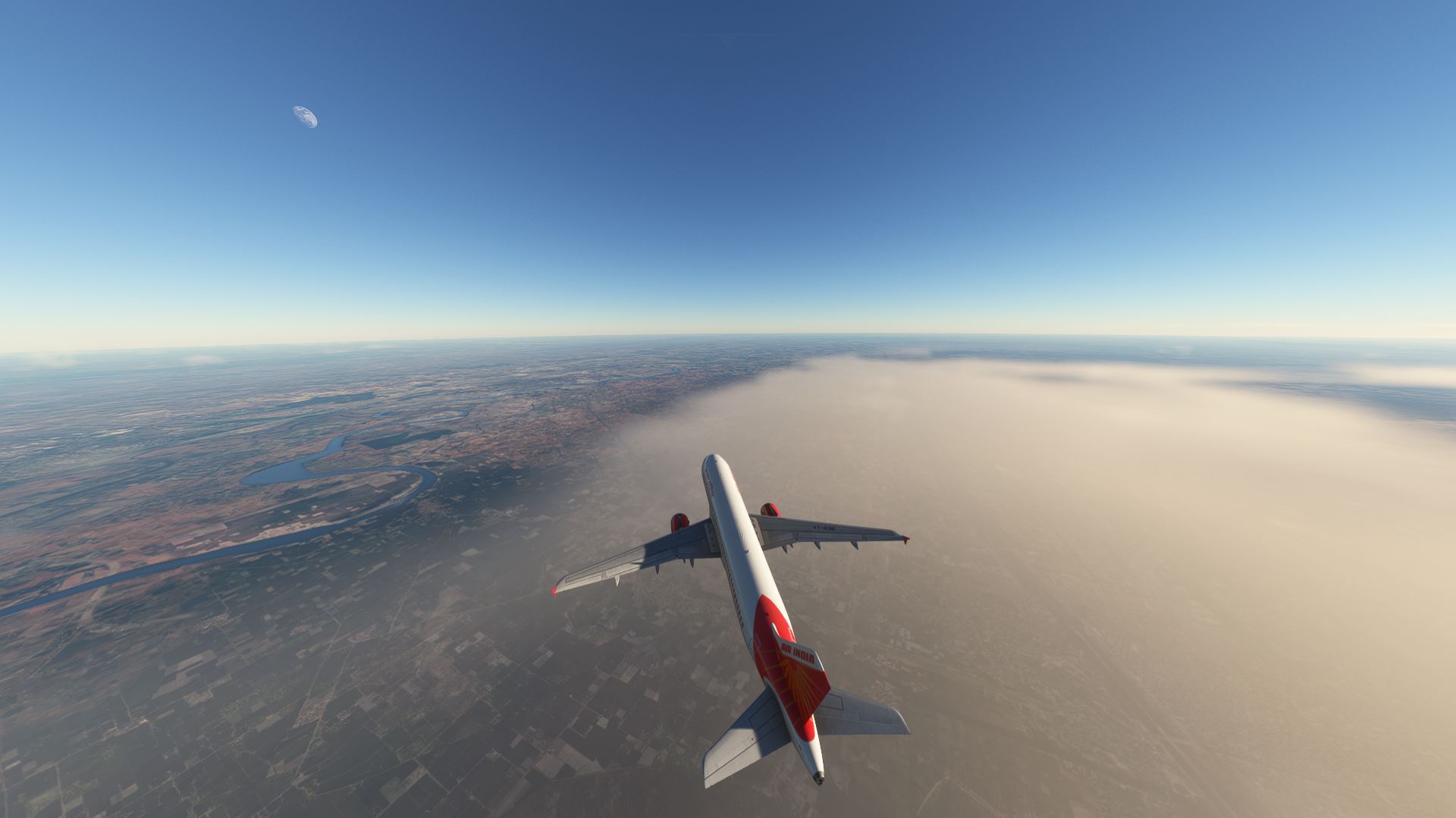
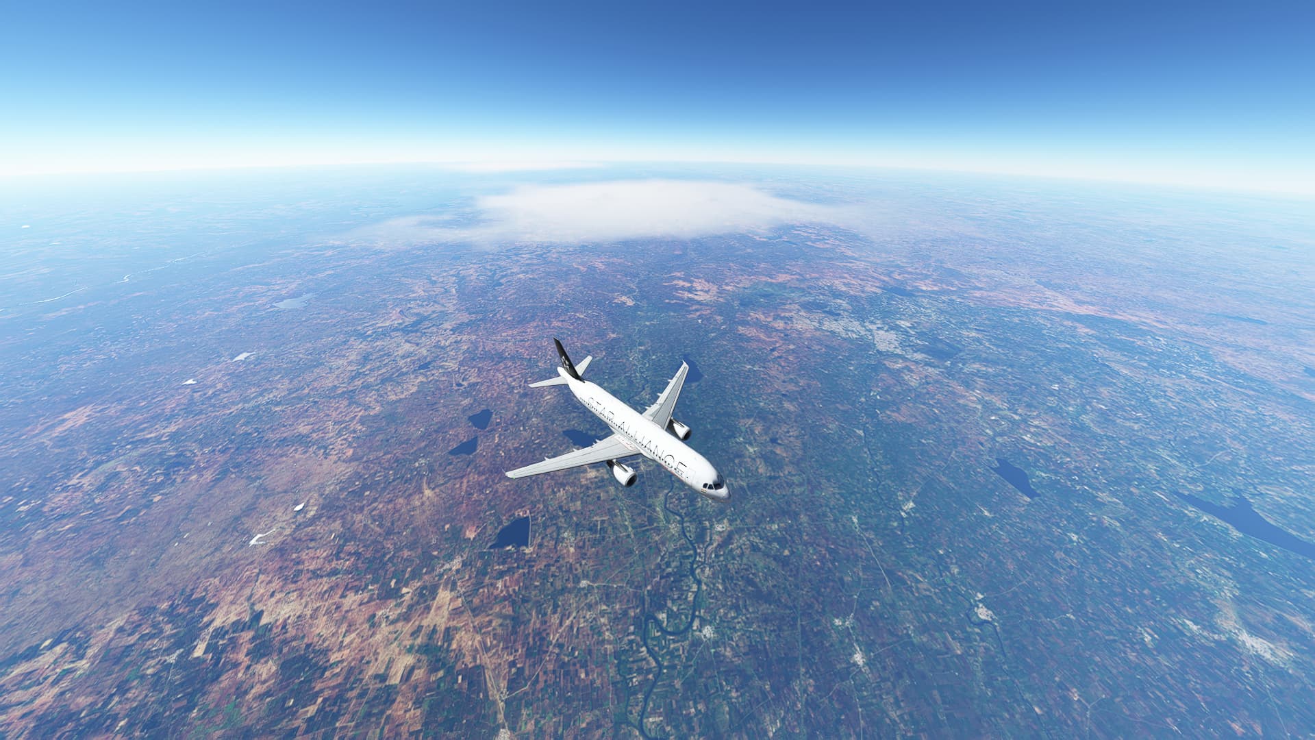
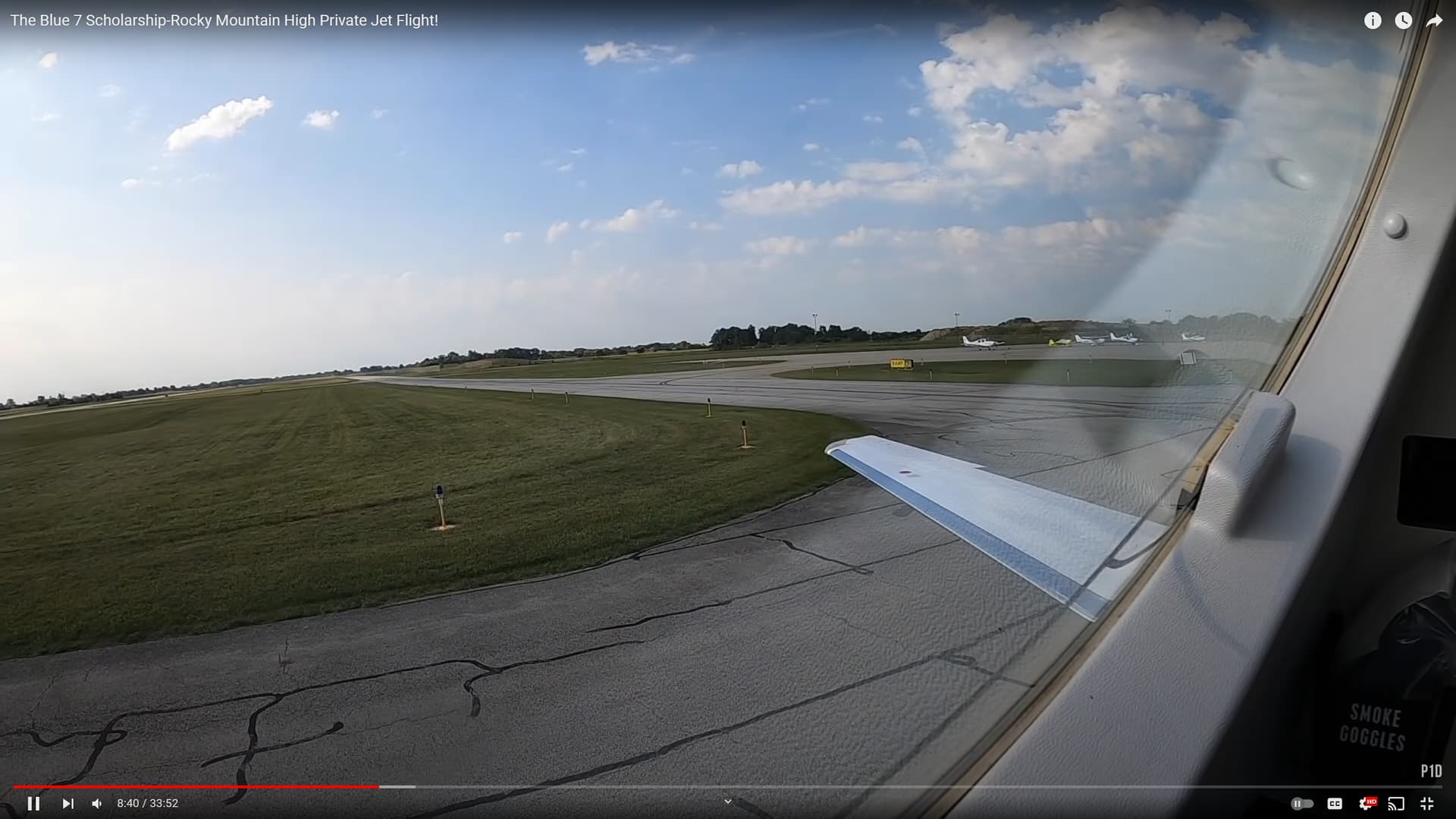
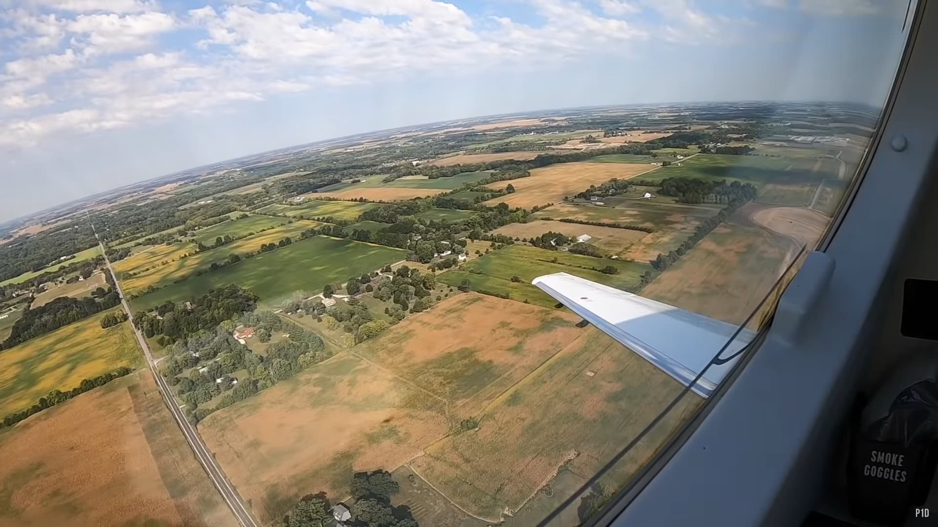
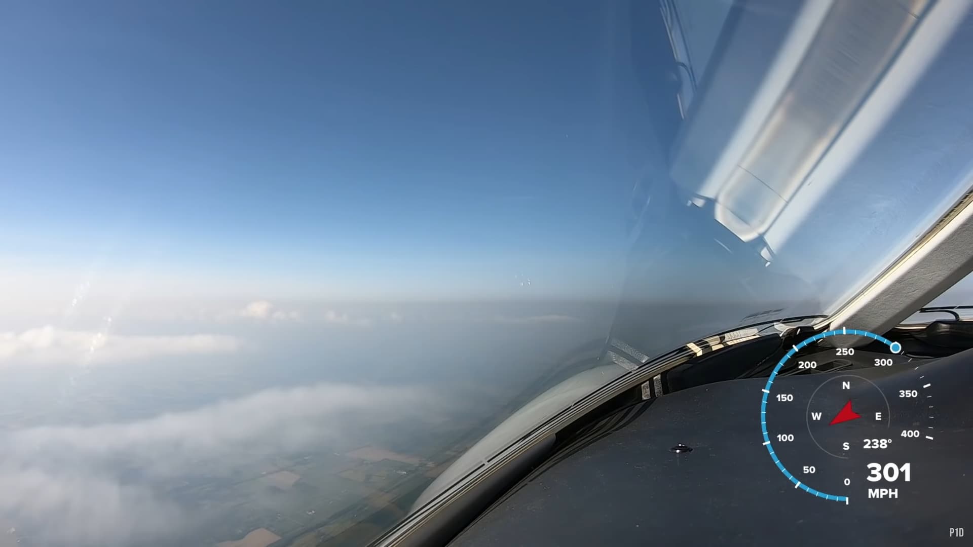
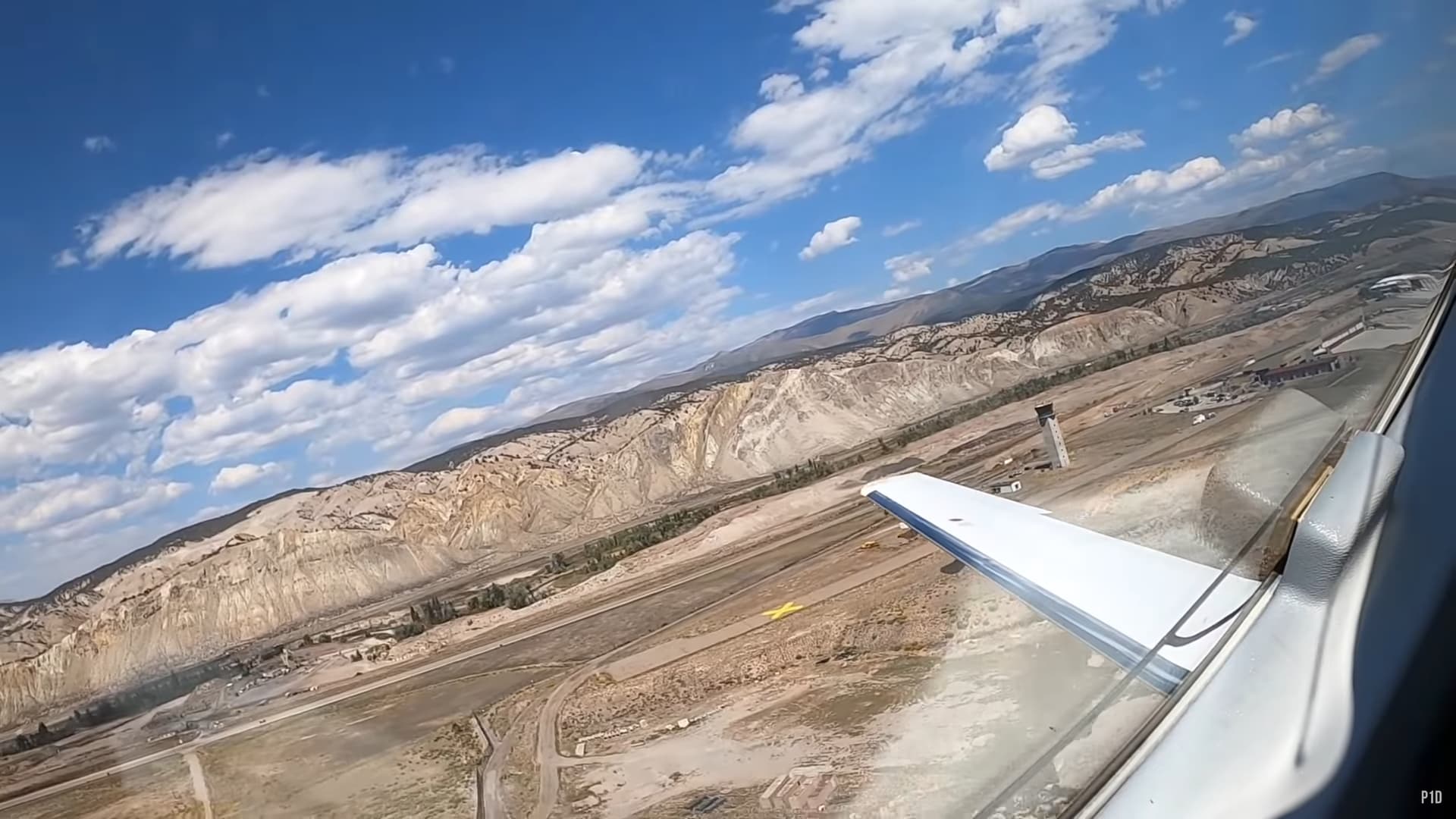
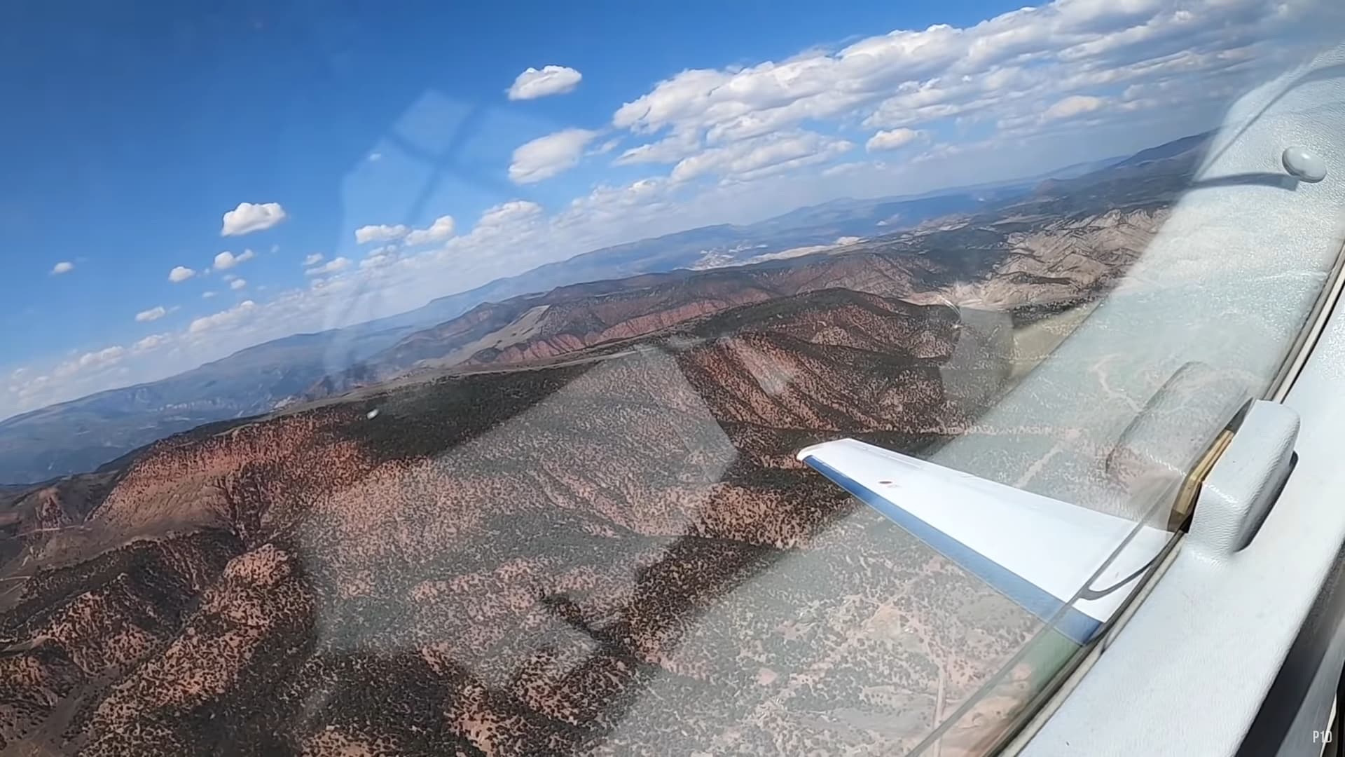
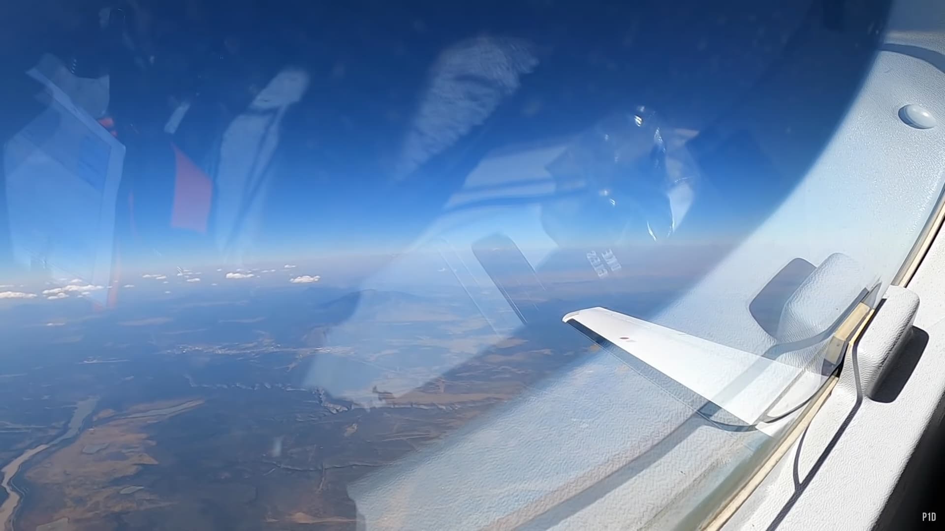
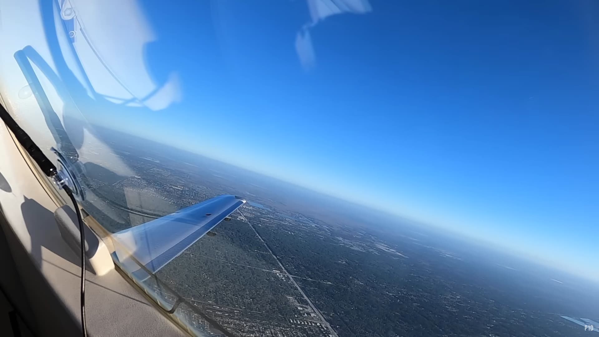
Global haze is incredibly important. It is literally all or some of what we call the sky. Its a major contributor to sunsets and sunrises being either boring or colorful. When you are on the ground, you sometimes cant even tell its there but then you rise above it and its impossible to miss.
Like in these photos: Start out on the ground and its just part of the sky:
Basically, haze controls the sky that you see. Perhaps it is the sky. Trillions of particles reflecting or refracting the light… varying densities, all doing their thing to create amazing sky optics for us to enjoy. It’d be a nice touch but I also think its
really important.
METAR Injection/blending seems to be critically involved in most cases where RW weather depiction falls short of the minimum feature expectations.
I.e: It is possible to set up extremely life-like layers of haze using static weather presets. However, with Live Wx, these areas ares of haze are invariably (and most unauthentically) confined strictly within those “Metar Crop Circles”.
This is yet another point that has suffered a massive downgrade since SU7, when Metar “blending” was added - Mind the quotes now, as there isn’t really much blending in fact. The edges of these circles are unnaturally hard and sharp.
All the more reason to have a toggle - Metar Blending is an extremely detrimental compromise that sacrifices a lot of quality in exchange for a little more* real-time accuracy. (*with dubious results at that)
It is not reasonable that all of us should have to surrender so much for these small benefits (if any) desired mostly by a minority subset of the player-base, that is: VATSIM users.
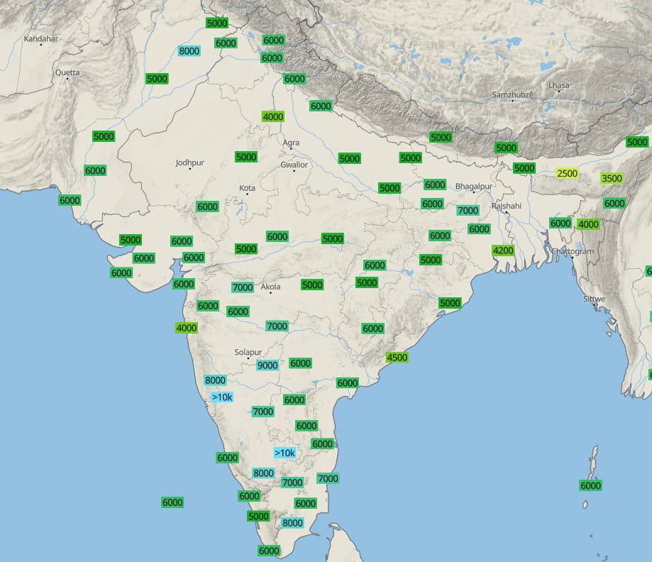
Now imagine having those isolated haze circles at all of those labels and that too with a fixed ceiling AGL which has no scientific explanation.
Some argue that METARs should be done away with altogether, so all we would end up having is clear CAVOK conditions throughout this and similar regions which is only going to make the matters worse as far as realism goes.
The solution is a thorough rework of weather model to have server-side blending of visibility conditions and meteoblue has enough data for Asobo to work with. The only missing piece seems to be the will and effort to take up that leg work.
The question that we need to ask is why are we relying on small-area surface observations to generate visibility? Or put another way - why don’t the MB models account for that natively over a broader area?
We already know that if the data are generated too far in advance (ie from a forecast versus an observation), they often get the details wrong, in both timing and space. Diurnal variations often kick off the actual weather and the gap between forecast periods doesn’t allow for accurate updates. You see this with fog/marine layers on the coasts, radiation fog in lowlands, katabatic winds in the mountains at night, and thunderstorm initiation during the day.
A way to effectively account for both the low-level haze (water vapor) and upper-level clouds could be to integrate satellite water vapor and visible imagery data. I’m not sure what kind of real-time input/output MB has for their short (time) range model (maybe it’s already there), but US GOES imagery updates every five minutes, similar to NEXRAD (radar). The downside is you have to deconflict snow from clouds in the winter and the upper level clouds often block the lower level. Then at night all you have is IR (cloud tops) and water vapor.
Smoke and smog are very insidious, as well. They are often very underreported in surface visibility observations, but they really only show up in visible satellite, air quality monitoring, and those pesky, inaccurate short-range surface vis observations.
Quite honestly combining all of these inputs into a useable, realistic-behaving model is a Herculean lift.
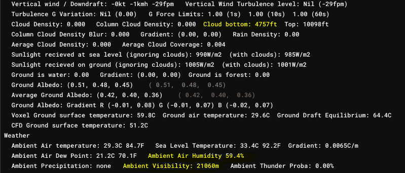
Well, I would argue that if only they could start visual rendering of humidity that gets calculated in real time in their own weather debug window, this sim would have a fairly realistic looking atmosphere.
All they need to do is to render a haze effect with a ceiling till cloud bottom according to humidity level outside the METAR vicinity. That would also prevent that infamous haze circle with hard boundaries around airports with METAR data.
Again I would reiterate the same point, it doesn’t seem to be the lack of data that’s handicapping this weather system.
I don’t disagree on general principle of rendering some haze from the surface to the LCL. The question becomes how much. It’s not a cut-and-dry “5° temp/dp delta gives you visibility x.” Or “%RH” etc. Stability is going to play in, as well as wind, hydrometeors, dust, etc.
But, in general, I could go along with a global something up to the LCL. Can the sim calculate that on its own? I’d argue that it can, given a standard adiabatic lapse rate, which won’t be perfect, but it would be passable in most places. Or can MB provide that directly as an input value? I mean, it’s kind of what the models spit out anyway as far as cloud bases. But then you have layers of moisture (or dry air) at different altitudes and the surface parcel may not make it to the LCL to begin with. Meaning, you let the sim loose to develop clouds based on surface temp/dp alone, it’ll be cloudy everywhere.
The problem, I assume, will be filling in the gaps where observation/reality doesn’t meet forecast, and how far back that forecast was generated. Again, diurnal shifts and fronto/storm-genesis and -olysis mess with all of that. Otherwise, we’d just do all our real-world flying based on forecast and never use real-time observation.
Why do they need to blend it? Why can’t the forecasted data be unchanged without blending that destroys the forecastmodel? We all know the limits of forecasted data. We also knows the limits of observations.
Only add a toggle that adds the observation data on top of the forecasted data if we need the observations to match 100%. It will only blend well if those sources match 100% anyway and then it will blend by it self. In the future those forecasts will get more and more accurate by it self and the blending will improve by it self.
Will forecasts be 100% accurate in the future? I don’t know. But i know those always improves a bit after every simulation run.