dear community, now with the Kodiak 100 i want to to give my IFR flying a break and start flying into remote places. How shall i start to plan such flight?
I am not planning to use LittleNavMap but Navigraph. How do you approach the flight planning?
is there a list available where i can see which routes are appropriate for bush trips?
since most of this small airfields have no SIDs and STARs how do you know beforehand which runways are available? how does the terrain looks like in the vicinity?
for bush trips I really recommend using LNM, it’s just a lot better suited for it.
How I approach this; I look for a (pack of) nice bush strips on flightsim.to (there’s loads available these days), and then just plan a route through valleys / along rivers etc, whereever the scenery seems nice. This is where LNM with the different map layers comes in very helpful.
no SIDS and STARS indeed. Just come in, fly over the airport, see what way the windsock points (if available), enter the pattern and land.
Thanks for your feedback. Well maybe i shall spend some time seeing how LNM works because it seems more appropriate for Bush trips than Navigraph. So if i understand correctly you download your trips from flightsim.to and then adjust them as necessary and start flying right?
I just grab some nice looking bush strips (so small airports) from flightsim.to, and then plan my own route in LNM. Just start with a departure and arrival strip, and then add waypoints / other airports along the way. You can drop a waypoint anywhere you want with LNM.
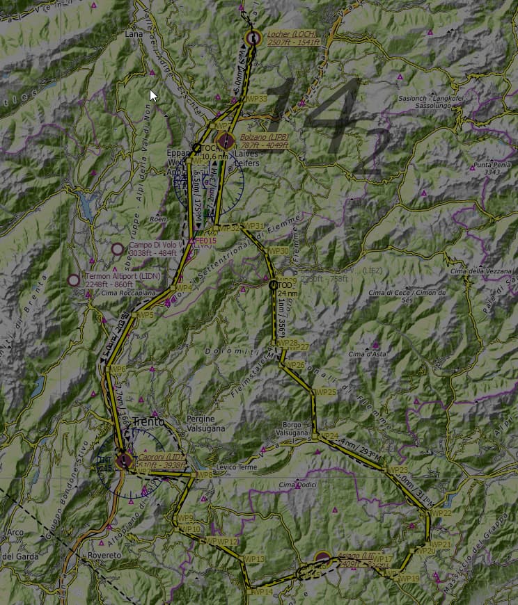
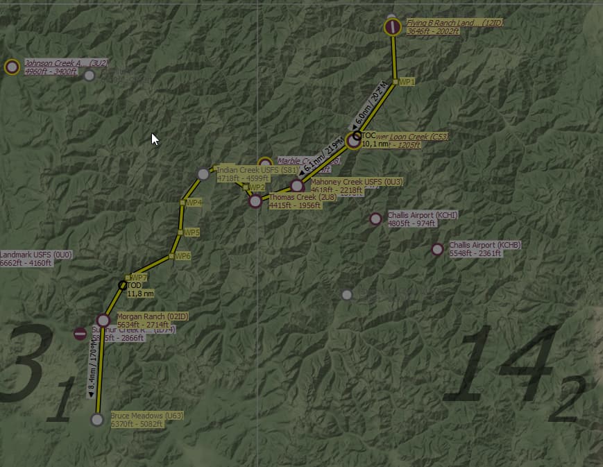
You could use my flight planner to examine the terrain, set up waypoints, and then use its navigation window to follow the plan. That might be more help than is “fair”, but you can take a look.