I think I tried that. Just never realizing LOC is the ILS? I will have a closer look next time.
I’ll try what PZL104 suggested, that would be handy. Then I see if I can input the frequency on the airbus, if it works great, then I’ll see how to input it for smaller airplanes. But who knows maybe one day they get back to the previous version, automatically.
Keep you posted and thanks again.
You can only enter the LOC frequency. The GS (if available) is tied to the LOC frequency.
And it’s always odd numbers for the ILS/LOC.
1 Like
Yes, that’s what I usually do too with these bugs: just wait patiently til they fix it. In the meantime trying to work around it. But it’s quite a list of workarounds by now, depending on where you want to fly and how. It’s all small stuff, but can be quite annoying.
Usually you would need a chart for your planned approach anyway if you are planning to fly IFR.
Especially for the US most of these charts are available for free on the internet.
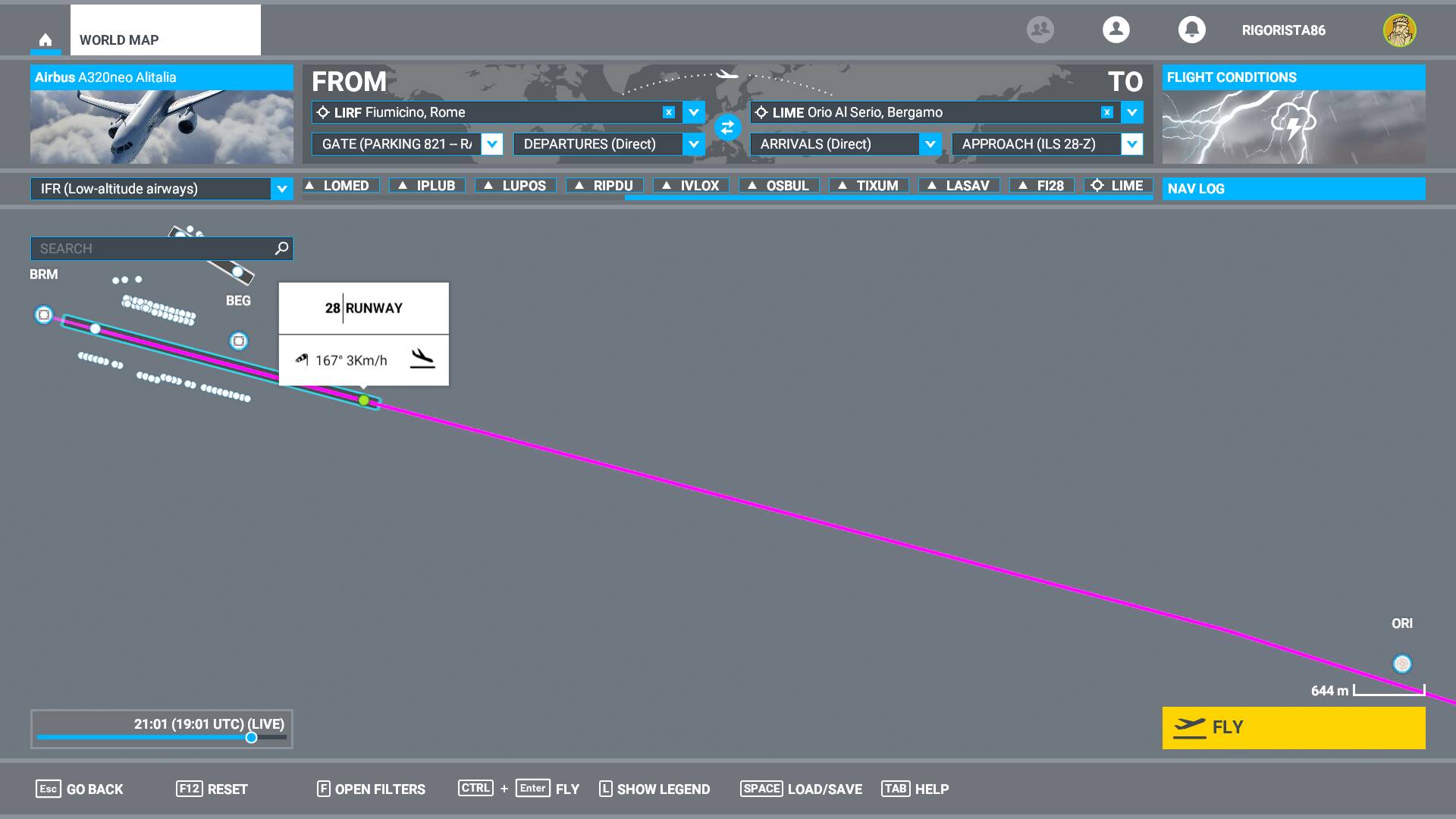
@PZL104 I am trying now what you suggested, but after I zoom the airport I see more symbols. For example one has small dots, I click I see type NDB 0 feet and frequency (this is “before” the airport somehow"), then above the airport I get some squares, one with “localizer DME” 784 feet and frequency, and another one with “VORDME” 810 feet and frequency.
Is it the BRM (the one with localizer dme) that I have to use to check the frequency for runway 28?
Yes, I sometimes look at those, but they don’t make much sense to me yet. And the places I flew recently aren’t represented very well in the MSFS data. So you can have your chart and then have MSFS mess it up.
I sometimes play with those approaches (first dropdown), just to see my flight plan completely messed up. Lines shooting everywhere. And then when I try to get back to my first attempt, it doesn’t clear up. Better start over. Seriously… that user interface… it really needs some TLC by good developers…
I think for me it’s time for Navigraph, load it up in Little Nav Map and skip that MSFS planner completely.
BRM is the correct one. The LOC antenna is (almost) always behind the opposite threshold.
I see it now too. That’s helpful.
So it’s 108.7 to fill in for @Rigorista86 and then he can finally land without crashing ![]()
The only really important items for an ILS approach on these charts are the
- correct frequency and LOC course
- point/distance where you intercept the glideslope and
- altitude to intercept the glideslope.