Update 10th January 2024
Version 3 is now live on Flightsim.to and available for download here
For the full description of what is included jump to this post.
Update 24th January 2023
Version 3 has entered beta testing. This will add 200 new beacons to complete CAM8 from San Diego to Seattle and add CAM18 from San Francisco to Salt Lake City. We will also have new hangar models and more Intermediate Landing Fields.
Update 10th December
Version 2.1 of the addon is now live at flightsim.to with lots of new features - check our main update post here: [Updated] Arrows Across America: fly the US Air Mail routes 1926 - 1934 - #127 by PipsPriller
Bare bones navigation from the dawn of commercial aviation…
Flying really low and slow in all weathers, day and night, no autopilot required…
Following in the slipstream of Leon D. Cuddeback & Elrey B. Jeppesen…
If this sounds like your kind of flying, then we might have something for you.
Inspired by a discussion on the MSFS 1950 - Historical Airports thread we have been recreating an original US Air Mail airway for the sim.
In 1926 the US Postal Service & Department of Commerce began contracting air mail routes that would eventually criss-cross the USA.
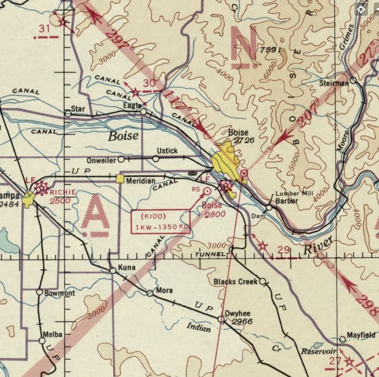
Each route was marked every ten miles by a path of yellow concrete arrows with flashing beacons mounted on 51’ towers, interspersed with landing fields. Some surviving arrows are visible on Bing Maps, meaning that they are also visible in the sim, if you know where to look.
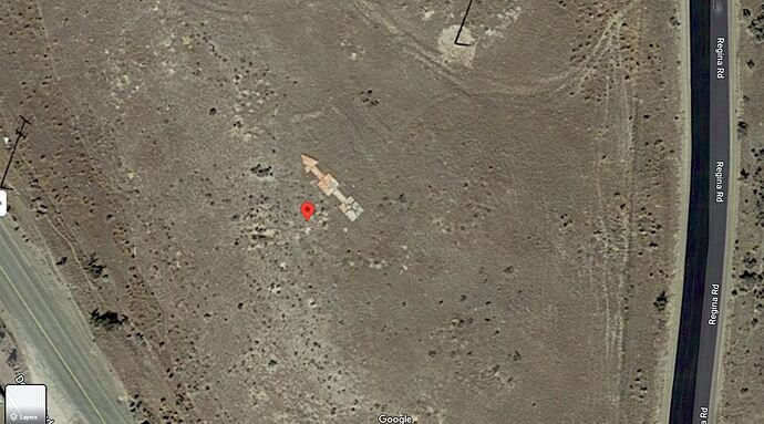
CAM5 Beacon 27 Arrow in Bing Maps
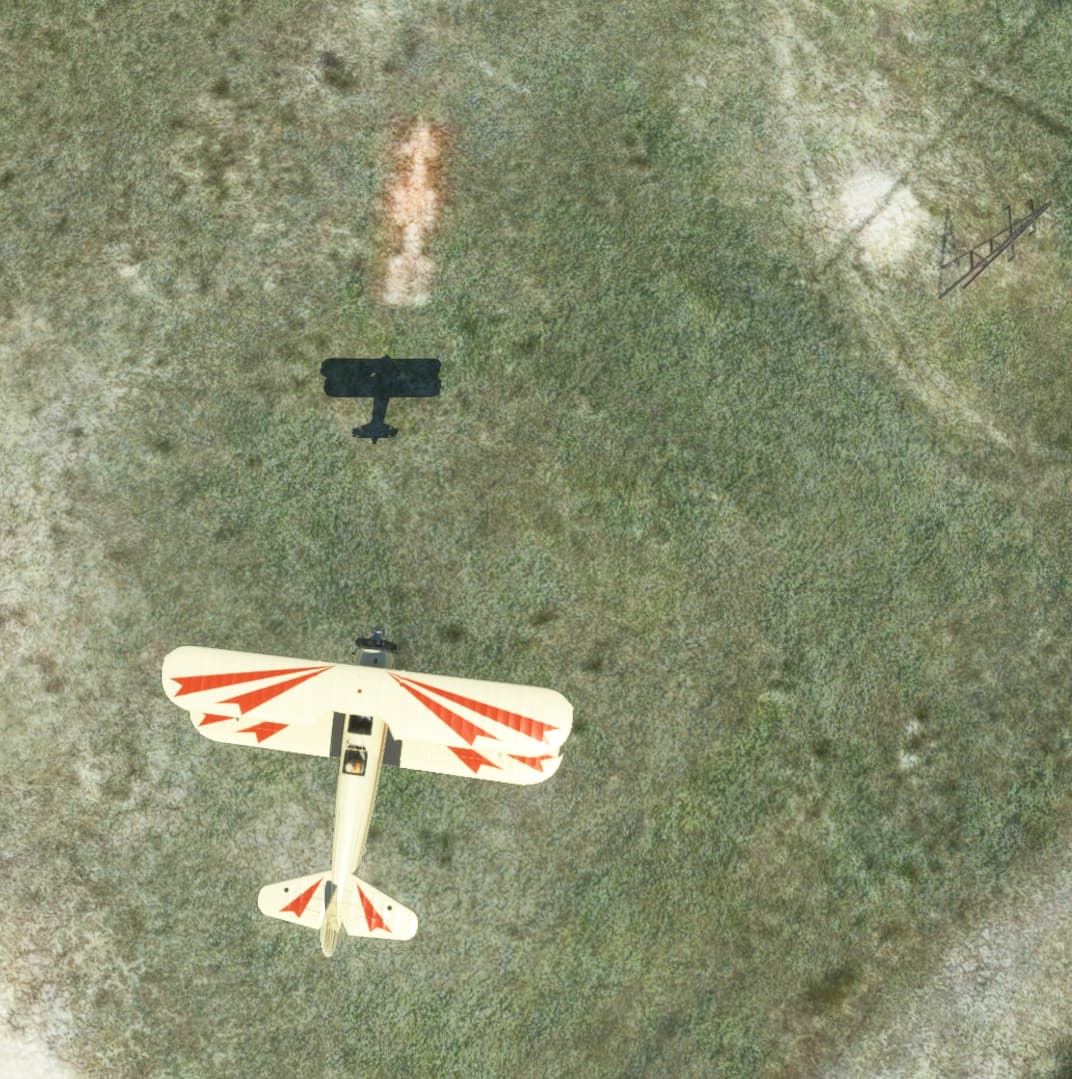
CAM5 Beacon 27 Arrow in sim
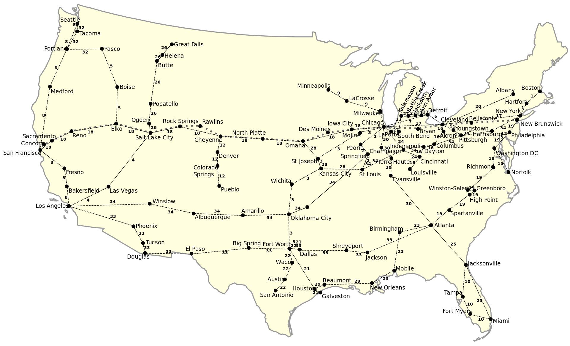
However, we have decided to recreate the whole 600 mile Contract Air Mail 5 (CAM5) route from Salt Lake City UT to Pasco WA, using original maps and research by aviation historians.
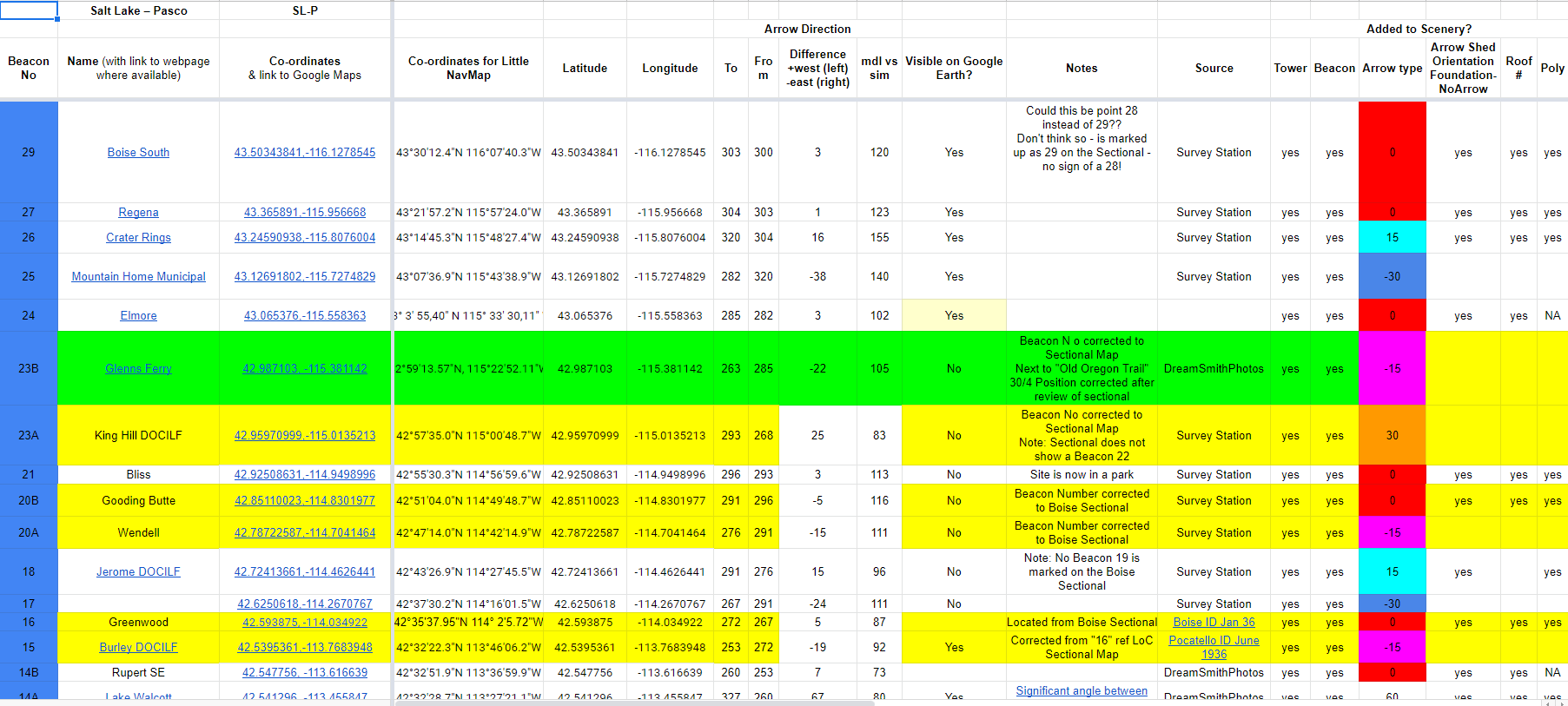
The route is mapped, 59 individually numbered beacon sites have been built to scale, positioned precisely using the original sectionals & surviving remains and are now being tested…
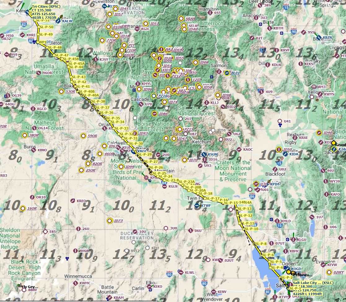
CAM5 route in LNM
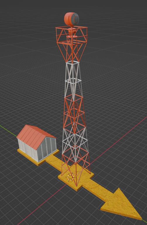
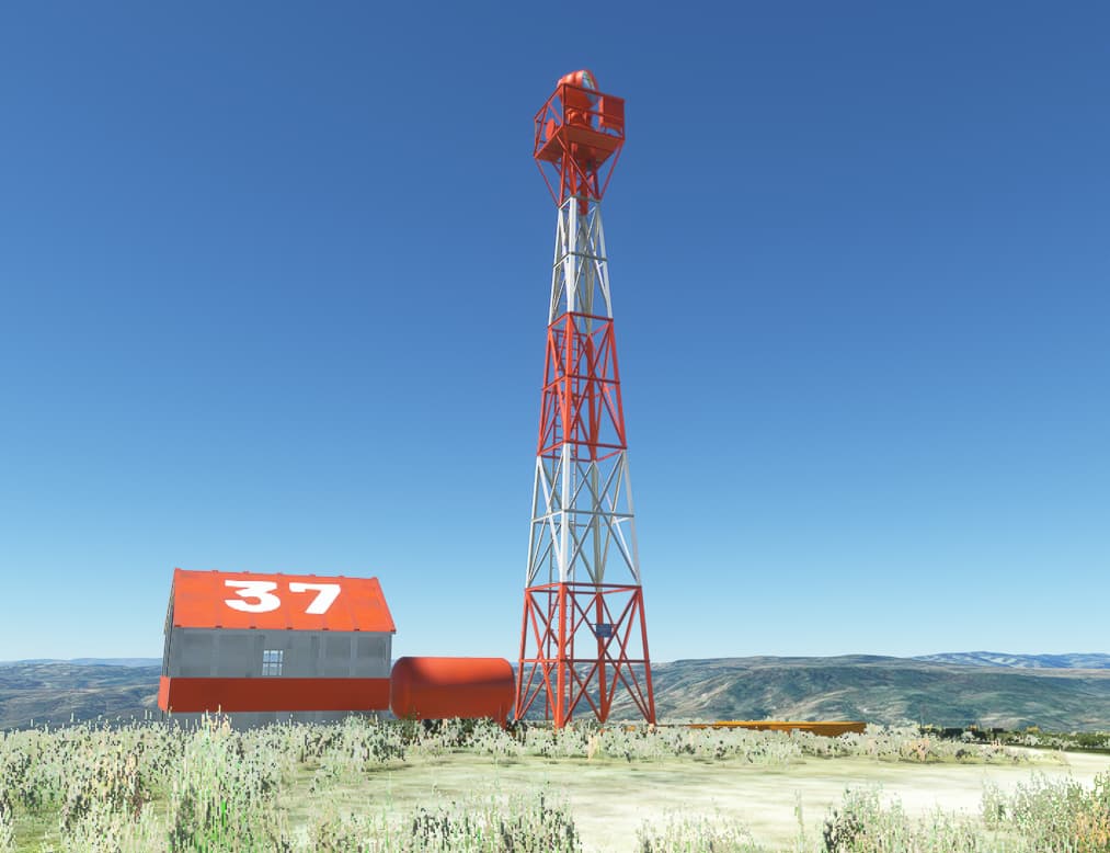
Arrow, mast and generator shed in Blender
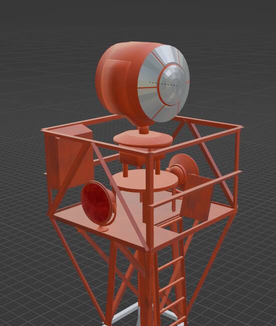
Beacon in Blender
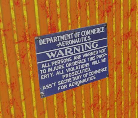
Beacon sign
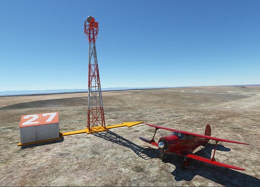
CAM5 Beacon 27 in sim
You can now download the freeware release from Flightsim.to - Arrows Across America: fly the US Air Mail routes 1926 for Microsoft Flight Simulator | MSFS
If you want to find out more about the airway system, then these sites are a great place to get started:
Arrows Across America
Zhanna’s Survey Station
And for an account of how low you need to go to fly the mail check this interview with Elrey Jeppesen
See you on the Airway!
@RobCap1966 - modelling; CAM5 & CAM8 lead
@PipsPriller - research, route mapping & documentation; ILF lead
@Megadyptes7635 - terraforming; CAM32 lead
@WaldoP3pper - beta testing
@Stearmandriver2 - beta testing