I was just flying for discovery when I stumbled on this place I saw once on a picture. Ronda in Spain.
Below is the Bing elevation data.
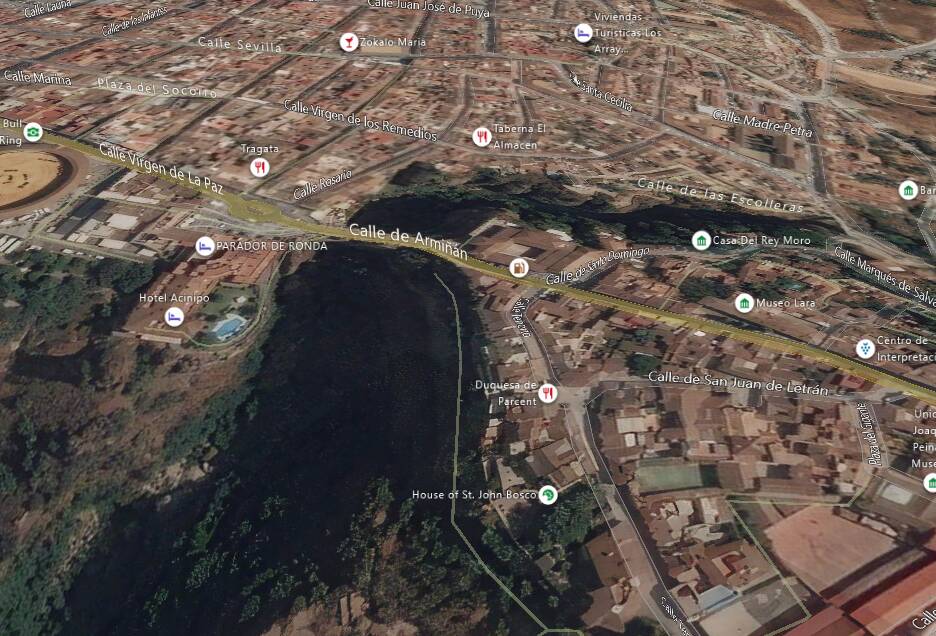
Then, this is from Google Maps.
The worse is that Google renders the whole thing blazingly fast in full 3D with real buildings… in my browser.
One can wonder if Bing terrain data is not stale. There’s not much 3D telemetry being added outside from major cities. And it has been like this for a long time.
MSFS would really benefit from using… Google Maps data 
2 Likes
Unlikely this sim will ever use google maps could you imagine the cost to microsoft to pay google to use their data. Best we can hope for is that more effort is put into getting better map data with bingmaps.
And this is from Bing maps
The world is being created by AI, this scene is completely unique to any other on the globe by a long shot.
There will be much more deep learning going on before it gets anywhere near deciphering that arch.
As it is the sim is still working out gables and strangely pitched roofs.
exactly. I don’t think many people understand how mapping works. Give it some time, people. Google was on this a long time ago… Apple is in it. Microsoft is in it. It will just get better and better.
I know it’s a default to go to Google but even though Google allows you to zoom in beyond Bing’s max (as shown) but side by side the clarity and color go to Bing IMHO in my neighborhood anyway.
I would accept your comment if Microsoft had done any serious work for mapping in the last years. They did not.
They started mapping some cities with proper 3D telemetry but it stopped there. No additional update in this domain for quite some time. Google seems, unfortunately, to be much more involved into this, having telemetry for even remote places.
Unfortunate. Especially since MSFS is tied to Bing mapping.