Like many others I’ve been a little frustrated by some recent bugs. I even pulled up X-Plane 11 as a backup plan. But I was reminded of why I fell in love with MSFS.
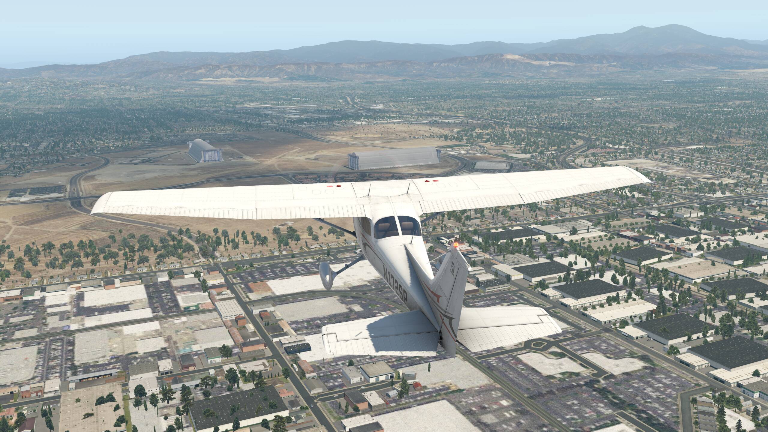
This is the old Tustin Marine base in Orange County, California just after takeoff from KSNA. The World War II-era blimp hangars are visible from miles away and are specifically called out on FAA VFR sectional charts as a navigation aid:
For all its faults, this iteration of Microsoft Flight Simulator is many nautical miles beyond the competition in general scenery quality for VFR where you’re navigating by landmarks, especially in the photogrammetry areas.
So thanks, MS and Asobo, for bringing us some pretty awesome stuff. And please work out that flaps thing.
There is scenery you can get for X-plane 11 that gives you all the landmarks and visual references; and it’s free. Obviously the default scenery is not going to compare.
The best part is that the scenery in MSFS is not static like one-off scenery packs. As things change in the real world, those changes eventually make their way into the sim. Not real-time, but certainly dynamic.
Try California with Orthos. You can hardly tell the difference between the two sims- other than the lighting (which MSFS does spectacularly), autogen styles, and weather of course…
Thanks, Orthos should help a lot for ground textures on X-Plane! Building landmarks will be kinda hit or miss still but some are available as add-ons too (I even found one that lists the blimp hangars here, though it doesn’t include other nearby things like shopping centers and amusement parks)
I live in a state where only a small portion of the capitol city is PG, the rest is Bing Maps and Blackshark Autogen. But it came REAL CLOSE. Like, I could find the Navy base, the Walmart and the parking lot outside of the perimeter, the rare rotary (there’s only seven in the state, that’s why people here don’t know how to drive in one ) - clearly the main bridges are wrong, but they’re all wrong in MSFS unless they’re hand-crafted - Blackshark AI limitation from only having top-down views, but I could follow the road to my house from my parents’ 30 minutes away, highways, secondary roads, it was all accurate from 1500’. And all non PG.
Even the best of Orbx couldn’t get that kind of fidelity. And I swore by Orbx packs in FSX.
It’s been a long time so I’m afraid I don’t really remember. I live in Southern California so that was one of the first areas I enhanced. I would start with the pre-done Orthos that were in the X-plane forums. I think the title was something like US Enhanced Orthos Project. They are available state by state.
I have also download many individual packages of scenery available on x-plane.org. I suggest spending an afternoon doing an extensive search.
Yeah, we’re kind of stuck between two imperfect sims these days. I was in XP for a while but can’t bring myself to go back to it. I’m not at all happy with the current state of MSFS, but it’s enough to keep me occupied… sim limbo I suppose
I am very familiar with the OC - and yes, I agree 100%. I’ve said this since release - out of the box - vanilla/default scenery in MSFS is light years beyond the rest (and other previous iterations). I especially enjoy the approach iinto KSNA for Rwy 20R - with the 55 freeway just to my right beneath me, and then swooping over the 405 freeway just prior to touchdown. The immersive element in MSFS is brilliant.
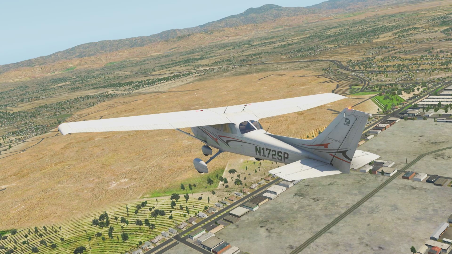
Ok, for fun I installed two major things in X-Plane:
“Extra landmark package” that includes many landmark models, including the Tustin blimp hangars - this was an easy drop-in
“US Orthophotos” for California, Oregon, and Washington - this required large BitTorrent downloads, then running a program to convert the textures to the proper GPU-friendly format that would’ve made for larger download if provided in one step
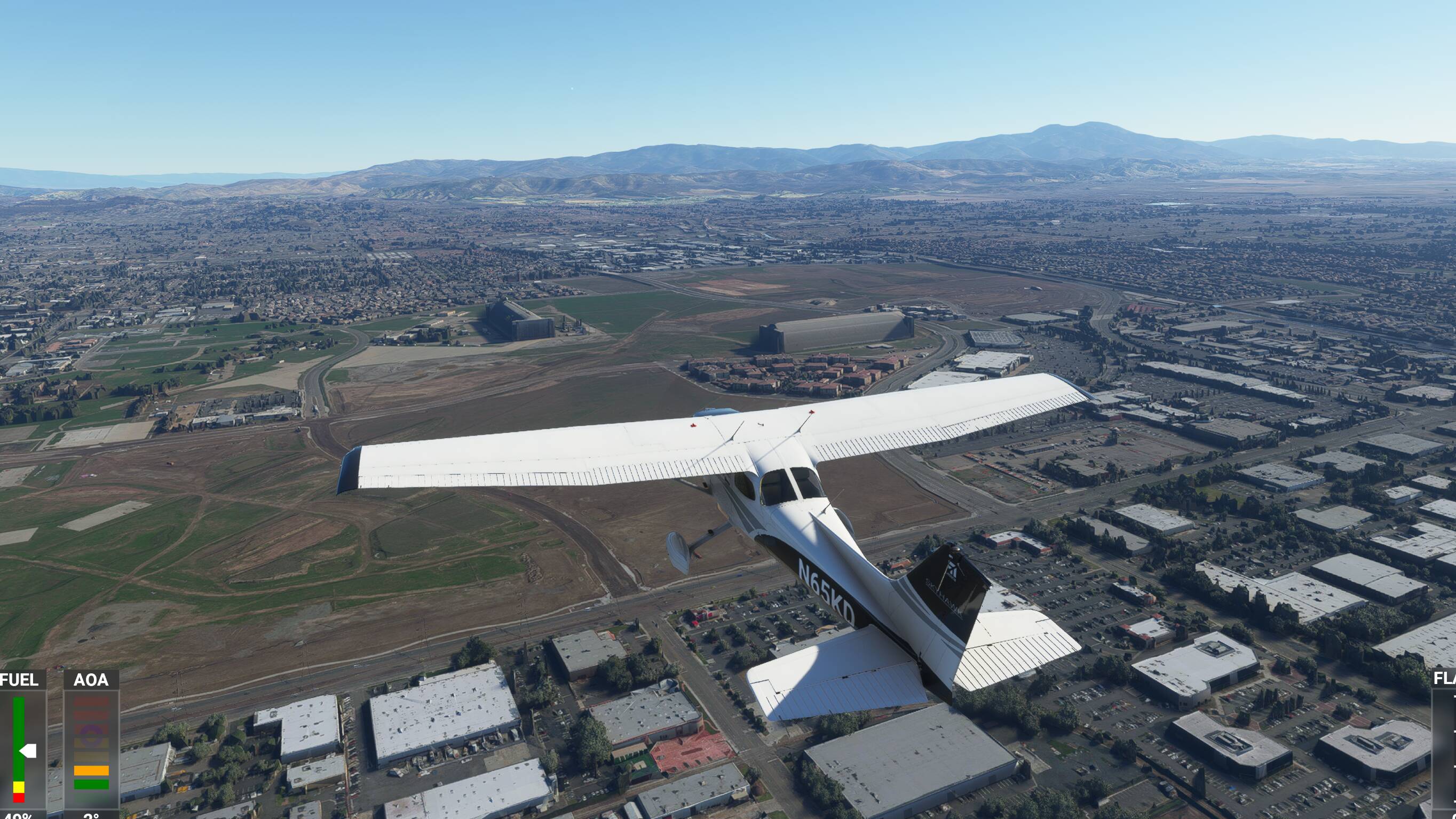
This makes a significant boost, thanks for the suggestions! The particular case of the Tustin blimp hangars now looks pretty good, with terrain textures for the old base grounds and 3-d models of the hangars:
But it still falls down as soon as you’re trying to navigate by anything that wasn’t modeled, like the shopping center The Marketplace a mile or two down the road, with its distinctive brick-red walls and spires in the parking lot:
 But I was reminded of why I fell in love with MSFS.
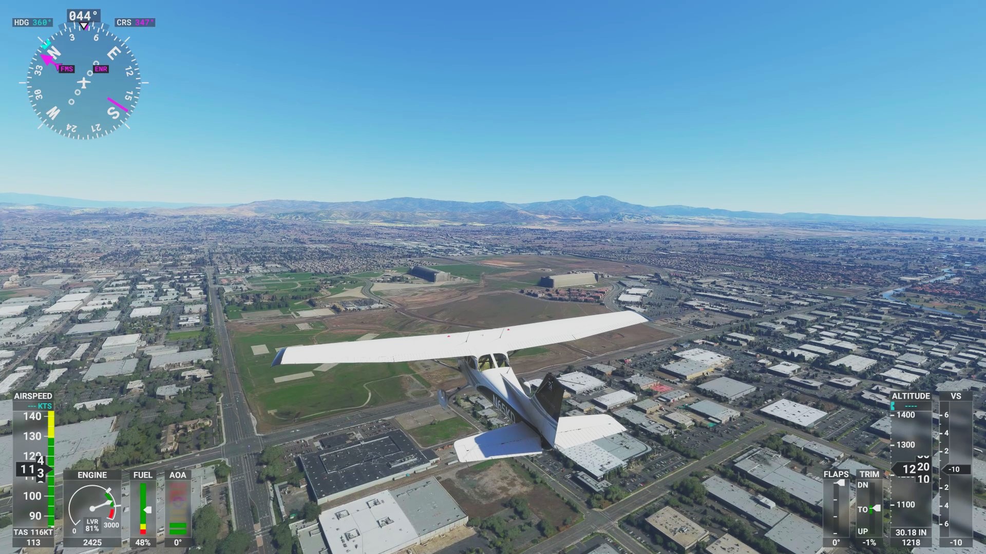
 ) - clearly the main bridges are wrong, but they’re all wrong in MSFS unless they’re hand-crafted - Blackshark AI limitation from only having top-down views, but I could follow the road to my house from my parents’ 30 minutes away, highways, secondary roads, it was all accurate from 1500’. And all non PG.