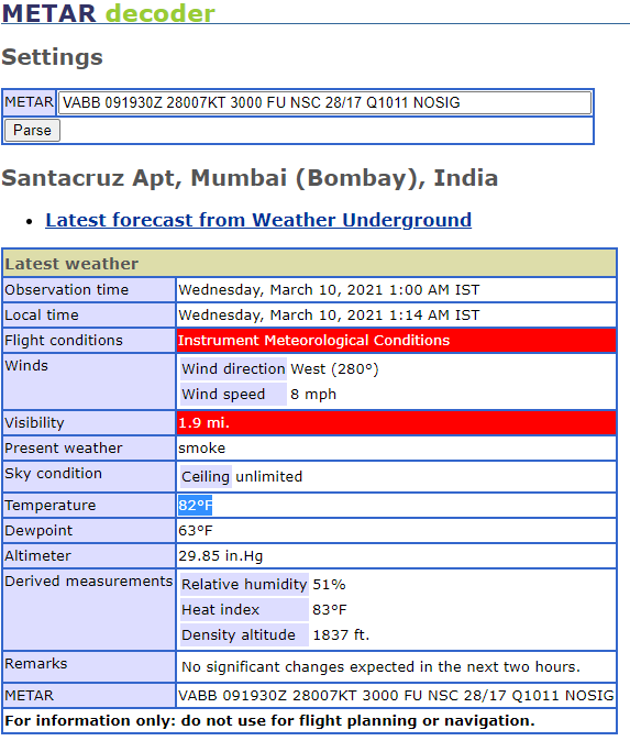
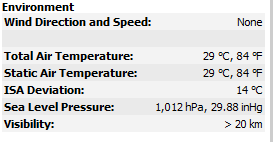
It’s disappointing to see that after so many sim and world updates, there has been no work on the actual visibility simulation in the sim.
Here are some screenshots to illustrate the actual vs simulated visibility at VABB airport
Actual METAR decoded data
Sim data as read by Little NavMap
How it appears in the sim
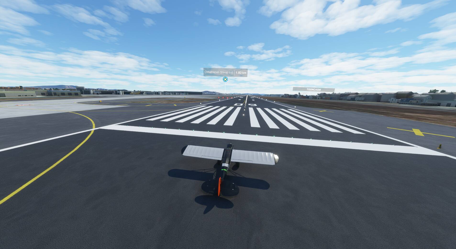
Note: I load the live weather once the flight is loaded at live UTC time