OK, thanks, I thought something was missing ![]()
Once at final, ILS or RNAV worked perfectly.
I gather “Visual” approaches were a G1000 item only?
OK, thanks, I thought something was missing ![]()
Once at final, ILS or RNAV worked perfectly.
I gather “Visual” approaches were a G1000 item only?
Visual Approaches become available once G3000 is updated to the NXi standard, which is coming later (this year?). Until then, it remains using the legacy Flight Planning logic (same as the sim) which doesn’t know about Visual Approaches as a Procedure Type.
Should we keep an eye on GitHub or will it be working it’s way into the store?
Can we assume that altitude restrictions will get auto-populated in this future release?
Best to ask WT that question on their Discord server, but I imagine it would. If it’s a feature in the actual Garmin, the team intends to recreate it in the sim.
WT is building a complete new G3000 similar to the G1000nxi. we have to wait until later the year is released.
then lets see what is included.
Quick question for the TBM / G3000 wizards…
(Mugz TBM with working title G3000)
At the top of the MFD it shows distance/bearing etc until the next waypoint. Is there any way to make this display the details for the destination, ideally a total distance to the destination including the previous waypoints?
Thanks in advance
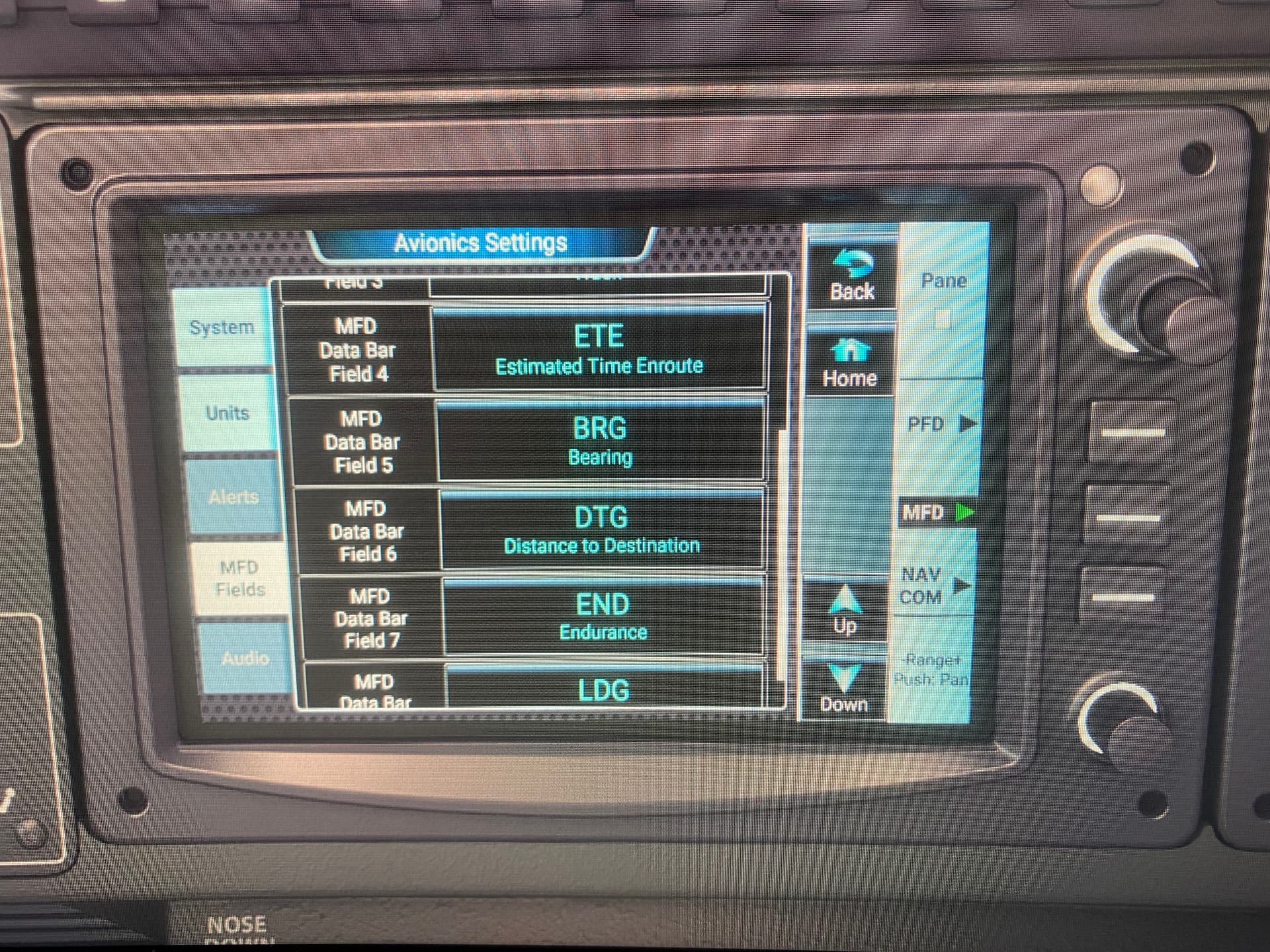
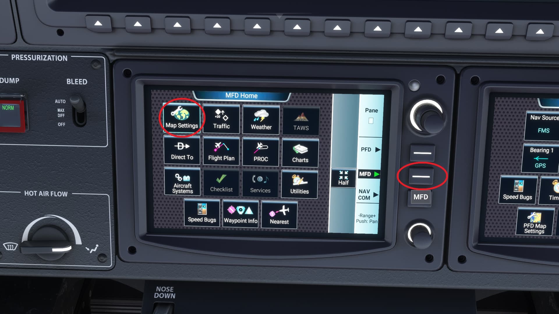
Yes, you can change it via the touch screen thingies. Under map settings I think. You can change each of the 8 info boxes to show what you like.
MFD utilities → Avionics settings → MFD Fields
I was able to change one of the fields from distance to next to ‘distance to destination’ which is exactly what I was after!
Thanks again ![]()
Hi, I have a problem with MFD. Practically the map does not follow the air route. It gets stuck. I installed Working Title G3000. Thank you
Wondering if the Working Title G3000 mod has a working VPTH functionality yet like the G1000NXi? I know they have been working on it a long time so wanted to follow up
Do you mean VNAV automatic descents, beyond the current “advisory VNAV”? If so, not yet. Supposedly later this year the G3000 WT will get a full rework…I’m looking forward to that.
yes, exactly. the WT G1000 mod enables this currently so you can descend automatically all the way to the runway. but the more advanced G3000 hasn’t been able to do this yet. hoping it’ll be enabled as it’s been mentioned for well over a year now. but all good things come to those who wait
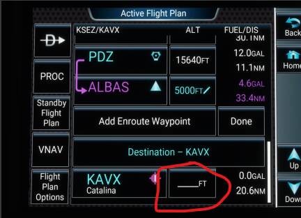
another question: is there a way to get the ADVISORY VNAV all of the way down to the runway threshold? Currently I can only get it to the last waypoint enroute. When I click the altitude setting next to the actual airport the button doesn’t work and nothing happens.
VPath will not be enabled, Working Title is building a fully new G3000 ! the new one will have vnav then.
probably later the year.
My guess: by that point you are already in Approach mode (RNAV, ILS, etc.), so VNAV, advisory or otherwise, is no longer relevant. (Others might have more exact language than me.) That said I usually enter the runway altitude in that field, just for reference.
I don’t think that’s it, as it in indeed very relevant as there’s no guarantee you’re in an approach yet. Also many routes don’t have states approaches so the advisory vnav is even more important. in my example above the last en-route waypoint is still over 20miles from the field so the advisory vnav is still very much needed. i’m not sure if this is a bug or if there’s another technique i’m misssing as it should indeed allow you to either place an elevation at the field or at least add an additional waypoint before the field -1 miles
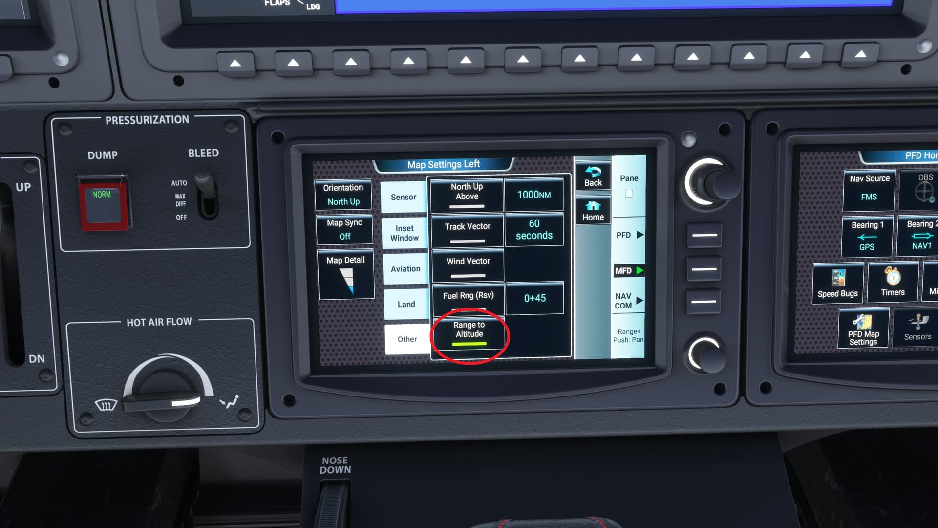
TBM930, The blue arc on the MFD is your friend. When climbing or descending in VS mode, it shows where you will be at the selected altitude. Vary the VS rates to achieve an altitude at a certain point in the climb or descent.
i think i know what you’re talking about but a screenshot would be helpful. however i dont think that works past the last waypoint
Hopefully this shows what @simmnut is saying about the blue arc line as he is spot on!