yes that happens to me a lot too! I live in Northern Ireland and from November to March, even April we get a lot of stratus clouds, and no sun for weeks, yet in MFS it’s always cumulus clouds, and if we have heavy rain CB that when you fly above them they look like volcanic hash cauliflower, you can fly even further north in the the hemisphere but you will find the same clouds too. It’s an immersion killer for me!
3 Likes
Yep we see the same here in the UK almost weekly. The ‘other’ sim is able to show these higher layers of overcast cloud in live weather, but MSFS just is rarely showing this anymore. Almost always now in MSFS in live weather, despite the cloud cover being depicted on the world map, the rectangle weather indicator will even suggest overcast is present, but then you load in and it’s just broken cumulus blobs with blue sky through the gaps when the reality is as you say, higher overcast layers.
3 Likes
In the name of all that is holy, please don’t follow your repeated calls to gather empirical evidence with ‘I’m not seeing clouds follow suit’.
Clouds absolutely do follow suit and make bubbles, all the time. How many hours in game do you have? Are you flying in metar heavy zones like the US, or no metar zones in Siberia?!
2 Likes
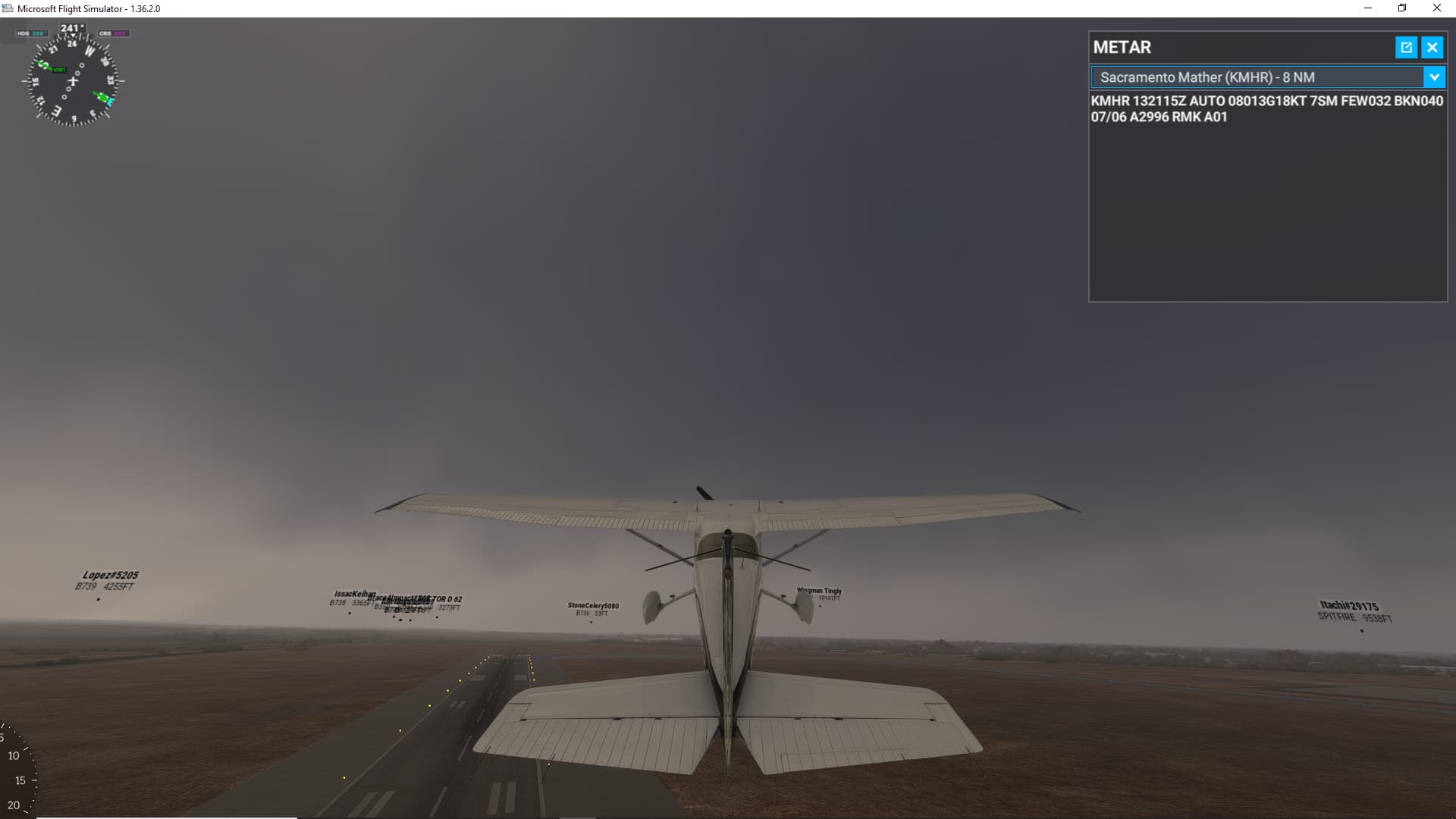
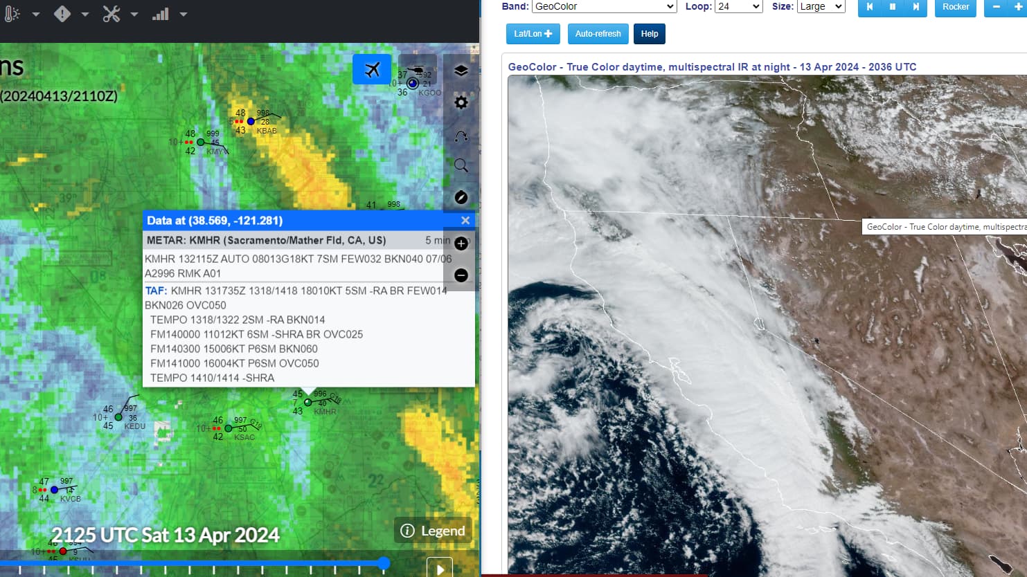
I’ll indulge your harassing tone with evidence, since you don’t seem interested in providing your own. I collected it when I had some spare time today because I figured you’d be back. Anyway, here is a sampling of airports I found that were reporting skies that did not correspond with the in-sim clouds at all. I tried to find METARS that were surrounded by METARS that were reporting the opposite (clear surrounded by clouds, and vice-versa) and supporting it with pics of the in-sim clouds. Some of these were surrounded by METARs that were close, others had METARs that were very distant. In any case, I could find no airports that had a “bubble,” and in all cases but one, any in-sim cloud depiction was supported by external models or observations that correlated with either the breaks or cloud cover. But again, they did not match the METAR exactly and they did not do so by generating any “bubbles,” which is the point.
Mather (KMHR) Reporting FEW032 BKN040. Doesn’t look like either to me:
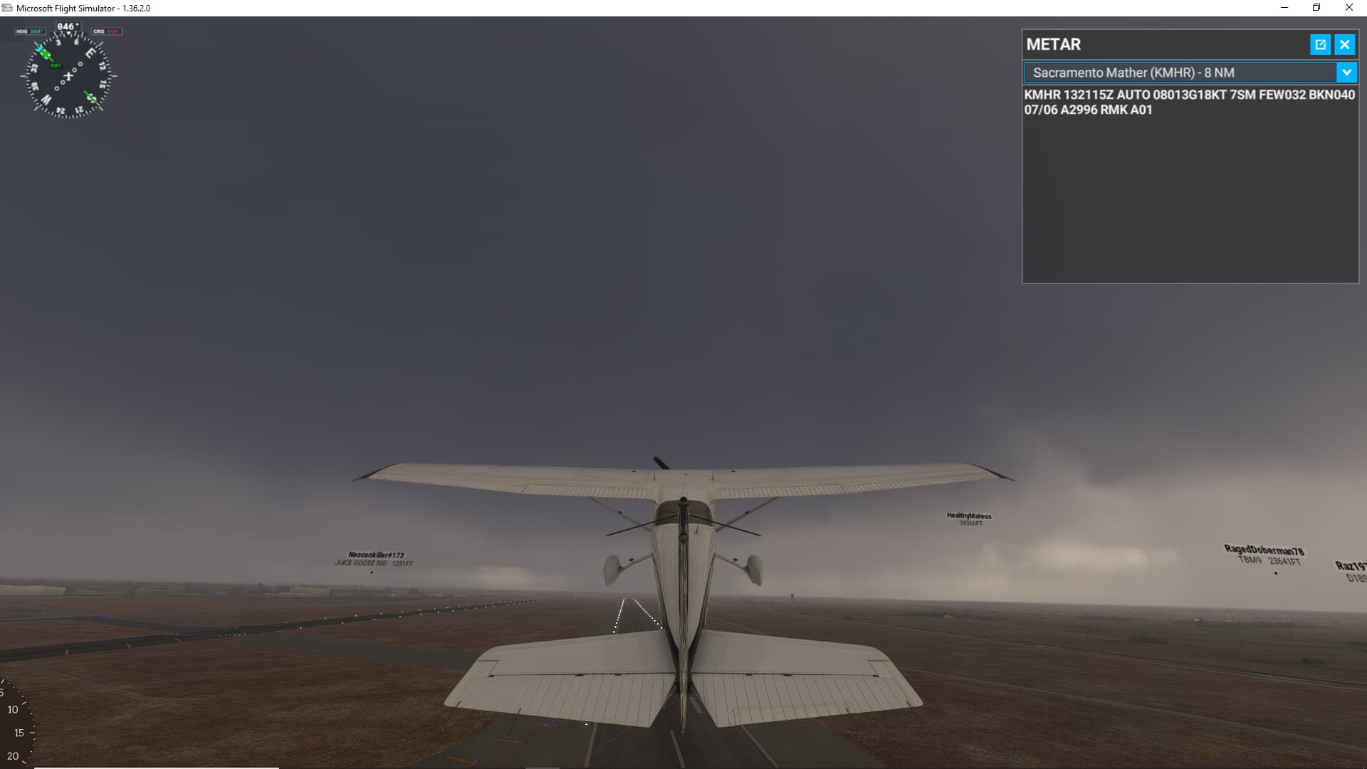
Looking the other direction:
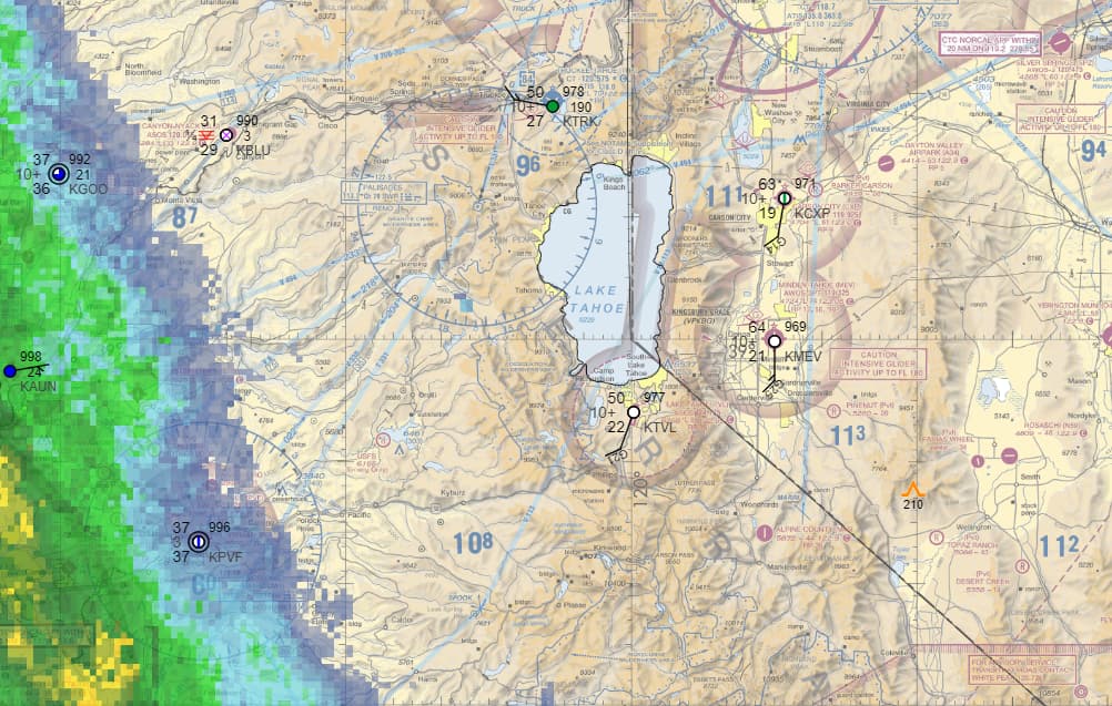
South Lake Tahoe (KTVL) - Reporting clear, doesn’t look clear:
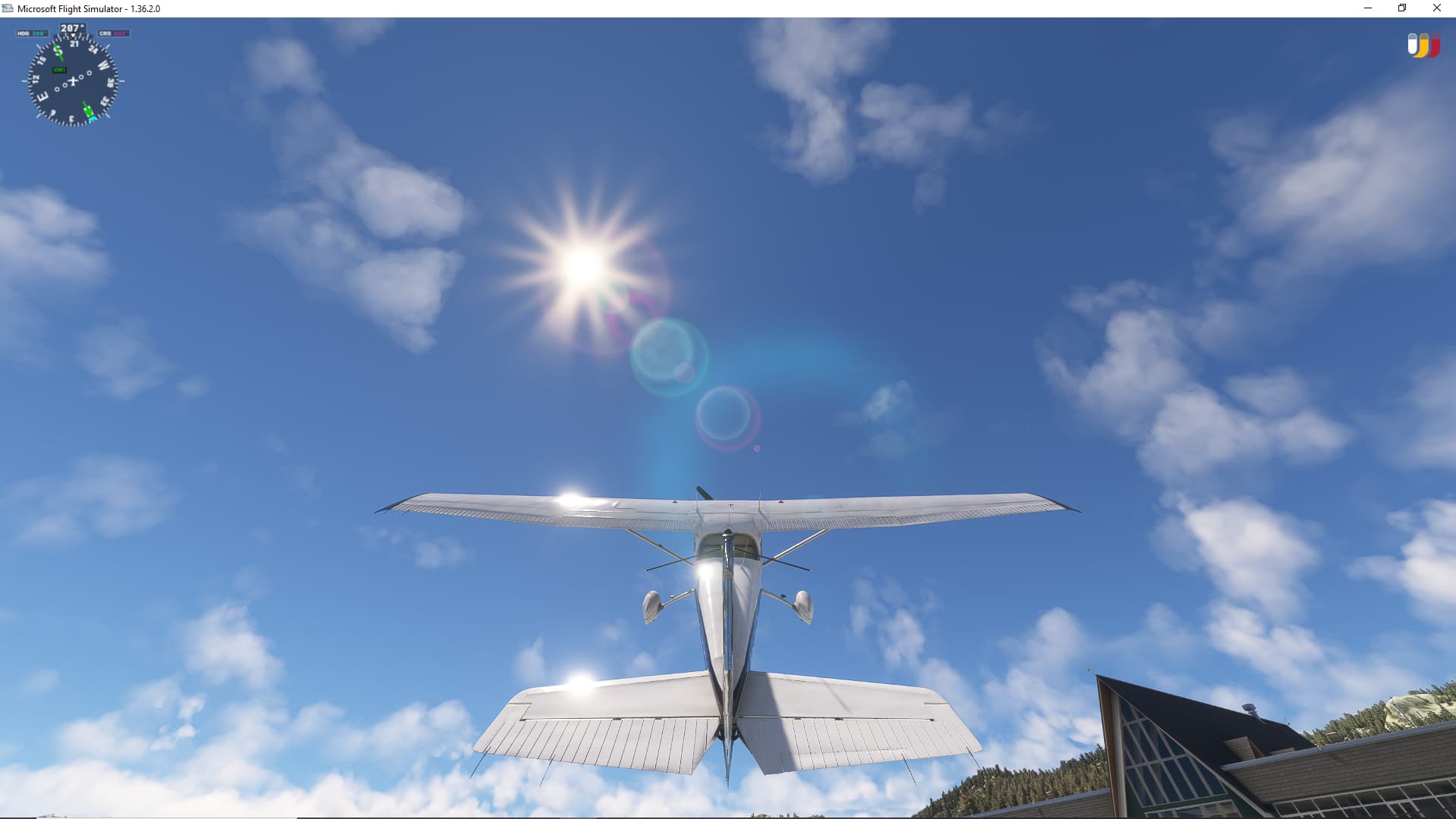
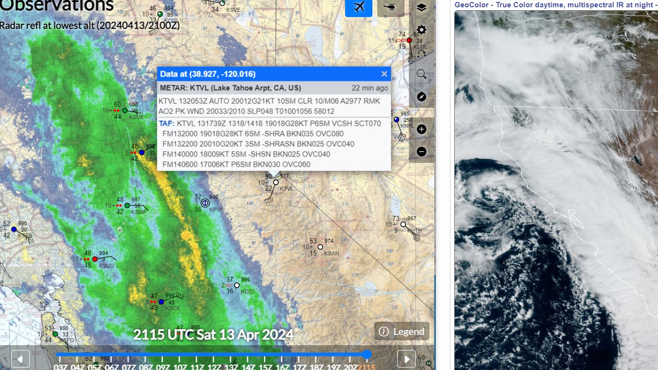
Here’s a zoom-in on those adjacent METARs so we can see which one is driving that. Ope, none are:
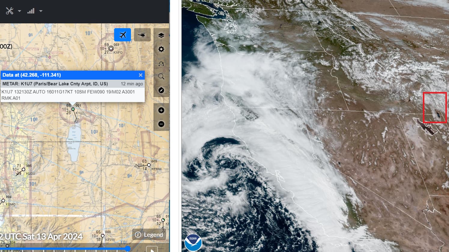
Bear Lake County (1U7) - reporting FEW090. Offering a different perspective. This one was cute. I thought maybe I found a bubble. But it turns out it was matching the satellite. And the cloud cover was nowhere near centered on the airport, nor was it FEW (and as we’ve seen so far, it doesn’t seem to matter):

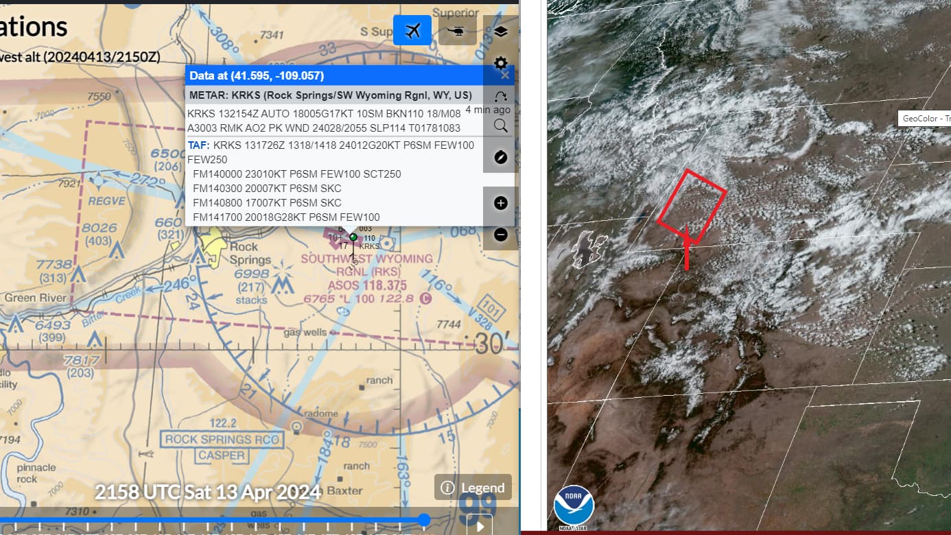
The last one I had time for today, Rock Springs, WY (KRKS). Reporting BKN110. I wouldn’t call this BKN anything. And this is another very isolated ASOS station, nothing else within 50nm. But it’s an interesting case that is actually showing the opposite issue, in that the clouds aren’t enough. Maybe they lagged and got more realistic in the sim later. I don’t know, the sim crashed shortly after and I had other stuff to do. Anyway:

I normally don’t feel it’s necessary to appeal to a person’s sense of what passes for sim experience, but since it seems to matter to you, I have a least two thousand hours since this sim launched and thousands in various sims for several decades prior. I’ve got several other bonafides, but I don’t think this is the place for a cv. Either way, I’ll just let the evidence do the talking. And as I’ve repeated many times, yes, I fly primarily in the US. But why are you suddenly qualifying METAR-heavy and non? Do you think it matters?
Either way, I’ve suspected for a while and allowed that other parts of the world may be getting weird data. But I’m not going to do your homework, I’ll do it instead in defense of where I’ve had experience and have made the observations.
1 Like
I’m going to stay out of the technical debates about better cloud and weather representation in MSFS2020. Personally, I’m in awe of what has been achieved in the SIM generally but this topic has opened my eyes to what could be achieved in the future!
The level of knowledge of weather and passion for flight and flight simulation here is awesome ![]()
(A bit of accurate cloud turbulence would be great)
3 Likes
Interesting that Active Sky is rumoured to be coming to MSFS shortly. It will be intriguing to see if that brings any improvements.
After all these years, I’ve slightly given up on the accuracy of the weather, be it coming from METARs or meteoblue data. It often doesn’t match either… I would just love to see improvements to the clouds themselves, instead of seeing yellow/brown eruptions.
Sadly from the Active Sky screenshots, it’s looks to be the same mess in terms of actual depiction.
6 Likes
“When are we going to be rid of those horrible mash potato clouds. They are so unrealistic.”

4 Likes
There is no APi for westher, how will hifi do this !
2 Likes
Clouds cannot form “METAR bubbles”, because Asobo does not use METAR to generate clouds anymore. I think they stopped doing it around the time of SU11. At the same time, Georg mentioned in a dev live stream that they are now using real-time satellite imagery to help with cloud placement. I have seen plenty of evidence that they are indeed doing so. I use Foreflight with XMapsy to place my MSFS aircraft onto Foreflight’s moving map screen. FF has the ability to overlay r/t satellite imagery on the map, and I normally do so.
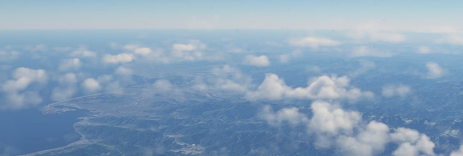
I recently did a flight at FL370 from Lincoln, NE (KLNK) to Knoxville, TN (KTYS) . Weather for the first part of the flight was clear. The Foreflight satellite image showed there was a lower cloud deck that was aligned right along the Mississippi River, with an “intrusion” of cloud cover to the west in the vicinity of Saint Louis. My flight took me right over KSTL, and the “intrusion” was present, and matched the satellite imagery almost perfectly, with the rest of the cloud deck indeed aligned with the Mississippi to the north and south of KSTL.
On the other hand, METAR-induced “surface visibility bubbles” are still “a thing”, and can be seen from high altitude.
3 Likes
I am willing to change my perspective when presented with evidence. @francobfort posted such evidence elsewhere and from that, I see that clouds are still somewhat influenced by surface observations.
Here’s the caveat: you have to be really high up to discern it well, like in the realm of 250,000’ feet or more. Otherwise, you might notice if you’re really looking for it and/or it’s an egregious isolated case (as some folks seem to run into “in the wild” - I still have not). At lower altitudes, these are blended into surrounding weather and very difficult to discern.
They are also irregularly applied. I spent hours yesterday trying to find a common denominator as to when it’s applied - scattered vs broken vs overcast, ceiling height, isolated vs surrounded by other observations, surrounded by accompanying weather. I’ll be honest, it doesn’t make sense - there doesn’t seem to be a commonality. One airport could be reporting BKN028 and have a sizable cloud cover applied, one 20 miles away reporting BKN022 and nothing. To that end, it’s almost like there’s a filter so they don’t end up looking like a bubble. They are also often not centered directly on the airport, instead perhaps several miles away - I discovered this many times.
All of that said, I don’t have a problem with the way they’re presented. At all. It seems less a disruption than it is an augmentation of where the other info being fed in cannot discern where clouds exist. Think: low clouds at night not associated with frontal activity, such as radiation fog or an advecting coastal marine layer. Or something that has just initiated, like a thunderstorm, or a thin train of clouds.
So allow me to redirect the question back to the hill I’m going to die on and the point I’ve made umpteen times - when these weather features are too granular to publish, should the sim simply ignore them and continue “publishing” clear skies? My vote is absolutely not. I’ll take what we’ve got. And to that point, in bouncing all over the US yesterday, I was floored by how accurate and good the weather looks, despite the above findings. If we could fix the cloud type depiction, add some better cirrus and blending, and address thunderstorms, it would be amazing.
Edit: Since we can’t post for 4 hours, I see the post by @FinalLightNL below this one. It would help immensely that any picture griping about weather is given with context. Time stamp, location, altitude (if applicable), camera direction, local METAR, time stamp, and any other corroborating info. What you posted looks a little low-fi in places, but honestly, without context, it looks like coastal advection or a low-topped squall line. It’s hard to agree with and easy to dismiss a post claiming “see” without more context.
this is the weather current in rotterdam, i’m setting up my flight atm with the new fenix update.
i never saw such horrible cloud formations before.
edit as requested by @CharlieFox00 : EHRD live weather 14:23UTC @ D3 parking spot
METAR:

2 Likes
That’s been my concern, not that it may not match the live weather, but its depiction of the clouds used to be better when we had inaccurate/delayed live weather. I’m just greedy wanting both. ![]()
That looks like clouds set to High, or lower.
4 Likes
@FinalFlight1494 I’m glad your post got unlocked. ![]()
1 Like
I did some testing last night and I think it’s fair to say you are probably correct. With no local METAR available it does seem to use the general weather forecast rather than the closest METAR (which was 180NM away). Unfortunately much of the weather over the north island was similar last night so I can’t say for absolute certainty, but the winds did seem to differ in accordance to what was showing on windy.com.
It does beg the question as to why I’ve occasionally seen sudden shifts in weather though. I’m definitely not imagining it.
3 Likes
It would be interesting to see you do an analysis like this outside of the USA.
You can fly in SLVR (Bolivia) and see if the clouds are consistent with what meteoblue or the metars show
Please always check ATIS as well as METAR when checking cloud conditions accuracy. Its been a while since I was testing but it used to be that clouds were closer to ATIS but ATIS and METAR never were close.
I’d love to figure out the source of ATIS info.
and - it just seems to me - that both Alaska and New Zealand have clouds more like the old weather - and I don’t know why.
I would also like to say that the current clouds and lighting can look really good in presets.

2 Likes
Me too, just a bummer it has a 4 hour cooldown which is incredibly high.
1 Like
Everyone remember these clouds?
Look so much better than MSFS in my opinion…

6 Likes
the issue with these clouds are that they are basically images.
2D layers.
It’s hard to get real volumetrics looking like this.
here is an example in a different engine tho with real volumetrics, they just aren’t dynamic.

5 Likes
Yes, agree with the topic title. Not only do clouds look like this 99% of the time
But when you fly through them, there is zero buffet, zero ‘feeling’ that you are actually flying through them at all. Its so sad given the huge potential this game has but alas, we get things like Dune instead. C’est la vie … We will just buy 2024 on some promise perhaps.
One thing that might kick them into doing anything about the clouds is if the other product improves their rendition to the extent that flight simmers take notice of them.
10 Likes