We are calm. We’re just asking the question to make sure Jorg et. al. knows how important this is to many of us. And people keep having questions about what it is we’re asking. I’m not sure what’s not clear about what we’re saying.
I’m also not sure why the information has been kept under wraps. Perhaps it had to do with the negotiations with LIDO? I dunno. Seems weird from the outside, but I imagine there’s a good reason(s).
As you note, hopefully our “fears” are moot, and if LIDO doesn’t cover what we’re asking, they also are processing the FAA charts regularly, too. That would be the best of both worlds. If not, that’s fine, but there will be wishlists created. But at least Jorg has heard us. Or Jorg will tell us there’s no plans for whatever reason. It will be what it will be.
Look at the Aviaplanner terms and conditions. They no longer have a contract with Lufthansa and only use public data.
Whatever they show is indication of what a LIDO chart might look like. Personally I like the use of colour and find them easy to read.
We must not speculate on the charts that MSFS2024 has at launch. Also remember that with streaming, data can be updated 24/7 and improvements may silently appear.
Time will tell how Asobo inform us about changes.
Many share the same opinion however let’s say you want to fly into the Highmore Municipal Airport in Highmore, South Dakota. Chances are so incredibly small that it will be covered by LIDO charts in MSFS 2024. Jeppesen does cover it though as does the FAA with their charts (personally I like Jeppesen charts more than the FAA charts).
There are a number of airports you could land some big commercial jets into given their runway lengths that aren’t covered by LIDO charts. There are also airports with shorter runway lengths that are covered by LIDO charts.
Shot in the dark here: Could it be that there are airports/aerodromes counted as “on the charts” that do not have any charts? An airport that appears on an enroute chart that does not have any approach or other procedures charted? Just a thought as to the difference in counts and terms used to describe the various chart set offerings discussed.
Lufthansa (LIDO) is a (I call it as) “tailored record provider”, equal to NavBlue. That means, depending on the supported airlines - they offer the charts for these airports. That´s the reason why Asobo/MS must merge Lufthansa (LIDO) with some other source again to cover some areas where Lufthansa is not as present as in other parts of the world (like Europe).
Lido charts also offer basic runway information and a distance to DME altitude chart. However, while most charts include minima for all classes of aircraft, Lido omits class A and B data you may require.
Where are the major differences now? Jeppesen is a “standard record provider,” which means worldwide data/charts, airliners independent. And minima for all classes from A to D, which is much better for VFR and GA.
In my eyes, only the data provider was changed. As you see with the FAA merge, Asobo/MS needs to combine data/charts from external sources to cover areas as comprehensively as possible. The amount of standard data/charts is greater than at NavBlue, that´s for sure, and that´s the great benefit of this cooperation now—but they are still far away from coverage, completeness, and unified data/chart support.
The FAA merge? This is the second time we’ve heard mention of the fact they’ll also have FAA charts as well as the LIDO charts, but there’s been no official word on this? Or are you just talking about the normal AIRINC update every month that Microsoft has been doing.
In the 1930s Elrey Borge Jeppesen began selling his collection of aviation notes in order to help other pilots because “no-one else was doing it”.
His charts helped the United States Navy and Army during World War Two.
From the 70s onwards his charts began getting used in commercial aviation.
You are the gold standard, and it still blows my mind that we have unlimited access to Jeppesen data in the sim for such a cheap price.
All these are reasons why I am more than happy to continue supporting navigraph, I have no interest in not being able to get class A or B data and only being able to fly half of my aircraft, you also have helicopter and VFR data too.
With Jeppesen/ Navigraph I know if a chart exists they’ll have it.
In MSFS 2020 the only way to do flight planning natively was with the World Map. Once you were in the flight, there was no real access to that other than the limited VFR map, and no charts.
So the addition of the new virtual tablet with flight planning and charts is going to be a big step forward even if it does not have 100% coverage of all airports in the world. Some or Many is better than None. I’m guessing it was also needed for (or at least a benefit to) some missions. I think it’s going to be a huge improvement for many people.
I plan on keeping my Navigraph subscription and will use both. Each will have strengths and weaknesses. For me (on Xbox) the ability to have a flight plan work with native ATC is important. Eg in the PMDG planes to use native ATC I would have to try to replicate the flight plan in the World Map which was tedious. I’m not sure if there will be a way to send a flight plan from the 737ng or 777 to the sim in MSFS 2024 or not, but we’ll know soon.
Navdata: Just like Jeppesen, Lido is also a standard record provider and offers worldwide coverage. This is a huge improvement over Navblue which was actually just offering records their customers required.
Charts: Lido is tailored provider and offers the coverage that customers require. If you know / knew Aerosofts NavdataPro you know what to expect in terms of coverage.
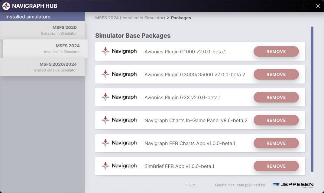
I’m seeing a lot of runway / procedures mismatching in MSFS 2024 relative to Navigraph. I have Simbrief sub but in Navigraph hub there’s Airac Cycle update only for MSFS 2020: