Pee-Wee talked with an old friend yesterday, and the conversation took her back to the late '90s and her brief stay in Northern Colorado. I’m not familiar with the area, but after a quick peek at Paul Freeman’s seminal “Abandoned and Little Known Airfields” website (our favorite place on the Internet), we were off and running!
We took the Rans for a workout around Fort Collins, Colorado. She was a rocket down at sea level in Louisiana, so we were curious to see how she would do in the rarified air of the “Nine-Tenths of a Mile High City.” Just in case, we left behind a few hundred pounds of camping gear and gas. I also encouraged Pee-Wee to forego the second “60/40” at Big Al’s Burgers and Dogs (more on that, later).
Pee-Wee Says: Careful, buddy. The ice is getting pretty thin. ![]()
Fort Collins (population 169,000) straddles the Cache La Poudre River in the high Colorado desert beneath the Rocky Mountains’ Front Range. It’s about 60 miles north of Denver if you’re a crow, or about an hour driving on Interstate 25. Cheyenne and the rolling, windswept plains of Wyoming are 40 minutes north. Defense contractor Woodward, Inc. produces aviation governors and synchro-phasers in Fort Collins, and your cell phone’s Otter Box is from here, too. For the lushes out there, the town boasts more than twenty breweries ranging from small family-run operations like Gilded Goat and Jessup Farm to large corporations Anhauser-Busch and New Belgium.
The most important tenant to our tour today, though, is the Colorado State University, which occupies nearly 600 acres in central Fort Collins. Approximately 27,000 students attend this public land-grant college annually, which boasts one of the country’s preeminent large animal veterinary schools. It also has its own airport, and that’s why we’re here!
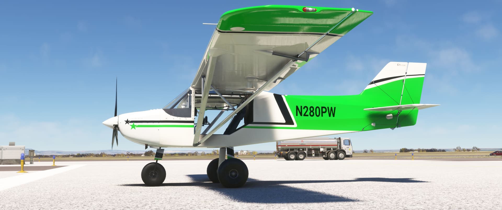
Here’s our Rans, N280PW, on the ramp at Northern Colorado Regional Airport (KFNL), midway between Fort Collins and neighboring Loveland. The tricycle-geared, tundra-tired Coyote isn’t the most attractive airplane ever built, but she’s comfortable and capable. We chose this paint scheme to match CSU’s green and white.
Pee-Wee Says: I just realized she looks like a Lego airplane. Now she’s definitely my favorite!

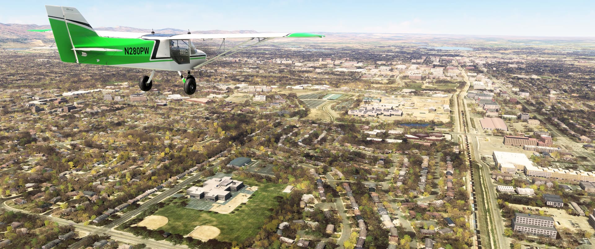
Yes, there’s still snow on the mountains! Fort Collins experiences milder winters than surrounding areas, but the heaviest snowfalls in town usually occur in September and May. Residents never fully pack away their winter gear! The distant peak above 280PW’s left wing is Mount Blue Sky, formerly known as Mount Evans. In 2023, growing concern over namesake governor John Evans’s legacy became the impetus to rename the peak in honor of the native Arapaho and Cheyenne tribes.
![]() The Choice City: Fort Collins, Colorado
The Choice City: Fort Collins, Colorado
MSFS: 40.58 -105.07
Skyvector: 403453N1050437W
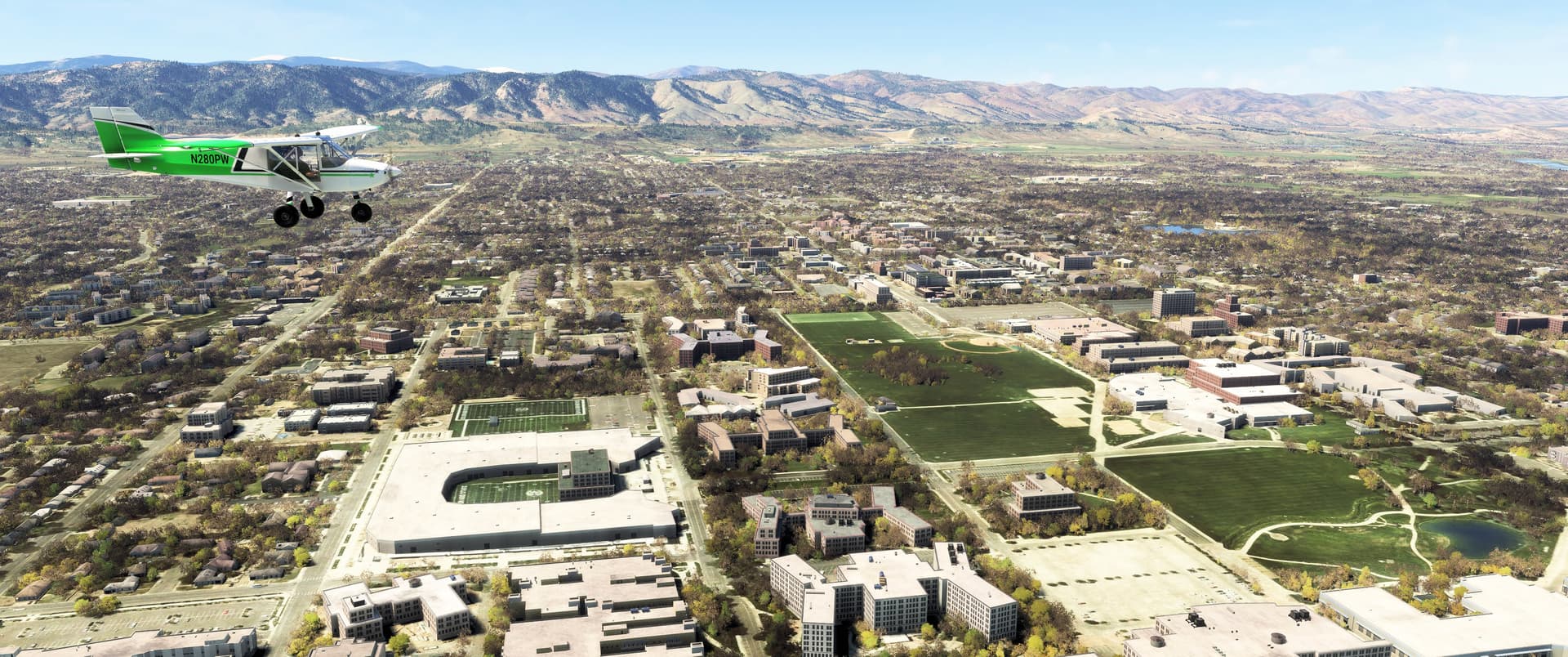
Here we are flying north toward central Fort Collins. Ahead you can see CSU’s Veterinary Health Complex and the James L. Voss Veterinary Teaching Hospital. Beyond that is the CSU Main Campus, including the new 36,500-seat Canvas Stadium. Old Town Fort Collins’s quaint curio shops, coffee bistros, comic bookstores, and craft restaurants, including the aforementioned Big Al’s Burgers and Dogs, are on the east side of campus. BNSF’s Front Range Subdivision runs through the heart of town, connecting Denver with the railroad’s Wyoming operations and points north.
Pee-Wee Says: That line is how I got to Fort Collins the first time. Long Story. Anyway, Big Al’s is a local restaurant in Old Town, and its signature burger is a double-stacked, culinary masterpiece dubbed the “60/40.” Each patty is 60 percent ground beef and 40% ground bacon. Be still my beating heart! (Figuratively, not literally. I wouldn’t consider it “health food” ![]() )
)
Big Al’s doesn’t seem to publish nutrition information on its website. Weird. ![]()
Here’s another algorithm failure of epic proportions. That holed structure below our Rans is supposedly Canvas Stadium, complete with office building atop the north endzone. Nice try, Asobo!
![]() Part-Time Unofficial Seaplane Base: Fort Collins Downtown Airport (3V5)
Part-Time Unofficial Seaplane Base: Fort Collins Downtown Airport (3V5)
MSFS: 40.588 -105.041
Skyvector: 403518N1050230W
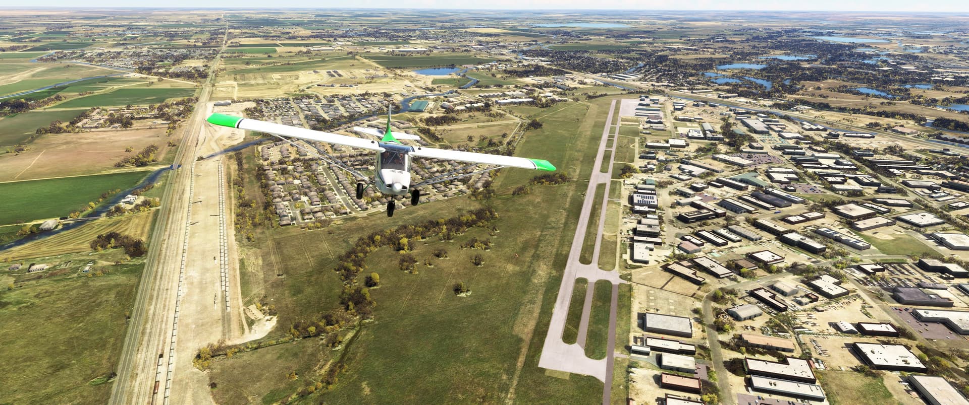
From downtown we turned east and overflew the former Downtown Airport, once Fort Collins’s busiest airport. Prone to flooding and with development encroaching, the field closed in 2006, replaced by KFNL further south. Curiously, it’s still “open” in MSFS with the identifier 3V5. To the north is BNSF’s Vine Drive yard, where cars are sorted for movement north to Anheuser-Busch’s Wellington brewery and interchanged with the Great Western Short Line, which serves industries in Windsor and Greeley, including Vestas, one of the nation’s leading manufacturers of large wind turbine blades.
![]() The Tic Tock Before Tic Tock: Stations WWV and WWVB
The Tic Tock Before Tic Tock: Stations WWV and WWVB
MSFS: 40.6787 -105.0447
Skyvector: 404043N1050240W

And now for something completely different! Several miles north of Fort Collins, rising above farmland between several reservoirs, we found the skeletal masts of radio stations WWV and WWVB. Operated by the National Institute of Standards and Technology (NIST), these two stations transmit continuous time signals that are used by organizations as diverse as the Department of Defense, television networks, and watch manufacturers for establishing extremely accurate timing. Six on-site atomic (Cesium) clocks–four for WWV and two for WWVB–provide the time basis. Do you own a clock that automatically updates its time? Chances are the signal emanates from Fort Collins! The taller masts on the left are WWVB.
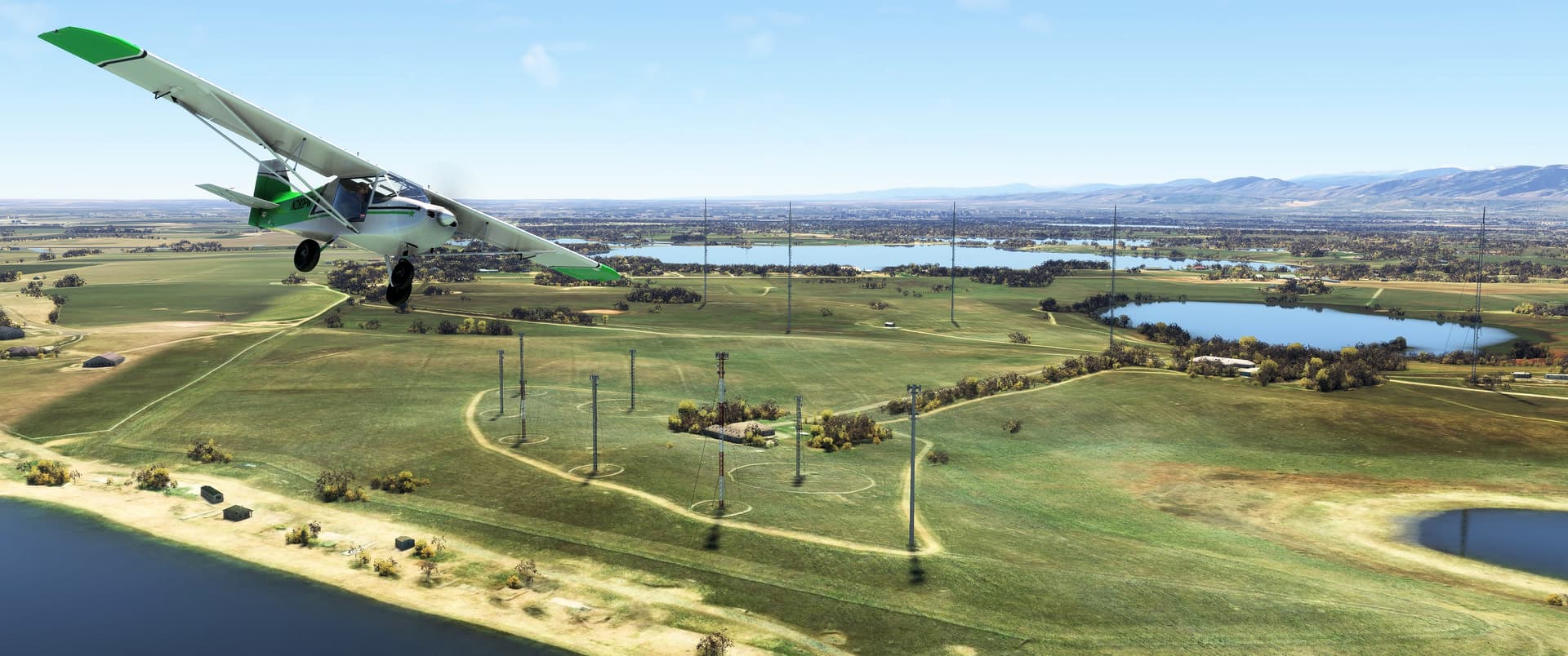
And here’s the shorter masts of WWV. For the amateur radio enthusiasts, Wikipedia has excellent articles about WWV and WWVB. Want to hear the signal yourself? Dial 303-499-7111.
Pee-Wee Says: The signal is pretty monotonous. Definitely don’t listen after downing a 60/40. ![]()
![]() A Mercenary Pilot and the President’s Wife: Christman Field (CO55)
A Mercenary Pilot and the President’s Wife: Christman Field (CO55)
MSFS: 40.5965 -105.1443
Skyvector: 403547N1050839W
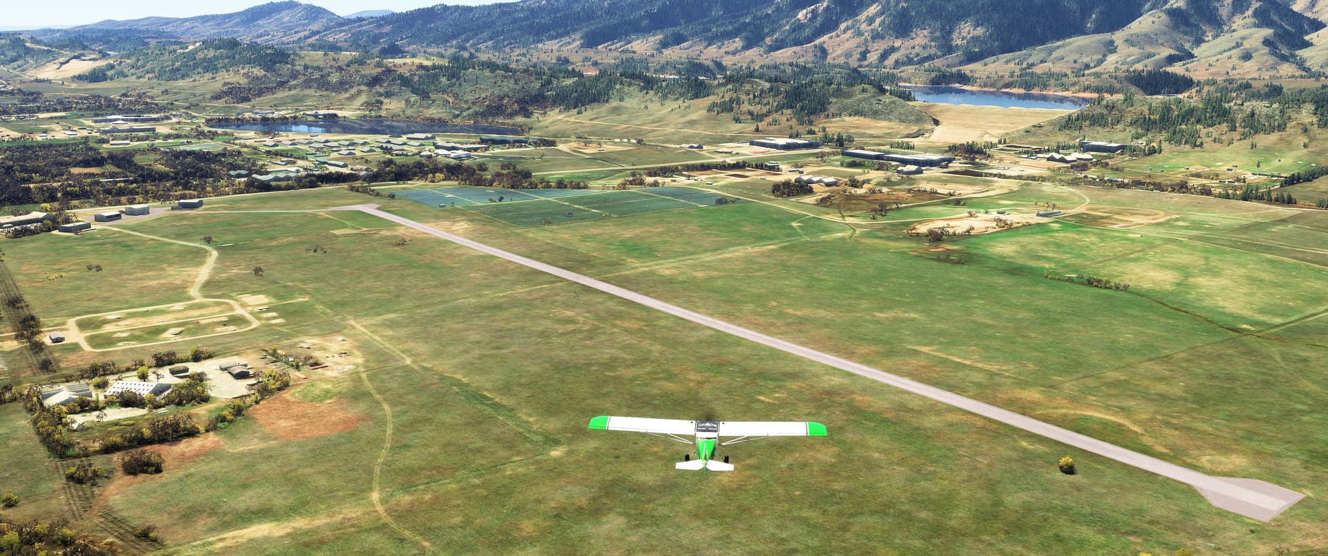
Here we are northwest of town, approaching Christman Field (CO55), originally the Fort Collins Municipal Airport. Opened in May 1929, it was later renamed Christman Field in honor of Fort Collins native Allen Christman, a Naval aviator who died in January 1942 while fighting with the American Volunteer Group (“The Flying Tigers”) over Burma. The true history buffs will remember that Christman was also the illustrator of the newspaper comic strip Scorchy Smith. He reportedly put his artistic talents to use in China, personalizing his squadron’s aircraft.
Beyond the airfield is Horsetooth Reservoir and two of the four earthen dams holding back the 157,000 acre-feet of water stored within. Soldier Canyon Dam is on the right with Dixon Canyon in the distance. To our left is the local firefighter academy, and just beyond the runway is a solar farm, with CSU’s Engineering Research Center and Advanced Laser for Extreme Photonics (ALEPH) laboratory against the ridge forming the reservoir.
Pee-Wee Says: Remember that knucklehead who was buzzing boats in a lake back in '22, and then crashed his Cessna and fled the country? That was Horsetooth. Rest in peace, N9049H. ![]()
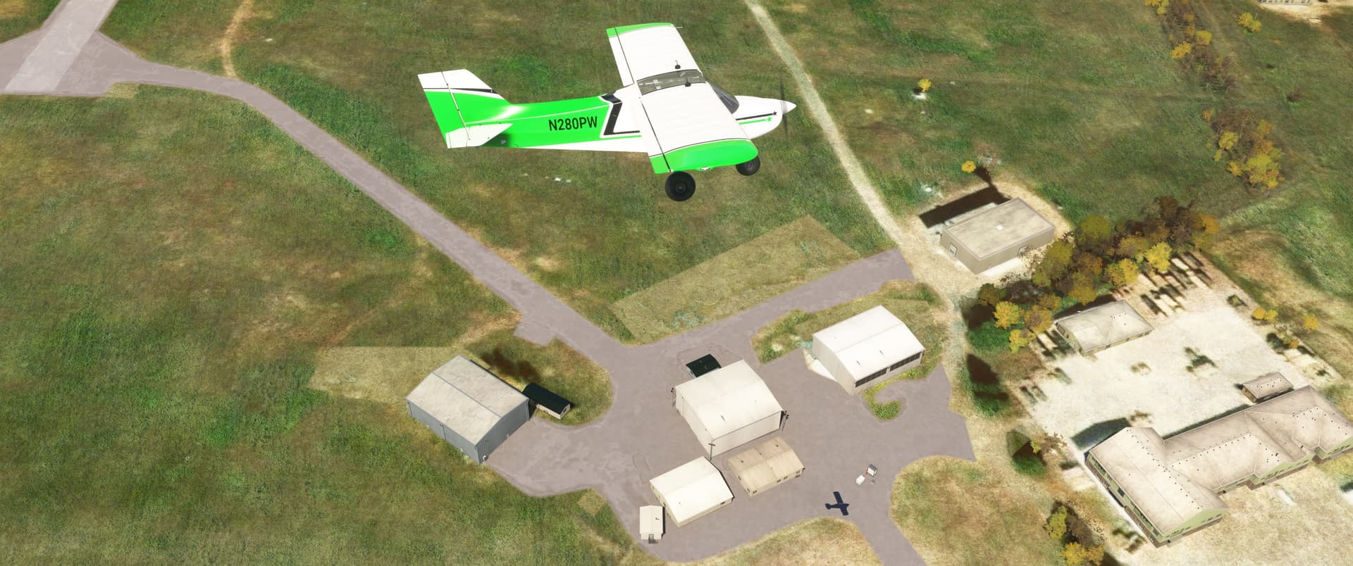
The three hangars directly below 280PW date to World War 2 and housed the local Civilian Pilot Training Program’s Stearman biplanes. The hangar to their right came later, as did the Army National Guard Armory in the lower right. In 1955 local arc welder manufacturing company Forney purchased the production rights to ERCO’s legendary Ercoupe monoplane from Univair and began production here of its Forney F-1 three years later. Forney completed 138 F-1s and F-1A trainers before production ended in 1959. Remarkably, 49 F-1s and 9 F-1As are still registered in the United States today, including two in Colorado.
Christman is still open, but not to the public. It currently serves as CSU’s drone testing and flight facility, although its 4,000 foot (1,220 meter) runway is occasionally used by National Forestry Service firefighting helicopters.
Pee-Wee Says: Eleanor Roosevelt delivered CSU’s commencement address in 1958 when her grandson graduated. She landed at Christman Field with her son, World War 2 USAAF veteran Elliott.
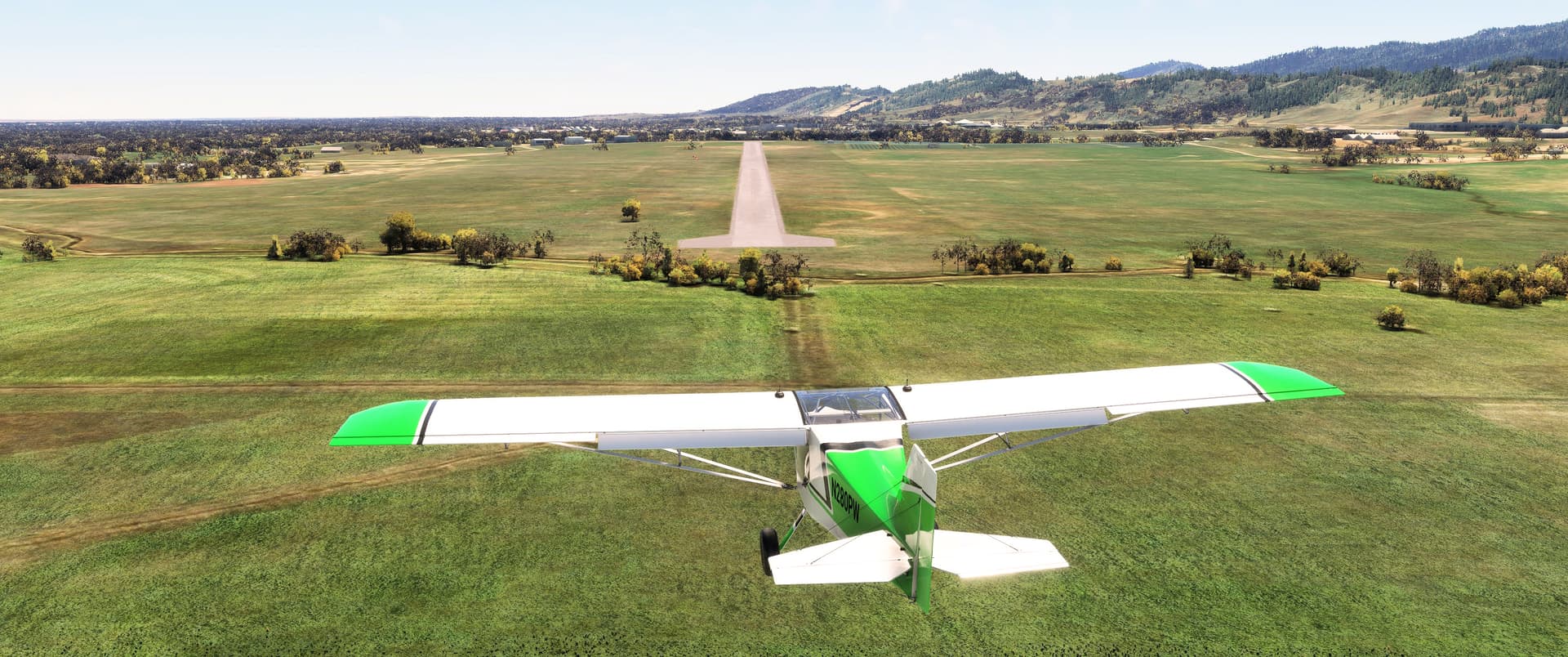
The tricycle Rans was easy to land, being less “squirley” than most MSFS light airplanes, even with a direct left crosswind. Visibility over the nose is definitely more restricted than other similarly configured GA planes I’ve flown, but not unmanageable. And while her performance suffered a little at our density altitude of 6,800 feet (2,100 meters), she still managed getting airborne in about 1,200 feet (365 meters).
That’s all for today! We’re both out of town this coming weekend, but we’ll return next week. And for those of you in the middle of the country, remember to not look directly at the sun!
Pee-Wee Says: 60/40. Mmmm ![]()
Fly safe! ![]()