Welcome back to the Sunshine State! In this multi-part Skytour, we’ll explore some abandoned airfields, Cape Canaveral’s historic launch sites, a hazard to navigation with a funny name, a beautiful stone tower that sings, and a church that once held Sunday services underneath a supersonic jetliner. There’s much more to Central Florida than Disney!
To see these sites as we did, you’ll need some addon scenery modules, all available for free from flightsim.to. There’s a complete list at the end of each writeup.
And with that…gear up!
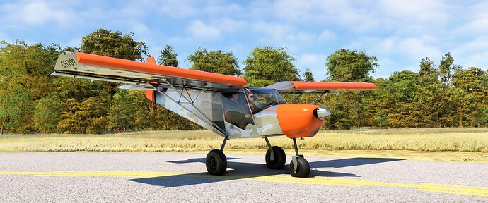
Pee-Wee Says: We chose the Zenith for this tour, since some of the abandoned fields we intended to visit had very short runways–if any runway at all–including one that appeared covered in storage containers and trucks.
Okay, so the gear will stay down. ![]()
We started at Valkaria Airport (X59) ten miles south of Melbourne. One of two satellite fields serving the day fighter school at NAS Melbourne during World War 2, Valkaria boasted three runways and a CVE-sized wooden deck complete with arresting gear and catapult used for initial carrier training and for instructing new Landing Signal Officers. Speaking of LSOs, Lieutenant Commander Dave McCampbell served as head LSO instructor here in 1943 before returning to the Pacific, where he downed 34 Japanese aircraft, becoming the highest scoring US Navy ace of World War 2 and earning the Medal of Honor to boot!
Since 1959 Valkaria has served the general aviation community and, more recently, drone operators, and was named the Florida Department of Aviation’s Airport of the Year in 2019.
Pee-Wee Says: Valkaria once hosted a tracking system used for ranging NASA and military rockets launched from Cape Canaveral. There’s a reason this part of Florida is called the Space Coast: it seems that every locale has some connection to the space program!
![]() Bounces and Paddles: NOLF Malabar, Malabar Transmitter Annex
Bounces and Paddles: NOLF Malabar, Malabar Transmitter Annex
MSFS: 28.02 -80.68
Skyvector: 280112N0804048W
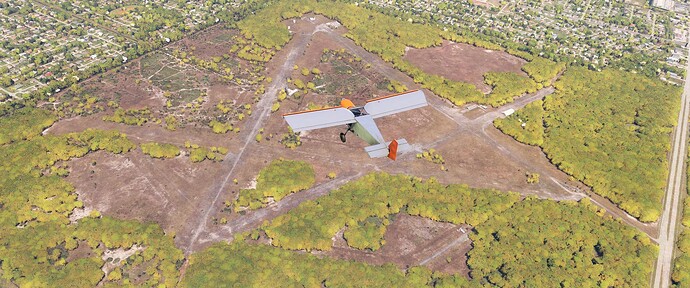
Our first stop was former Naval Outlying Field Malabar, NAS Melbourne’s other satellite field located seven miles northwest of Valkaria. Malabar apparently remained active until 1954 when it was leased to local farmers as grazing pasture. Two years later the Air Force acquired the site for use as a communications station supporting nearby Air Force and NASA activities.
In this northwest-facing photo you can still clearly see the remains of Malabar’s three runways and several taxiways. Just above our Zenith’s left wing is the communication annex’s control center and single 200-foot (61-meter) radio mast. Above us, in the northwest corner of the field, there are several domed buildings that may date back to early 1960s and an Air Force laser testing program.
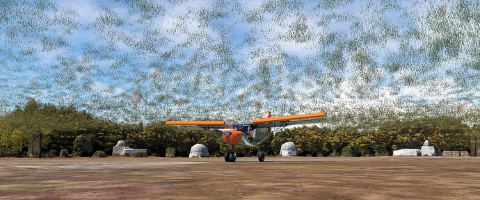
Pee-Wee Says: We landed near those domes on the western end of former Runway 11. Malabar lies within MSFS’s default Palm Bay photogrammetry area, so the environs look great, but the grass is on a whole different level…literally. It made for a weird sight picture while landing!
The Florida Army National Guard will construct a readiness center and armory at Malabar in the near future, so if you’re planning a simulated landing here, you should do so sooner rather than later!
![]() Florida Panther Country: Florida Institute of Technology, Florida Tech
Florida Panther Country: Florida Institute of Technology, Florida Tech
MSFS: 28.064448 -80.624569
Skyvector: 280352N0803728W
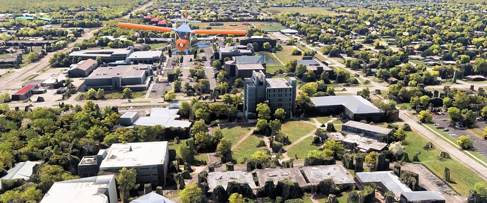
Here we are flying north over the Florida Institute of Technology’s main campus in Melbourne. “Florida Tech” is a private research university and one of very few universities in the United States with an entire college dedicated to aeronautics. The L-shaped building at center right is George Skurla Hall, home of the College of Aeronautics.
FIT opened in 1958 as the Brevard Engineering College, and provided continuing education opportunities to the employees of newly formed NASA working at nearby Cape Canaveral Missile Annex, leading some wags to nickname the school “Countdown College.” In 2023 Florida Tech enrolled nearly 4,500 students on campus, with a further 4,800 off-campus and online.
Pee-Wee Says: FIT sounds like a really nice place to get an education, especially if you’re interested in aviation or oceanography. But you’d better rob a bank first: annual tuition is just shy of $45,000, and the price soars to almost $61,000 when you factor in additional costs like eating. I wonder if they’ll accept payment in solid gold bars, kidneys, and small children? ![]()
![]() Not Really in Orlando: The Melbourne Orlando International Airport (KMLB)
Not Really in Orlando: The Melbourne Orlando International Airport (KMLB)
MSFS: 28.1012 -80.6451
Skyvector: 280604N0803842W
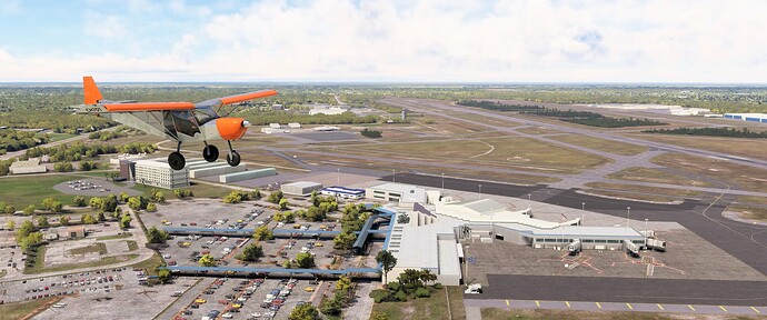
Continuing north we passed over the Melbourne Orlando International Airport. That’s the air carrier terminal dominating this screenshot, with general aviation parking in the distant right. Just in front of our Zenith is FIT Aviation, where Florida Tech students learn to fly. Just beyond that, to the left of the control tower, is Northrop Grumman’s facility, the birthplace of the Air Force’s E-8 J-STARS. Thanks to Bullfrogsim for this wonderful (and recently updated) scenery!
NAS Melbourne and Operational Training Unit Two were established here in 1943. Initially a fighter training school utilizing war weary F4F Wildcats, by 1944 Melbourne had transitioned to the F6F Hellcat, with 150 aircraft managed by 1,800 officers, enlisted, WAVEs, and civilians producing approximately 92 trained fighter pilots per month.
During the 1960s National Airlines in particular flew between Melbourne and various locations in Texas and California bringing thousands of engineers and other workers to the launch sites at Cape Canaveral. Today, Melbourne is served by four domestic and one international airlines and touts its proximity to Orlando.
Pee-Wee Says: The drive from Melbourne to Orlando takes one hour, assuming you don’t die on Interstate 95. It’s a nice idea, but I think I’ll stick with MCO. ![]()
Our next planned stop was the Brevard Zoo off Interstate 95 north of town. Alas, the MSFS rendition is almost completely overgrown by trees, and there was nothing to see.
Pee-Wee Says: But it’s probably the best little zoo I’ve ever been to! There’s a waterway that encircles the main large animal exhibits, and you can kayak all the way around with no fences between you and the animals. It’s awesome, especially with kids. Remember your sunglasses and sunscreen!
![]() Sand Fleas and Golf Courses: NAS Banana River, Patrick SFB
Sand Fleas and Golf Courses: NAS Banana River, Patrick SFB
MSFS: 28.2387 -80.6099
Skyvector: 281419N0803635W
Naval Air Station Banana River was commissioned in October 1940 but didn’t receive mission aircraft until a year later when six PBM seaplanes arrived from Norfolk. After the war, the station was transferred to the Air Force and renamed Patrick Air Force Base. Gained by the fledgling Space Force in 2020, units here operate both Cape Canaveral Air Force Station and the Eastern Range, while the Air Force Reserve’s 920th Rescue Wing flies SAR HC-130s and HH-60s here.
Back in December 1945, one of Banana River’s PBMs was lost searching for Flight 19, the five TBM Avengers that disappeared on a training flight from NAS Fort Lauderdale. While no definitive probable cause was established, the Mariner was known for occasionally exploding when gasoline fumes trapped in its bilge ignited. Thirteen sailors were lost.
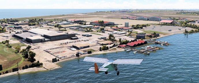
Here we are approaching Patrick from the northwest from over the Banana River. Immediately to our left is one of two remaining seaplane ramps that allowed water access from the original hangars just beyond. In the distance are the more recent hangars and airfield. A memorial to PBM BuNo 59225, lost while searching for Flight 19, stands at the water’s edge just north of the seaplane ramp. This scenery is included with MSFS.
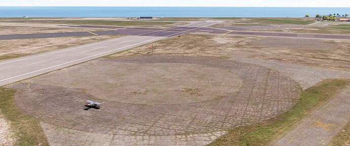
Pee-Wee Says: Banana River also served as a forward operating location for NAS Richmond’s blimps, and the two mooring pads remain today, southwest of the Runway 20 and 29 intersection. To give you an idea of the Zenith’s capabilities, we touched down about one plane length inside the paved circle.
Oh, if you want a touching story about a fallen “service member,” read this 2023 story from the Space Coast Daily.
Pee-Wee Says: He cried a little.
![]() Business in the Front, Party in the Back: Port Canaveral
Business in the Front, Party in the Back: Port Canaveral
MSFS: 28.4099 -80.6113
Skyvector: 282435N0803640W
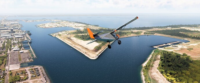
We’re at the east entrance of Port Canaveral in this photo. To our right is the Navy’s Trident Wharf, and to our left is the dock where SpaceX’s Autonomous Spaceport Drone Ships (ASDS) tie up. Further in the distance are several cruise ships terminals and the Canaveral Lock, which connects the Atlantic Ocean with the Banana River beyond.
Barges carrying Saturn V rocket assemblies and Space Shuttle external tanks and solid rocket boosters would pass through the Canaveral Lock enroute to the Kennedy Space Center. From the Banana River, a channel allows passage directly to a dock adjacent to the Vehicle Assembly Building (more on that in the next episode).
Pee-Wee Says: There’s one thing that’s not well represented in MSFS. Follow the shoreline to our left up to where it makes a tiny 90-degree jog to the left, just before the SpaceX dock. Right there, if you look closely, you’ll see a single tree casting a big shadow. That’s supposed to be the sail of SSBN-636 Nathaniel Greene, one of America’s “41 for Freedom” ballistic missile submarines, placed here as a memorial to those first “boomers.” ![]()
I think Cape Canaveral, our next stop, will require its own episode. There’s a lot to cover!
That’s all for now. Join us very soon for Part 2 of this tour in which we’ll explore Cape Canaveral and its historic launch sites!
Pee-Wee Says: Good night! ![]()
You’ll need the following files to see this tour the way we did, all available from flightsim.to:
KMLB - Melbourne Orlando Intl Airport by BullfrogSim
Water Fixes for Merritt Island/Kennedy Space Center Area by michail71
