Welcome back to Part 3 of our Central Florida Skytour! In Part 1 we toured historic sites on the Atlantic Coast from Melbourne north to Cape Canaveral. Part 2 focused exclusively on Space Force and NASA rocket launch and landing facilities on the Cape. Today we’ll head inland toward Orlando and see what we can find!
Pee-Wee says: Most of the areas we’ve flown over benefit from photogrammetry, and it makes a huge difference. I wish we could cover the whole world with that!
![]() Highest Obstacle on the Chart: The Bithlo Towers
Highest Obstacle on the Chart: The Bithlo Towers
MSFS: 28.5973 -81.0756
Skyvector: 283550N0810432W
From the Shuttle Landing Facility, we headed almost due west toward Bithlo about fifteen miles east of Orlando. There’s not much happening in this unincorporated community that was known for many years only for its trash dump and mosquitos, but it’s well-known to pilots because of its hazard to navigation.
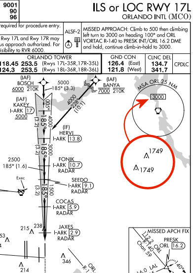
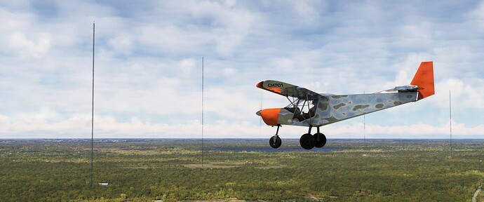
If you’ve flown an instrument approach into Orlando, you’ve probably noticed the 3,000-foot Minimum Safe Altitude (MSA) and the 1,749-foot obstructions northeast of the airport. Those are the Bithlo Towers, a group of six massive television and radio transmission towers, two of which are depicted on the chart.
Here we are in the vicinity of the towers, flying west. Dozens of television and radio stations transmit digital and analog signals from Bithlo in a service volume that covers much of Florida. Disclaimer: do not fly near these towers in a real airplane! The guy wires extend out hundreds of feet from the towers and are virtually invisible to pilots.
Pee-Wee says: We flew toward the general location of the towers at 500 feet, hoping to spot them before hitting them, which was a little uncomfortable. Definitely do NOT try this at home! ![]()
![]() Big Ugly Fat…Memorial?: B-52 Memorial Park
Big Ugly Fat…Memorial?: B-52 Memorial Park
MSFS: 28.449642 -81.312767
Skyvector: 282659N0811846W
Here we are over B-52 Memorial Park at Orlando International Airport. Easy to spot but hard to get to, visitors can access this free park by following signs for Air Cargo or North Economy Parking. Access via Bear Road from the northwest side of the field is easiest and allows a nice view of the west side runway complex.
56-0687 (manufacturer’s serial number 464058) is one of sixty-nine B-52Ds built at Wichita and was delivered to the Air Force in 1957. In 1964 she was stationed at Fairchild AFB with the 92nd Strategic Air Wing’s 325th Bomb Squadron. There’s painfully little information online about her twenty-seven-year career, but it’s very likely that she flew combat missions over Vietnam. Having reportedly spent some time with the 306th Bomb Wing at McCoy AFB (the future Orlando International Airport), 687 was flown here in 1984 when the 7th Bomb Wing at Carswell AFB wound down its B-52D training operations.
Pee-Wee says: I found a photo that shows two names painted below the aircraft commander’s seat on 687, and thought I it was important to look them up…
Colonel Keith Heggen was assigned to the 325th Bomb Squadron at Andersen AFB and was serving as an observer-pilot aboard B-52G 58-0198, callsign “Olive 01,” on December 21st, 1972, when it was downed by an SA-2 near Hanoi. He escaped from the aircraft but succumbed to his injuries within a week while in captivity. His remains were repatriated in 1974. Colonel Heggen is interred at Arlington National Cemetary, Section 11, Grave 105-1. He is survived by his wife and two children.
Chief Master Sergeant Charlie Poole was assigned to the 346th Bomb Squadron at U-Tapao RTAFB and was serving as the gunner aboard B-52D 56-0608, callsign “Rose 01,” on December 19th, 1972, when it was downed by an SA-2 near Hanoi (a portion of the aircraft remains to this day where it crashed in Hồ Hữu Tiệp lake near Hanoi). He was unable to exit the aircraft. His remains were repatriated in 1996 and identified in 2003. Master Sergeant Poole is interred at Hillcrest Memorial Park and Mausoleum in Red Chute, Louisiana next to his wife, Army nurse Sergeant Laura Poole who passed away in 1994, two years before Charlie’s remains were discovered.
Rest peacefully, gentlemen, and thank you ![]()
![]() It’s a Small Strip After All: Lake Buena Vista STOLport
It’s a Small Strip After All: Lake Buena Vista STOLport
MSFS: 28.398912 -81.571120
Skyvector: 282356N0813416W
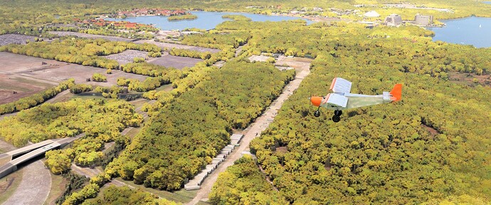
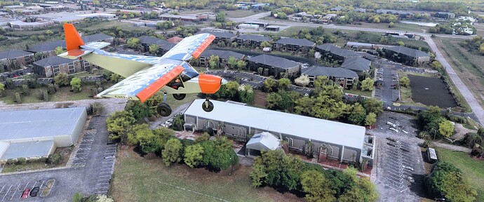
Here we are fourteen miles west of MCO over the former Lake Buena Vista STOLport, Walt Disney World’s very own airport. You can see the Magic Kingdom’s iconic monorail station and Space Mountain rollercoaster in the distance above our Zenith. Built during the early 1970s, the airfield briefly served Shawnee Airlines’ Twin Otters carrying parkgoers from Orlando International Airport. Today the 2,000-foot (610-meter) closed runway is used for staging busses and storage.
Pee-Wee says: But since it was an abandoned airstrip, we had to land there! ![]()
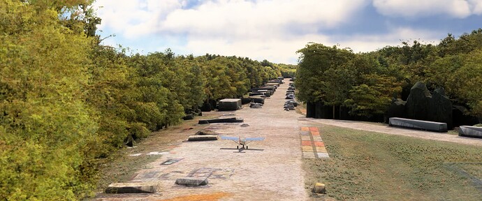
We landed to the south on the runway’s north threshold, touching down just after the blocks near the bottom edge of the photo. With a slight headwind, our ground roll was negligible. Taking off was a different matter: it was difficult to see the trees with such a nose high attitude! If you intend to land here, definitely bring a STOL-capable machine!
Pee-Wee says: And extra undies. ![]()
![]() Yesterday’s Airport That Never Was: The EPCOT Airport of Tomorrow
Yesterday’s Airport That Never Was: The EPCOT Airport of Tomorrow
MSFS: 28.329023 -81.556706
Skyvector: 281944N0813324W
This spot is a little different from the others we toured since there was absolutely nothing to see, and that was the point! Walt Disney’s original design for an Experimental Prototype Community of Tomorrow (EPCOT) included an “Airport of Tomorrow” for both air carrier and general aviation traffic. The intended site was near the current Interstate 4 and US Highway 192 interchange. Disney eventually built a scaled-down EPCOT in the late 1970s which dispensed with the overly ambitious airport.
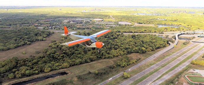
We’re flying east over Interstate 4 in this photo. That’s the ESPN Wide World of Sports Complex directly above us, with EPCOT and the Magic Kingdom beyond. The Airport of Tomorrow, with its three runways, the longest measuring 7,000 feet (2,140 meters), would have been located in the trees directly under our Zenith.
Pee-Wee says: I can only dream that, had this airport been built, the controllers would have used Goofy’s voice for the ATIS. ‘EPCOT Airport Information Bozo, Time One Six Five Four Zulu, yuk, yuk, yuk!’
![]() The Church of Speed: The SST Air Museum
The Church of Speed: The SST Air Museum
MSFS: 28.279548 -81.352412
Skyvector: 281646N0812109W
America’s dream of an indigenous supersonic jetliner ended in 1971 when Congress terminated funding for the delayed and incredibly expensive (i.e. controversial) project. Boeing had already built a full-sized metal mockup of its winning Model 2707-300 in Seattle, and with the program’s end, had no need for the 300-foot (91-meter) long behemoth. Enter billionaires Mark Morris and Don Otis, who offered the Government $31,119 (about $235,000 today) for the mockup. After considering locations in Nebraska, Colorado, and Kansas, they settled on Kissimmee, Florida, near Disney World’s Magic Kingdom as the home for their new supersonic transport (SST), and on July 4, 1973, the SST Air Museum opened its doors.
Left
Although constructed specifically for the museum, the building wasn’t quite big enough for the huge SST, and its vertical stabilizer protruded through the roof (see the photo on the right, above). Eventually the museum went bust and the building–with the 2707 inside–was sold to a church, which routinely held services underneath the mockup (the photo on the left, above). The SST was evicted in 1990 and wandered for years between owners including the Hiller Aviation Museum in San Carlos, California, before finally returning to Seattle and the Museum of Flight. Unfortunately, only the forward fuselage remains, but museum volunteers plan on restoring it for display.
Today, the old museum building lives on as the Life Christian Academy, located at Partin Settlement Road and Aeronautical Drive. A nearly complete rebuild removed any hint of its former tenant, and the open fields that surrounded the museum are filled with apartments, an ice rink, and a fire station. We’re flying southeast in the screenshot above, the direction in which the 2707 pointed.
Pee-Wee says: The American SST program died for many reasons, not the least of which were noise and potential environment damage. What a blow that must have been: America put a man on the Moon and built the 747 but couldn’t manage to build a really fast jetliner. ![]()
Oh, by the way, that B-25 in the photo above? That’s none other than N9079Z, better known as “Panchito,” the Delaware Aviation Museum’s restored B-25J!
![]() Who Needs Airports When You Can Have Even More Houses?: St. Cloud Airfield
Who Needs Airports When You Can Have Even More Houses?: St. Cloud Airfield
MSFS: 28.234 -81.284
Skyvector: 281402N0811702W
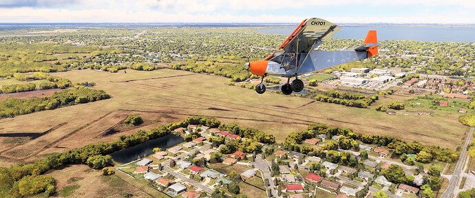
Here we are ten few miles south of MCO, scanning the former St. Cloud Airport for suitable landing ground. That’s East Lake Tohopekaliga in the background. The winds favored Runway 8, which was quite smooth and actually had the grass in the right place.
St. Cloud Airfield opened sometime between 1959 and 1965 with four runways, the longest of which was 2,300 feet (700 meters) long. Two T-hangars were located northwest of the runways. Their remains are visible below our Zenith’s tail, to the right of the trees just north of Runway 8/26. Having been closed for years, we were both surprised by how little St. Cloud had deteriorated.
Pee-Wee says: The latest Google imagery shows a housing development going up over the top of St. Cloud, so if you plan on landing here, you should do it before the Bing imagery catches up! What an interesting thought: you might be the last person to ever land at this airport, real or simulated!
![]() The Singing Tower: Bok Tower Gardens
The Singing Tower: Bok Tower Gardens
MSFS: 27.935337 -81.577573
Skyvector: 275607N0813439W
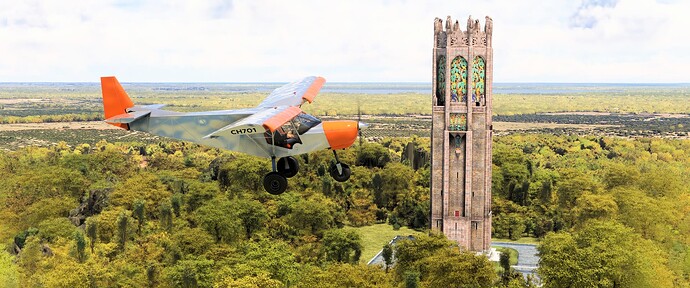
Here we are passing one of Pee-Wee’s favorite places on Earth: Bok Tower Gardens in Lake Wales, Florida, about thirty-five miles south of MCO. Edward Bok, editor of Ladies Home Journal, built a beautiful garden and bird sanctuary atop Iron Mountain after retiring here, and commissioned a spectacular combination water and carillon tower in 1925. The 205-foot (62-meter) stone tower was dedicated by President Coolidge in 1929, only months before Bok’s death.
Today the 250-acre Bok Tower Gardens is open to the public daily, and features walking paths, reflecting pools, a koi pond/moat surrounding the tower, and daily performances by the 60-bell carillon. The Bok Tower is included with MSFS.
Pee-Wee says: I first visited the Singing Tower when I was living in Jacksonville, and I still think it’s one of the most beautiful places to visit, especially during an evening concert under a setting sun, with the birds singing and the glowing tower reflecting in the water. Oh…it’s amazing! ![]()
From the Bok Tower we flew north-northwest to the Fantasy of Flight airfield where we parked for the night. Our total flight time was just over three hours, and we landed with almost eight gallons of fuel remaining. This was a particularly interesting outing because of the varied sites we found, from rocket launching sites to botanical gardens to television transmitters.
That’s all from Central Florida! We’re already planning our next flight, so check back here for more Skytours. May your simulated skied be always blue, but not Blue Screen of Death blue. Just regular blue.
Pee-Wee says: Thanks for flying with us! We’ll see you soon. ![]()
To see this tour as we did, you’ll need World Update #10 (for the Bok Tower) and the following scenery addons, available for free at flightsim.to:
- We Love VFR - Region 2 by PuffinFlight
- B52 at KMCO, Orlando, FL by Timberleaf
