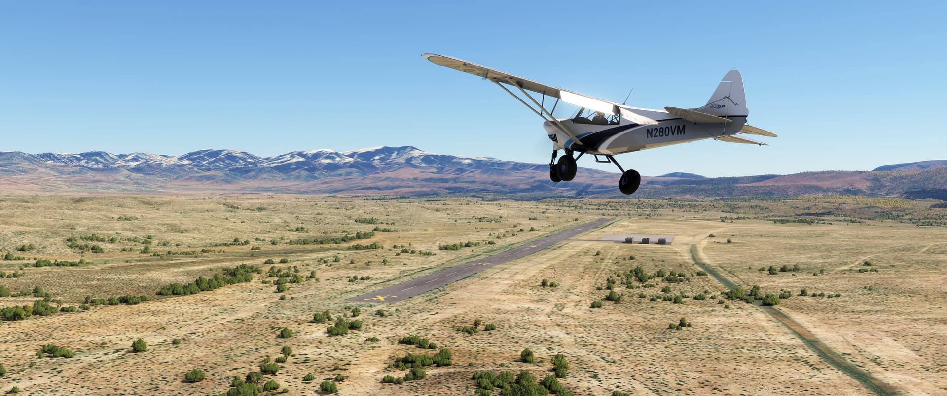
Let’s continue with the second day of our round robin tour of southern Nevada. Today we focused on the Nevada National Security Site, formerly known as the Nevada Test Site, a 1,350 square mile (3,500 square kilometer) chunk of real estate synonymous with America’s nuclear test program. There’s a lot of ground to cover today with lots of screenshots, so this will be a multi-part post.
We delayed our departure from Bonnie Claire until around 4 p.m. Many of today’s sites were craters and having a lower sun angle helped with photos.
Pee-Wee says: The NNSS is nearly surrounded by the Nevada Test and Training Range (NTTR, where the US military conducts Red Flag and other training exercises). We chose to focus only on the NNSS during this tour, and believe it or not, our first batch of nuclear test sites were dedicated mostly to “peaceful” purposes. ![]()
![]() Just Like the Moon: Schooner Crater
Just Like the Moon: Schooner Crater
MSFS: 37.343340, -116.566670
Skyvector: 372036N1163400W
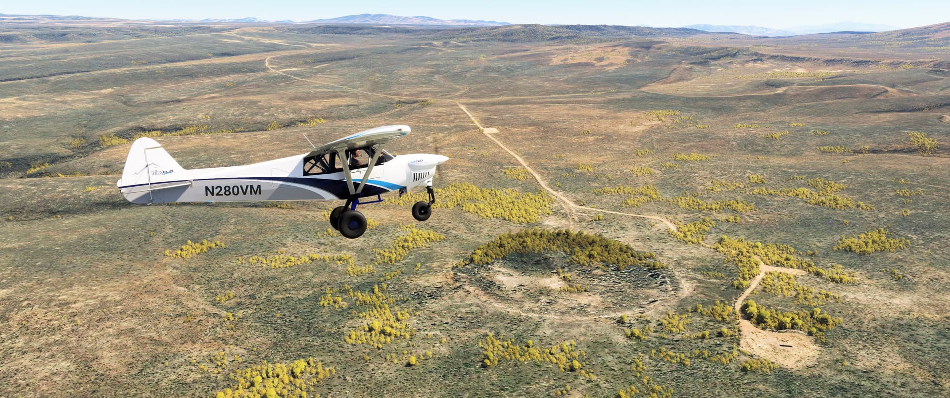
We’ve flown approximately 30 nautical miles (55 kilometers) east-northeast from Bonnie Claire across the NTTR’s Tolicha Peak Electronic Combat Range (TPECR) to Pahute Mesa and the northwesternmost corner of the NNSS’s Area 20. Just ahead of and below our Monster in this photo is Schooner Crater. Excavated on 8 December 1968 by a 30-kiloton explosive buried approximately 360 feet (110 meters) underground, the crater measures just under 1,000 feet (305 meters) across and 250 feet (77 meters) deep. The detonation resulted in a massive fireball and dust cloud breaching the surface. Ejected material fanned outward and laid a blanket of dirt one quarter mile (one half kilometer) in every direction. Schooner was one of three tests on Pahute Mesa that resulted in a significant spread of radioactivity.
The Schooner shot was one of twenty-seven nuclear tests conducted under Project Plowshare, America’s effort to find peaceful uses for nuclear explosives. Beginning in 1961 and running for almost two decades, Plowshare explored ways that nukes could be used to quickly and efficiently carve harbors from shorelines, bore through impassable mountain ranges, excavate irrigation canals, and gain access to previously unreachable mineral and gas deposits.
Schooner’s resemblance to craters on the Moon wasn’t lost on NASA. Beginning in September 1970, the prime and backup crews of Apollos 14, 15, and 16 trained at Schooner with Caltech Professor of Geology Lee Silver, who taught the astronauts not only the basics of geology but also a layman’s method of reporting and recording their findings. A wonderful interview with Professor Silver regarding his role in Apollo’s success is available on NASA’s web site.
Pee-Wee says: In HBO’s wonderful series From the Earth to the Moon, Professor Silver is the focus of Episode 10, “Galileo Was Right.” The final scene in which Silver and Apollo 15 Commander Dave Scott talk after the crew’s successful Lunar landing brings me to tears every time. Never underestimate the effect that one person–a humble teacher–can have on history and the world.
Professor Silver passed away in January 2022, aged ninety-six. Silver Spur, a unique landform near Apollo 15’s Lunar landing site, is named in his honor.
![]() Honey, I Blew Up the Desert: Pahute Mesa and NNSS Area 20
Honey, I Blew Up the Desert: Pahute Mesa and NNSS Area 20
MSFS: 37.24 -116.48
Skyvector: 371424N1162848W
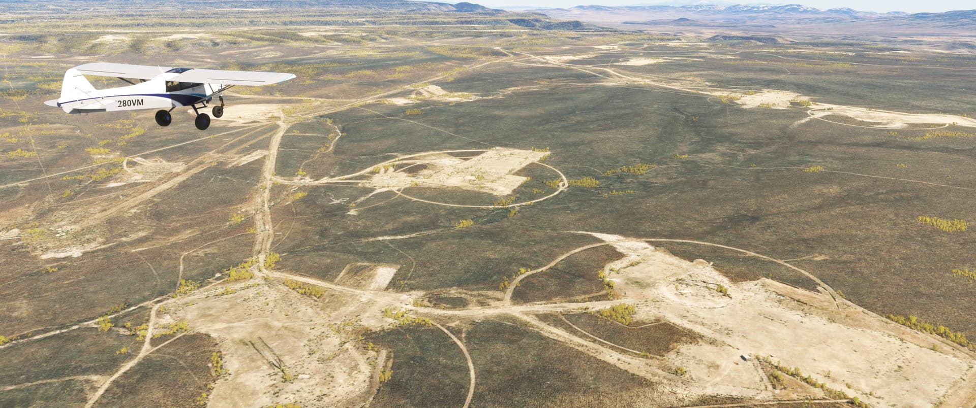
Here we are flying southeast over Pahute Mesa and Area 20. After passage of the 1963 atmospheric test ban treaty, nuclear testing at the NTS moved a few miles west to Pahute Mesa and surrounding areas, as the soil at Yucca Flats wasn’t conducive to high-yield underground testing. Eighty-five nuclear tests were conducted underneath Pahute Mesa between 1965 and 1992.
When a nuke explodes underground, it momentarily creates a large cavity. In most cases the ceiling of that cavity immediately collapses downward. On the surface this creates a subsidence crater, and the NNSS is littered with them. At least twelve are visible in this photo.
Pee-Wee says: That’s one way to ruin your resale value, and your neighbors’, too. ![]()
![]() NASA’s School of Rock: Buckboard Mesa
NASA’s School of Rock: Buckboard Mesa
MSFS: 37.100000 -116.355000
Skyvector: 370600N1162118W
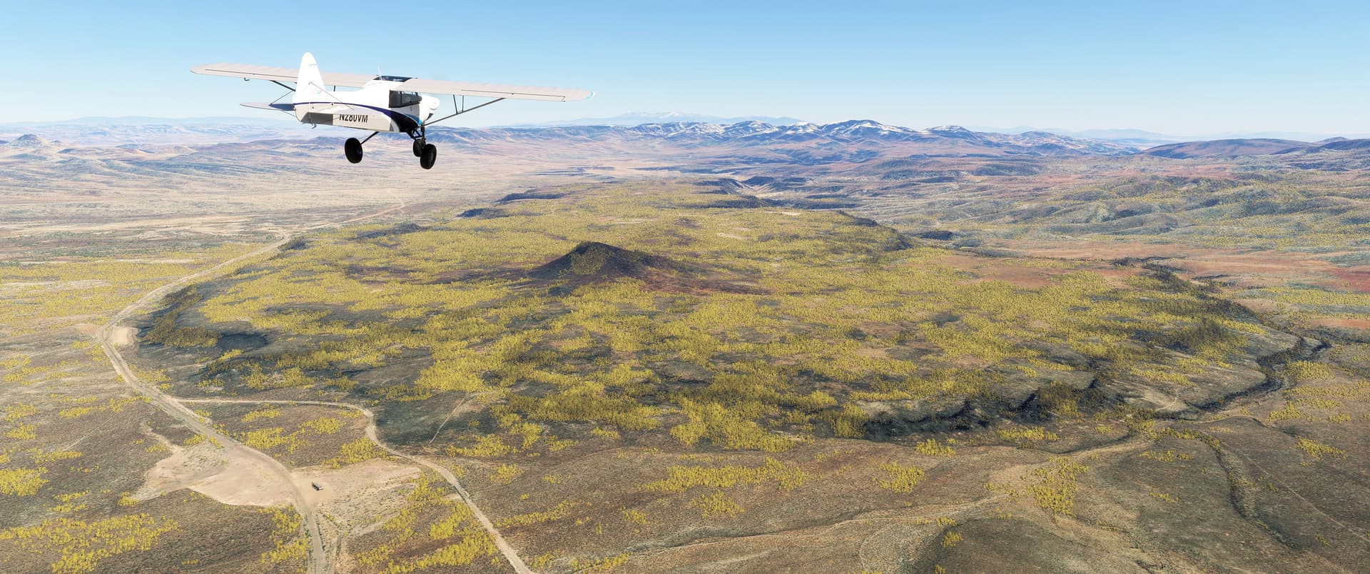
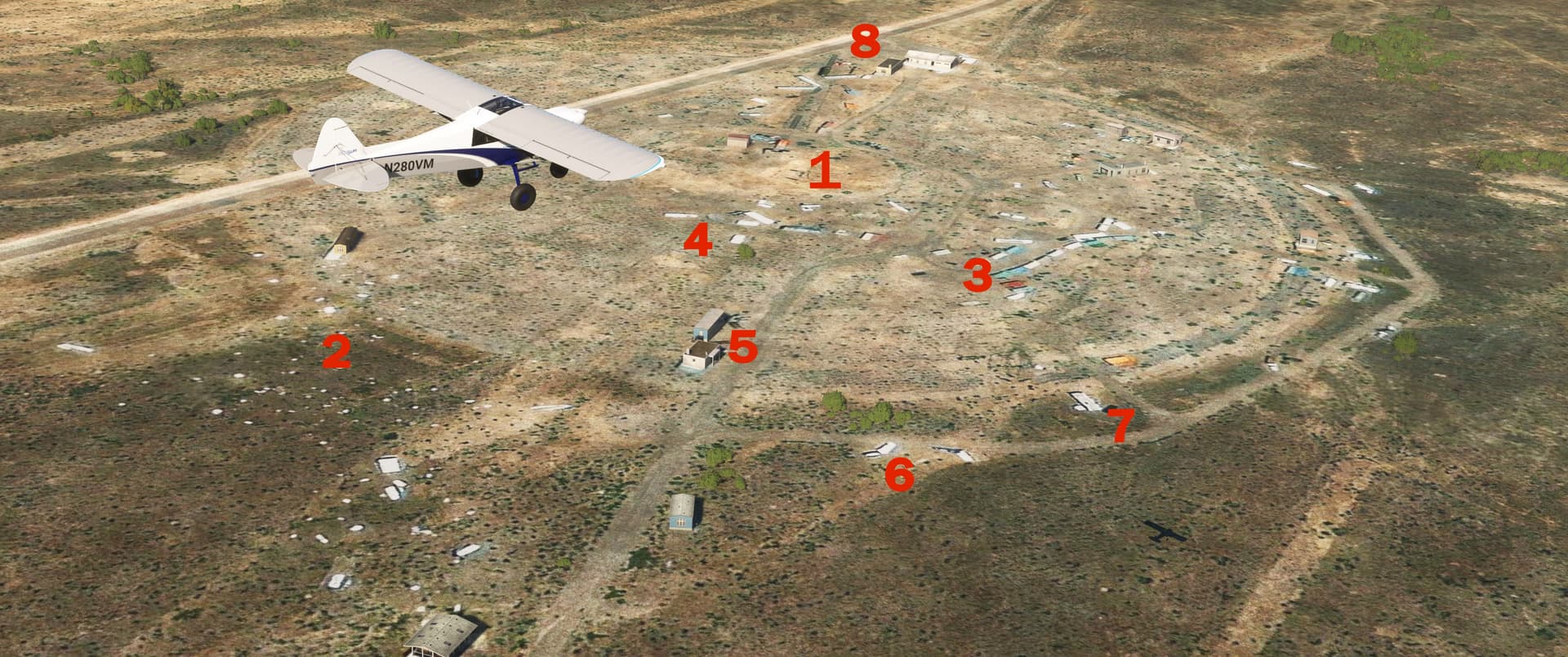
Here we are approaching Buckboard Mesa. Don’t be fooled by MSFS’s tree algorithm: this place is nearly bare, especially after the punishment it received from at least nine underground nuclear tests. That’s Scrugham Peak jutting 574 feet (175 meters) above the mesa. The Apollo 14, 15, and 16 crews trained here as well.
They even tried out their new Lunar rovers. Starting from a “landing site” south of Scrugham Peak, they traversed an approximately 4 mile (6.5 kilometer) southerly route, stopping to conduct training at several subsidence craters. On the photo below, we’ve drawn the approximate route the astronauts took, and labelled the craters.
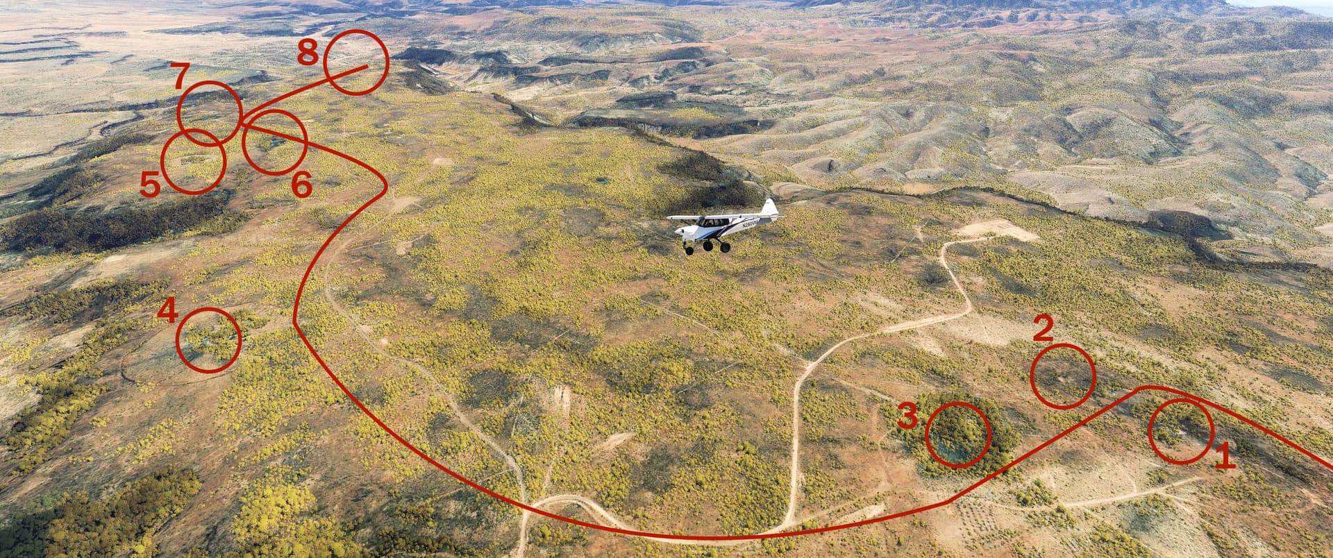
The craters are: (1) Little Danny Boy (“Little Dan”), (2) Baby Danny Boy (“Baby Dan”), (3) Danny Boy (“Dan”), (4) Delta, (5) Charlie, (6) Dugout, (7) Bravo, (8) Big John, Little John, and Baby John.
Pee-Wee says: The Charlie test site is rare, having not formed a subsidence crater. It appears the ground above the explosion is projected upwards into a ragged dome–an inverted crater–called a “retarc,” which is crater spelled backwards. Ah, those clever scientists! ![]()
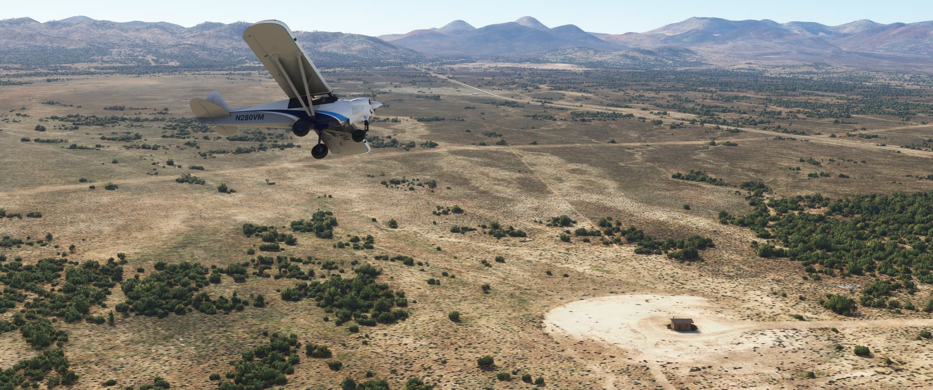
![]() Intermission: Pahute Mesa Airstrip
Intermission: Pahute Mesa Airstrip
MSFS: 37.102945 -116.312598
Skyvector: 370611N1161845W
Pahute Mesa Airstrip was built in 1941 as an emergency landing field for aircraft using the newly designated Tonopah Bombing Range (which became today’s Nevada TTR). Owned by the Department of Energy, this remote airstrip is 5,800 feet (1,768 meters) long, and while it’s open and usable in both real life and MSFS, the entire length is marked with yellow "X"s. Facilities include what appear to be three barracks-like buildings and water storage, but not much else. I believe the word is “spartan.”
We weren’t planning to land here, but Pee-Wee had to wee.
Pee-Wee says: And you were tired of my nagging. Player two has entered your game. ![]()
![]() Schoolhouse for a Really Bad Day: Radiological/Nuclear WMD Incident Exercise Site T-1
Schoolhouse for a Really Bad Day: Radiological/Nuclear WMD Incident Exercise Site T-1
MSFS: 37.053011 -116.103473
Skyvector: 370311N1160612W
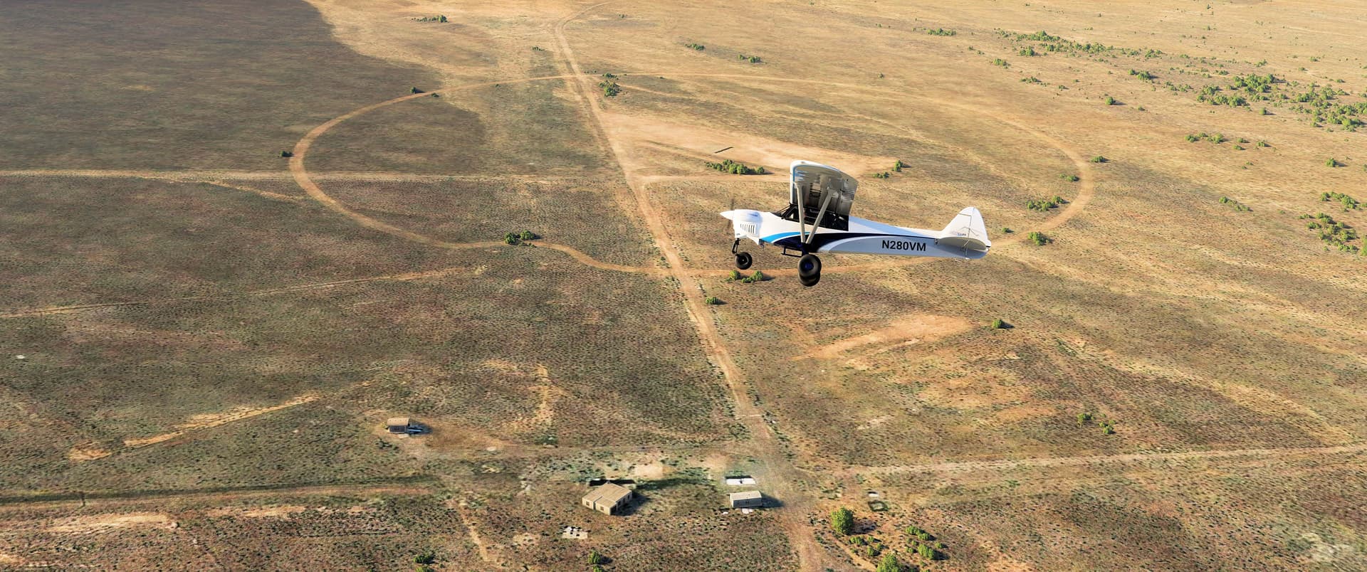
Here we are about ten miles east of Pahute Mesa Airstrip, and we’ve finally descended into the valley where Yucca Flat lies. We’re passing over the Radiological/Nuclear Weapons of Mass Destruction Incident Exercise Site T-1 on the valley’s western edge.
Pee-Wee says: The R/NWMDIES T-1. Got it. ![]()
There are several “zones” within the site, including: (1) the original nuke tests’ ground zero, (2) airliner debris field, (3) downtown city, (4) airport terminal, (5) restaurant/strip mall, (6) crashed vehicles, (7) residences/safe houses, (8) railroad station and school.
This unique training facility was constructed at the ground zero of four above-ground nuclear weapon tests: Ranger Easy, Plumbbob Galileo, Teapot Apple-II, and Upshot-Knothole Simon. All four weapons were airbursts or towered, greatly reducing residual radiation. National, local, and military emergency response teams train here, perfecting techniques for handling mass-casualty events involving dirty bombs, chemical/biological weapons, and other such nasties. T-1 highlights why the Nevada Test Site was renamed National Security Site.
Pee-Wee says: The airliner debris field is really interesting. The “building” directly below our Monster’s tail in the photo is actually the forward fuselage of a Delta Air Lines 727-200. We’ve seen a few photos online but haven’t been able to determine the aircraft’s identity. It’s painted in the old black cheatline/widget scheme, so she left the fleet quite a few years ago. If anyone has any additional information, please drop me a DM!
A quick note: DoD nucelar tests were grouped into named series, like Plumbbob or Ranger, while individual blasts were given names that generally progressed in alphabetical order, like Able, Easy, and Simon. So “Ranger Able” was the first shot of the Ranger series, and “Castle Bravo” was the second shot of the Castle series. Now you know!
![]() I Don’t Think Your Insurance Covers This: The Apple-II House
I Don’t Think Your Insurance Covers This: The Apple-II House
MSFS: 37.045587 -116.078457
Skyvector: 370244N1160442W
Here we are turning north about 1.5 miles (2.4 kilometers) east of T-1. That’s MSFS’s autogenerated representation of the famed “Apple-II house” down there. You’ve probably seen old black-and-white videos of this two-story residential home being pummeled by a nuclear shockwave during the Teapot Apple-II weapons effect test of 5 May 1955. The house survived, although with its windows and doors blown inward and paint scorched. The tower supporting the 29-kiloton bomb was located at the center of T-1, visible to the immediate right of our Monster’s propeller hub.
Pee-Wee says: The Apple-II house is one stop on the NNSS tour route. I would love to take that tour someday, but seats are extremely limited and sell out almost immediately. I’m never fast enough, or I’m busy on the few days offered. Someday the stars will align!
![]() From Sea to Shining…Nevada?: Louisville’s Gun Turret
From Sea to Shining…Nevada?: Louisville’s Gun Turret
MSFS: 37.139471 -116.109081
Skyvector: 370822N1160633W
Six miles north of T-1 and the Apple-II house we found one of the most unlikely structures on Yucca Flat: a gun turret from an old warship. Engineers replaced its three guns with a single 45-inch (114-centimeter) barrel and collectors tuned to gather emissions from above ground nuclear tests. The turret could be swiveled to cover the whole of Yucca Flat and was used during the Plumbbob Diablo, Shasta, Smoky, and Whitney shots.
We’re looking north in the photo above. The turret is below and to the left of our Monster, on the north side of the road in the lower left corner. It’s unfortunately represented by an autogenerated building, although closer examination of the underlying imagery reveals the barrel, pointing east. The circular road behind us marks the ground zero of another unknown above-ground test.
Pee-Wee says: After comparing visible repairs with known battle damage, researchers decided the turret was most likely removed from CA-28 USS Louisville, a Northampton-Class cruiser built in 1930. She served mostly in the Pacific during World War 2 and survived a catastrophic Kamikaze attack off Leyte on 21 October 1944. Louisville was sold for scrap in 1959. Her bell is on display at the Navy Operational Support Center in Louisville, Kentucky.
![]() Okay…This is Getting Ridiculous: The Sedan Crater
Okay…This is Getting Ridiculous: The Sedan Crater
MSFS: 37.176869 -116.046045
Skyvector: 371037N1160246W
On 6 July 1962 the Atomic Energy Commision, through the Lawrence Radiation Laboratory–Livermore, answered the nagging question “can we make a really big hole with a nuke?” The answer was a resounding “yes” that measured 4.75 on the Richter Scale. The resulting hole is 1,280 feet (390 meters) across and 330 feet (101 meters) deep and qualifies as the largest “single event” manmade hole in the world.
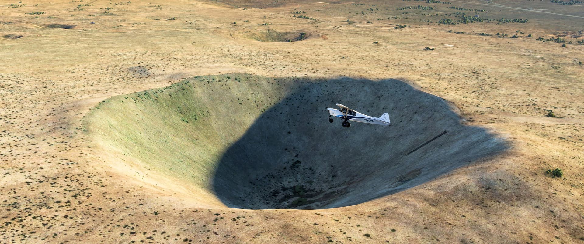
Here’s the crater excavated by the 104-kiloton Sedan shot in Area 10 near the north edge of Yucca Flat. It’s hard to gauge the size of this massive hole in the Nevada Desert, so…
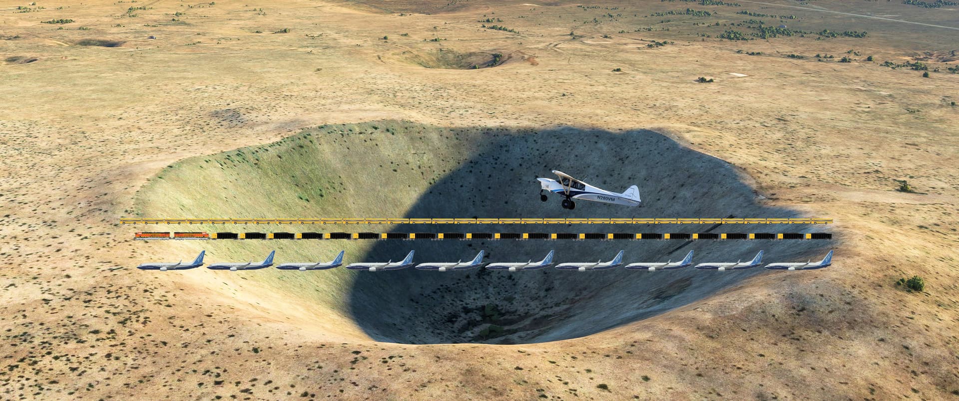
…we overlaid some comparable objects on this photo. From top to bottom, that’s thirty-two 41-foot Blue Bird school busses, a train of two ES44ACs and twenty-two 53-foot gondolas, and ten 737-800s. The Empire State Building, laid on its side, would touch both edges of the crater, and if the Statue of Liberty was stood inside, the top of her torch would be 30 feet (9 meters) below the crater’s lip.
It’s a big hole.
Plowshare determined that nuclear explosives could be used for large excavation projects, but never quite reconciled with the residual radiological effects or how any nuclear excavation project would be pitched to neighboring populations. The program quietly died in 1977.
A group of Apollo astronauts, including Neil Armstrong and “Buzz” Aldrin, toured the Nevada Test Site in 1965, and spent time at Sedan in preparation for their Lunar excursions. The Apollo 14, 15, and 16 prime and backup crews examined Sedan in more detail as part of their training in 1970-71. Background radioactivity was reportedly low enough to not require protection for the astronauts and their instructors, and none suffered any ill effects.
Pee-Wee says: Sedan is probably the premier location on the aforementioned NNSS tour. For more information, visit the NNSS web site. Just don’t take my seat! ![]()
From Sedan we turned south over Yucca Flat for the final stretch of our tour. We’re at our 10-photo-per-post limit, so we’ll break for the next part here.
Pee-Wee says: Bye for now! ![]()