Hi, everyone! Nag is working and Mini-Wee is moved back in, so I had some free time this evening to tie a few loose ends from our Southern Nevada tour. Enjoy!
![]() Rough-Rider, Conman, Legend: Death Valley Scotty
Rough-Rider, Conman, Legend: Death Valley Scotty
Scotty’s Castle
MSFS: 37.031973 -117.340626
Skyvector: 370155N1172026W
Scotty’s Junction
MSFS: 37.298788 -117.053271
Skyvector: 371755N1170312W
While touring Bonnie Claire, we questioned the identity of “Scotty,” the person who rated not one but two airports in his name. One quick Internet search later and all was revealed!
He was Walter Scott of Cynthiana, Kentucky, a prospector, rodeo performer, and conman whose turn-of-the-century exploits in the southwest of Nevada earned him national attention and the appellation “Death Valley Scotty.” He surveyed railroads and mines near Bonnie Claire, rode with Buffalo Bill Cody’s Wild West and Congress of Rough Riders of the World, set a record for fastest transcontinental train trip, robbed local area mines of high-grade ores, and conned thousands and perhaps millions of dollars from wealthy investors drawn to his fictional gold mine.
An interesting character indeed ![]()
Curiously, after Scotty’s deceptions were revealed, he and one of his investors, Chicago insurance magnate Albert Johnson, became lifelong friends, so much that Johnson allowed Scotty to live nearly full-time at his vacation getaway in nearby Grapevine Valley. Scotty, of course, convinced everyone that the home was his, and even today the Death Valley Ranch is known as “Scotty’s Castle.”

Here’s MSFS’s autogenerated rendition of Scotty’s Castle in Grapevine Canyon, just across the California border from Bonnie Claire. Construction of this large Mission-style home began in 1922 under the direction of Mat Thompson, a Stanford-educated civil engineer who helped design airbases at Mojave (later Edwards AFB) and Kadena, and participated in nuclear test planning on Bikini and Eniwetok Atolls. Now owned by the National Park Service, the Castle (which, of course, isn’t really a castle) was recently damaged by flooding and a fire and is currently not open to the public.
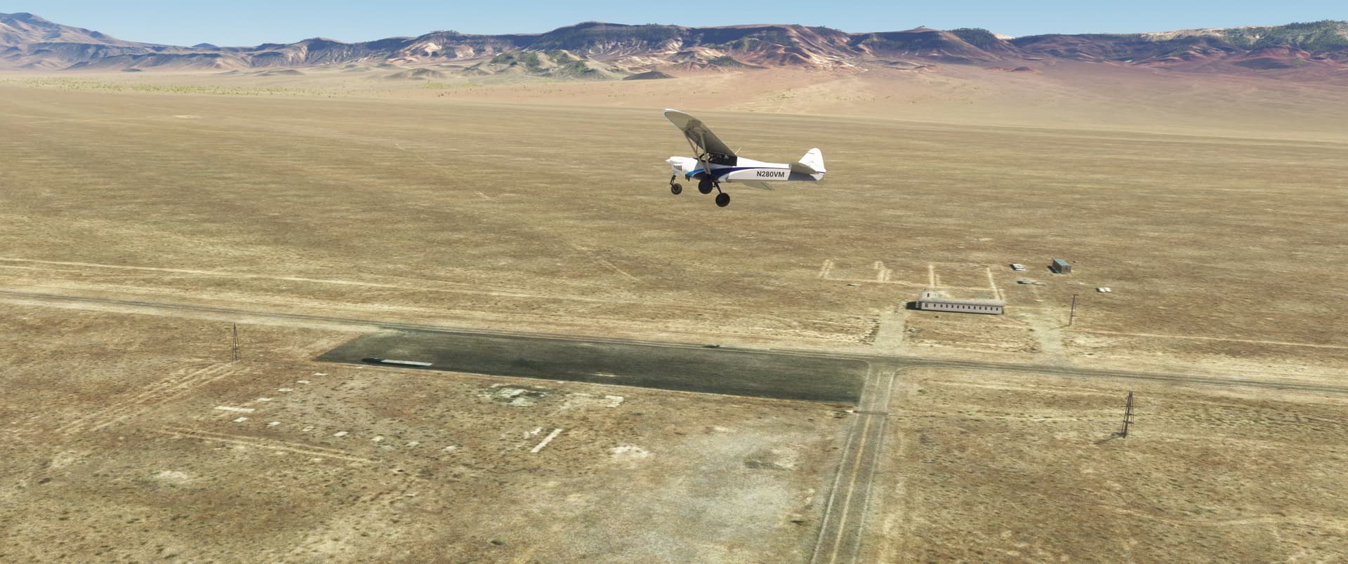
And here I am over Scotty’s Junction, about eleven miles northeast of Bonnie Claire Dry Lake and 25 miles from the Castle, flying roughly parallel to Nevada Highway 95. That’s Scotty’s Castle Road running off the bottom of the photo. For years the only thing at this intersection was a roadhouse/truck stop that burned sometime in the early 1970s. A large parking area is all that remains. The shop and houses across the highway are all abandoned, and it seems that even the ghosts left this town!
Speaking of ghosts, this was where 81-year-old Death Valley Scotty met his end enroute to a hospital after suffering a heart attack in January 1954. He’s buried on the hill overlooking his eponymous castle.
![]() What’s in a Name?: Bonnie Claire/Grapevine Dry Lake
What’s in a Name?: Bonnie Claire/Grapevine Dry Lake
MSFS: 37.16698 -117.162227
Skyvector: 371001N1170944W
Reviewing Paul Freeman’s outstanding web site Abandoned & Little Known Airfields (the site that got me started in aviation archaeology) revealed a curious detail we’d both forgotten: one man’s theory on whether or not Bonnie Claire Dry Lake strip was an emergency landing field for the X-15 spaceplane. The NASA historical publication X-15: Extending the Frontiers of Flight, discusses X-15 launch areas and contingency airstrips, including “Mud Lake” and “Grapevine Lake.”
Does Grapevine sound familiar? There’s Scotty and his Castle, again! ![]()

Here’s the view from 50,000 feet (15,240 meters) over Mud Lake, looking toward Edwards AFB. I’ve circled Bonnie Claire Dry Lake.
Bonnie Claire, which is very near Grapevine Valley and Peak, lies almost directly between Mud Lake, a known X-15 launch site, and Edwards AFB. It’s also within easy gliding distance of an X-15 launched from overhead Mud Lake. It was definitely plausible that what we call “Bonnie Claire Dry Lake” NASA calls “Grapevine Lake.”
And then on Page 267 I found a map of all the X-15 launch, landing, and alternate landing sites, and there, just to the northwest of Beatty, was Grapevine Lake.
So there you have it: Bonnie Claire/Grapevine was in fact an emergency landing site for the X-15.
Look at that: 10% more information for the same low price! ![]() Thanks for tuning in again, everyone, and I hope to see you all back for our next adventure. I have another short Skytour already planned, and expect a special episode to be presented in the beginning of June. Until then, fly safe and remember to not squeeze the Charmin. Good night
Thanks for tuning in again, everyone, and I hope to see you all back for our next adventure. I have another short Skytour already planned, and expect a special episode to be presented in the beginning of June. Until then, fly safe and remember to not squeeze the Charmin. Good night ![]()