Pee-Wee’s Little Adventures
Episode One: The Phantom Menace
Pee-Wee says: Welcome back, history and sight-seeing friends! I’ve been flying solo lately and decided to write a few “little adventures” that focus on smaller areas than a full Skytour. Again, I’m dispensing with the italicized text since I’m the only one talking (yes, I miss Nag, too, but he’ll be back soon ![]() ).
).
Those of you who frequent this thread already know my passions veer toward the eclectic, like wooden blimp hangars and their buoyant tenants, Fairbanks-Morse cab units, Russian airliners and prototypes, and other oddities. But I bet you don’t know my favorite Cold War fighters. ![]()

Boom. British Phantoms.
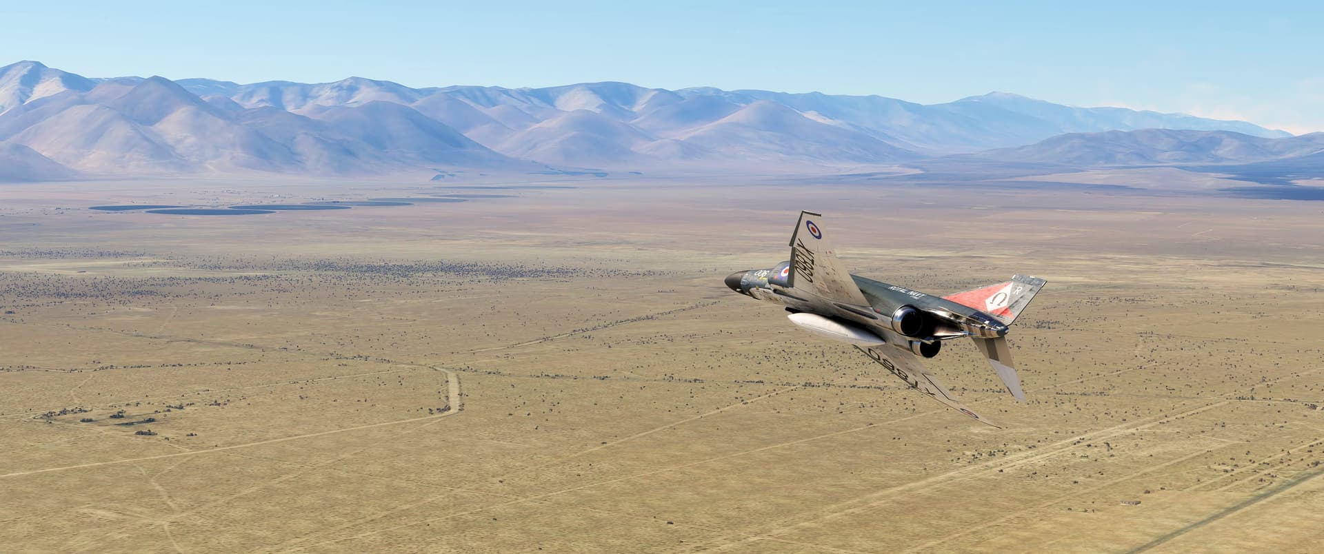
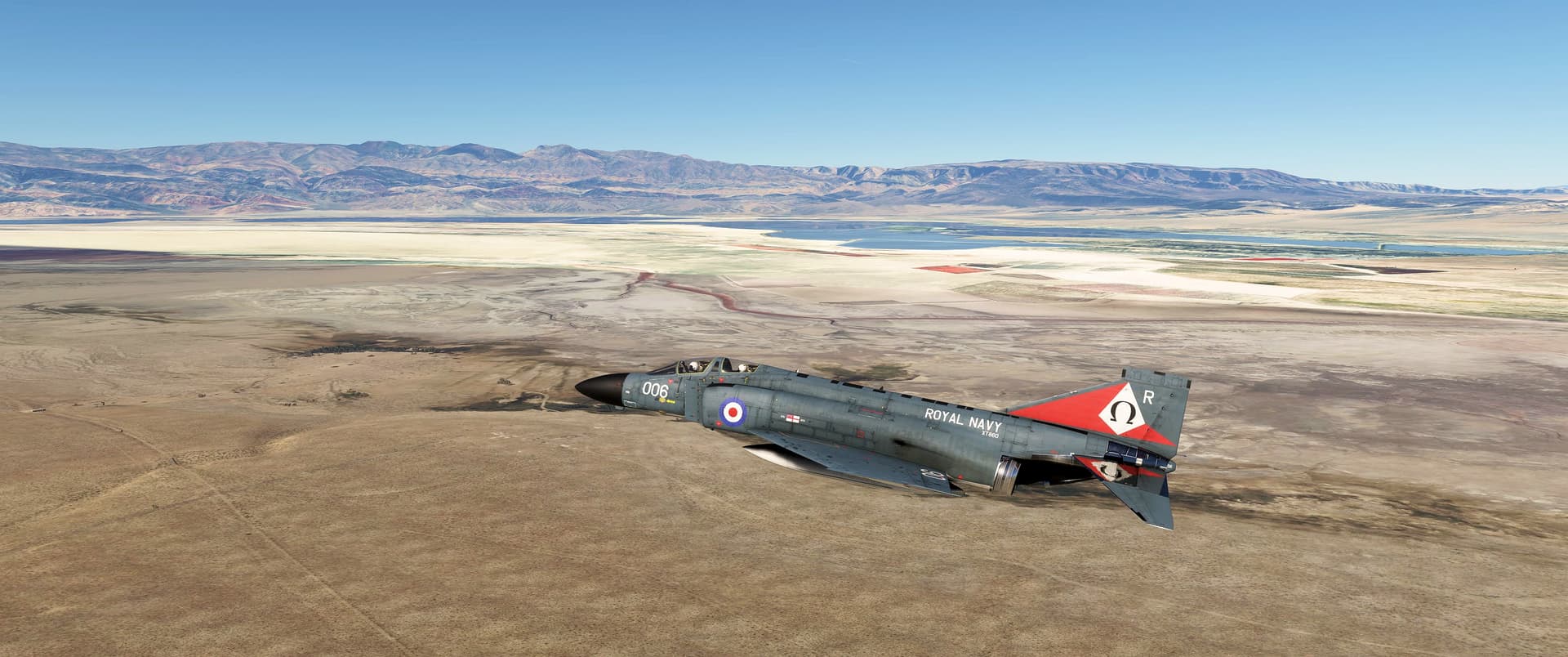
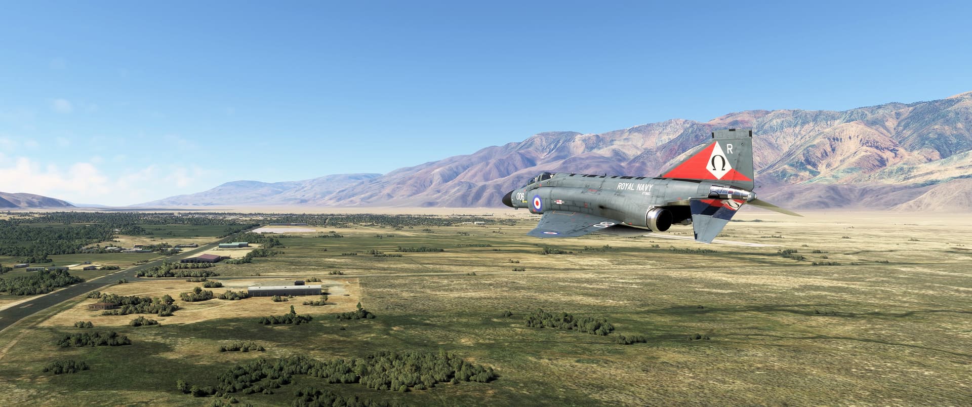
This is Phantom FG.1 XT860, one ship of the inaugural trio delivered to NAS Yeovilton on 29 April 1968. She flew with 700P Squadron and later with 892 Squadron aboard HMS Ark Royal before joining the Royal Air Force’s “Fighting Cocks” of 43 Squadron in 1978. Sadly, she and her crew–Flight Lieutenants Philip Clarke and Kevin Poysden–were lost in the North Sea off RAF Leuchars on 20 April 1988.
The Phantom model is by DC Designs, and the brilliant skin, which presents XT860 as she appeared in 1977, is the work of Merida72 at www.flightsim.to.
It was believed the Phantom would be the last fixed-wing aircraft operated from Royal Navy aircraft carriers, and 892 Squadron accordingly chose the ultimate Greek letter Omega as its symbol. (It seems nobody–not even the Fleet Air Arm–anticipated the Sea Harrier. ![]() ) The “R” indicates assignment to Ark Royal’s carrier air group, and she carries a commemorative marking behind her fuselage roundel with the numbers “1976” and “976” flanking the white Royal Navy Ensign. As the RN was formed in 1546, I’m stumped as to its meaning. If anyone knows, please send a DM!
) The “R” indicates assignment to Ark Royal’s carrier air group, and she carries a commemorative marking behind her fuselage roundel with the numbers “1976” and “976” flanking the white Royal Navy Ensign. As the RN was formed in 1546, I’m stumped as to its meaning. If anyone knows, please send a DM! ![]()
Today I’ll be flying one of my favorite low-level round robin routes through southern California: from NAWS China Lake, I’ll turn north and run up the Owens Valley to Lone Pine, hop over the Inyo Mountains into Saline Valley, turn south over the Malpais Mesa, drop through Rainbow (“Star Wars”) Canyon into Panamint Valley, and whiz past Trona on the way home. The whole route takes about twelve parsecs (sorry…couldn’t resist). ![]()
![]() Borax and Bombs: Naval Air Weapons Station China Lake
Borax and Bombs: Naval Air Weapons Station China Lake
MSFS: 35.686 -117.691
Skyvector: 354110N1174128W
Nothing satisfies my sense of irony like the United States Navy owning a Rhode Island-sized chunk of desert more than 120 miles (193 kilometers) from the nearest ocean. Named the Naval Air Weapons Station China Lake, this massive facility contains 35% of the U.S. Navy’s total land holdings worldwide. The name derives from the predominantly Chinese immigrants who worked the nearby borax mines.
During World War 2, the U.S. Navy needed a remote range to test new rockets, and the California Institute of Technology (CalTech) needed someplace away from prying eyes to develop nuclear weapon “shapes” for the Manhattan Project. Straddling three counties–Inyo, Kern, and San Bernardino–the 1.1 million acre (4,500 square kilometer) Naval Ordnance Test Station opened in 1943.
Over the following decades the Navy and other armed services tested everything from air-to-air missiles (including the über successful AIM-9 Sidewinder) to submarine-launched ballistic missiles, electronic countermeasures, ejection seats, and even anti-satellite weapons here.
At least three add-on scenery packages for China Lake’s Armitage Field are available at www.flightims.to, although I used the basic MSFS scenery for this flight.
![]() Dropping In: Turning North Along the Sierras
Dropping In: Turning North Along the Sierras
MSFS: 35.794 -117.861
Skyvector: 354741N1175142W
In this screenshot I’m pointed toward Pearsonville on U.S. Highway 395 north of Inyokern. The Sierra Nevada Mountains and Alabama Hills form the western edge of the Owens Valley, which lies beyond the volcanic hills in the distant right. The pivot-irrigated (i.e. circular) fields in the distance make a great landmark to help find the highway.
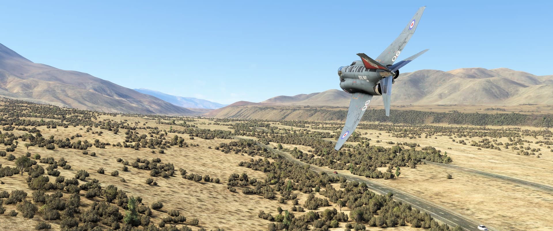
And here I am following the highway north toward Owens Valley. US-395 runs from Hesperia in San Bernardino County, California, to the Canadian border at Laurier, Washington and is part of the original transcontinental “Grand Army of the Republic Highway.” (Seriously, how many Star Wars references can I fit into this writeup?
Be very careful: there are numerous unmarked high-tension transmission lines crossing here! I strongly recommend flying no lower than 200 feet (60 meters) above the terrain until exiting the pass ahead.
![]() Thanks for the Water, Los Angeles: Owens Valley
Thanks for the Water, Los Angeles: Owens Valley
MSFS: 35.987 -117.919
Skyvector: 355916N1175509W

Exiting the narrow pass you’ll see the 560-foot (170-meter) tall and aptly named Red Hill cinder cone and Fossil Falls geologic site, with its basaltic lava flows shaped by glacial melt, on the right. You’ll also see more power lines. Watch out!

In this south-facing screenshot, I’m passing over the Coso Junction and Rest Area where US-395 meets two roads that wind away into the desert to the east and mountains to the west. That’s Red Hill in the distance, and Volcano Peak to the left directly above my Phantom.
The Timbisha Shoshone, a tribe of the Northern Paiutes previously called the Coso People, occupied these lands for centuries. Their artwork adorns thousands of rock faces throughout this region and constitutes one of the largest collections of native petroglyphs in the Western Hemisphere.

A few miles north of Coso Junction I passed west of the manmade North and South Haiwee Reservoirs and the Coso Range Wilderness Area. These two reservoirs were flooded in 1913 to feed the Los Angeles Aqueduct that runs from here to Van Norman Lake in Granada Hills.
In a classic case of comeuppance, the White settlers that forced the native Timbisha from their fertile farmlands during the Owens Valley War of 1862-63 were themselves forced to abandon their homes as Los Angeles sucked the valley dry in the 20th Century. Today, Owens Lake is virtually empty and sees far more sulfate and borax mining than farming. In the distance above our Phantom’s tail, you can see some of the surviving marshlands along the lake’s southern margin. The Owens Lake West Delta Birding Area is barely visible at the lake’s northern shore up ahead.
![]() Sportsman’s Paradise: The Former J. G. Motel and Airstrip
Sportsman’s Paradise: The Former J. G. Motel and Airstrip
MSFS: 36.256 -117.998
Skyvector: 361523N1175955W

This one took some sleuthing! Just north of the Haiwee Reservoirs I found the former J. G. Motel (the generic buildings to the left of our Phantom) and its airstrip on the west side of Highway 395. Carved from the desert shortly after World War 2, the airfield served aircraft ferrying motel guests and sportsmen over the Alabama Hills to Monache Meadows in the High Sierras. A period brochure shows a proud pilot or guest standing next to a nicely demobbed BT-13 trainer, apparently one of three aircraft in the motel’s fleet. There are rumors that Howard Hughes frequented this establishment, but honestly, I’m hard-pressed to find anywhere in California that doesn’t make that claim!
Today the motel is the two-star Ranch Hotel, and it appears…a little rough around the edges, and perhaps in need of…updating, or perhaps some…napalm. ![]() The airstrip was active as a glider field until at least 2015, although it hasn’t been marked on aeronautical charts since the Sixties. Maybe Nag and I will return here in more suitable aircraft another day?
The airstrip was active as a glider field until at least 2015, although it hasn’t been marked on aeronautical charts since the Sixties. Maybe Nag and I will return here in more suitable aircraft another day?
![]() There Sure Are Many Pines In: Lone Pine
There Sure Are Many Pines In: Lone Pine
MSFS: 36.605 -118.063
Skyvector: 363620N1180348W
Here I am approaching Lone Pine and the eastward turn toward the Inyo Mountains. Continuing up the valley ahead would take me to Bishop, Mono and Mammoth Lakes, and eventually to Reno and Naval Air Station Fallon, current home of the Navy’s Fighter Weapons School (“Top Gun”).
Directly above my Phantom’s tail is 11,105-foot (3,385 meter) Keynot Peak and Forgotten Pass where I’ll cross the ridge and drop into Saline Valley. At the photo’s upper right corner is New York Butte.
Huh, would you look at that? My “little adventure” is running out of control and I’m nudging the ten-screenshot limit! Let’s break here and pick up again in Part 2! ![]()