Pee-Wee and Nag Over Middle America
St. Louis to Kansas City, Part Two
Welcome back, gang! In our last installment we toured sites around St. Louis before landing at Lambert International Airport in the northwest suburbs.
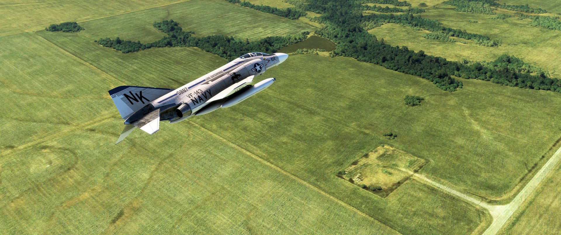
Pee-Wee says: After a quick lunch and restroom break, we hopped back into our Phantom, lit the burners, and headed west toward Kansas City. Today’s tour covers the land in between, generally along the Interstate 70 corridor through Columbia.
We planned to remain low and fast over the entire route and, as there’s few suitable alternate airports between STL and MCI, we strapped on the Phantom’s 600-gallon (2,270-liter) center tank in addition to the two wing-mounted Sargent Fletchers, giving us over 22,000 pounds (9,980 kilograms) of fuel, about two hours endurance at 8,000 pounds (3,630 kilograms) per hour.
Pee-Wee says: And since the Phantom is limited to about 5 G’s with the center and wing tanks fitted, we’ll still have a turning radius of between 3,000 and 6,000 feet (915 to 1,830 meters), suitable for maneuvering around obstacles and setting up for screenshots. See? There’s actually quite a bit of planning that goes into these tours. ![]()
Time to head west to Kansas! But first, we’re going to execute some geographic wizardry and fly northwest from Lambert to the east side of the Mississippi River.
![]() St. Louis’s Supersonic Shield: Nike Site SL-90
St. Louis’s Supersonic Shield: Nike Site SL-90
Launcher
MSFS: 38.9953 -90.5100
Skyvector: 385943N0903036W
Fire Control Center
MSFS: 38.9817 -90.5083
Skyvector: 385854N0903030W
Administration and Barracks
MSFS: 38.9797 -90.5120
Skyvector: 385847N0903044W
Between 1960 and 1968, St. Louis’s heavy materials and manufacturing industries were protected from Soviet attack by four Nike Hercules surface-to-air missile batteries situated approximately 30 miles (48 kilometers) northeast, southeast, southwest, and northwest of the city. The Hercules’s 90-mile (145 kilometer) range meant that a battery in one quadrant could engage targets in the opposite. A command center at Belleville Air Force Station near Scott AFB provided coordination and overall control of the four batteries.
Battery SL-90 was located northwest of St. Louis near Grafton, Illinois, and inside the Pere Marquette State Park. It consisted of three separate, closely spaced installations: the Fire Control Center, the Launcher, and an administrative and personnel area. The radars and command center were located at the Fire Control Center, which was located less than one mile up Scenic Drive from the barracks and personnel facilities. The launcher was located one mile north on Upper Park Drive.
The St. Louis Nikes were removed in 1968, and within a few years nearly every trace of their presence was removed or erased by redevelopment.
Pee-Wee says: When we plan our tours, we start by researching potential sites along our route, then perform some “photo recon” using Google Maps or Earth and flight planning using Skyvector. To keep things interesting, we never look at Bing Maps beforehand, which means we never know exactly what we’re going to find in MSFS. It’s always exciting to find the site just as we expected, but sometimes it just doesn’t work out, as in the case of SL-90. Normally, we bin the more lackluster sites in “post-production,” but we thought you’d appreciate some insight into how we “make the sausage.” ![]()
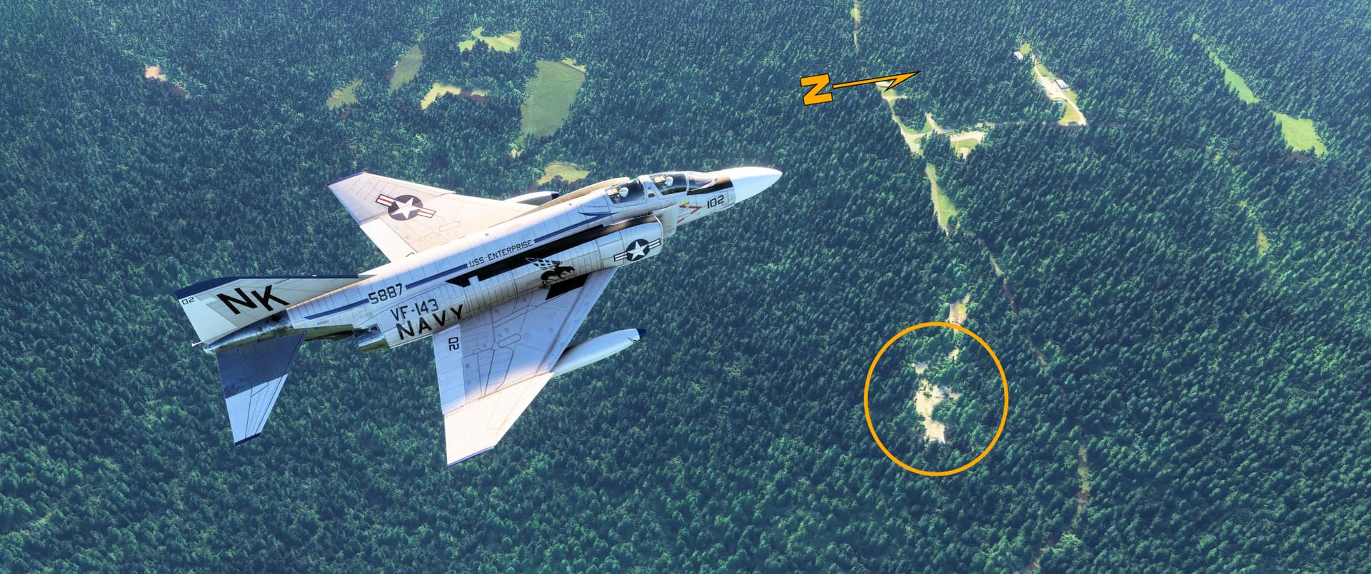
We needed three passes to positively identify SL-90’s launcher in MSFS (circled in this screenshot). Few traces of this Nike battery remain today: the Control Center, represented by a generic autogen building, was barely visible hidden in the trees at the fire control center. The Launcher was almost nearly completely obscured beneath the excessive MSFS forest canopy.
Pee-Wee says: So, basically, there’s nothing to see here. Want to try your hand at finding the other sites? This excellent website gives you everything you need to get started. Feel free to post screenshots of what you find! ![]()
![]() Draught Horses and Draft Beer: Warm Springs Ranch
Draught Horses and Draft Beer: Warm Springs Ranch
MSFS: 38.949 -92.588
Skyvector: 385657N0923518W
Approximately 95 nautical miles (176 kilometers) west-southwest of SL-90, nestled between Interstate 70 and the Missouri River, we found the Warm Springs Ranch, home of the world-famous Budweiser Clydesdales. Built in 2007, the 300-acre (120-hectare) ranch currently houses half of the brewer’s 250 horses. Budweiser maintains three touring teams–“hitches”–of ten Clydesdales each near the company’s breweries in St. Louis, Fort Collins, Colorado and Merrimack, New Hampshire.
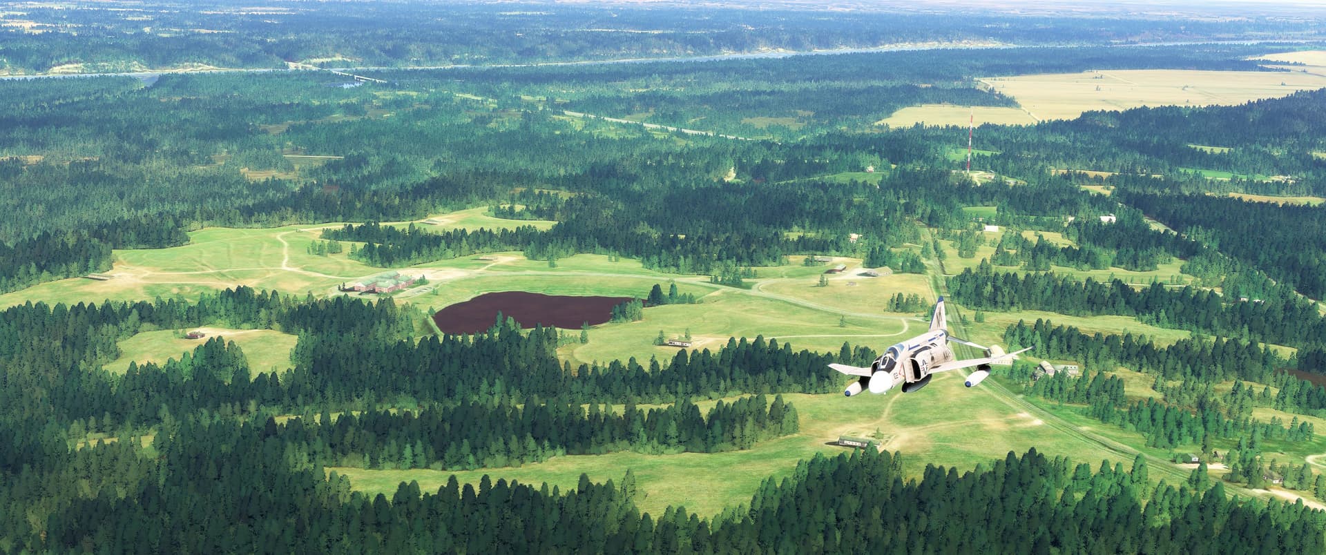
Pee-Wee says: You can see Warm Springs Ranch to the left of our Phantom in this east-facing screenshot. The main stable lies north of the pond, and if you look carefully in the parking lot behind, you’ll see one of the iconic red semi-trucks used to transport the horses between venues. The trademark red 1900 Studebaker wagons are carried in a separate truck.
Budweiser’s Clydesdales made their first appearance shortly after the repeal of Prohibition in 1933 and have been a staple of Budweiser’s advertisements and marketing campaigns ever since. The Company’s simple “9/11 Tribute” featured the Clydesdales and is still one of the most memorable commercials in television history.
Pee-Wee says: Let’s not forget about the other iconic members of the Clydesdale team, the dalmatians! These black-spotted canines joined the hitches in 1950 initially as guard dogs but took on a more public role almost immediately. Today they ride atop the wagons and interact with the public while on tour. Two dogs are assigned to each hitch, although only one tours at a time. It seems their careers last about ten years, and you’ll be happy to know that in retirement they find happy homes with lucky Budweiser employees.
Curving to the northeast toward St. Louis above our Phantom is Interstate 70, or as this portion is known, the “U.S. Submarine Veterans Memorial Highway.” Dedicated in 2004, the 54-mile (87-kilometer) stretch of highway memorializes the 52 U.S. Navy submarines and 3,506 sailors lost in World War 2, the 129 sailors and contractors lost aboard Thresher in 1963, and the 99 sailors lost aboard *Scorpion" in 1968.
Pee-Wee says: To all submariners on eternal patrol, fair winds and following seas. ![]()
![]() Missouri Boon Town: Boonville, Missouri and the Santa Fe Trailhead
Missouri Boon Town: Boonville, Missouri and the Santa Fe Trailhead
MSFS: 38.988 -92.742
Skyvector: 385918N09244332W
A few miles further west is the riverside town of Boonville, population 7,964. Founded in 1817, the town is named indirectly for legendary American frontiersman Daniel Boone, whose sons Daniel and Nathan operated a thriving salt business at a saltwater spring–“Boone’s Lick”–nearby.
Pee-Wee says: The first settler here was 48-year-old widow Hannah Cole who settled with her nine children on the river’s south shore in 1810. Her homestead soon became a “fort” in which local settlers sheltered from attacks by British-allied natives during the War of 1812. She later operated a commercial ferry across the Missouri River to Franklin, and her home hosted the first court, church, and school in the area. Hannah passed away in 1843 and is interred at the Briscoe Cemetery south of Boonville. Today, one of the Boonville R-1 school district’s elementary schools is named in her honor.
Boonville’s location astride the vital Missouri River made it strategically important during the American Civil War, and the Union victory over the local militia here in 1861 guaranteed Federal control of the river for the war’s duration. Today Boonville is the seat of Cooper County and boasts a casino, a state correctional center, and a budding tourist industry.

Pee-Wee says: We’re flying west over the Missouri River’s north shore in this screenshot. Boonville is visible across the river. That’s the Boonslick Bridge carrying U.S. Highway 40 just ahead of our Phantom. The former MKT Railroad’s vertical lift Bridge #191.1 further upstream is missing completely from MSFS. Directly beneath our Phantom is where the town of Franklin stood before the catastrophic flood of 1827 forced the residents to rebuild further inland.
In the field beneath our Phantom is the trailhead of the famous Santa Fe Trail that provided a commercial connection between Missouri, New Mexico, and points west. Established by William Becknell in 1821, the trail followed long-established trails blazed by local natives and European explorers and remained viable until at least 1880 when it was supplanted by railroads. The Atchison, Topeka & Santa Fe Railroad’s mainline paralleled the old wagon trail for much of its traverse across the American West.
The Boons Lick Road continued east from here to St. Charles, Missouri, and provided access to the area’s saltwater springs for westbound settlers from St. Louis.
![]() Spirits of the Plains: Whiteman Air Force Base (KSZL)
Spirits of the Plains: Whiteman Air Force Base (KSZL)
MSFS: 38.724254 -93.549346
Skyvector: 384327N0933258W
Scenery by nickb007 @ www.flightsim.to
Pee-Wee says: Next we hustled across the central Missouri plains to scenic Knob Noster in Johnson County, about 60 miles (97 kilometers) east-southeast of Kansas City. According to the town’s website,
“Knob Noster” is derived from an English word meaning “rounded hill” (knob) and the Latin adjective for “our” (noster).
I wonder what you call someone from Knob Noster? A Knobnosterite? Knobnostrian?
Pee-Wee says: Maybe you just call them Knobs.
Ouch. ![]()
Immediately south of Knob Noster is Whiteman Air Force Base, the only place to view stealth bombers in the wild. Whiteman’s story stretches back to 1943 when the airbase was Sedalia Army Air Field, the home of 12th Troop Carrier Command’s glider pilot school. Sedalia was transferred to the fledgling U.S. Air Force in 1951 and welcomed the 340th Bombardment Wing’s B-47s and KC-97s in 1955, the same year it was renamed for 2nd Lieutenant George Whiteman, an Army Air Corps pilot killed while attempting to takeoff in his P-40 during the Japanese raid on Pearl Harbor.
The 351st Strategic Missile Wing arrived in 1963, and Whiteman became one of five Minuteman I intercontinental ballistic missile (ICBM) stations. The improved Minuteman II arrived here in 1966 and remained on alert until 28 September 1991. Under the START I treaty, Whiteman’s silos and missile facilities were wiped away, the final silo being destroyed in 1997.
Today, Whiteman hosts the B-2s of the Air Force’s 509th Bomb Wing and the Missouri Air National Guard’s 131st Bomb Wing (the ANG’s only nuclear capable unit), the A-10s of the Air Force Reserve’s 442nd Fighter Wing, and the UH-60s of the Missouri Army National Guard’s 135th Aviation Regiment. The Oscar-01 Minuteman missile alert facility remains intact and is available for tours, although generally not to the public.
Pee-Wee says: I would make a snide comment about the Air Force here, but instead I’ll point out that my beloved Phantom, designed as a fleet defense fighter for the Navy, served in far greater numbers with the Air Force, so…yeah.
![]() Minuteman, No Más: Launch Control Center Hotel-01
Minuteman, No Más: Launch Control Center Hotel-01
MSFS: 37.860000 -94.066389
Skyvector: 375136N0940359W
The 351st Strategic Missile Wing’s three squadrons each occupied five Launch Control Centers (LCC) and fifty Launch Facilities (LF) surrounding Whiteman: the 508th Strategic Missile Squadron to the east, the 509th to the south, and the 510th to the west. With fifteen MAFs and 150 silos spread around Western Missouri, we struggled deciding which to tour!
Pee-Wee says: We finally settled on the 509th SMS’s historic LF Hotel-11 and its associated LCC, Hotel-01, located 64 miles (103 kilometers) southwest of Whiteman near El Dorado Springs, Missouri. Hotel-11 was the very last Minuteman II silo imploded on 15 December 1997.
The Minuteman LCCs are hardened, subterranean bunkers from where two-man Minuteman Combat Crews (MCC) monitored and controlled their ten missiles. The LCCs were connected via a hardened telephone network, and those designated as Squadron Command Posts (SCP) could launch any of the squadron’s fifty missiles. One of these SCPs was designated as the Wing Command Post (WCP) and could launch—or prevent the launch–of any of the Wing’s 150 missiles.
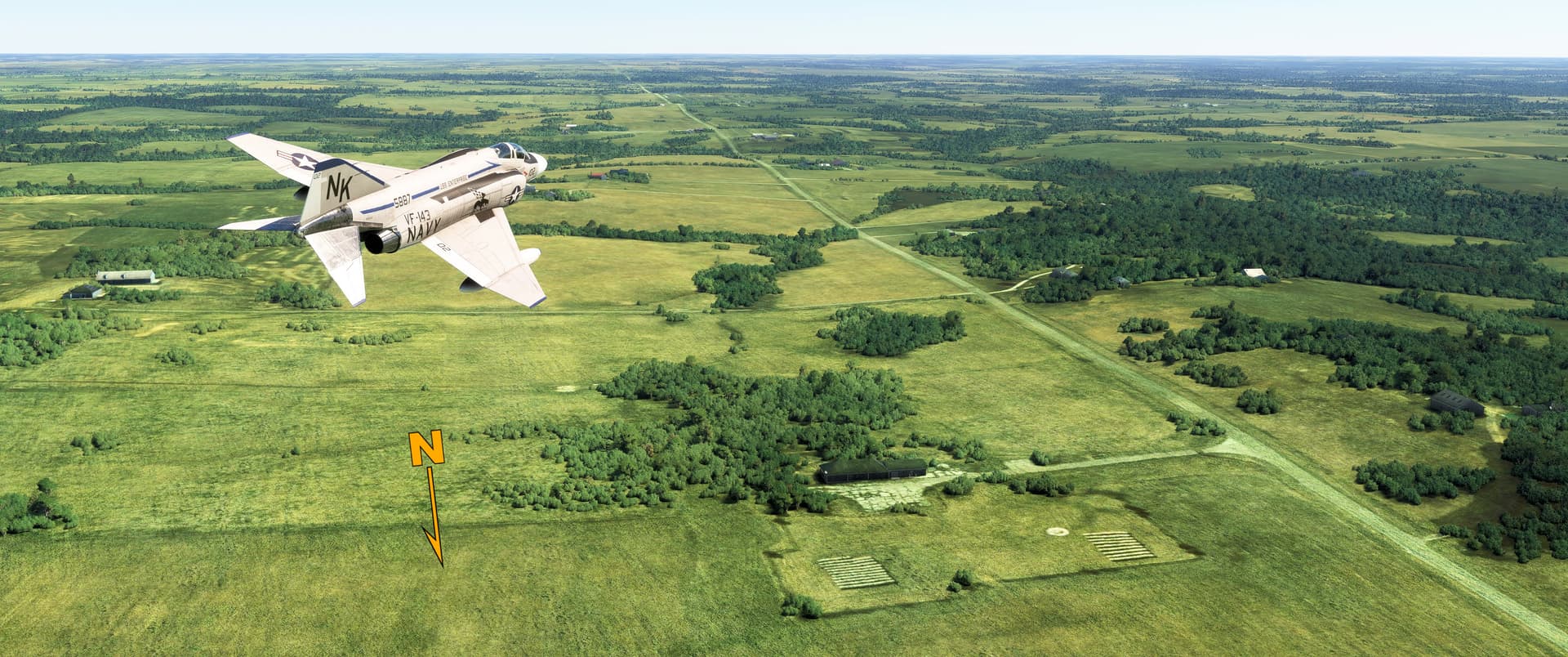
Pee-Wee says: Here’s the abandoned LCC Hotel-01 in the lower right of this south-facing screenshot. El Dorado Springs–population 3,493–lies about one mile east and would have been totally destroyed by a Soviet attack against this high-value target. The only above ground structures remaining here are the security fence and a few overgrown foundations, but MSFS erroneously places an autogen building at the site. You can clearly see the circular hard high-frequency transmit antenna between bales of hay, the presence of which indicates H-01’s designation as a Squadron Command Post.
![]() Atomic Bird’s Nest: Launch Facility Hotel-11
Atomic Bird’s Nest: Launch Facility Hotel-11
MSFS: 37.917222 -94.121667
Skyvector: 375502N0940718W
In a field alongside County Road AA five miles (eight kilometers) northwest of Hotel-01 are the nondescript remains of Launch Facility Hotel-11. A Minuteman II launched from here could have struck the entirety of the Soviet Union south to central Kazakhstan and northeastern China with its single 1.2-megaton warhead.
On 15 December 1997 three hundred people, including a local school group and “Red” and Suzanne Bellinghausen, owners of the farmland surrounding Hotel-11, were on hand to witness the silo’s destruction. After the ninety charges detonated, the Delta-09 Launch Facility in distant Wall, South Dakota became the last surviving Minuteman II silo in America. Today, the Delta-09 LF and LCC are both part of the Minuteman National Historic Site.
The Hotel-01 LCC and Hotel-11 LF are both located on private property and are not open for tours.
Pee-Wee says: These days Hotel-11 stores hay instead of a nuclear missile. It’s interesting to note that the original security fence still surrounds the former silo. If I was the landowner, I’d keep that high-quality government fence, too!
![]() Where Old Airplanes Go To Die: Harry Truman Regional Airport (2M1) and BAS Kansas City
Where Old Airplanes Go To Die: Harry Truman Regional Airport (2M1) and BAS Kansas City
MSFS: 39.018 -94.087
Skyvector: 390107N0940515W
Scenery by SkyArkDesigns @ www.flightsim.to
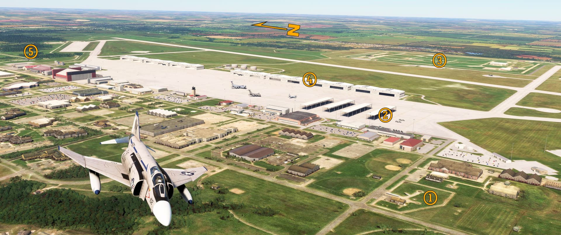
Pee-Wee says: Oh, how I’d love to explore this next spot in real life! The Harry S. Truman Regional Airport in Bates City, Missouri, is home to BAS Kansas City, formerly White Industries, an aircraft scrap and parts dealer. One online report I found says that there are more than 2,000 junked aircraft here!
Would you be more interested in tinkering or researching the airplanes’ histories?
Pee-Wee says: Yes. ![]()
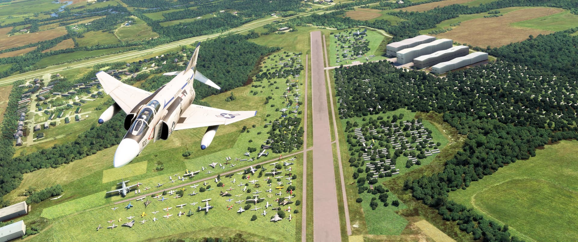
Here we are flying northeast along Truman’s 4,400-foot (1,341-meter) Runway 3. That’s Interstate 70 in the distance and the “I-70 Mobile City” RV/mobile home community directly behind our Phantom. SkyArkDesigns did a great job adding “junked” airplanes and other detritus to the default MSFS airport. There’s even a few pleasure boats sitting on the west side of the runway as depicted in current satellite imagery! Aircraft stored here cover the entire spectrum from GA singles to business jets and turboprop commuters.
Pee-Wee says: White Industries was acquired by BAS Parts Sales of Greeley, Colorado in 2023, and the new owner quickly implemented changes to bring White’s aged sales model into the 21st Century. That’s great for buyers, but maybe not so great for plane spotters: according to its website, BAS is “listing the KC inventory that we are trucking home to Colorado,” which could mean the end of this fascinating airplane graveyard.
Regardless of its name, the Truman Regional Airport is privately owned and doesn’t appear open to the public. At one time White Industries allowed limited tours of the airfield and its inventory, but we’d recommend calling ahead!
Pee-Wee says: Incidentally, although it’s missing in SkyArkDesign’s wonderful scenery, in real life you’ll find Learjet N20EP on display just outside the airport. She’s the eighth Learjet 23 built, and one of the oldest surviving examples of this pioneering bizjet.
![]() Can We All Just Get Along?: Independence Temple
Can We All Just Get Along?: Independence Temple
MSFS: 39.091043 -94.426395
Skyvector: 390528N0942535W
Scenery included in World Update #10
Joseph Smith, founder of Mormonism and leader of the Latter-Day Saint movement, prophesied in 1831 that “New Jerusalem” would be established in America. Six months later Edward Partidge, First Bishop of the Church of Jesus Christ of Latter-Day Saints, purchased 73 acres (30 hectares) for the church in Independence, Missouri, including the “temple lot” where a single stone was laid marking the northeast corner of the future temple that would be New Jerusalem’s centerpiece. The Mormons planned to purchase all the land from Independence westward to the Missouri River.
Pee-Wee says: I suppose you could say they made a wrong turn, because things went south instead. The white settlers already living between Independence and the Missouri River didn’t appreciate the Mormons’ plans, or their political beliefs, or even their very presence in Missouri, and violence ensued. To make a long story short, “New Jerusalem” never appeared, and the “temple lot” remained vacant. The Mormons eventually returned, and after more than a century of fighting and infighting, the Independence Temple was built in 1994 across the street from its ordained location.
The 300-foot (91-meter) tall Independence Temple was designed by Gyo Obata, designer of the McDonnell Planetarium in Part 1 of this tour. It stands on the “greater temple lot” amidst the headquarters of the Community of Christ (formerly the Reorganized Church of Jesus Christ of Latter Day Saints). The main sanctuary seats 1,000 on the main floor and an additional 600 in the balcony and features the spectacular 5,685-pipe Opus 3700 pipe organ designed by renowned Canadian builder Casavant Frères Limitée.
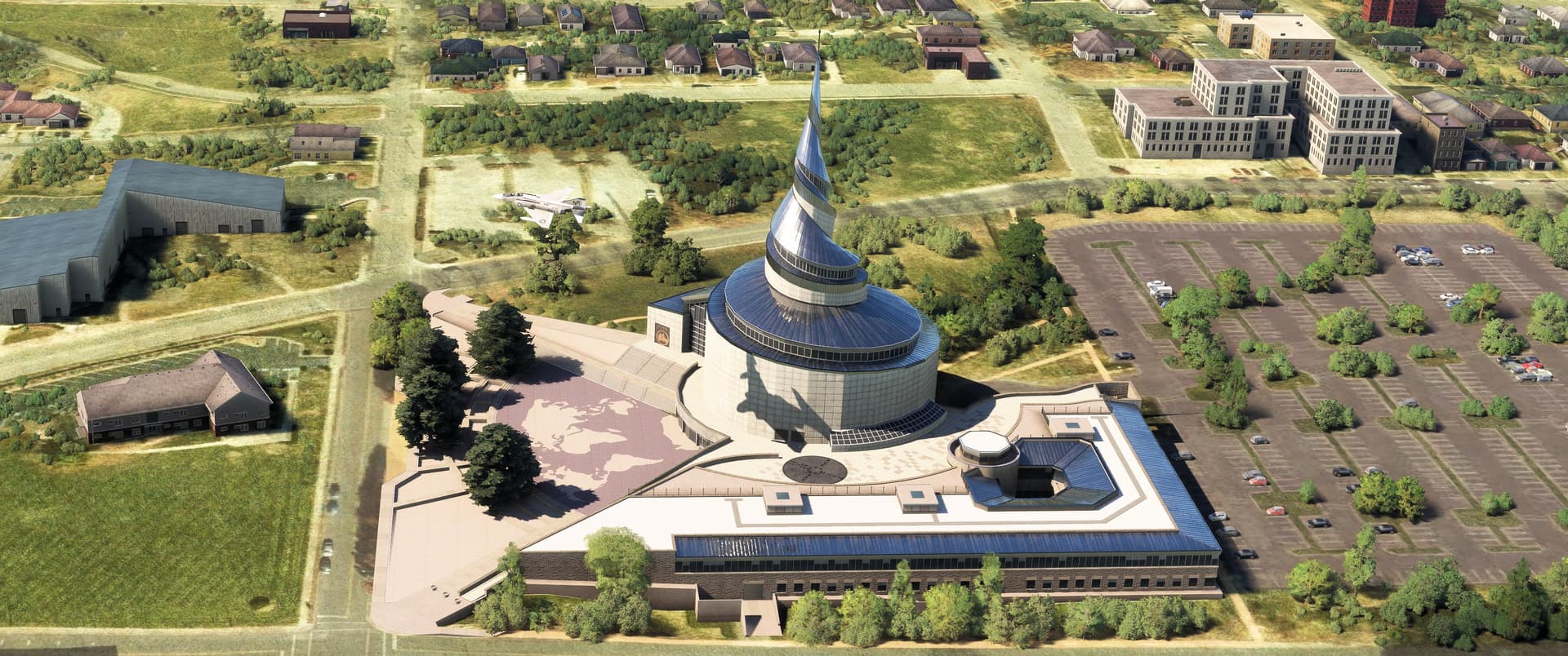
Pee-Wee says: Here we are desecrating eardrums at the Independence Temple. In this north-facing screenshot, the original “temple lot” and the small Church of Christ (Temple Lot), an independent LDS offshoot that claimed the original lot in 1867, are visible to the left, across South River Boulevard from the imposing Independence Temple. It seems that Joseph Smith’s prophecy still hasn’t come to pass.
We’ve reached the eastern suburbs of Kansas City, so we’ll break here. Next time we’ll explore sites in Kansas City proper, including art museums, a notorious prison, an abandoned airport, a fragile hotel, and a memorial that played a major part in a movie about the end of the world. Stay tuned!
Pee-Wee says: Thanks for tuning in again, everyone. We’ll be back soon! ![]()