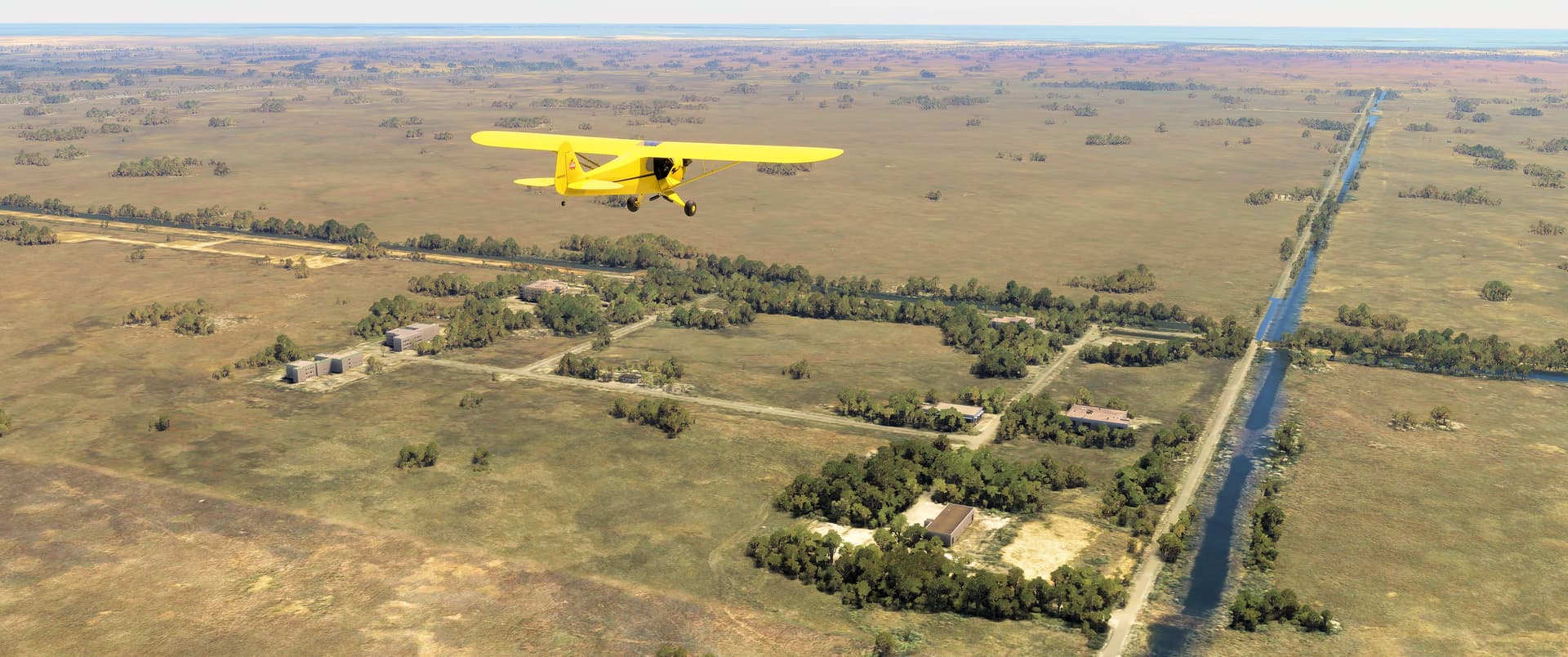
Welcome back! Today’s tour takes us to Miami and sunny Florida’s southeast coast. We’ll explore thirteen sites, ranging from CIA training facilities to abandoned airfields and an iconic lighthouse. For ease, we’ll break this one into three parts. Part 1 will cover sites near Homestead and south of Miami. In Part 2 we’ll see the area around Miami itself before heading north toward Fort Lauderdale in Part 3. We flew our newly acquired 1947 Piper J-3C-65 Cub, N69059, courtesy of BT Simulations. I’ll do the flying, while Pee-Wee navigates, scribbles, and scrolls.
Pee-Wee Says: Boy, I do love a classic Cub. I really miss A2A’s rendition, but the new BTS package isn’t bad. She flies very well, so it’s a shame the entire model—inside and out—looks slathered in gloss varnish! The BTS Cub is in early “factory” configuration, with no electrical system and no mixture, so plan accordingly. By the way, I really wish some of you painters out there would show this little gem some love!
We departed from the uncontrolled Miami-Homestead General Aviation (X51) airport a few miles west of Homestead, and almost forty miles southwest of downtown Miami. Opened in 1963 with a single 3,000 foot (915 meter) east-west runway, Miami-Homestead today averages more than 200 daily operations. Assuming sunrise to sunset operations, that’s a whopping fifteen an hour, or one every four minutes! There’s parachute jumping over and an aerobatics box adjacent to the airport, so keep your eyes open!
Pee-Wee Says: Based on feedback from our readers, we’ve added the latitude and longitude for each location in two formats. If you’re creating a waypoint in the MSFS flight planner, use the decimal coordinates. For those using Skyvector, use the string format. We’ll continue to provide Google Maps hyperlinks in the titles and text, too. Hope this helps! ![]()
![]() Nukes in the Swamp: Nike Hercules Battery HM-69
Nukes in the Swamp: Nike Hercules Battery HM-69
MSFS: 25.369 -80.684
Skyvector: 252211N0804105W

Here we are circling south of our first site, HM-69, a former Nike Hercules surface-to-air missile battery southwest of Florida City. Constructed in 1965 and operated by Battery A of the Army’s 2nd Missile Battalion, 52nd Air Defense Artillery Brigade (A/2/52) until 1979, the site is currently maintained by the National Park Service, and is open for tours daily. The three missile sheds, visible in the foreground, currently house a restored Nike Hercules, and are occasionally used by the NPS to store sensitive equipment whenever hurricanes threaten. The smaller building on the left was the missile assembly and test building, and just above that is the dog kennel and support shack. The former battery control facility, seen up the road in the distance, is now the Daniel Beard Research Center, where the USGS Fort Collins Science Center assists South Florida’s national parks in managing invasive reptiles.
From here we turned east toward our next site, also related to rockets, but in a less explosive manner.
![]() A Big Freakin’ Rocket: HM-65/66 and Aerojet’s Rocket Factory
A Big Freakin’ Rocket: HM-65/66 and Aerojet’s Rocket Factory
MSFS: 25.362 -80.562
Skyvector: 252144N0803343W
Battery B joined the rest of 2/52 in South Florida in late 1962 and occupied a temporary site southwest of Florida City until 1965, when California-based rocket motor manufacturer Aerojet purchased the site and established a factory here for the production and testing of potential solid-fueled motors for the Apollo program. In this first shot, we’re flying south over the former HM-65/66 Nike launch site and Aerojet factory proper. The lighter colored roadway and clearings to our left are the remains of the original launch site’s radars and control facilities. The test silo is three miles further south down the road and canal.

And here we are over the test silo, which appears as a house in MSFS (in reality the silo is covered by concrete bridge beams laid parallel). Three 260-inch diameter motors (SL-1 through -3) were tested inside this silo, their nozzles pointed skyward. When fired, the motors reportedly shook the ground in nearby Homestead, and the massive flames and smoke plumes were visible in Miami.
SL-3 remains inside the silo to this day. During its only test firing, this motor produced nearly 5.4 million pounds of thrust, 63% more than NASA’s vaunted SLS Five Stage Booster, making SL-3 the actual “most powerful rocket motor ever.” Following NASA’s decision to use liquid-fueled rockets on the Saturn V, Aerojet shuttered its Dade facility. You can find many “urban explorer” visits to this site on YouTube.
Pee-Wee Says: Apparently NASA doesn’t have access to Google, or figured that nobody would actually research its SLS claim! I don’t get it. We all know that size doesn’t matter. ![]()
Next we headed further east toward our first “spooky” site. Along the way, we passed over canal C-111, also known as the Aerojet Canal. Excavated during the 1960s as part of a Corps of Engineers’ flood control program, the canal would have allowed Aerojet to transport its rocket components upstate to the Kennedy Space Center via Florida’s Intracoastal Waterway. Sadly the damage wrought by the canal to the Everglades ecosystem is still being repaired.
![]() Dial-An-Infiltration: Bell South’s Card Sound Road Microwave Tower
Dial-An-Infiltration: Bell South’s Card Sound Road Microwave Tower
MSFS: 25.325 -80.404
Skyvector: 251932N0802415W
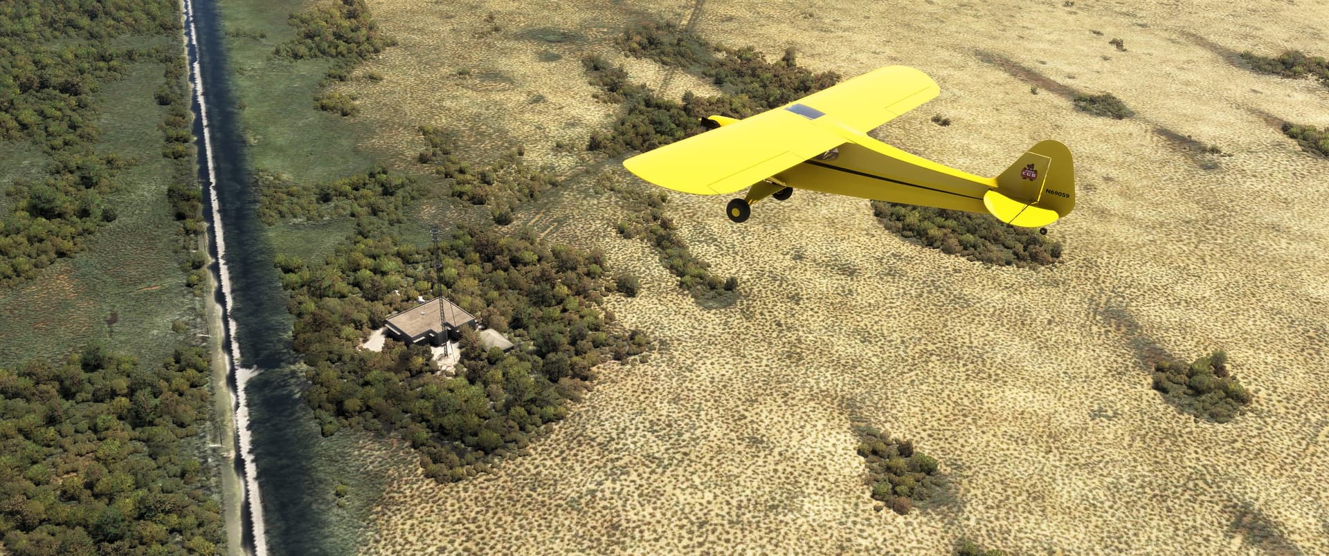
This nondescript microwave relay station between Homestead and North Key Largo doesn’t seem important, and outside of telecommunications, it isn’t. But it was reportedly used during the 1960s by several nearby CIA training camps as a training “capstone” goal. Being similar to potential infrastructure targets in Cuba, student “spooks” were required to successfully infiltrate, “sabotage,” and egress this facility to graduate. As it was protected by active electric fences and armed (and unaware) security guards, the scenario was highly realistic!
Pee-Wee Says: And, no doubt, very stressful. Yikes! ![]() Before researching this tour, I had no idea just how prolific the CIA was in South Florida after Castro’s rise to power. It was, quite literally, everywhere, even the restaurants!
Before researching this tour, I had no idea just how prolific the CIA was in South Florida after Castro’s rise to power. It was, quite literally, everywhere, even the restaurants!
Nice segue… ![]()
![]() Spooks and Conch Fritters: Alabama Jack’s Bar
Spooks and Conch Fritters: Alabama Jack’s Bar
MSFS: 25.291 -80.378
Skyvector: 251729N0802243W
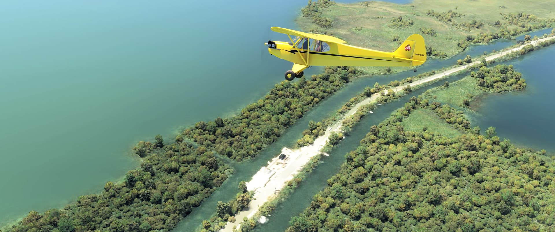
Two miles further south, we found Alabama Jack’s Bar (Pee-Wee Says: Someone send them a map!), or at least the spot where it should be. MSFS displays only a single structure on the roadside lot, and it’s not even the bar itself! The Card Sound Machine cover band has been performing here for nearly three decades, and many foody websites credit Alabama Jack’s with the world’s best conch fritters. Oh, and CIA instructors and students apparently frequented this establishment on their way north from training camps in the Keys and barrier islands.
From here we turned north onto the longest leg of our trip. Along the way we passed the Turkey Point Nuclear Power Generation Station, the Homestead-Miami Speedway, and then crossed over the center of Homestead Air Reserve Base. Nothing much to report here, and sadly, no photos.
Pee-Wee Says: Turkey Point’s cooling canals were quite the site. You all should have seen them. Not sure how we missed taking a screenshot. ![]() Oh well. Go and see for yourself!
Oh well. Go and see for yourself!
![]() Gas Bags, Rolling Stock, and Zebras: Naval Air Station Richmond
Gas Bags, Rolling Stock, and Zebras: Naval Air Station Richmond
MSFS: 25.62 -80.39
Skyvector: 253700N0802402W
Pee-Wee Says: Ooh! This one’s mine ![]() Here we are about fifteen miles southwest of downtown Miami, passing former Naval Air Station Richmond, the home of Airship Patrol Squadron Two-One, the Navy’s largest World War 2 “battle blimp” squadron. ZP-21 operated here with fifteen K and M-Class blimps between October 1942 and the war’s end, and is credited with helping reduce the number of Allied ships lost off Florida’s coast from 1943’s high of 114 to only 4 during its first full year of operation. The squadron’s K-74 was the only Navy blimp lost to enemy action when it was downed while attacking U-134 southeast of Miami in July 1943.
Here we are about fifteen miles southwest of downtown Miami, passing former Naval Air Station Richmond, the home of Airship Patrol Squadron Two-One, the Navy’s largest World War 2 “battle blimp” squadron. ZP-21 operated here with fifteen K and M-Class blimps between October 1942 and the war’s end, and is credited with helping reduce the number of Allied ships lost off Florida’s coast from 1943’s high of 114 to only 4 during its first full year of operation. The squadron’s K-74 was the only Navy blimp lost to enemy action when it was downed while attacking U-134 southeast of Miami in July 1943.
In September 1945, all three hangars collapsed and burned when “Kappler’s Hurricane” passed directly overhead. More than 360 military and civilian aircraft that had sought shelter inside were lost, as were 25 blimps. The hangars were never rebuilt. (Lt. Bernard Kappler was the meteorologist aboard the USAAC B-25 weather plane that discovered the approaching storm near Antigua three days before it struck Florida.)
After the war, NAS Richmond became the University of Miami’s “South Campus,” served as the command post and nerve center for Miami’s ring of surface-to-air missile defenses, and became the home of “Zenith Technical Enterprises,” a front company for the CIA’s clandestine intelligence gathering operation targeting Cuba. Much later, portions of the station were occupied by the Gulf Coast Railroad Museum and Zoo Miami.
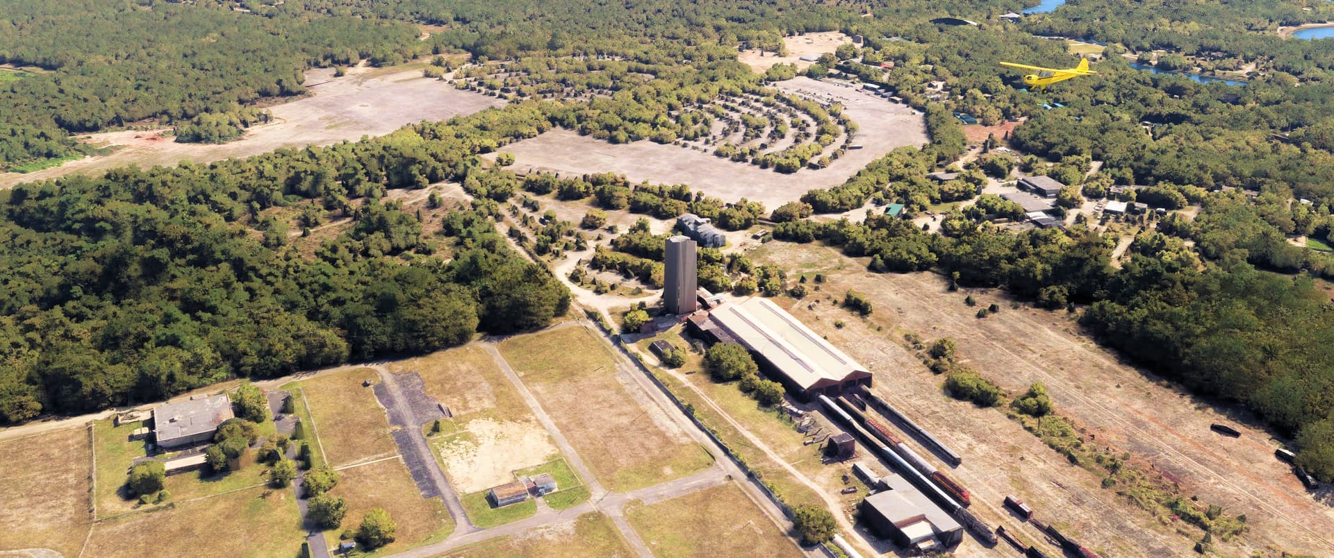
There’s a lot to see in this photo, thanks to MSFS’s photogrammetry! The concrete “tower” in the center of this photo is the remaining portion of Hangar 1’s structure, which currently supports a Dade County communications mast. Hangar 2 stood in the field below our Cub, and if you look carefully, you can see the railroad track that ran through its center. Hangar 3 was located in the clearing below the red dirt piles near the photo’s left edge. The former station headquarters, now the Miami-Dade Military Museum, is visible directly above the tower, having been relocated from just out of the shot to the left. The buildings at the tower’s base and the sheds immediately to the right belong to the Gold Coast Railway Museum. Look carefully below those sheds and you’ll see some of the remaining concrete arches that supported the massive hangar. You can also see some the museum’s rolling stock, including FEC’s red and yellow E-8A #1594 directly above CB&Q’s silver E-9A #9913. The museum’s Track #4, the furthest occupied track to the right, originally ran through the center of Hangar 1. Directly to the left of our Cub is Zoo Miami’s parking lot, built atop the huge circular landing pad. Several of the original mooring mats are still visible, but they’re just out of the upper left corner of this photo.
I’ve been fascinated with Navy blimps since meeting one of the last remaining active-duty LTA NCOs in Jacksonville many years ago (he’d long since changed ratings). Two of my favorite books are American Airship Bases & Facilities and U.S. Navy Airships by James Shock. I’ve read both cover-to-cover several times! They’re hard to find, but if you’re interested in Navy LTA, I highly recommend them both! And if you’re an LTA nerd like me, look for an upcoming tour that covers all of the Navy’s CONUS blimp stations. ![]()
That concludes Part 1 of our Miami Tour. Stay tuned for Part 2, in which we’ll see one of the first CONUS naval air stations, more abandoned airfields, and another “nuclear neighbor.”
Pee-Wee Says: Thanks for tuning in! ![]()