Welcome to Part 2 of our Gold Coast tour! We ended Part 1 southwest of Miami over former Naval Air Station Richmond and Zoo Miami. Let’s continue to the northeast and our first stop.
![]() Clippers, Coasties, and Councilmen: Dinner Key
Clippers, Coasties, and Councilmen: Dinner Key
MSFS: 25.73 -80.24
Skyvector: 254340N0801402W
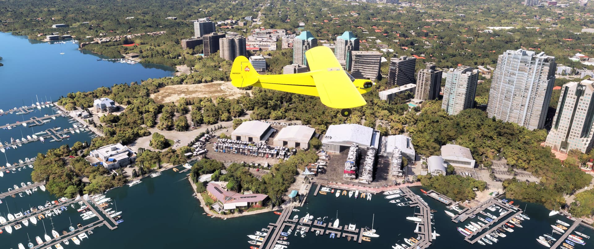
We’ve flown eleven miles northeast to the shore of Biscayne Bay, south of downtown Miami. That’s Dinner Key down below. Once the site of a Coast Guard air station and international airline terminal, Dinner Key today serves only the private boating industry with more “wet” slips than any marina on the US Eastern Seaboard.
Established in 1917, Naval Air Station Dinner Key served as a seaplane training base primarily operating Curtiss N-9s. Commercial carriers took over after the war, including Pan Am, which built a beautiful art deco terminal here in 1934. That terminal now serves as the Miami City Hall and is visible in the lower left of this photo on the circular drive near the water’s edge.
Five hangars from the field’s flying days remain, visible directly below our Cub. The furthest to the right was CGAS Dinner Key’s hangar until 1965. Look closely and you’ll still see “U.S. Coast Guard” painted above the door! The parking lot to its right was the tarmac where HU-16 amphibians and HH-19 and HH-52 helicopters parked. Follow the pavement down and to the left and you’ll find the seaplane ramp still extending into Biscayne’s waters. There are currently no aviation activities at Dinner Key.
Pee-Wee Says: I have a soft spot in my heart for our Coast Guardsmen and Women, those truly selfless heroes ![]() This story is a perfect example, from the days when aviation was still kinda’ sketchy. Talk about getting the job done! BTW, if you’re a movie fan, newly-delivered HH-52A #1388 from CGAS Dinner Key is the machine that rescues Commander Bond from a coral grotto in the 1965 movie “Thunderball.”
This story is a perfect example, from the days when aviation was still kinda’ sketchy. Talk about getting the job done! BTW, if you’re a movie fan, newly-delivered HH-52A #1388 from CGAS Dinner Key is the machine that rescues Commander Bond from a coral grotto in the 1965 movie “Thunderball.”
We flew northwest, climbed another thousand feet, and crossed over Miami International’s eastern boundary to avoid traffic landing to the west, then followed 8th Avenue north to our next stop.
![]() An Air Traffic Nightmare: All American Airport/Master Field
An Air Traffic Nightmare: All American Airport/Master Field
MSFS: 25.88 -80.25
Skyvector: 255248N0801500W
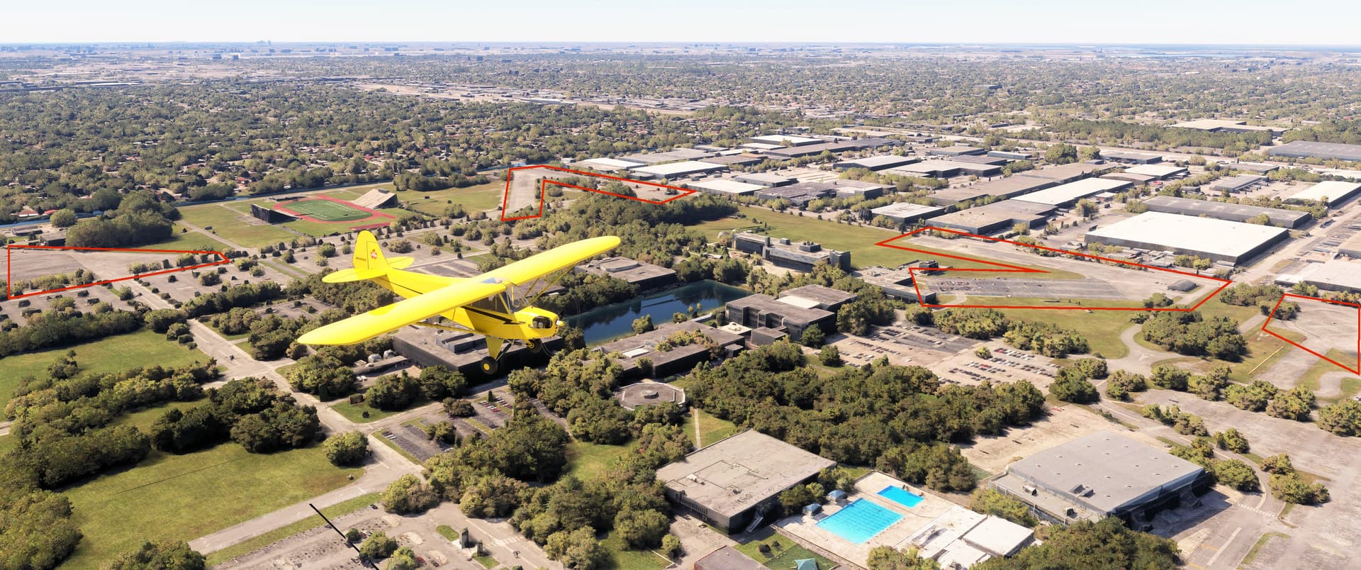
Here we are northbound over the former All American Airport/Master Field, looking southwest. The adjacent Miami Municipal Airport, the city’s original air carrier field, was located in the distant right across the highway and former Seaboard Line tracks where the large T-shaped warehouse sits.
All American eventually became Master Field and served the Navy and Navy Reserve before closing in the early 1960s. Construction of the Miami-Dade Community College’s North Campus began on the site shortly thereafter.
Bits of All American’s aviation infrastructure remain today. The barrel-roofed maintenance building at the very left of this photo is a hangar dating from the 1930s, while a more recent Navy hangar is visible to the right of the swimming pools. We’ve outlined the remaining taxiway and runway segments. With a sufficiently capable STOL plane, you could easily land here ![]() Nothing recognizable remains of the neighboring Miami Municipal.
Nothing recognizable remains of the neighboring Miami Municipal.
Pee-Wee Says: We couldn’t find any reasoning behind building All American right next door to Municipal. Add Opa Locka to the northwest and eventually the 36th Street Airport (the future Miami International) to the south and you have a very busy block of airspace. Watch out!
![]() Top of the Ring: HM-03 Nike Hercules Launcher
Top of the Ring: HM-03 Nike Hercules Launcher
MSFS: 25.961 -80.303
Skyvector: 255741N0801813W
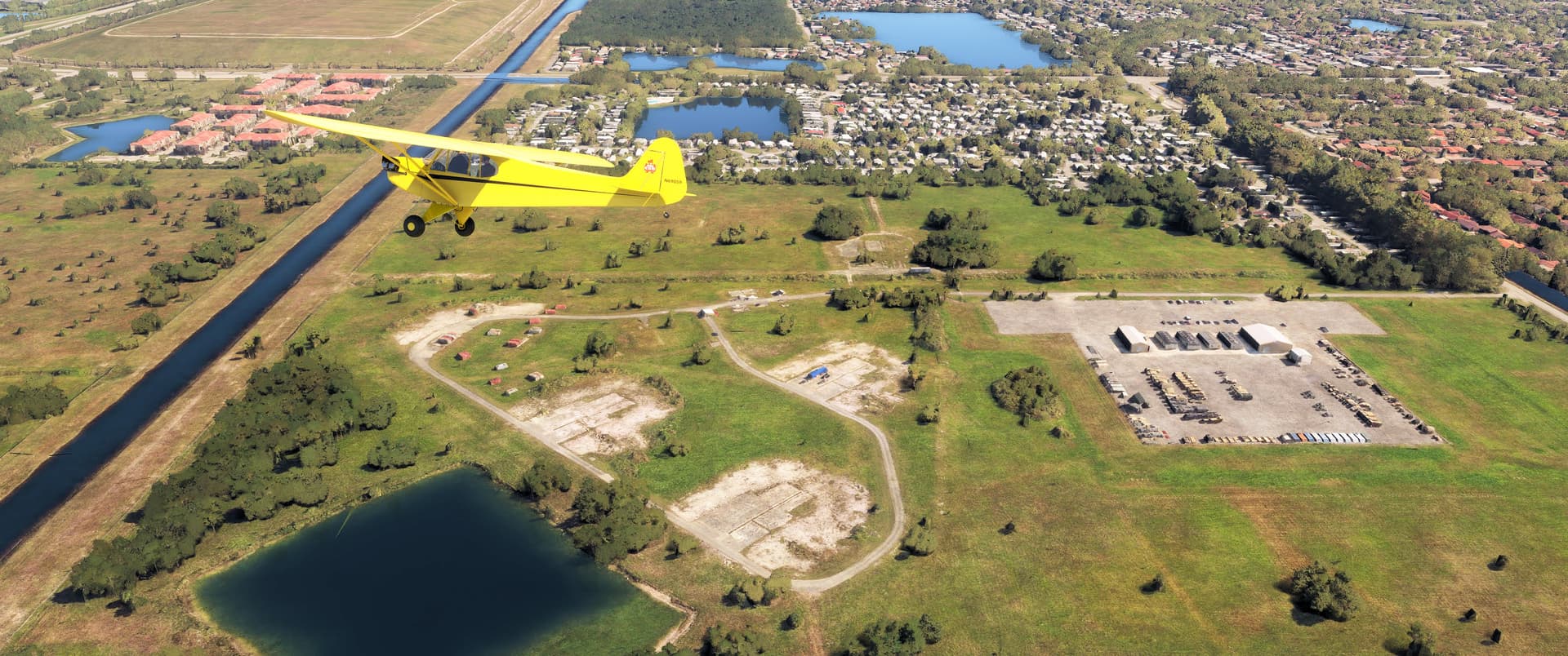
Six miles northwest of All American we found another Cold War relic, the former HM-01/03 Nike Hercules launch site. Occupied by Battery C of the 2nd Missile Battalion, 52nd Air Defense Artillery Brigade (C/2/52) in 1965, HM-03 was the most northerly of the seven Nike and Hawk SAM batteries surrounding Miami and Homestead. Located just over one mile further south, HM-03’s control center was Homestead-Miami’s Secondary Master Fire Unit (SMFU). From there crews could control the other batteries if the main command post at NAS Richmond have been knocked out of action. The control center site is currently occupied by a Navy and Navy Reserve Training Center.
None of the launch site’s structures remain, although you can clearly see the pads where the missile sheds stood. The assembly building and dog kennel were located amongst the red shipping containers below our Cub. The buildings to the right are associated with the neighboring National Guard armory located below this frame.
Pee-Wee Says: As with the Lake Champlain area, I’m awestruck by the number of Cold War sites smattered around Miami. Assuming twelve Hercules per battery armed with the highest yield warhead, that’s potentially 36 missiles and approximately 1.4 megatons of defensive power. And some of those missiles were capable of surface strike. It’s a good thing the war never heated up ![]()
![]() An Open-And-Shut Case: Opa Locka West Airport (X56)
An Open-And-Shut Case: Opa Locka West Airport (X56)
MSFS: 25.95 -80.42
Skyvector: 255700N0802512W
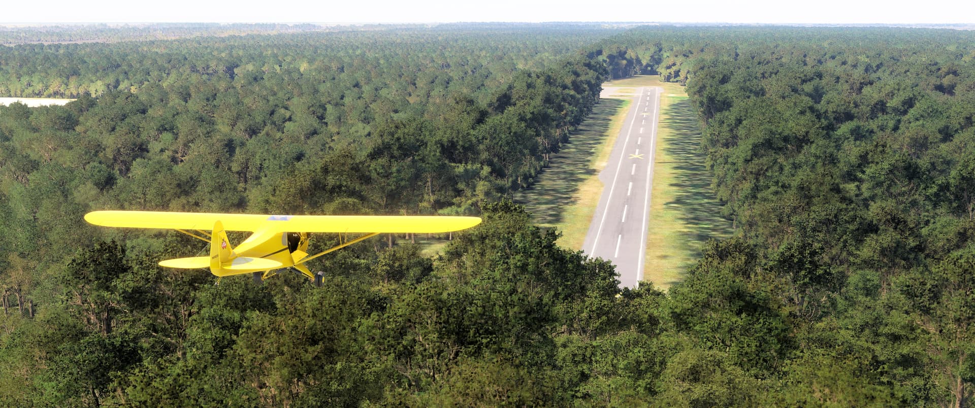
We headed due west to an abandoned airfield on civilization’s western frontier, the former Opa Locka West Airport. Opened in 1970 as its namesake’s urgently needed reliever, the field boasts two 3,000-foot / 915-meter runways, a paved ramp, and loop taxiways at each runway end. Sadly, the field closed around 2006, the victim of the County’s desire to quarry the land instead.
The Countyline Dragway briefly operated on Runway 18/36, but ceased operations after crashing headlong into the brick wall of County politics.
Opa Locka West is still open in MSFS, although the runways are marked with X’s. Once again, the tree algorithm got overzealous. We’re on short final for Runway 36 in this photo. I had to slip the Cub onto the runway just past the trees, and while we (Pee-Wee Says: Barely!) cleared the trees off the other end after a touch-and-go, it would have been safer to stop, taxi back, and use the full runway length. User beware!
Pee-Wee Says: Because of the trees, the field is difficult to see until you’re almost over it if you’re flying low. Look for the green and turquoise quarries: the field is at their northwest corner. Oh, and perhaps we should check the tree height setting in AccuSeason? ![]()
That’s all for tonight! The third and final part of our Miami tour includes an airfield with connections to a mysterious legend and a Spielberg alien movie, the “Miracle on Commercial Boulevard” site, and a melted lighthouse. We’ll see ya’ then!
Pee-Wee Says: Bye for now! ![]()