The reason PG doesn’t work overall is because places like McCarran International where the runways actually spread out into the surrounding residential when you taxi your aircraft eye level with the PG where it suffers the MLBS(melted lego block syndrome) so you go from sharp airport structures and textures to residential MLBS while ground taxi.
We know PG was certainly not intended for any type of ground level exploration but these are instances where you are forced to view the PG at ground level because of where the airport premises meets residential boundaries and it totally ruins the immersion and experience.
It’s due to a different method of photogrammetry used for the newer cities like london and paris. Asobo anounced this before the release of wu3 that they’d try a different technique or source (can’t remember exactly). This should result in higher quality but obviously isnt.
I think these scans are able to create much higher quality but i think the mesh resolution msfs uses just simply isn’t high enough ti benefit from this. Probably would be way to much polygons. I think this is the cause of the artifacts.
Also looking at some of the cranes and powerlines in those cities it looks like there hasn’t been to much optimisation been done to the 3d scan models. There’s floating pieces of powerlines and stuff everywhere. Wouldn’t take too much time to get rid of this in any 3d software. I’ve tried some photogrammetry editing in blender for example and wasn’t to hard to btush select polygons and delete them and smooth things out.
So yeah… I still like those cities though… But i definately agree there’s a big difference in quality between the two different method’s used.
Ps. I’m not 100% aure about any of this. Just my thoughts
Edit: i just realised that the data is streamed ofcourse… So probably not able to adjust the scan data to better suit the msfs graphics engine
You’ll have to excuse me as I throw up more pictures; here’s the shot of your Bristol one from the other thread you mentioned. (Longmead Avenue and Maple Road northwest of Bristol County Ground just for reference)
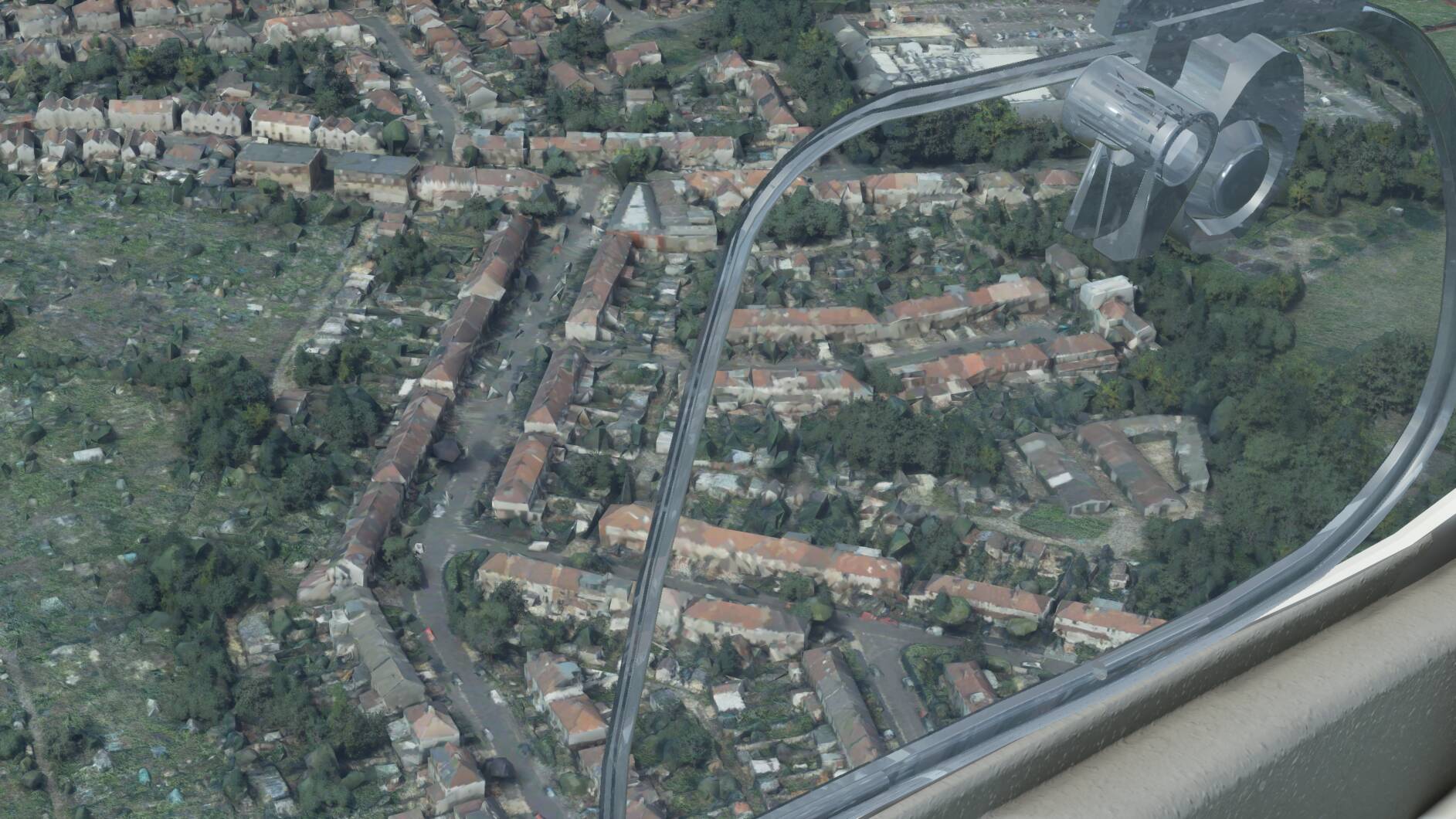
As i’ve just flown over it:
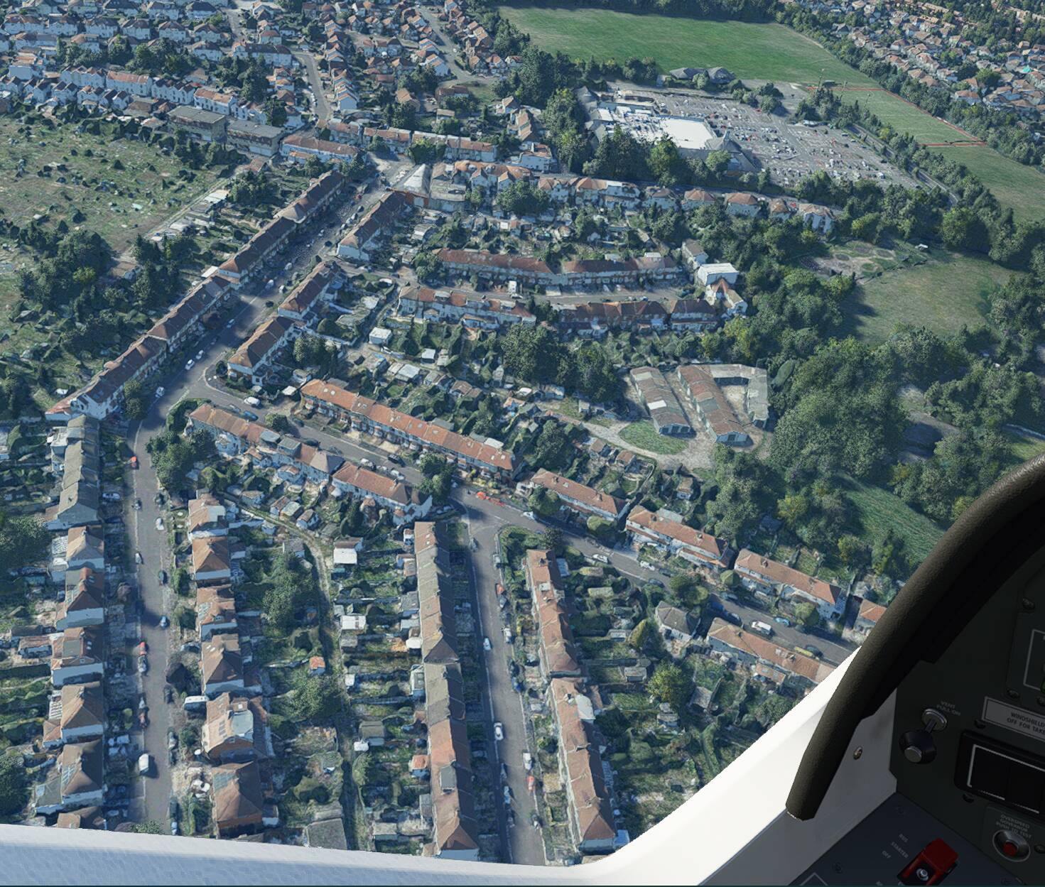
And via the Drone Camera

RTX2060 Super - mix of Ultra High End and Medium settings.
Conclusion: The Bristol PG, like London and Paris, is arguably sub standard compared to some of the other PG that’s been in the sim (and shown in this thread) since launch, but it’s not as bad as your screenshot would suggest.
Ciao!
In Amsterdam I noticed that happened where recent infrastructure works or maintenance was done in RL. Elevation is constantly changing, especially in the Netherlands. In fact, Bing should update their elevation data to reflect works in progress, because car drivers using routers based on Bing data need to know ! It’s the same market… In our scenery, the result will be e.g. roads that go underground, and cars popping out on the other side, or floating cranes.
Hello,
Before creating new topics, please use the search function to look for existing topics. Duplicate topics can negatively impact the community by splitting the conversation, reducing the number of votes an idea receives and making it hard for users to find useful information.
You can use the search system by clicking on the magnifying glass on the top navbar. You can make use of the advanced search system by clicking the options link in the search box.
Thank you!