As we close in on 200 downloads (thanks everyone!), work on our first Intermediate Landing Field is underway.
I have been working on Strevell ILF using three sources:
- the visible remains of the north-south runway
- the description from the 1929 Airway Bulletin which has the orientation and measurements for the two runways
- the description of the lighting system for ILFs from the same bulletin
There is some fine tuning of the positions to do but the overall layout looks like this:
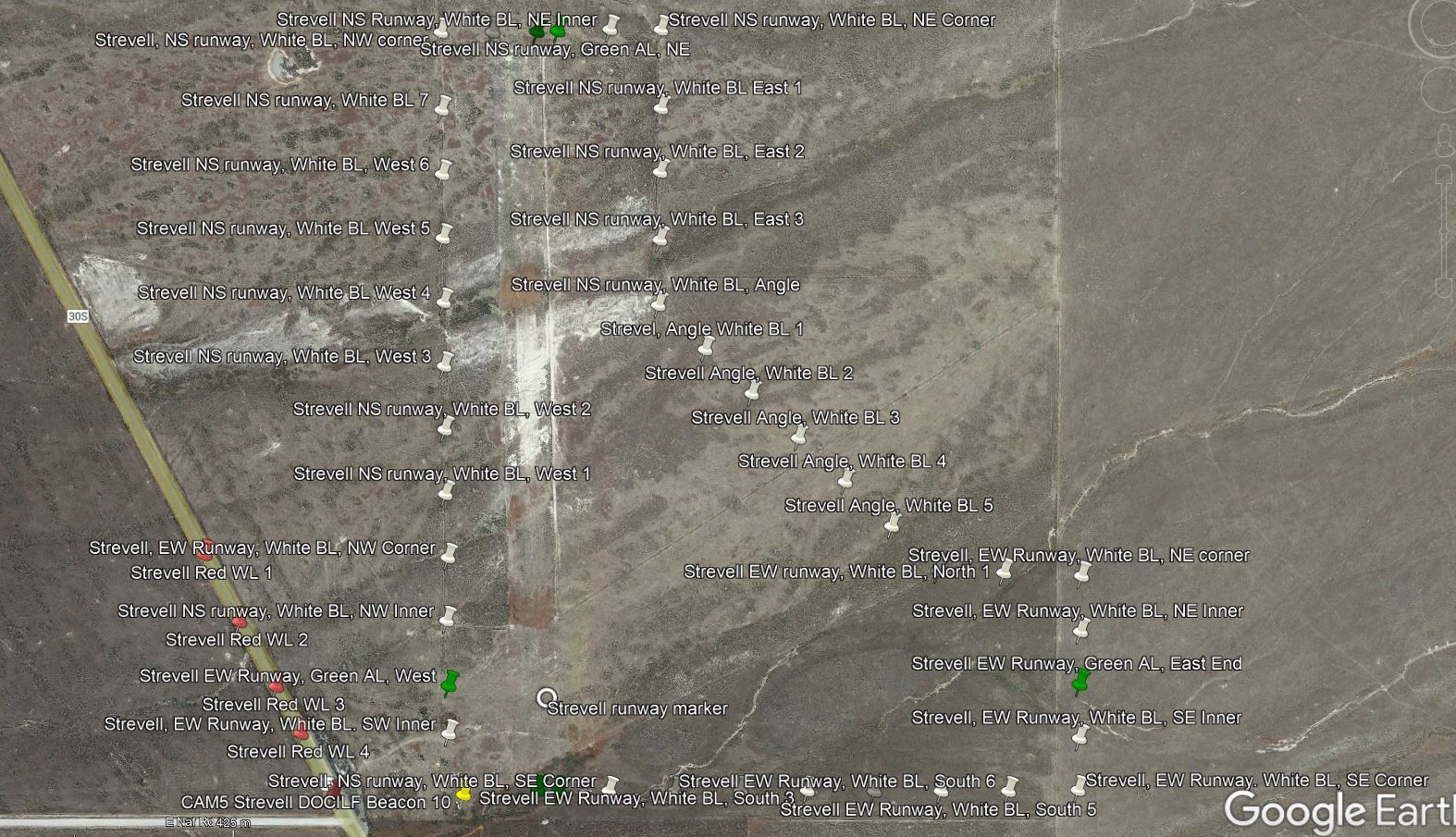
Green lights were used to mark the runway centrelines, two at each end of the principal runway (assumed to be N-S given that it was the longer of the two and still visible) and one for the secondary runway. White boundary lights then marked the remainder of the perimeter.
The triangular section was designed to assist with cross wind landings.
Red warning lights were used to mark hazards and I have assumed a line along the highway to the west of the field.
The intersection of the runways was marked with a chrome yellow circle with projecting bars indicating the two runway headings.
At Strevell, the airway arrow and beacon was in the SW corner of the field. Although fuel was stored there, as this was an emergency field there were no hangers.
Now it’s over to @RobCap1966 to work his magic, modelling the lights and runway marker and dropping them into the sim.