Is it just me, or is there a complete and total lack of vertical development of thunderstorms in live weather? Weather Force does an incredible job rendering CB’s and TCU’s, but inevitably, when switching to live weather, although the weather is correct, the clouds generating lightning and heavy rain look like stratus clouds. They build as layers of stratus clouds, not vertical columns of rapidly rising cumulus.
Hi everyone. This topic may have already been mentioned, but i have only just joined the forums. Over the past couple of months, I have began to realise that the clouds, although can look stunning at the right time, seem to be just stretched or thinned cumulus clouds. For example, the high level clouds (cirrus clouds) miss out on the wispy effect that they have in real life and just appear to be flat thin clouds. I also feel that cumulonimbus clouds are not represented too well either. Maybe this is my opinion, but when I compare simulator clouds to IRL clouds, there is quite a big difference.
I would move this thread to the Weather Bug forum and rename it “Native Support of All Cloud Types functionality does not work”. See the weather discovery serie published when FS2020 was launched: Feature Discovery Series Episode 2: Weather - YouTube
Not only cumulonimbus type is not represented right but many other cloud types are missing. Also in that video you can realize that many other advertised weather functionalities are not working or are not implemented.
There is also this thread in the weather bug forum that talk about the issue with cloud types: METAR keeps disrupting the weather/ bugged weather/Cumulus/CB clouds only/no medium to high cloud coverage
I’ve been operating in SE Asia now for the past few years, where towering cumulus and cumulonimbus play a massive role for half the year.
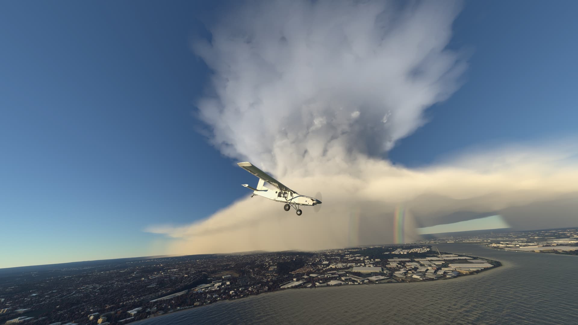
I’ve seen the odd screenshot with a massive CB cell in it, but I’ve never encountered these personally, just a big mess of cloud globs and lightning effects.
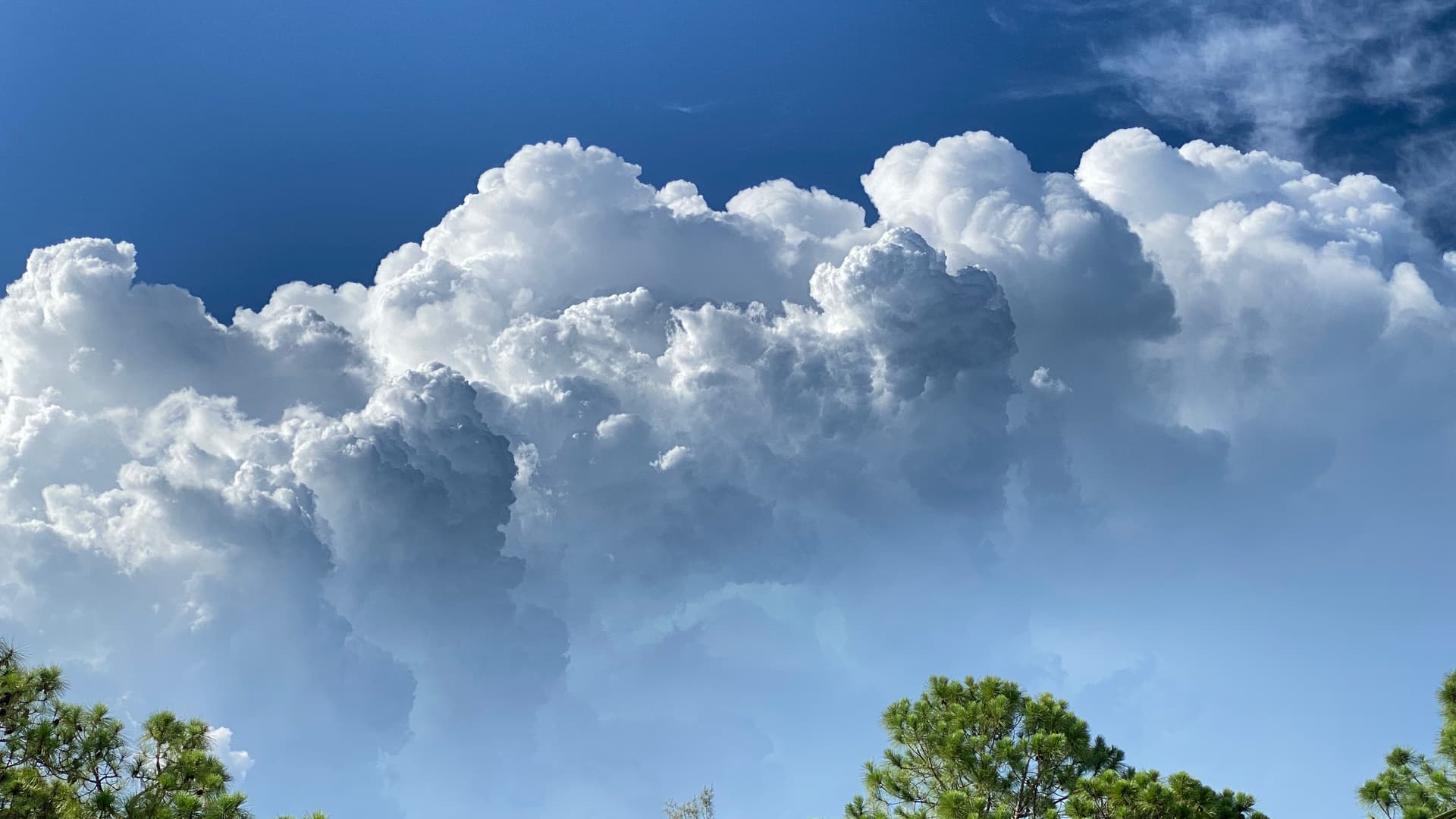
CBs have a flat base, usually with tightly packed cumulus around their base. Then a turbulent middle shaft with strong updraughts and downdraughts which then expands again into the anvil, which can stretch tens of miles downwind of the storm.
The engine can render them, it just needs the code behind it to form them.
I’ve noticed recently a significant lack of towering CBs, in areas where there should be CBs such as most afternoons in Singapore there should be towering CBs up to sometimes 50,000ft, but there aren’t any. Even when met reports state isolated CBs there are just a few cirrus clouds around, no huge towers of cloud. It would be amazing if they could be added. If anyone has any photos please feel free to attach it to this thread.
Precisely.
Isolated CB storm; the area around the cell was absolutely clear. Cloud tops on the IRL CB were at least 60,000FT tall. Sim only had 15000FT and dispersed clouds all over the place. I’d like to see Asobo at least acknowledge this as an issue…