I have searched and couldn’t find this request, which surprised me. Apologies if I have duplicated it.
Add a hybrid or road map layer to the EFB map.
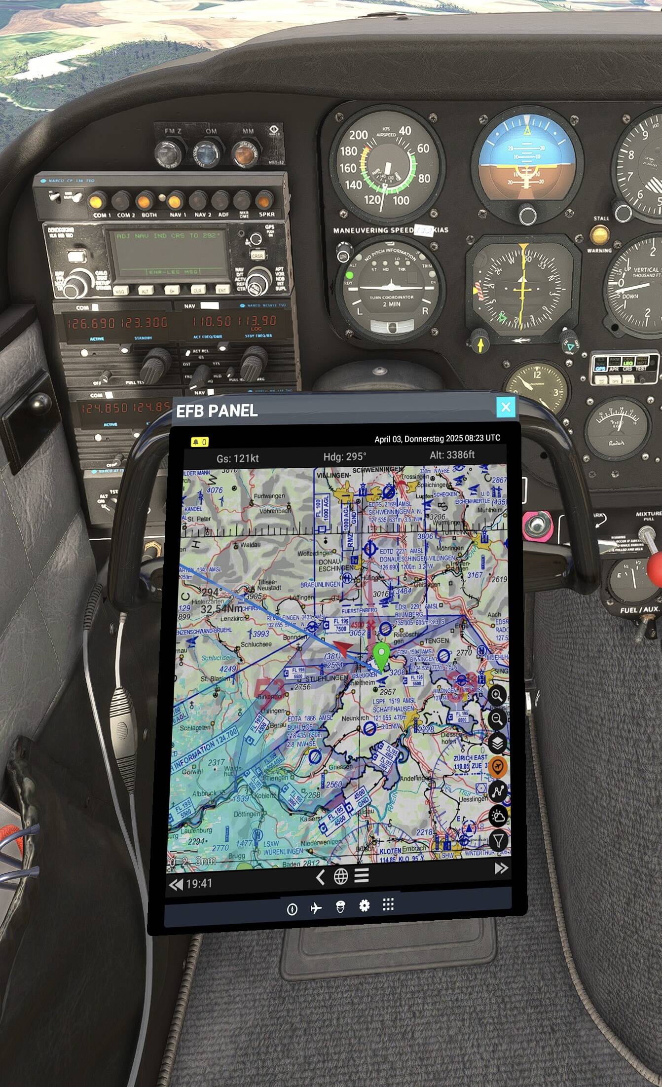
I love exploring new places in MSFS, but it is very frustrating so see something interesting out of your aeroplane window and not be able to pull up a map to be able to identify what the place is.
Even flying around somewhere I am familiar with would greatly benefit from being able to positively identify a place, town, or landmark.
I appreciate that PC users have solutions to this problem, but I am playing on Xbox and it is very frustrating when I don’t know where I am without a lot of messing about with maps on my phone and trying to cross reference satellite imagery from the EFB with what I see on my phone to be able to tell where I am.
Matching up in game places with real life places is really enjoyable but ultimately very difficult with the EFB map as it is.
As an Xbox pilot, this is one of the features that i really want to see added to the flight planner. Just to know the name of that river, mountain or lake is great for immersion and digital tourism.
Unfortunately, due to the technology available inside the sim HTML programming stack, we are already at the limit of what layers we can provide from inside the EFB map.
It would take a leap of embeddable in-game browser technology to match the web based planner, but so far no such technology is available in the game engine market. We’re definitely on the lookout though for changes in this tech space and maybe some time far down the road this could be implemented.
But Sky4Sim does this as an EFB app - shows varying road maps with no problem. So regardless of semantics it’s clearly do-able. (Sy4Sim got broken along with other add-ins with SU2).
Is there a possibility of the web based planner displaying a real time location of your aircraft, specifically on Xbox? I know PC users can benefit from this but as an Xbox user I miss out on knowing where I am flying over.
Both of these things are true, but also neither of them are displaying what’s in the sim. In both cases they stream static map image tiles from a cloud server, and those are what is displayed.
However, this is a non-starter for a core MSFS feature, because they don’t interact at all with your installed addons. If you install an addon airport, those tools cannot show those because they’re just static images; likewise they do not reflect what you have in the sim in any other area, for example if you own a larger scenery area.
Because each user’s install can have differing addons, there isn’t really a server-side image based solution that works for the sim as a core sim feature; instead the sim itself must dynamically render the map based on what the user actually has installed, which is what we do today, up to the limit of the available in sim technology stack.
Thanks , that makes sense for this usecase, but didn’t the flightplanner also don’t represent the individual sim state? Is this extra mile really necessary that it’s preferred to all or nothing? Doesn’t it also apply to the lido charts that are used now?
I just can speak for myself, but i use real Word VFR maps because they give me all the information I need in one place, even outdated ones , and I just want a similar thing in VR (works ok with passthrough but the actual location is nice) . For me this approach is absolutely fine and enhances the usability of the sim in VFR A LOT compared to a plain white space, sat image or a terrain relief.
But i understand it’s MY opinion, I can’t speak for others.
Don’t get your points. Sky4Sim shows a variety of map options with roads, all up to date, all move as I fly. Includes all airports on current maps, including any ‘addins’ as they are reral life existing airports. I follow Texas roads right to where all my family and friends live. I use road maps each and every flight and it works perfectly.
Those of us who are digital tourists, flying low and slow touring the photogrammetry cites, we really need road maps, and even better if it can also show info about places we are viewing on the map, businesses etc.
For a long time 3rd parties have been giving us this very needed missing feature, I’ve been using sky4sim for a long time now but as of today the map broke and it is just black. I’m pretty sure it is because bing maps api shut down and it needs to be migrated to azure maps.
But it is such a crucial functionality, it really should be built in. I mean don’t you already use all the bing maps data in the sim? Surely this could be added easily to give us road maps like are used in cars or on phones. I don’t care if it is Bing or open streetmap, I just really cannot do without some kind of road map because that is how I navigate. The loss of this today via sky4sim no longer working really hurts my enjoyment of the sim.
Please please please please give us street/road maps in the tablet, and it must work in VR.
Edit: please add your vote if you agree.
Edit 2025-07-04 - so it turns out the sky4sim developer already solved the issue by adding new google map layers to replace the no longer working Bing map layers. I just needed to go into configuration settings to enable it. Bonus, for $5 they now have an add on to integrate sky4sim directly into the EFB in 2024. All is back to being very well in my flight sim world where I navigate by roads.
The map feature you get with Just Flight aircraft EFB is a very good basic map with your aircraft for VFR flying but a bit difficult to view.
The map you get with the sim EFB is very basic and needs more info but the satellite view is very good.
Something else we need is spot height on the map so we can see how high things are in mountainous areas.
The other thing I would like to see is a better aircraft symbol on the sim EFB and get rid of that annoying blue circle.
looks good. I have almost the same (I guess) in H145/H160 from HYPE (DMAP). But as your solution Airport, Heliport, PoI has it’s own databases and so they are not 100% what MSFS 2024 has in the sim. I fly around the world VFR with visual navigation (streets, river, coast line, mountain, …)