I’m enjoying this aircraft right now, putting in the time to get smoother landings, but I’m still getting the hang of descents from high altitudes, is there not an option in the nav system that show on your screen when you will reach the selected altitude based on your descent angle?
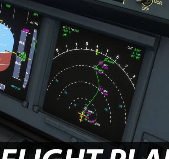
Also, haven’t figured out what that little green line hanging off the left of the nav path is, right above the plane icon and nearby waypoints.
Thanks!
That is your Top of Climb (ToC) indication.
You will see it pointing the other way for your Top of Descent (ToD) indication.
Very cool, thanks! Will that only show up if you have a flight plan with altitudes? I usually just use VFR mode and hop around randomly from airport to airport.
I enter the airport, click direct to and then manually work out the altitudes and whatnot to my preference in the moment.
1 Like
You will need a flight plan entered in the MCDU with altitudes.
Without that the points cannot be calculated.
1 Like
Thanks again, time to learn/practice the MCDU more
1 Like