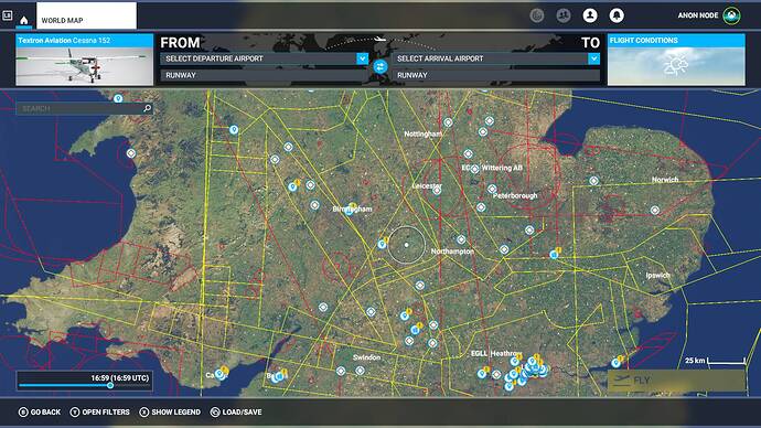
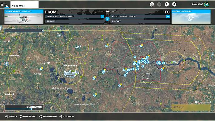
What do the different colours mean and the shapes obviously mean the boundaries?
Hi @AnonNode
The colors represent the kind of airspace (eg. Class A-E for controlled airspaces).
Usually when flying VFR you need a chart for that particular area you are flying (sectionals). In the United States these charts can be found on skyvector.com. In Europe they are a little bit more difficult to find and sometimes you even have to pay for them.
There are airspaces that you can only fly in when you have permission or clearance from ATC, like controlled airports and cities. Some spaces you can’t go to at all (military). I’m assuming these are the red ones.
From the wiki page on the UK:
"In addition the UK has a couple of special classes of airspace that do not fall within the ICAO classes:
** Aerodrome traffic zones (ATZ) are circular zones around an airport with a radius of 2 nmi or 2.5 nmi depending on runway length, extending from the surface to 2,000 ft (600 m) AAL (above aerodrome level). Aircraft within an ATZ must obey the instructions of the tower controller (if present), or must make radio contact with the Aerodrome Flight Information Service unit or Air/Ground Communication Service unit for the aerodrome before entering the zone (in the case of an uncontrolled airfield), or must obey ground signals if non-radio.[15]*
** Military air traffic zones (MATZ) are zones around military air bases in class G airspace. Military aircraft treat these as if they are controlled airspace; civilian traffic are advised but not obliged to do the same (although they must respect the ATZ contained within the MATZ). A MATZ usually consists of a circular zone with a radius of 5 nm, extending from the surface to 3,000 ft (900 m) AAL (above aerodrome level). Stubs 4 nm wide and 5 nm in length, orientated with the aerodrome’s main runway, extend on opposite sides of the central circle, extending from 1,000 ft (300 m) to 3,000 ft (900 m) AAL."*
Some useful links:
I would really love to have the “Enforce airspace restrictions” option for ATC. But for now those lines are meaningless, you can fly anywhere you want.
Right, so interesting to see where the restricted zones are in any given country, are these accurate, up to date, irl airspaces?
Yes, it would add abit more realism.
Yes it’s interesting indeed!
I’ve cross-referenced some of the airspaces in MSFS with the ones on skyvector and they seem to be pretty accurate. They’re certainly not made-up but I’m not sure how up-to-date they are.
I believe MSFS uses NavBlue as their source for navigation data so it should be accurate and recent.
And yes, unfortunately there are no repercussions or consequences tied to violating restricted airspaces as of yet in the sim. That would make a nice feature request for the wishlist if there isn’t one already.
In Flight Unlimited 2 which was based around the San Francisco area, you did have enforced airspace, by ATC, I cant remember the exact wording went something like “aircraft on gaurd you are entering”
When I plan my VFR flights, I always try to avoid restricted and busy airspaces for realism but I find world map airspace filters insufficient so I still use SkyVector for planning.
I’ve never had ATC deny me permission to enter Class xxx airspace whenever I’ve requested it.

