Please tell me, how to use Jeppesen to find the following information circled in red?
Thanks
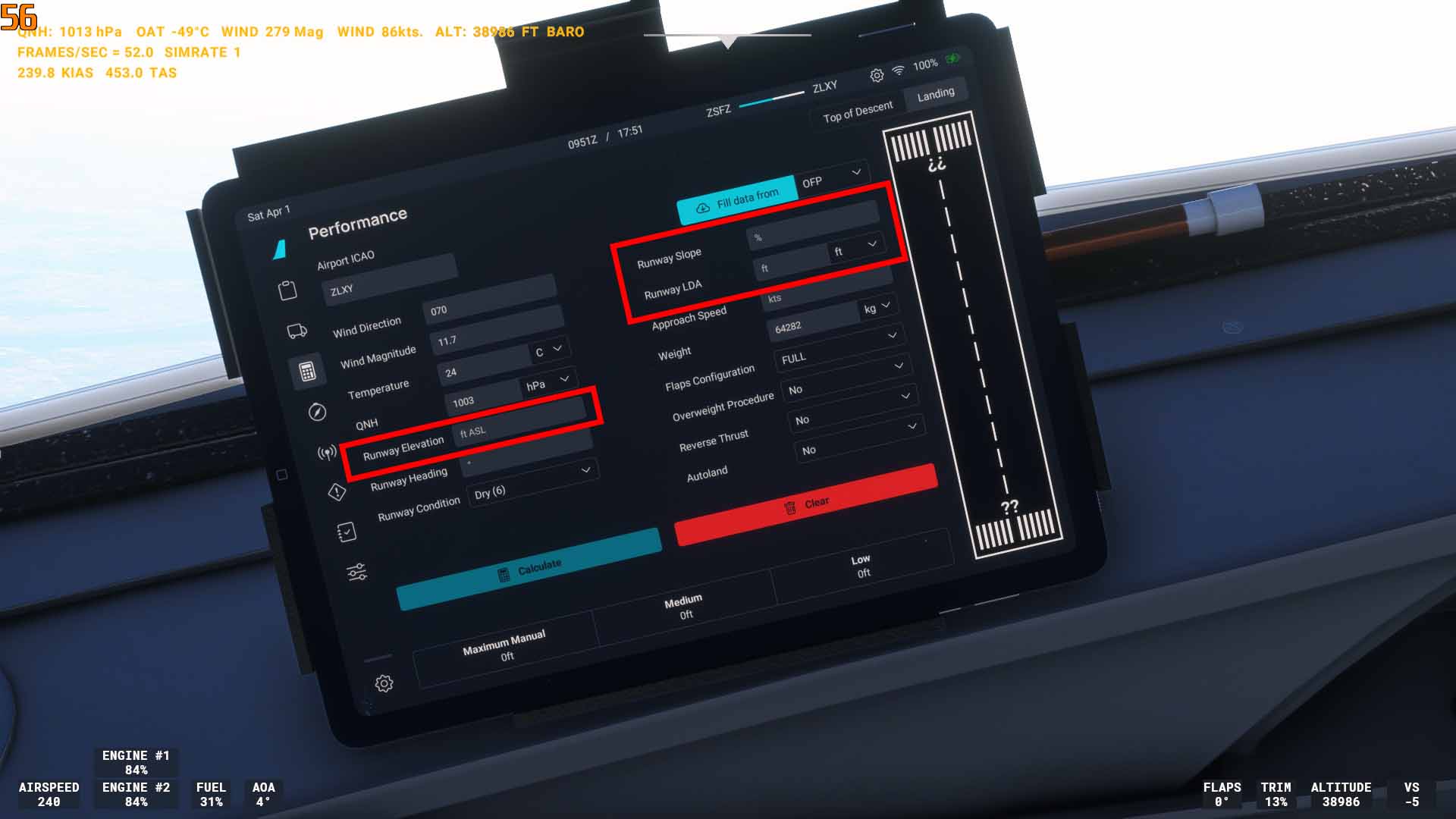
I don’t think this runway has a slope, and I think most are zero anyway, but here is an example of runway length of 5001 feet, and Touch Down Zone Elevation (TDZE) of 643 feet.

Hello there,
We ask that all members not use General Discussion for help, troubleshooting, bug reports, or advice questions. Your topic has been moved to Community Support.
As a general rule, Jeppsen charts don’t show runway slope. You can calculate it manually. Let’s say one runway end has an elevation of 100ft and the other end of 90ft, you can subtract thiese values from each other, in this case:100 ft - 90 ft = 10 ft.Now take the runway length (normally available in most of the airport charts), i.e. 10.000ft. Divide the difference in elevation through the runway length and multiply with 100 and you have got the runway slope in percent. E.g. 10 ft / 10.000 ft * 100 = 0.1 %. FAA charts for U.S. airports have the runway slope indicated on the airport diagram along the side of the runway (if there is a slope). For example, on FAA charts, KIAD RWY 01R/19L shows 0.3% up slope, and 01L/19R shows a 0.4% down slope. They use arrows to indicate which end is up or down slope.
Regards
The Airport/Facility Directory also has slope info for US airports. The NACO charts and A/FD will only publish slope when it’s 0.3% or greater, otherwise (and for Jepp charts as stated above), you have to do rise over run math using opposing touchdown zone elevations (TDZE).
LDA is landing distance available (not a localizer-type directional aid in this case ![]() ). This is a declared distance used when it’s less than the full runway length. It is usually the runway length minus the displaced threshold (and of course not including stopways and clearways), but a ometimes it’s whatever the airport decides to declare. If there isn’t a declared LDA published, use the runway length.
). This is a declared distance used when it’s less than the full runway length. It is usually the runway length minus the displaced threshold (and of course not including stopways and clearways), but a ometimes it’s whatever the airport decides to declare. If there isn’t a declared LDA published, use the runway length.