ATTENTION Aussie Flight Group Participants …
PLEASE DO NOT SPAWN ON THE RUNWAY. ENSURE YOU SELECT THE STARTING POSITION ON THE RAMP.
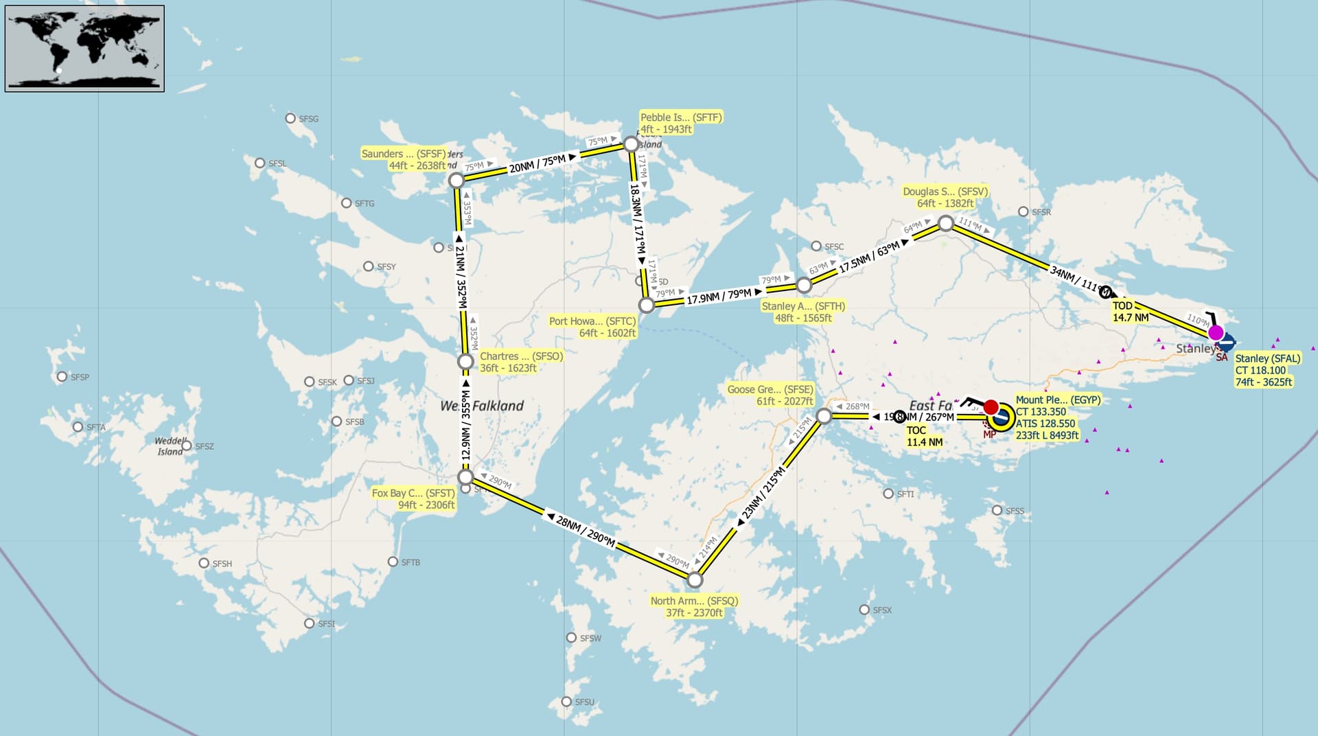
Route: Mount Pleasant(EGYP) Goose Green(SFSE) North Arm(SFST) Fox Bay Clay(SFST) Chartres(SFSO) Saunders Is Landing Strip(SFSF) Pebble Is Beach Airstrip(SFTC) Port Howard Airstrip(SFTC) Stanley Airport(SFTH) Douglas Station(SFSV) Stanley(SFAL).
Take off from Mount Pleasant(EGYP)
Track 267 deg to Goose Green(SFSE) 19.8nm
Touch and Go at Goose Green(SFSE)
Track 215 deg to North Arm(SFST) 23nm
Touch and Go at North Arm(SFST)
Track 290 deg to Fox Bay Clay(SFST) 28nm
Touch and Go at Fox Bay Clay(SFST)
Track 355 deg to Chartres(SFSO) 12.9nm
Touch and Go at Chartres(SFSO)
Track 352 deg to Saunders Is Landing Strip(SFSF) 21nm
Full Stop Landing at Saunders Is Landing Strip(SFSF) +++ 10 minute break +++
Take off from Saunders Is Landing Strip(SFSF)
Track 075 deg to Pebble Is Beach Airstrip(SFTC) 20nm
Touch and Go at Pebble Is Beach Airstrip(SFTC)
Track 171 deg to Port  Howard Airstrip(SFTC) 18.3nm
Touch and Go at Port  Howard Airstrip(SFTC)
Track 079 deg to Stanley Airport(SFTH) 17.9nm
Touch and Go at Stanley Airport(SFTH)
Track 063 deg to Douglas Station(SFSV) 17.5nm
Touch and Go at Douglas Station(SFSV)
Track 111 deg to Stanley(SFAL) 34nm
Full Stop landing at Stanley(SFAL).
Airport details:
Mount Pleasant(EGYP)
Elev: 233’
RW 10/28 Asphalt 8,493’
RW 05/23 Asphalt 5,012’
Goose Green Airfield(SFSE)
Elev: 61’
RW 14/32 Grass 2,027’
North Arm Airport(SFSQ)
Elev: 37’
RW 18/36 Grass 2,370’
RW 03/21 Grass 1,300’
Fox Bay Clay Airstrip(SFST)
Elev: 94’
RW 18/36 2,306’
RW 09/27 1,451’
Chartres Airport(SFSO)
Elev; 36’
RW 10/28 Grass 1,623’
RW 07/25 Grass 977’
Saunders Is Landing Strip(SFSF)
Elev: 44’
RW 10/28 Grass 2,638’
RW 11/29 Dirt 2,470’
RW 15/33 Grass 1,480’
Pebble Island Beach Airstrip(SFTF)
Elev: 4’
RW 07/25 Gravel 1,943’
Port Howard Airstrip(SFTC)
Elev: 64’
RW 01/19 Grass 1,602’
Stanley Airport(SFTH)
Elev: 48’
RW 11/29 Grass 1,565’
Douglas Station Airport(SFSV)
Elev: 64’
RW 05/23 Grass 1,382’
RW 14/32 Grass 961’
Stanley(SFAL)
Elev: 74’
RW 09/27 Asphalt 3,625’
RW 18/36 Asphalt 1,098’
Event details:
Altitude: The route can be flown up to 2,500’ to be clear of terrain.
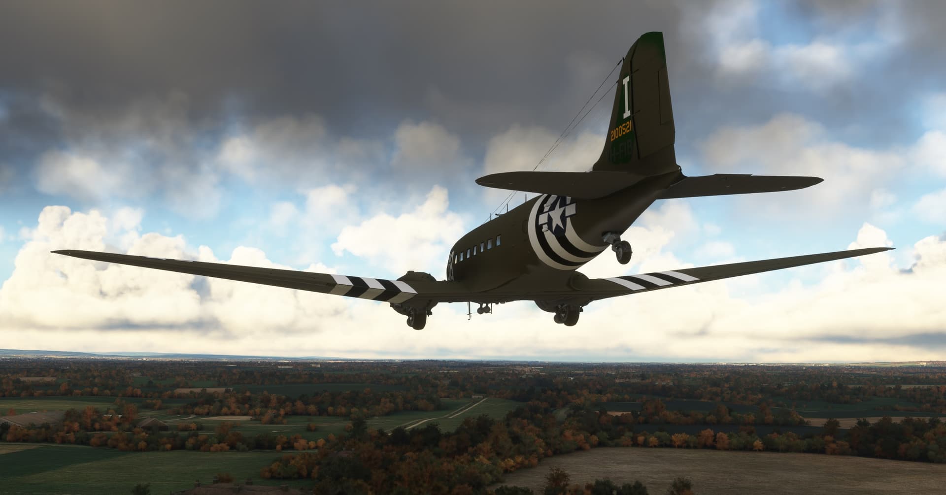
Aircraft: DC3.
Suggested Min Speed: 160knots
Server: South East Asia
Join Discord Server: Discord
Note: Joining the Discord Server is FREE. As a member it allows you to enjoy many services the site has to offer. You also use the Voice capability of the Discord server to chat during events.
Depart Time: 20:00z
Sim Time: 08:00am
Multiplayer: All Players
Weather: Live Weather
Flight Duration: 1hr 30min approx. (assuming min 160knots speed).
Flight Distance: 213nm
Flight Plans to support the event …
Little NavMap: VFR Mount Pleasant (EGYP) to Stanley (SFAL).lnmpln (3.1 KB)
MSFS: VFR Mount Pleasant (EGYP) to Stanley (SFAL).pln (4.0 KB)
Flight Card: Click Here