ATTENTION Aussie Flight Group Participants …
Group Flight: 2022-12-09T09:00:00Z
PLEASE DO NOT SPAWN ON THE RUNWAY. ENSURE YOU SELECT THE STARTING POSITION ON THE RAMP.
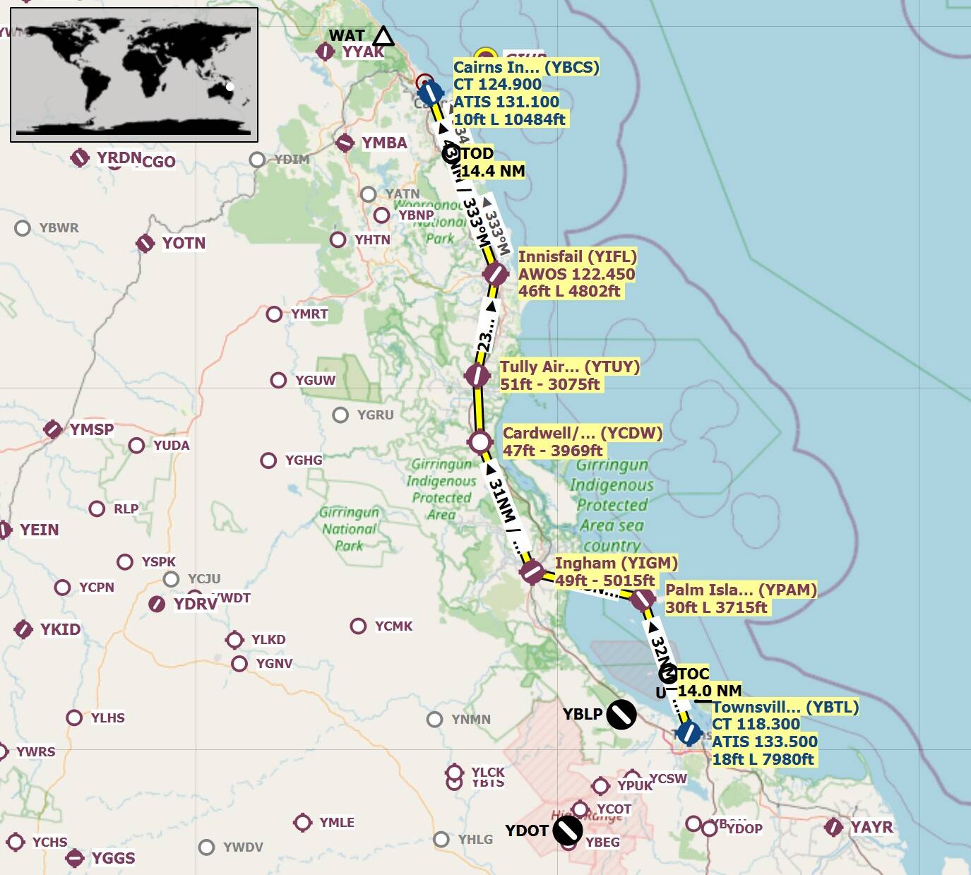
Route: Townsville(YBTL) Radar Site(RDRS) Rattlesnake Is(RKI) Havannah Is(HVI)) Palm Is(YPAM) Ingham(YIGM) Cardwell(YCDW) Tully(YTUY) Innisfail(YIFL) Aloomba(ALBA) Timbertop(TBRT) Cairns(YBCS).
Take off from Townsville(YBTL)
Track 354 deg to Radar Site(RDRS) 3.2nm
Track 311 deg to Rattlesnake Is(RKI) 13.3nm
Track 333 deg to Havannah Is(HVI) 12nm
Track 017 deg to Palm Is(YPAM) 5.9nm
Touch and Go at Palm Is(YPAM)
Track 276 deg to Ingham(YIGM) 25nm
Touch and Go at Ingham(YIGM)
Track 331 deg to Cardwell(YCDW) 31nm
Touch and Go at Cardwell(YCDW)
Track 350 deg to Tully(YTUY) 14.7nm
Full Stop Landing at Tully(YTUY) +++ 10min Break +++
Take off from Tully(YTUY)
Track 004 deg to Innisfail(YIFL) 23nm
Touch and Go at Innisfail(YIFL)
Track 332 deg to Aloomba(ALBA) 29nm
Track 343 deg to Timbertop(TBRT) 9nm
Track 320 deg to Cairns(YBCS) 5.2nm
Full Stop Landing at Cairns(YBCS).
Altitude: The route can be flown up to 4,500’ to be clear of terrain.
Airport details
Townsville Intl(YBTL)
Elev: 18’
RW 01/19 Asphalt
RW 07/25 Asphalt
Palm Is(YPAM)
Elev: 30’
RW 14/32 Bituminous
Ingham(YIGM)
Elev: 49’
RW 05/23 Asphalt
Cardwell(YCDW)
Elev: 47’
RW 14/32 Dirt
Tully(YTUY)
Elev: 51’
RW 01/19 Bituminous
Innisfail(YIFL)
Elev: 46’
RW 14/32 Asphalt
RW 03/21 Grass
Cairns(YBCS)
Elev: 10’
RW 15/33 Asphalt
For airport comprehensive airport details refer: Aeronautical Information Package - Airservices .
The information is available under the latest ERSA. Simply search for the airport.
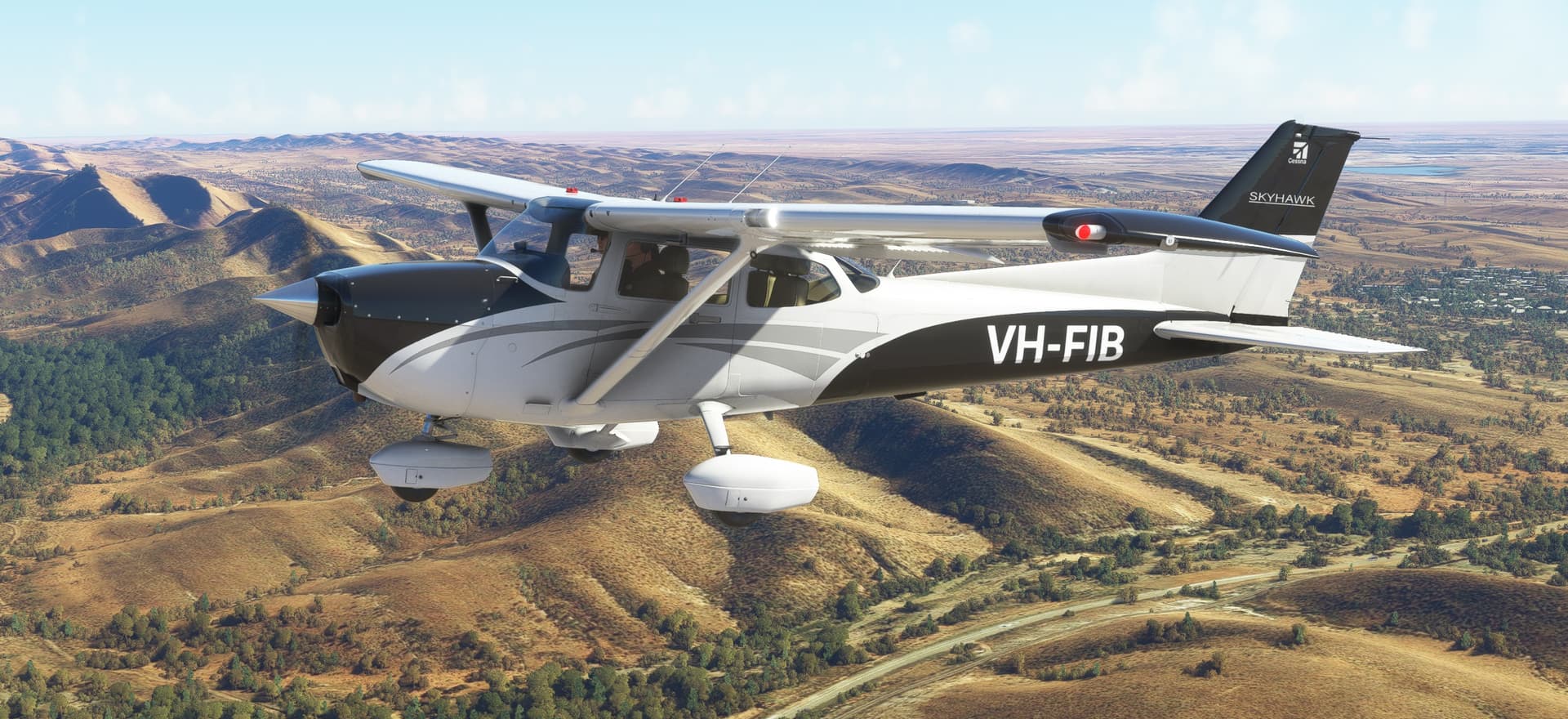
Aircraft: GA aircraft of you choice. Would suit a C172 or similar.
IMPORTANT: In the interest of keeping it REAL, please refrain from selecting inappropriate aircraft, like airliners. This only detracts from the immersion of the flight.
Seeing Aircraft Correctly: You need to do two things to ensure you can see the other pilots in the event and see them in the aircraft they selected.
Select the same server: To do this, proceed as follows:
From the Welcome Screen, click on your Username (top right)
From the list of servers, under Servers, select WEST USA
Turn off Generic Planes: To do this, proceed as follows:
From the Welcome Screen, click on OPTIONS
Click on GENERAL
With TRAFFIC selected, scroll down to the last option and set USE GENERIC PLANE MODELS to OFF
Turning off Crash/Damage:
Select Options/Assistance
Expand Failure & Damage
Disable Crash Damage
Disable Aircraft Stress Damage
Disable Engine Stress Damage
Accept the changes
Voice Room: My personal Discord server is used for voice comms. If you haven’t already joined my server, click on the below link to request access. I will set you up as a Member so you can access the server. Ensure you do this prior to the flight, as latecomers will need to wait for the next event.
Link to join the Voice Room: Discord
Note: this link is only valid for 7 days from posting.
Weather/Time: We will set the time to 8am. This will allow us to fly in daylight and choose REAL weather so that the winds are correct.
From the World Map view, click on Flight Conditions (upper right of screen)
Click on All Players, Live Traffic, Custom
Under Weather and Time, select Live Weather and move the time slide bar to show 8:00am.
Click Close and Fly from the World Map view.
We can start departing from 09:00z. There will be no need for official radio calls. Lets just have some fun taking in the scenery and the social aspects of the event.
Turning on Points of Interest
Select Options/Assistance
Expand POI
Set Landmark Markers to ON
Set City Markers to ON
Set Airport Markers to ON
Accept the changes
Turning on Name Tags (This will assist you in following the group if you get disoriented):
Select Options/GeneralTraffic
Set Show Traffic Nameplates to On
Accept the settings
Still confused, check out the multiplayer video tutorial from SimHangar Flight Simulation: MSFS | MULTIPLAYER | How To Guide | Everything You Need To Know | Fly in events coming soon. - YouTube
Let me know if there’s anything else that I’ve missed that you need to know.,
Regards, Paul