Group flights, Aussie style. Aussie Group Flights Team is the ultimate way to explore the world with your favourite people.

 Saltwater Shadows — NT Crocodile Patrol
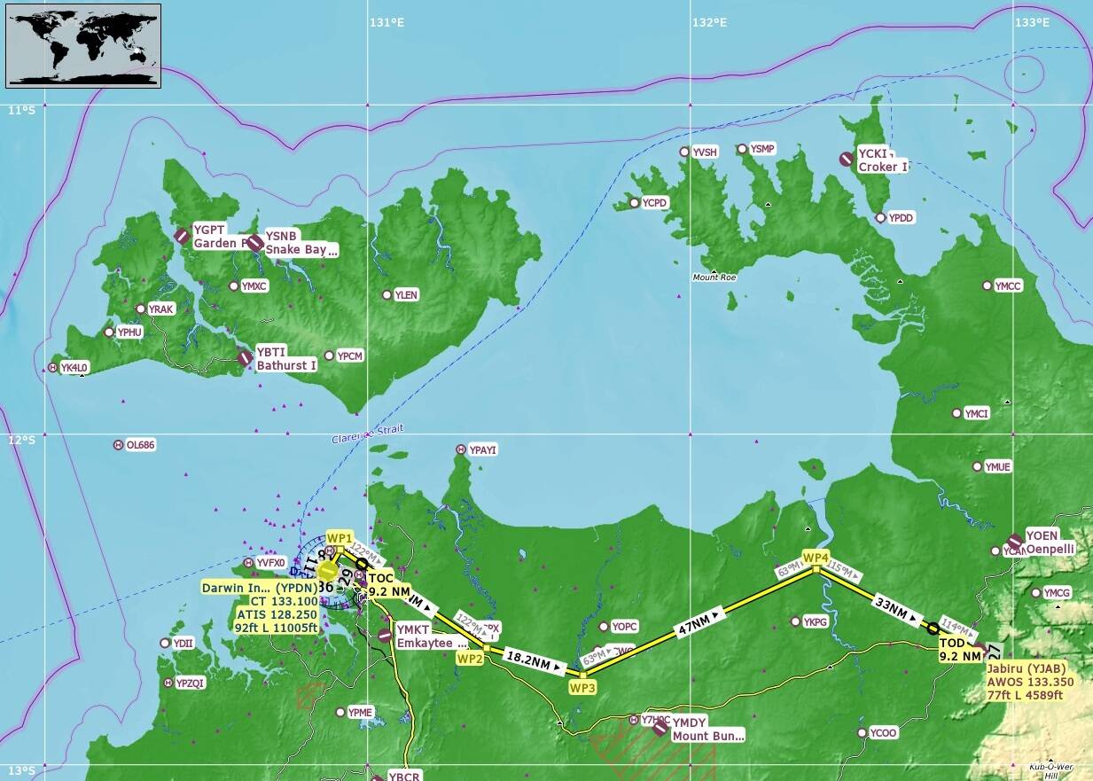
Aircraft: H125 / H160 / Cabri G2 / Bell 407 Route: YPDN Darwin → Mangrove Flats → Adelaide River → Mary River Wetlands → South Alligator River → YJAB Jabiru Distance: ~119 NM Region: Northern Territory, Australia Theme: Mangroves • Floodplains • Wetlands Wildlife: Saltwater Crocodiles (Confirmed)
Mission Overview
A low‑and‑slow heli patrol through the Northern Territory’s crocodile heartland. Depart Darwin International and trace the mangrove coastline eastward, following the tidal flats and river bends where saltwater crocs bask on muddy banks. Continue inland across the Adelaide and Mary River floodplains, then push toward Kakadu’s South Alligator River before landing at Jabiru. Expect dense vegetation, humid haze, and wildlife lurking just below the surface.
Recommended Flight Profile
- Altitude: 100–200 ft AGL
- Speed: 20–40 knots
- Visibility: Best along muddy shores and shallow water edges
- Formation: Tight group spacing for synchronized fauna spawns
Operational Notes
- Crocodiles are small and low‑contrast — hover slowly and scan riverbanks.
- Avoid high passes; fauna despawns above ~300 ft AGL.
- Maintain cinematic spacing for screenshots and group immersion.
- Weather preset: Scattered Clouds, late afternoon light enhances reflections.
Objective
Spot and photograph at least one crocodile per zone. Confirm sightings via group voice callouts. Complete the patrol with a full landing at YJAB Jabiru.
If you are not a member, to join for FREE, click here: Aussie Group Flights Team - On-line Flying
Details to follow. Hope you can join us.
PLEASE NOTE: THIS INFORMATION IS FOR FLIGHT SIMULATION USE ONLY.
Regards, Paul