ATTENTION Aussie Flight Group Participants …
PLEASE DO NOT SPAWN ON THE RUNWAY. ENSURE YOU SELECT THE STARTING POSITION ON THE RAMP.
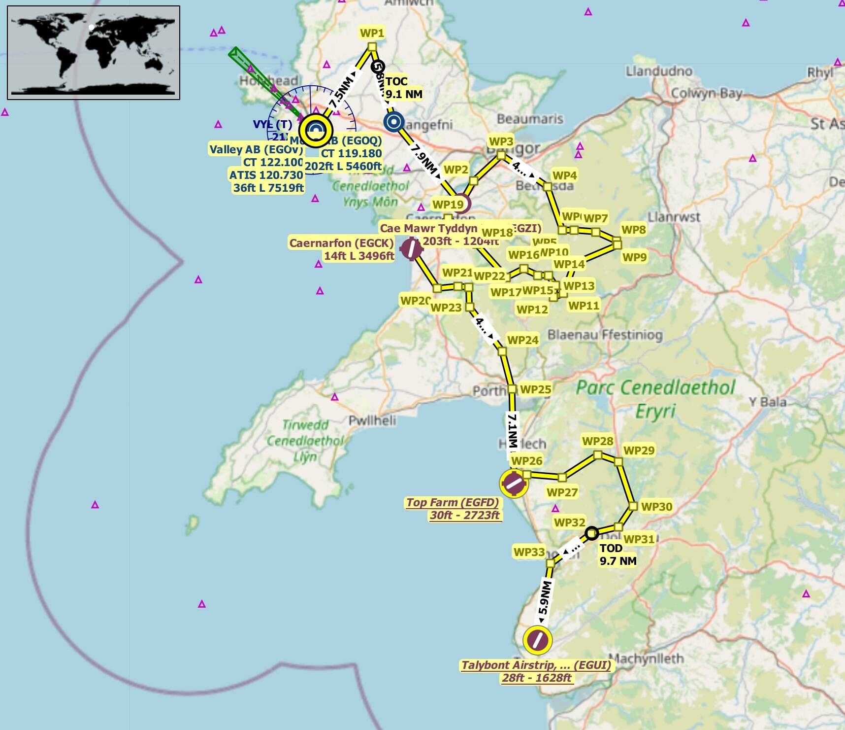
Route: Valley AB(EGOV) Mona AB(EGOQ) Cae Mawr Tyddyn Hen(EGZI) Caernarfon(EGCK) Top Farm(EGFD) Talybont Airstrip(EGUI).
* Take off from Valley AB(EGOV)
* Track 035 deg to Llyn Alaw(WP1) 7.5nm
* Track 165 deg to Mona AB(EGOQ) 5.8nm
* Touch and Go at Mona AB(EGOQ)
* Track 142 deg to Cae Mawr Tyddyn Hen(EGZI) 7.9nm
* Touch and Go at Cae Mawr Tyddyn Hen(EGZI)
* Track 031 deg to Y FelinHeli(WP2) 2nm
* Follow waypoints WP2 thru WP19
* Track 232 deg to Caernarfon(EGCK) 3.6nm
* Full Stop Landing at Caernarfon(EGCK)  +++ 10 min break +++
* Take Off from Caernarfon(EGCK)
* Track 148 deg to Pen-y-groes(WP20) 3.6nm
* Follow waypoints WP20 thru WP25
* Track 180 deg to Top Farm(EGFD) 7.1nm
* Touch and Go at Top Farm(EGFD)
* Track 059 deg to Llanbedr(WP26) 1.1nm
* Follow waypoints WP26 thru WP33
* Track 191 deg to Talybont Airstrip(EGUI)
* Full Stop Landing at Talybont Airstrip(EGUI)
Airport details:
Valley AB(EGOV)
Elev: 36’
RW 01/19 Asphalt 5,166’
RW 07/25 Asphalt 3,571’
RW 13/31 Asphalt 7,519’
Mona AB(EGOQ)
Elev: 202’
RW 04/22 Asphalt 5,460’
RW 13/31 Asphalt 2,104
RW 18/36 Asphalt 2,813’
Cae Mawr Tyddyn Hen(EGZI)
Elev: 203’
RW 08/26 Grass 1,204’
RW 01/19 Grass 1,199’
Caernarfon(EGCK)
Elev: 14’
RW 02/21 Bituminous 3,496’
RW 07/25 Bituminous 3,053’
Top Farm(EGFD)
Elev: 30’
RW unknown
Talybont Airstrip(EGUI)
Elev: 28’
RW 03/21 Asphalt 1,628’
Event details:
Altitude: The route can be flown up to 5,500’ to be clear of terrain.
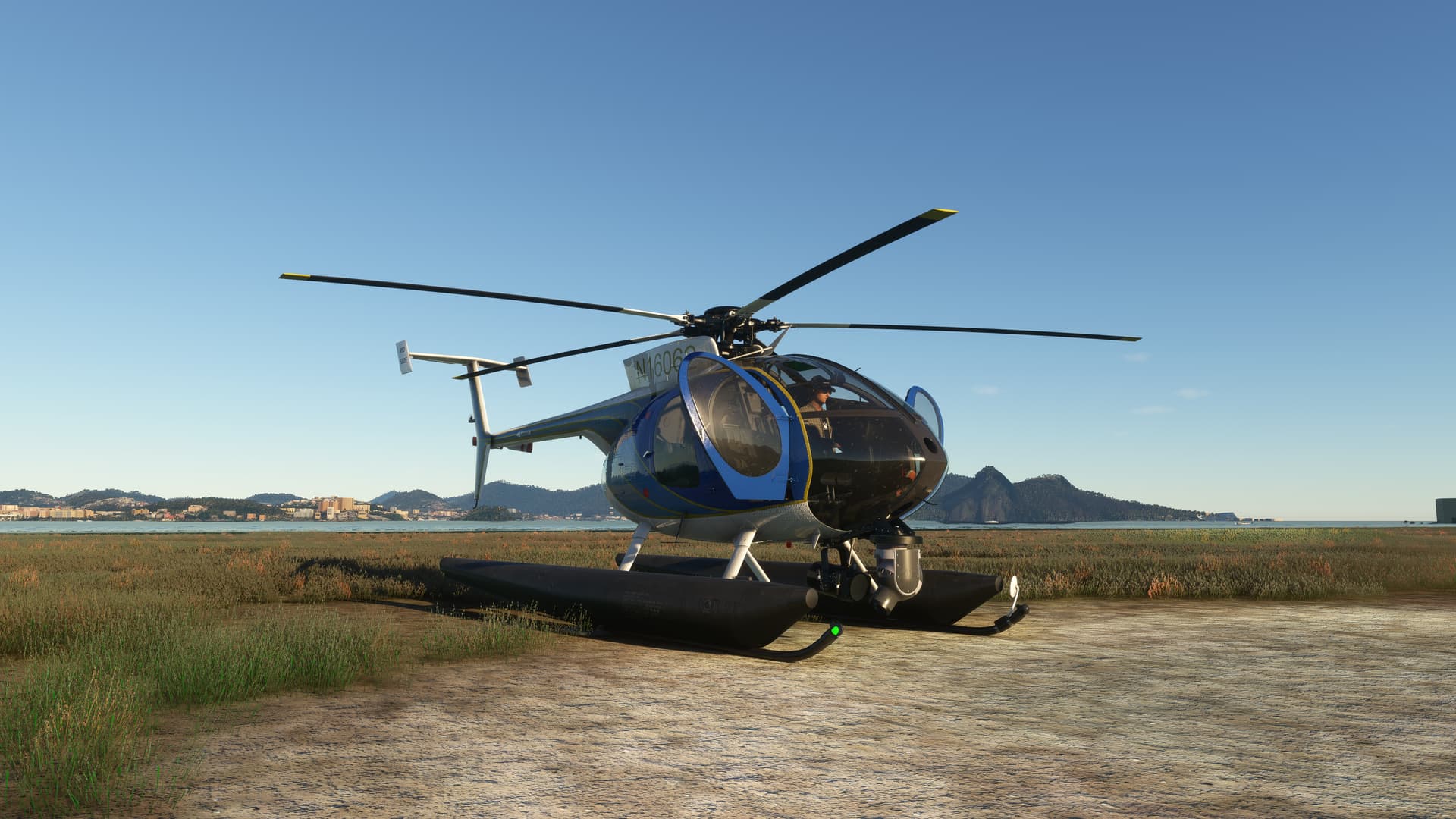
Aircraft: Strongly suggest a helicopter for this event, so you can hover and view the many points of interest.
Suggested Cruise Speed: 120knots
Server: South East Asia
Join Discord Server: Aussie Group Flights Team - On-line Flying
Note: Joining the Discord Server is FREE. As a member it allows you to enjoy many services the site has to offer. You also use the Voice capability of the Discord server to chat during events.
Depart Time: 20:00z
Sim Time: 08:00am
Multiplayer: All Players
Weather: Live Weather
Points of Interest: Turn on POIs to assist you in identifying them.
Flight Duration: 1 hr 30 mins approx.
Flight Distance: 107nm
Flight Plans to support the event …
Little NavMap: VFR Valley AB (EGOV) to Talybont Airstrip, Tywyn (EGUI).lnmpln (7.2 KB)
MSFS: VFR Valley AB (EGOV) to Talybont Airstrip, Tywyn (EGUI).pln (11.7 KB)
Flight Card: Click Here