ATTENTION Aussie Flight Group Participants …
Group Flight: 2021-09-24T10:00:00Z
PLEASE DO NOT SPAWN ON THE RUNWAY. ENSURE YOU SELECT THE STARTING POSITION ON THE RAMP.
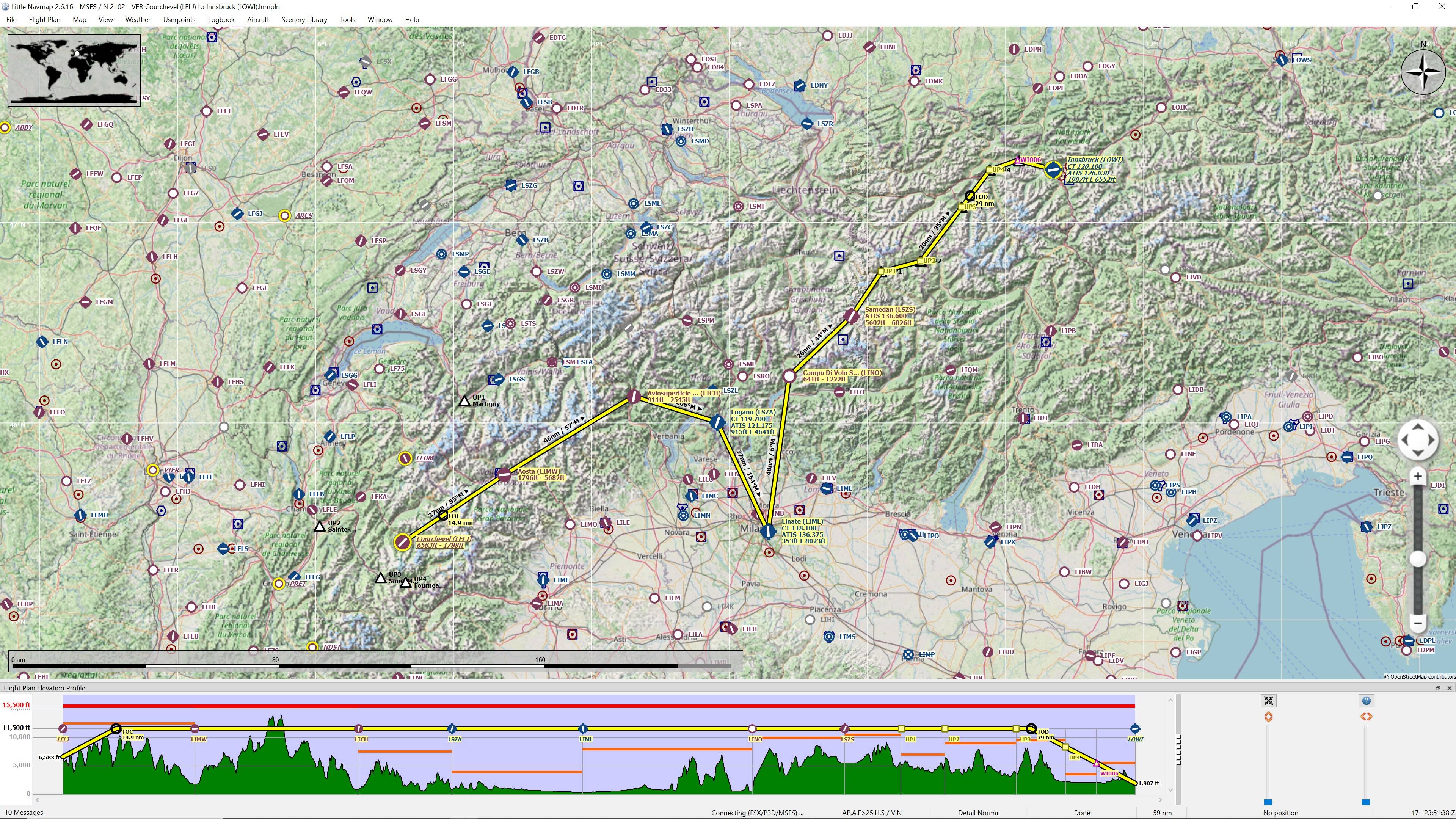
Route: LFLJ(Courchevel) - LIMW(Aosta) - LICH(Aviosuperficie Chavez-Marini) - LSZA(Lugano) - LIML(Linate) - LINO(Campo Di Volo Samolaco) - LSZS(Samedan) - LOWI(Innsbruck).
Take off from LFLJ(Courchevel)
Track 055 deg to LIMW(Aosta) 37nm
Touch and Go at LIMW(Aosta)
Track 057 deg to LICH(Aviosuperficie Chavez-Marini) 46nm
Touch and Go at LICH(Aviosuperficie Chavez-Marini)
Track 106 deg to LSZA(Lugano) 26nm
Touch and Go at LSZA(Lugano)
Track 154 deg to LIML(Linate) 37nm
Full Stop Landing at LIML(Linate) +++10min Break+++
Take off from LIML(Linate)
Track 006 deg to LINO(Campo Di Volo Samolaco) 48nm
Touch and Go at LINO(Campo Di Volo Samolaco)
Track 044 deg to LSZS(Samedan) 26nm
Touch and Go at LSZS(Samedan)
The next User Points are basically used to follow the valley around to Innsbruck
Track 032 deg to UP1(User Point) 15.9nm
Track 073 deg to UP2(User Point) 12.2nm
Track 035 deg to UP3(User Point) 20nm
Track 035 deg to UP4(User Point) 13.8nm
Track 071 deg to UP5(User Point) 9.1nm
Track 102 deg to LOWI(Innsbruck) 10.3nm
Full Stop Landing at LOWI(Innsbruck)
Altitude: The route can be flown up to 11,500’ to be clear of terrain.
Airport details:
Courchevel(LFLJ)
Elev: 6,583’
RW 04/22 Asphalt
Aosta(LIMW)
Elev: 1,796’
RW 09/27 Asphalt
Aviosuperficie Chavez-Marini(LICH)
Elev: 911’
RW 18/36 Asphalt
RW 01/19 Grass
Lugano(LSZA)
Elev: 915’
RW 01/19 Asphalt
Linate(LIML)
Elev: 353’
RW 18/36 Asphalt
RW 17/35 Asphalt
Campo Di Volo Samolaco(LINO)
Elev: 641’
RW 14/32 Grass
Samedan(LSZS)
Elev: 5,602’
RW 03/21 Asphalt
Innsbruck(LOWI)
Elev: 1,907’
RW 08/26 Asphalt
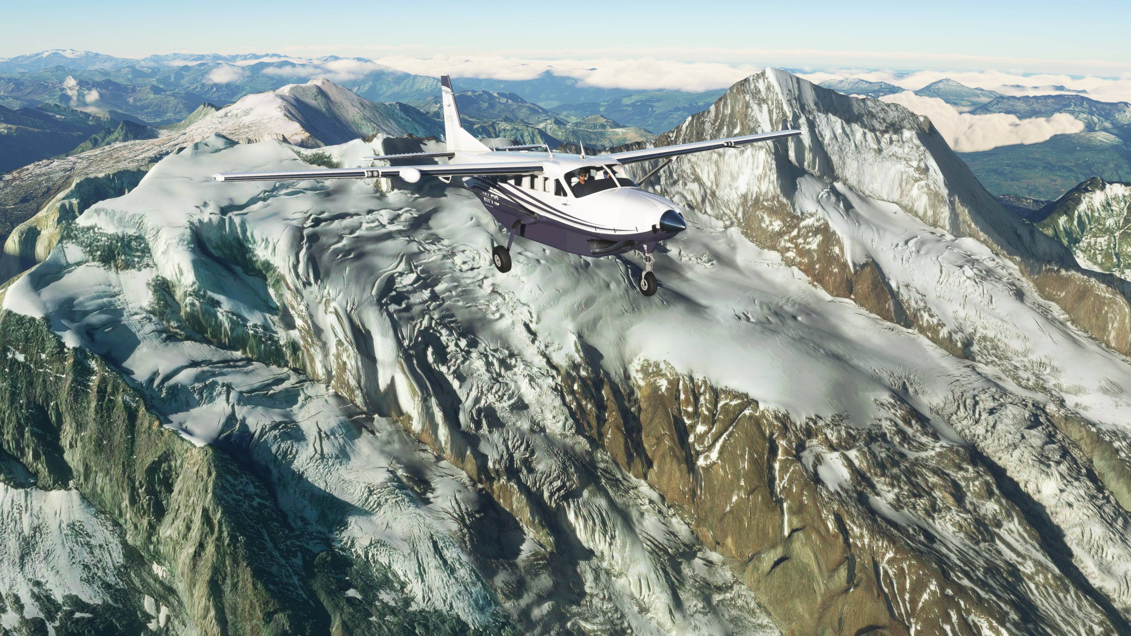
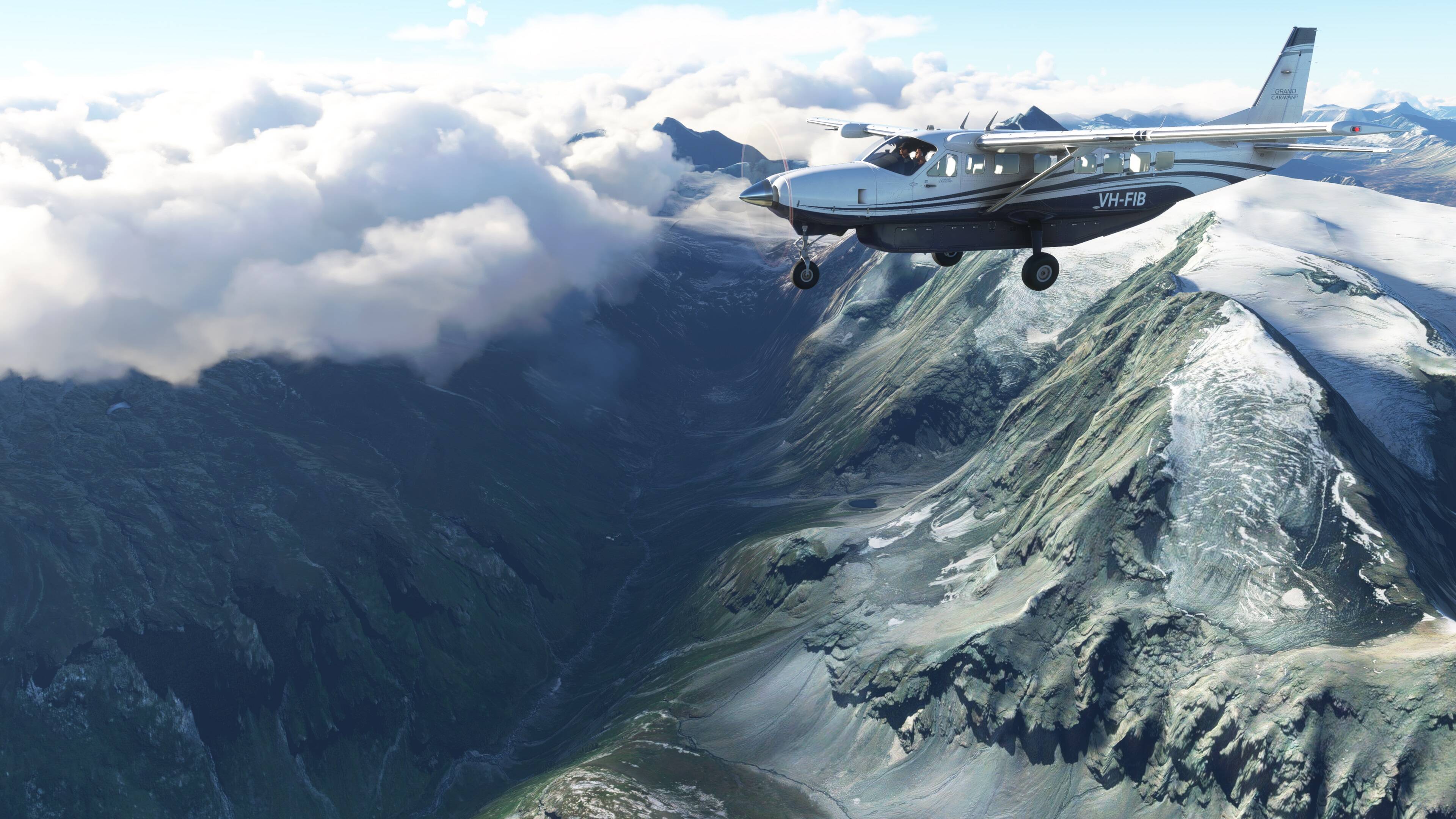
Aircraft: Suggest any GA Aircraft.
IMPORTANT: In the interest of keeping it REAL, please refrain from selecting inappropriate aircraft, like airliners. This only detracts from the immersion of the flight.
Seeing Aircraft Correctly: You need to do two things to ensure you can see the other pilots in the event and see them in the aircraft they selected.
Select the same server: To do this, proceed as follows:
From the Welcome Screen, click on your Username (top right)
From the list of servers, under Servers, select WEST USA
Turn off Generic Planes: To do this, proceed as follows:
From the Welcome Screen, click on OPTIONS
Click on GENERAL
With TRAFFIC selected, scroll down to the last option and set USE GENERIC PLANE MODELS to OFF
Turning off Crash/Damage:
Select Options/Assistance
Expand Failure & Damage
Disable Crash Damage
Disable Aircraft Stress Damage
Disable Engine Stress Damage
Accept the changes
Voice Room: My personal Discord server is used for voice comms. If you haven’t already joined my server, click on the below link to request access. I will set you up as a Member so you can access the server. Ensure you do this prior to the flight, as latecomers will need to wait for the next event.
Link to join the Voice Room: Discord
Note: this link is only valid for 7 days from posting.
Weather/Time: We will set the time to 8am. This will allow us to fly in daylight and choose CLEAR Weather, so can enjoy the scenery, if the REAL weather is poor:
From the World Map view, click on Flight Conditions (upper right of screen)
Click on All Players, Live Traffic, Custom
Under Weather and Time, select Clear Weather and move the time slide bar to show 8:00am.
Click Close and Fly from the World Map view.
We can start departing from 10:00z. There will be no need for official radio calls. Lets just have some fun taking in the scenery and the social aspects of the event.
Turning on Points of Interest
Select Options/Assistance
Expand POI
Set Landmark Markers to ON
Set City Markers to ON
Set Airport Markers to ON
Accept the changes
Turning on Name Tags (This will assist you in following the group if you get disoriented):
Select Options/GeneralTraffic
Set Show Traffic Nameplates to On
Accept the settings
Still confused, check out the multiplayer video tutorial from SimHangar Flight Simulation: MSFS | MULTIPLAYER | How To Guide | Everything You Need To Know | Fly in events coming soon. - YouTube
Let me know if there’s anything else that I’ve missed that you need to know.,
Regards, Paul