I noticed a few weeks ago an updated sat imagery data set was released on MS/Asobo servers for Australia, which was great because it updated really quite old imagery in many areas. Unfortunately, a couple of days ago it seems to have reverted to the old base sat imagery for Australia at least. Noticed it when in SU15, so I left Beta but problem persisted, so am rejoining Beta now. Funny thing is when it was first propogated through the servers a few weeks ago they also went back to the old data for a few days, but it seemed to have been a weekend thing and they seemed to fix it on Monday. This time it’s still ongoing into the week…
… not really an end of the world thing, but I like doing airport scenery mods and the difference between data sets directly impacts how the sceneries look. New updated airport scenery suddenly looks terrible when it happens… It’s also a lot of fun when I don’t notice the regression and find myself undoing all the updating progress ![]()
![]()
It’s not just a beta issue. It’s also on SU14 and I’ve never been part of the beta.
Moved to Scenery and Airports because it isn’t a SU15 Beta specific bug ![]()
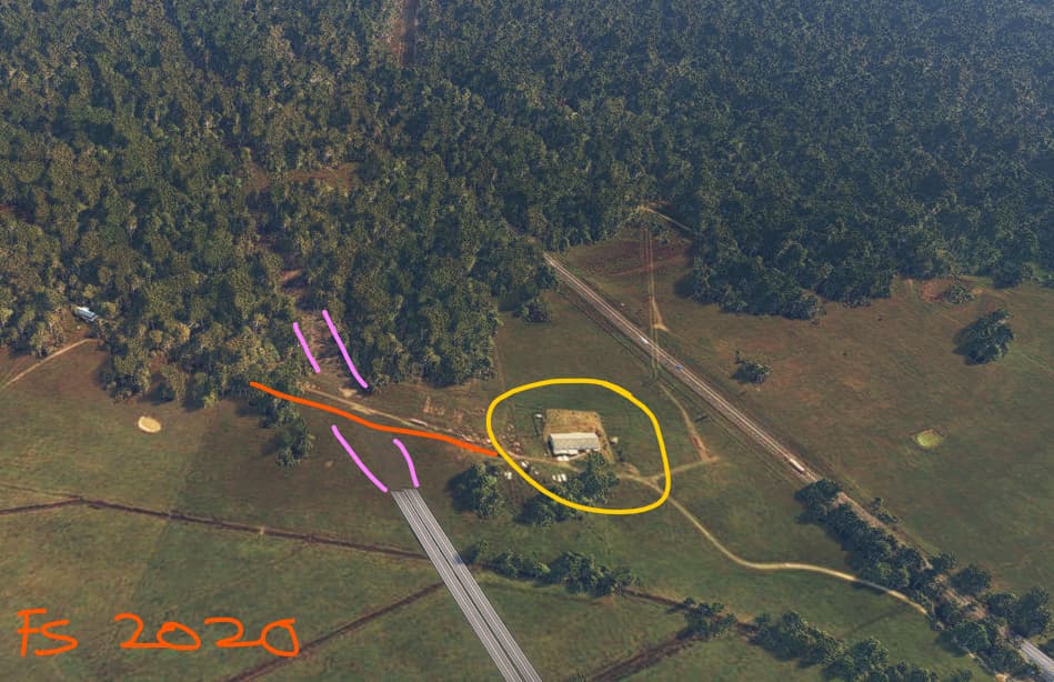
As an addendum to this point, I’ve noticed the roads on top of the imagery in Australia are also buggy (or more like you may need a dune buggy to get across certain sections). For example here’s a stretch where the newer Pacific Motorway (green, completed between 2016 and 2018) diverges from the older original ‘Pacific Highway’ (yellow) near Port Macquarie airport. Shows up correctly in Bing maps.
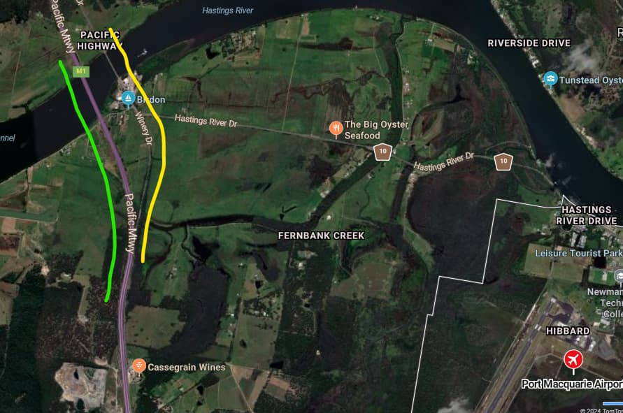
but in FS2020 scenery, the ‘new’ Pacific Motorway disappears under the terrain, while the older Pacific Highway is fully visible. You can still see cars moving along both.
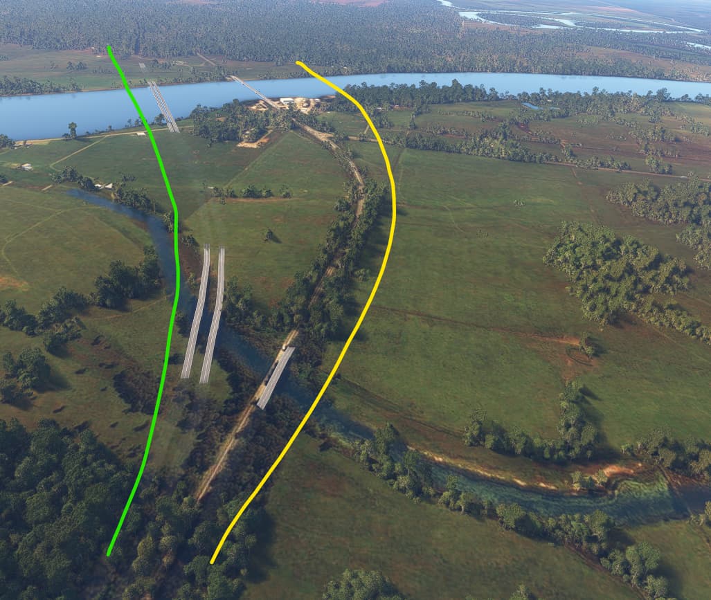
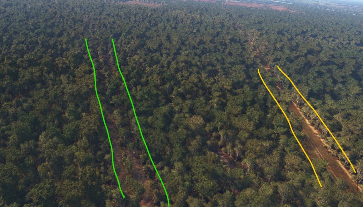
I expect this is a case of ‘old’ (pre-2016) satellite imagery appearing under where a road should otherwise clearly be visible. This is reinforced by the fact that this very wide highway is practically invisible when it traverses through a forest a little further on
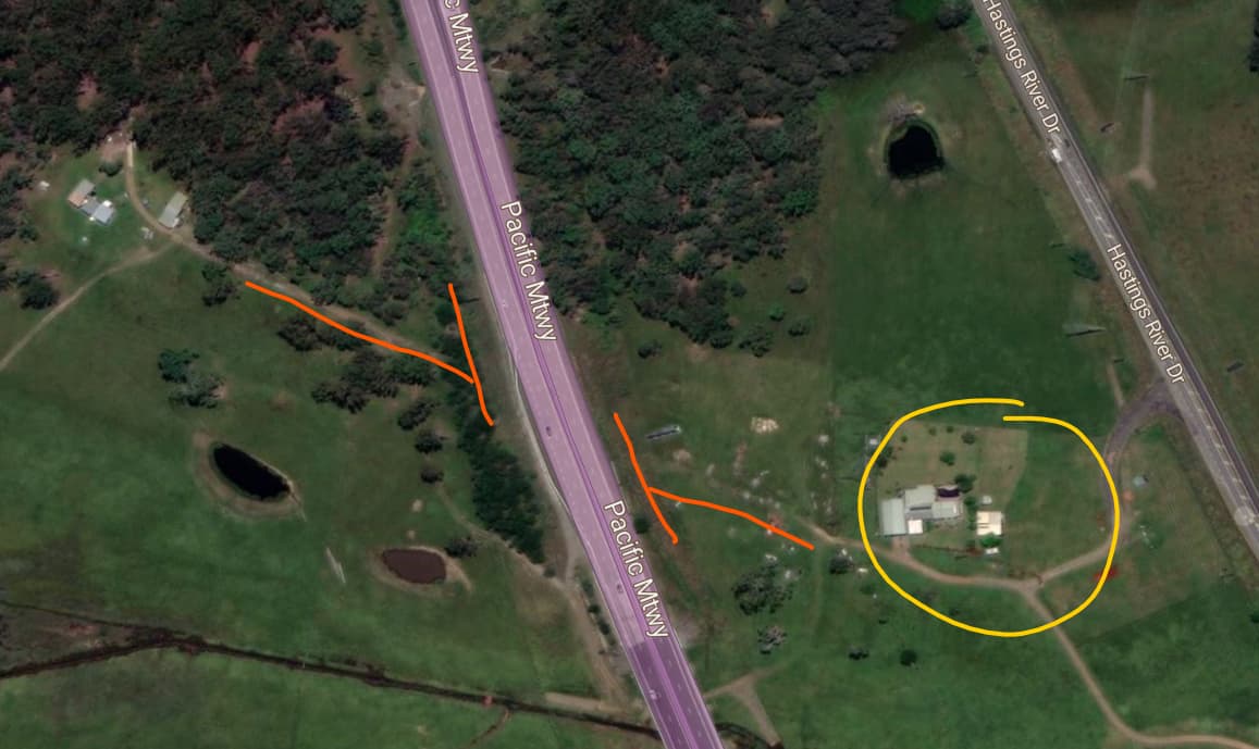
You can also clearly see properties with a connecting path that has been severed by the freeway in Bing maps, but in the visuals inside FS2020 here (with ‘World Update VII: Australia’ installed) you can clearly see the intact dirt path crossing where the freeway should be.
1 Like
I would actually love to know how to remove the road overlays as they detract from the satelite textures themselves, same with narrow creeks & channels…
I participated in the very brief FS2024 technical alpha. And remembering this issue, I returned to the Port Macquarie airport during the testing, to look at this same location. In the 2024 alpha, the roads around this spot correctly and more closely matched the Bing map. I should have grabbed a screenshot at the time, but it was a quick pass and I was just glad that the improvement would be coming.
Now that FS2024 is officially out (though I haven’t purchased it yet) I’m hoping that the newer world satellite imagery visuals will also begin refreshing and appearing in FS2020. Of course not to the same capacity as FS2024, with its improved dynamic 3d rocks and trees and textures. But I’m hoping at least for improved satelite-based views that are currently still outdated in FS2020 as mentioned at the start of this post.
Noting that there have been server capacity issues with the launch, I’m not surprised that possible newer imagery isn’t visible in FS2020 just yet, but I’ll be checking over the next week to see if this area around Port Macquarie changes to more closely reflect current Bing satellite views as they appear in FS2024.
No new ground imagery at all in 2020 as for now, contrary to what asobo had promised long time ago. I have checked many locations worldwide from kilimanjaro, west africa, spain, scandinavia, eastern europe, the whole asia, australia, and new zealand. Still previous old and patchy imagery. I’m afraid it simply won’t happen, at least in the near future, as developers are now busy with 2024 issues. Maybe 2020 will simply be forgotten by the dev. I’m still hoping that ground imagery update at least will come in the next sim update.