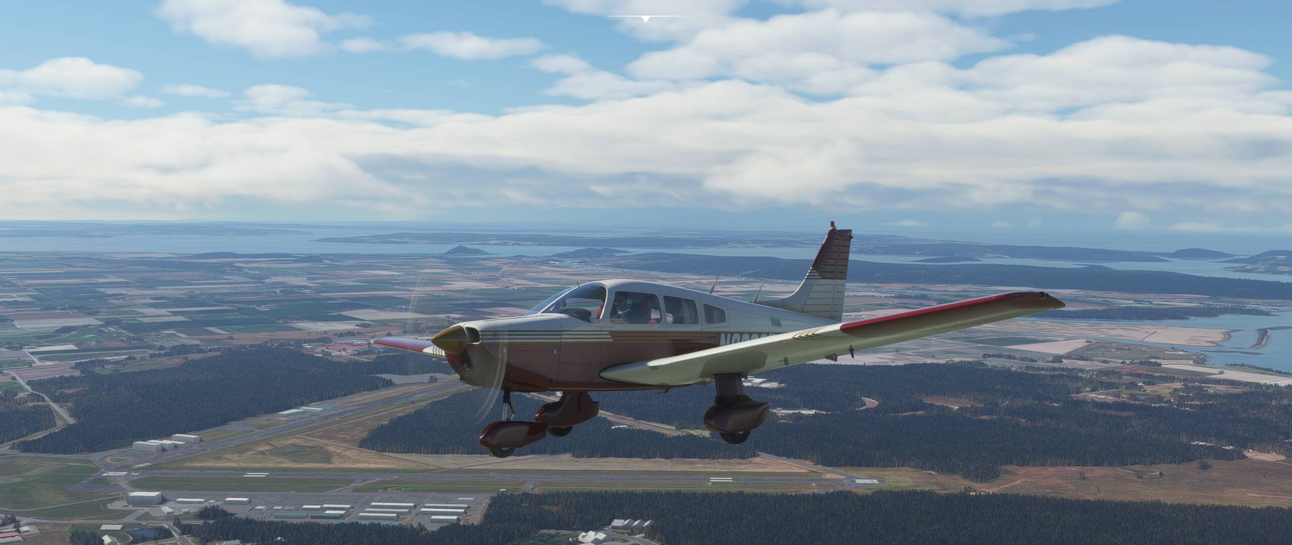
I was flying around Puget Sound with live weather and tuned in to KBVS automated weather to get the altimeter setting. It reported 3 mi visibility and clear skies. And here’s what it looked like right above KBVS. It was not even close neither to 3 mi nor clear skies. KBVS METAR at the moment was also different. It seemed just like some random weather in that report. Where does it take the data for them?

3 Likes
I have noticed this as well. Also that it is different from 25 miles out being closer than ten. And not a little bit mind you. It still says it is the same information (Kilo for example) but winds and speeds are shifted majorly and pressure varying by a lot. Makes planing for a runway a pain sometimes.
1 Like
ATIS is being overhauled in the next couple SUs.
Weather itself is also getting some love. Currently, the weather you see out the window is generated based on the forecast conditions. When it predicts rain at 15:00 then you get rain at 15:00 even if the actual front passed through IRL at 09:00. As a result the observed weather being reported by the Metars may or may not align. COMING SOON TO A SIM NEAR YOU, is a new blending system. In proximity to a reporting station we will get the Metar weather, albeit slight delayed due to the reporting lag. This METAR weather will then be blended into the forecast weather between reporting stations. The result SHOULD be a much more timely and accurate representation of “current” weather. (within the bounds of getting the METAR, processing it, generating the weather, applying it to the sim, you downloading it)
3 Likes
Meteoblue

Do you mean this is how it’s going to be in the stock sim?
That is what the team is telling us.
Well, I have obviously missed this, so thank you very much for this insight. If this is how it’s going to be and it will improve the precision of the weather reports, then it’s a thing to look forward to.
1 Like
I know where the RW ASOS/AWOS gets its information from – I was on the Design project for those systems many years ago when they were 1st introduced. in the USA !!
But in MSFS, that’s a Very Good Question - It “should” be from the Location where the Asos/AWOS system is located – but in MSFS – who really knows…

Ahhh-- happy memories !!
2 Likes
AFAIK, At the moment, there are no published standard sim vars that will give the weather anywhere else but at the aircraft’s current location - with the exception of Sea Level Pressure, which (for an aircraft in flight) will be the SLP directly below the aircraft’s position. I don’t think there is any SDK-enabled technique to query the weather at a specific airport when in flight, so the ATIS appears to be mostly a work of fiction at the moment. Hopefully that will change with some of the weather system enhancements that are coming.
1 Like
No, from Meteoblue.

To take this discussion a little further and actually answer the original question. According to I think it was the last Q&A, they had quite a long discussion on this subject, but still didn’t quite get to full detail.
From what I could make out of the discussion, their servers get a very rough, not very detailed world weather model. This is mostly what you get when you look at the weather on your route. The data, however, I think, could be 12 hours old or more. And it’s not very detailed.
When you create a flight plan, it sounds like what they do is access a processed METAR at your local airport (so it’s very likely a few hours old. It takes them some time to get METARs into their system). And they access the MeteoBlue servers for weather outside for your local location, probably a 10 or 30 mi radius or something.
So when you create a flight plan, they do not get detailed weather for your whole route, which, too me, is a pretty major problem. How can I create a trustworthy flight plan without knowing the weather along the whole route? But, then again, I understand their predicament. It costs them a not insignificant amount of money every time a user requests weather, and, if it worked as I’d expect, you’d be accessing quite a bit of data, especially on transcontinental routes. Not to mention, they’d also have to watch out for people who spoof the system and are constantly downloading weather and then selling it. Not only that, but, the data sharing is a pretty major load on their server system as well. So, for lots of people accessing weather all the time, it could get to overloading their servers if they got full detail for every access. There are licensing issues they have to work out. IOW, it’s not an easy problem to solve. But, they are working on it.
So, to answer your question a little more clearly, in my experience, they only have a bubble of weather around you as you fly (from MeteoBlue when you are in the air), and they access their current METAR database when you are about 5 mi or less from the airport. And there’s always a risk that their current METAR data is not up to date. I don’t know the details around how they process METAR data, and, I imagine, some areas of the world are more reliable and easier to get data from than others. So the weather can change from what you initially listened to, to what you actually get as you arrive at the airport.
As you’ve noted,I’ve had flights (in the northeast US) where I access the ATIS when I’m 30 mi out, but, the wind has ended up being totally different by the time I get to the airport, and the ATIS suddenly changes as I approach the airport.
Then again, there’s a LOT of people flying at any moment. It seems to me that they likely could go to a more distributed data model where they are able to use the same data for multiple users and not require so many accesses, etc… Maybe they’re doing this already? If they aren’t, maybe there are licensing issues around that?
Seb wasn’t completely clear in his discussion, but, that’s the basics as I understood it from the discussion. What he did say is they are working on a whole lot of issues surrounding the weather, including making transitions smoother, working with MeteoBlue to smooth the differences between MeteoBlue weather and METAR weather, and many other issues.
1 Like
Personally (and this is my personal GA choice), I prefer to have the SIM weather based on Metars (ie Rex wx force), and know that if I want the weather away from my current location (Real world current Metars & Tafs) , I can get it from the Internet from Real World Metars, knowing that that is the weather I can expect to get when I get to my that location.
Seems to work well for me … I’m happy – and being “Happy” is probably one of the most important things when using a non-commercial simulator at home.
1 Like
Thanks for this lengthy explanation. What I don’t understand is that why they use METAR data (that is a couple of hours old) to make an IN-SIM weather report instead of generating the report based on the conditions the sim has extracted.
I am “Guessing”, because that Metar Data may be being used to also augment the in sim weather model ?
But once again, I am Guessing, like I am forced to do with so much associated with MSFS, when hard factual data is absent. ![]()
2 Likes
Maybe a clarification of exactly what Metars, Asos.Awos and ATIS (and a weather Forecast) will help here .
Each is very different to one another, and it shoud be clear. when getting weather information , which one of these one wants, and which one one is getting.
Metar:
(Historic)

METAR is a format for reporting weather information. A METAR weather report is predominantly used by aircraft pilots, and by meteorologists, who use aggregated METAR information to assist in weather forecasting.
METARs typically come from airports or permanent weather observation stations. Reports are generated once an hour or half-hour at most stations, but if conditions change significantly at a staffed location, a report known as a special (SPECI) may be issued.
######################################
Asos/Awos:
(Current - Live)
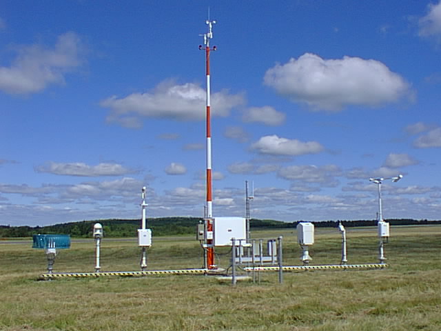
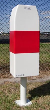
Airport weather stations are automated sensor suites which are designed to serve aviation and meteorological operations, weather forecasting and climatology. Automated airport weather stations have become part of the backbone of weather observing in the United States and Canada and are becoming increasingly more prevalent worldwide due to their efficiency and cost-savings.
############################################
ATIS:
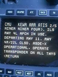
Automatic terminal information service, or ATIS, is a continuous broadcast of recorded aeronautical information in busier terminal areas, i.e. airports and their immediate surroundings. ATIS broadcasts contain essential information, such as current weather information, active runways, available approaches, and any other information required by the pilots, such as important NOTAMs. Pilots usually listen to an available ATIS broadcast before contacting the local control unit, which reduces the controllers’ workload and relieves frequency congestion.
############################################
Weather Forecast:
(Past - Present -Future)

Weather forecasting is the application of science and technology to predict the conditions of the atmosphere for a given location and time.
1 Like
I’m sorry, I don’t understand the question.
The METAR data is used to create the IN-SIM weather… it IS the IN-SIM weather… When using Live Weather.
If you’re using a template or created your own weather, that’s the weather for the whole world as far as I know.
As noted above, Live Weather is a combination of weather created from METARS at airports and MeteoBlue’s real-time weather system model of weather around the planet for everything in-between. The issue being MB’s weather system model of the whole planet would be too big to stream to everyone, so they process chunks of it around your aircraft. Hopefully it’s obvious that’s a big generalization there, as I’m sure there’s a lot going on under the covers to make it all happen.
The advantage of doing this is they are using a very simple to obtain weather source at airports that’s accurate, and where it’s most important to have accurate weather, and MeteoBlue fills in the blanks of the rest of the atmosphere.
The disadvantage is you’re getting weather from two different sources, and sometimes they don’t agree. They are working on improving how the weather changes at these boundaries.
The question is: why the weather reported IN THE SIM is so different from the weather actually loaded IN THE SIM? Why can’t they report the same weather they display to me?
METARS were not part of Live Weather until SU2 last year, and even now, the only parameters from real-time METARS that are currently used are surface wind speed and direction, surface temperature and surface pressure. These values are only injected for airports, and are only used from the surface to about 1500 feet AGL, at which point those values transition to the MeteoBlue model.
METAR parameters for clouds, precipitation and visibility are not used in MSFS. Those come from the MeteoBlue forecast model at all times - though that may change with some of the upcoming updates to the weather system.
The forecast model is much more highly detailed than any METAR for the state of the atmosphere as a whole. Typically a model will contain multiple discrete vertical levels from 2 meters above the surface up to about 50,000 feet, and for each level, there will be dozens of parameters, including wind speed and direction, pressure, temperature, air density, dew point, relative humidity, precipitation, vorticity (a measure of air rotation in the horizontal plane), potential temperature, (theta), equivalent potential temperature (theta-E), vertical motion, CAPE (a measure of stability) and much more.
That is not to say that all these parameters are used by MSFS - but almost any numeric forecast model will contain all the above parameters. The model data for the entire would would of necessity be very large (multiple gigabytes), which is why Live Weather only loads a portion of it at any given time. Based on several tests I have done looking at distant thunderstorms at high altitude, I think Live Weather extends out to at least a 120 to 150 mile radius around the aircraft’s current position.
METARS have their place, and will be “exact” for airport wind, temperature, pressure, and visibility. They are less exact for cloud details.
A METAR might indicate that there is a broken cloud layer at 3,500 feet above the ground, but will give no information as to what specific type of cloud it might be, nor how thick the cloud layer might be. If there is a solid overcast at a certain altitude above ground, the METAR will have no information at all as to any higher cloud layers that might exist, nor will it have any information on wind speed and direction or temperature anywhere higher than the airport surface.
From a pilot’s perspective, the main information of interest in a METAR report is whether the airport is VFR, IFR or low IFR (LIFR). For that reason, METAR reports often contain no detail at all on clouds or visibility if conditions are VFR. There might be a solid overcast at 7000 feet, but since that is well above IFR minimums, the METAR might simply report CLR. Likewise, if visibility is 6 miles or better, that is all the METAR will indicate. The actual visibility might be 6.2 miles, or it might be 50 miles - you would never know based solely on a METAR.
My local airport is at the lowest point in a valley, and at this time of the year, it is very common for dense fog to form around 03:00 and it does not burn off until around 10:00. It is a very localized phenomenon - 3 miles east or west of the airport, the visibility is often unlimited.
AFAIK, the upcoming changes to Live Weather will add the (currently unused) airport METAR parameters for clouds, precipitation and visibility.
2 Likes
Not 100% correct. Current Laser Ceilometers, can often measure multiple cloud levels and the thickness of those layers, and those multiple layers are often included in the metar,

After Klett processing the Laser returns, multiple levels of cloud can be detected.

2 Likes