Off the top of my head Florence, Bologna, Venice, come to my mind.
Pretty much all of them except any in the UK, Paris, 1 or 2 of the one’s added in the Germany CU & a couple of the new Canada updates.
I fly a lot in LA, SF, SD & NYC just because they’re decent quality & cover a large area.
Get FStarter to check out all the PG in the most easy way and compare.
I love my photogrammetry home town of Pensacola, FL (KPNS), especially all of the missing bridges, missing bridge spans and the popular Interstate 10 with missing bridge spans. It is interesting to see cars driving across the water and underneath the bridge going south from Pensacola to Gulf Breeze, FL, however, not very realistic for a photogrammetry city.
I believe it depends on the area; there are some mostly urban areas that have photogrammetric data, but that’s currently limited to IIRC the continental US (CONUS), Canada, various parts of mostly western Europe, Australia, and Japan (see Link to all photogrammetry cities and airports? and the link to a custom Google map there). Everywhere else, unless it’s a handcrafted 3D asset, to my understanding the buildings are autogen via Blackshark AI that takes a look at the satellite imagery and, using various data ported from resources like Open Street Maps, makes a guess at what the building should look like.
While the autogen buildings look believable and have cleaner lines, they can look a bit repetitive, and you can notice the lack of uniqueness compared to the photogrammetry of the real buildings; also, the autogen buildings often don’t look much like the real buildings as seen from the side, as the AI is often trying to guess off of only seeing the roof.
I think most of the photogrammetry is just used as-is, and they haven’t in most cases tried to have a person clean up the geometry and textures to look cleaner than the original point cloud and imagery construct.
I would have to disagree with this. While I certainly don’t know, it seems to me that the PG in areas like Los Angeles has improved over time and it looks to me like the roofs of buildings and some roadways have been better flattened and this makes good sense for two reasons. All of the data creates triangles so if you remove unneeded triangles you get better looking scenery that runs better in the sim…which is what I think we got. but its all my opinion.
Maybe the Pelican Drop caused all the bridges to fall into the sea ![]()
But isnt it better to have PG than none at all? I live in that in between land – so close and yet so far. and the previous place I lived - Dallas TX - hasn’t been done either. Its annoying. But Im happy to have Pensacola with or without the bridges.
Unfortunately, the PG stopped working for me when world update 6 arrived.
Every PG city looks like a warzone of melted buildings.
It worked great before WU6 but hasn’t worked since then.
I’ve tried rolling cache and turning PG on and off and switching servers and every other suggestion people have mentioned but it just doesn’t work anymore.
I know some will say it’s my connection, but nothing changed on my end. What did change was the game, WU6 released.
Or, just maybe it was Hurricane Ivan. I was here when Ivan dropped several spans of the Interstate 10 bridge for real and trapped a family that was , inexplicably, trying to cross the bridge in the middle of the night during the peak of the storm. Now, It is missing spans that were not a result of Hurricane Ivan and there are so many just plain missing bridges and others with missing spans it just makes no sense. But, you may be correct. It just may be caused by those darn pelicans !
Haha! Only photogrammetry isn’t taken from satellite. The clue is in the name. 100s of photos taken at different angles and stiched together as a 3D image with software.
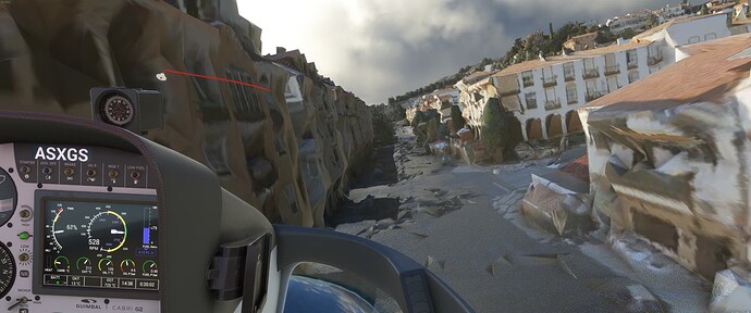
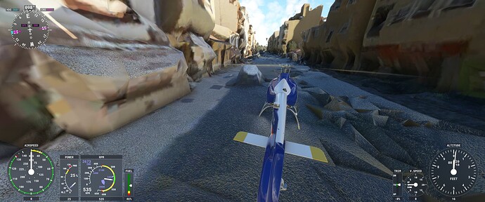
Spent an hour or so taking the Cabri chopper around here. It really is an interesting town, very diverse architecture / colours / styles and lots of little cute details (if you squint) and nestled buildings everywhere with interesting and unique layouts. Tons to see!!
Performance is top notch for the amount of detail here. On the flip-side, I also found the MOST realistic apocalyptic road in Malaga! Check out the realism! ![]()
…mind, blown.
I have hope that Nerf (Neural Radiance Fields) will significantly improve photogrammetry in the future. Maybe MS/Asobo could take a look into the possibilities AI can offer here.
That’s the double edge sword of PG. I don’t know SF well at all, so if I fly over it, I’d not likely notice the missing Salesforce tower, and the city would look fantastic to me, basically because of my lack of IRL familiarity.
It is amazing though, when everything aligns just right; lighting, altitude, good data…the PG can be mind blowing.
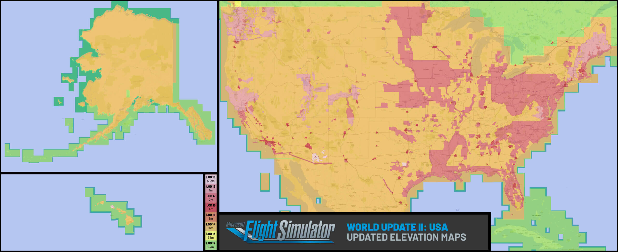
World Update II came with a handy map that showed exactly where the high resolution DEM data was being used. You could see what cities have the highest resolution. Tucson, AZ had 50cm data, for example. I thought including the map was quite useful. Maybe we could get more of those, updated as things progress?
Those are for the DEM data though, not the photogrammetry ![]()
where did you find that? PG or not, its interesting.
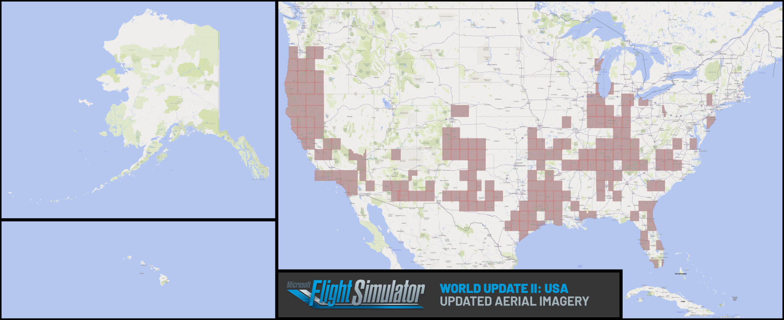
Here is the Aerial Imagery one:
Taken from the post here: [RELEASE] Release Notes (1.11.6.0) World Update II: USA Now Available!
I wish I could understand this better, because I see it written frequently, but I’ve never had any luck at all when trying to improve photogrammetry (especially deformed buildings and bridges) by flying over the area several times with rolling cache enabled. In fact, as my Internet feed is over 400 Mbs, the rolling cache doesn’t seem to improve anything besides photogrammetry, either. I leave it off.
Yes, Bunbury is pretty good! I live “down the road in Bridgetown”.
That’s a good point. It would be worth the investment to find a way to detect skyscrapers (they have the data) and apply a reflective material to the PG on those. That would really help!


