I just found out I have an extra tablet, so I’m planning to put it to use.
What are the best mobile methods of getting airport charts/sim flight planning resources?
Android tablet btw.
Thanks in advance
As far as airport charts go, I prefer to print the latest PDFs (2 per page) and put them on my little 6"x9" clipboard.
Haven’t used recent android apps because my tablet is a dinosaur - won’t run current apps. Used to use it as a GPS in flight sims, and a shift indicator for racing games 
Avare is free and might have charts, sim integration (unknown if working yet)
Navigraph is not free and has charts/maps and sim integration working
+1 not free, but worth it, if you are planning to use them frequently ! It´s a good tool for using it semi sim professional ![]()
I m using navigraph…and that’s really great, charts, sids, airport map, etc…10 dollars a month but really worth it…
1 Like
Also check out FltPlan.com.
Their free account let’s you view charts, checklists, flight planners, fuel planners and a lot more.
FltPlan seems great for US airports!
Is there a free equivalent for EU airports? What about the rest of the world?
Just jump on the airnav.com website if flying in the USA. Has the PDFs for every SID, STAR and instrument approach.
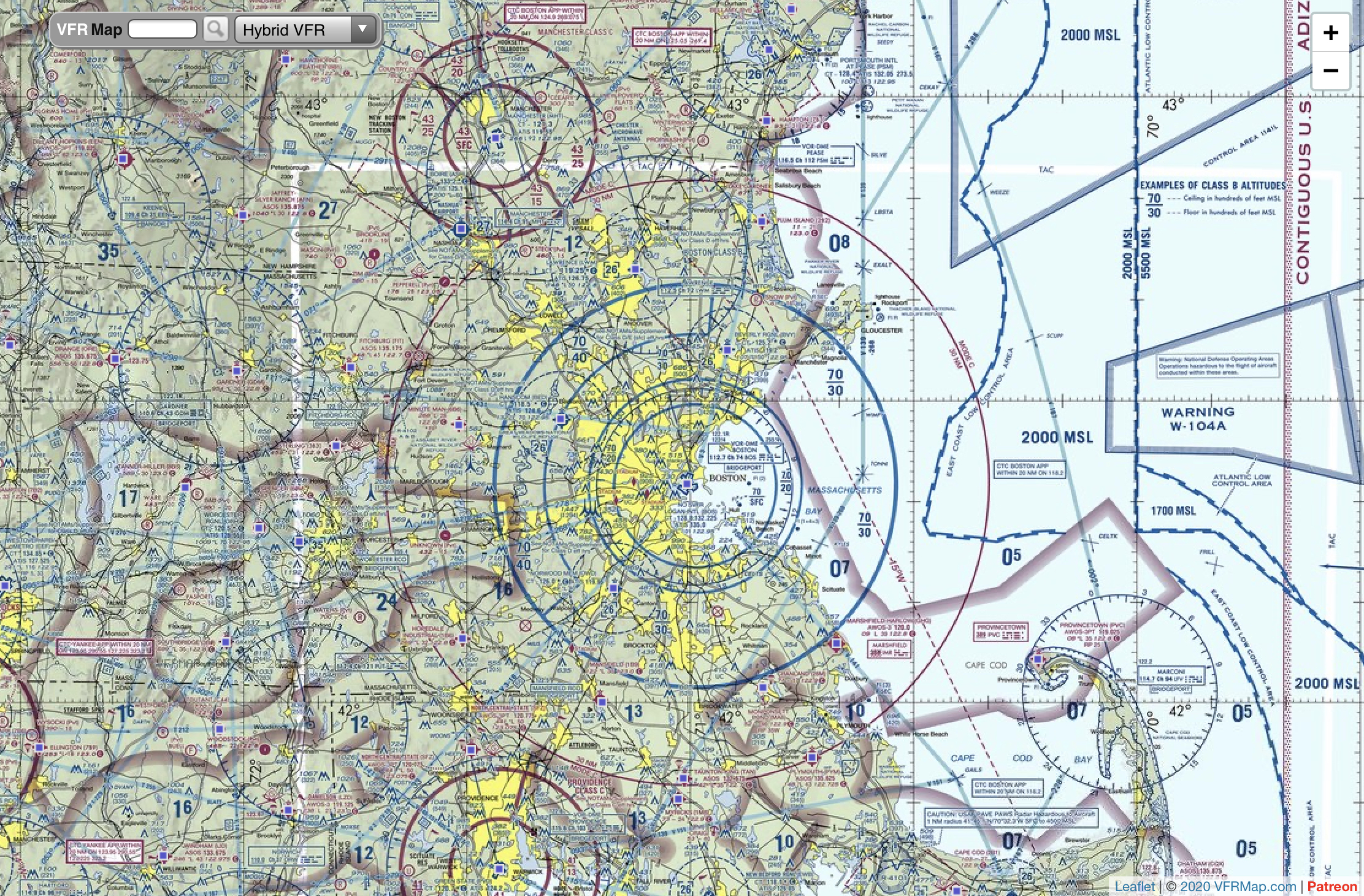
Skyvector.com has all IFR routes, waypoints, and VFR charts for USA
Both are free
I open up the tabs that I will need preflight and have everything in front of me
2 Likes
Avare has everything, all charts, chart supplements, weather, all free.
It would be appreciated if you’d donate, however, it’s just a bunch of guys developing it, as part of a non-profit organization.
It’s a moving map, and there are people who’ve gotten it to connect MSFS to use it just like you would in the cockpit. I, unfortunately, have not yet gotten it working. The instructions out there are sparse, and don’t discuss exactly which port to use, and how to know if you’re tablet/phone/whatever can see the data stream. I do have it connected to MSFS and it is streaming NMEA data (I don’t know if you should choose aviation format, or just check all the data, tho).
I wish somebody would write a detailed step by step, including how to know which port and how to know if it’s open.
I’m an AirNav.com fan. It’s free.
https://www.airnav.com/airports/
Just type in your airport code and a page comes up with stuff like everything you’d ever need like frequencies, hours of operation, runway type, fuel available, radio navigation aids, etc., etc. and items such as sectional charts which are zoomable and can be panned…
…and airport diagrams…

Everything is FAA up-to-date and all in one place, kinda a one stop shop sorta thing and like I said it’s free.