Betsiamites River - weird Game of Thrones style wall in Canada

:wave: Thank you for using the Bug section, using templates provided will greatly help the team reproducing the issue and ease the process of fixing it.

Are you using Developer Mode or made changes in it?

Have you disabled/removed all your mods and addons?

This is with stock MSFS scenery.

Brief description of the issue:

I was just flying over Canada and I saw this.

This is the Betsiamites River - somehow its height has been entered incorrectly along its whole length.

Provide Screenshot(s)/video(s) of the issue encountered:

ICAO or coordinates (DevMode > Debug > Display position)

48°58’23.9"N 68°52’53.0"W (48.973305, -68.881388)

Detailed steps to reproduce the issue encountered:

PC specs and/or peripheral set up if relevant:

Build Version # when you first started experiencing this issue:


:loudspeaker: For anyone who wants to contribute on this issue, Click on the button below to use this template:

Do you have the same issue if you follow the OP’s steps to reproduce it?

Provide extra information to complete the original description of the issue:

If relevant, provide additional screenshots/video:

1 Like

Quebec wanted to build a wall a long time ago to keep everyone out, the rest of us wanted them to build it so we could fill it with water :wink:

4 Likes

I can’t believe you guys live that close and have never heard of The Great Wall Of Calgary?

1 Like

Once the data load in properly with the servers running at proper capacity I expect all those issues will disappear. Sorry to spoil your fantasy my dear Quebecians!

Hello @Pr0metheus1962 ,
Do you have the coordinates for that?

2 Likes

Winter is comming !

1 Like

Winter never left…

1 Like

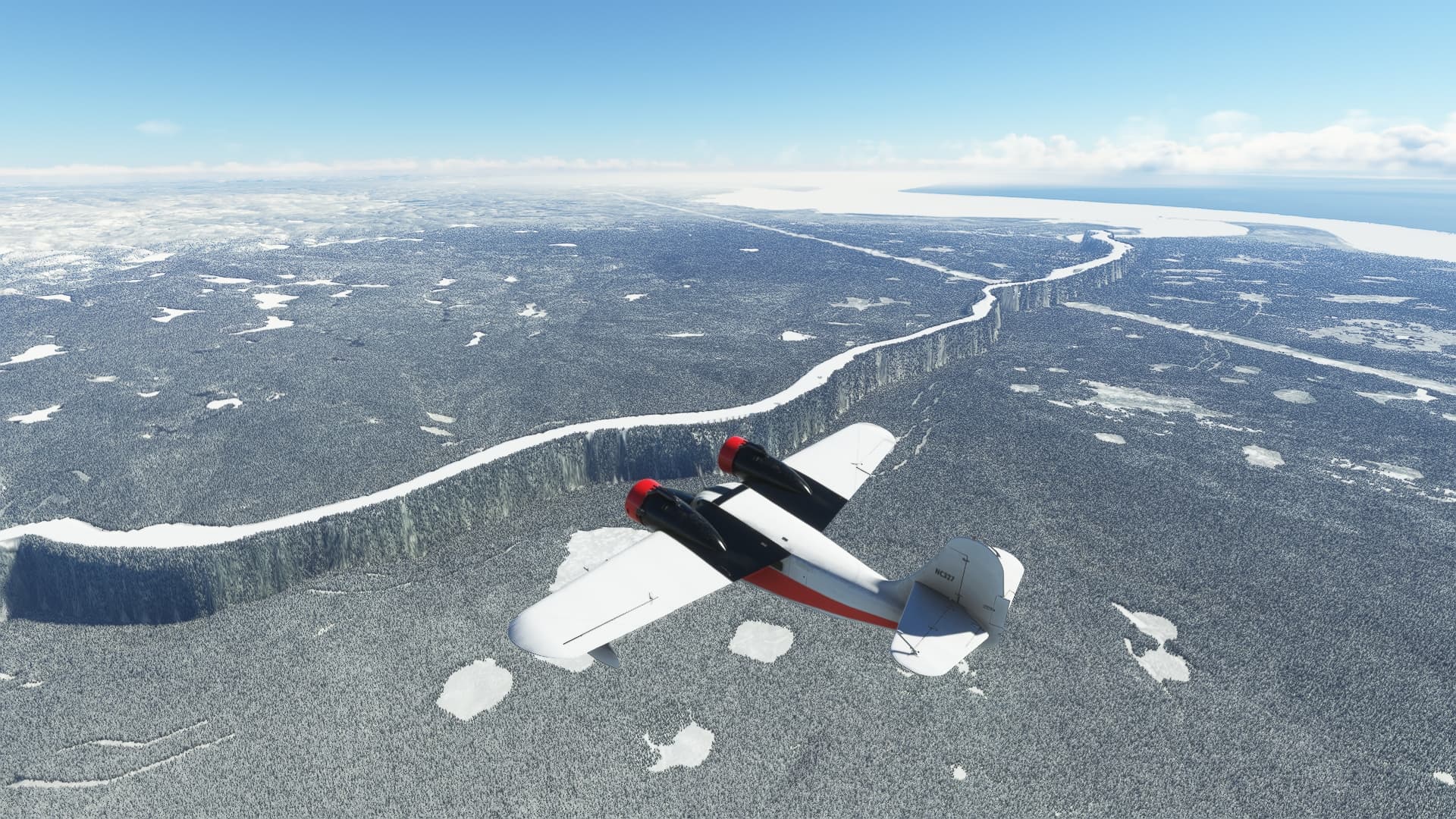
Yes. The image was taken at 48°58’23.9"N 68°52’53.0"W (48.973305, -68.881388).

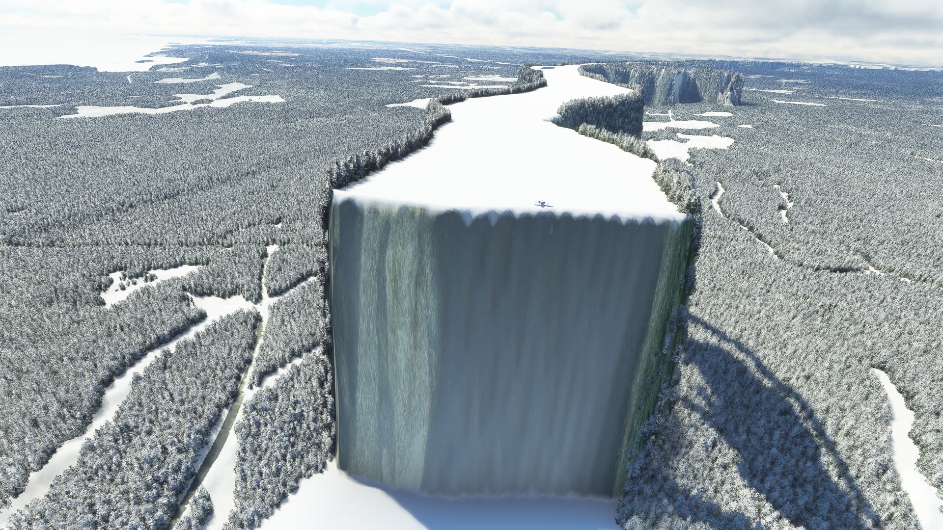
I was mistaken - it’s the Betsiamites River.

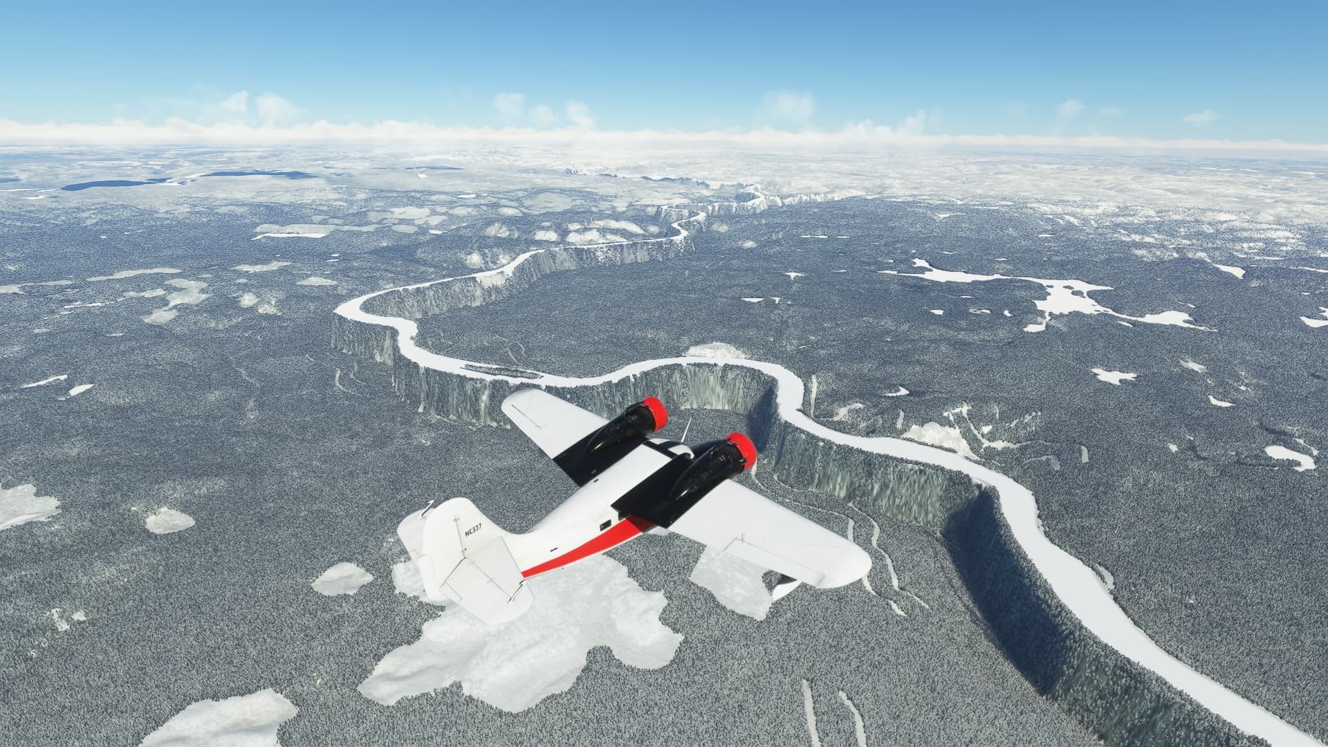
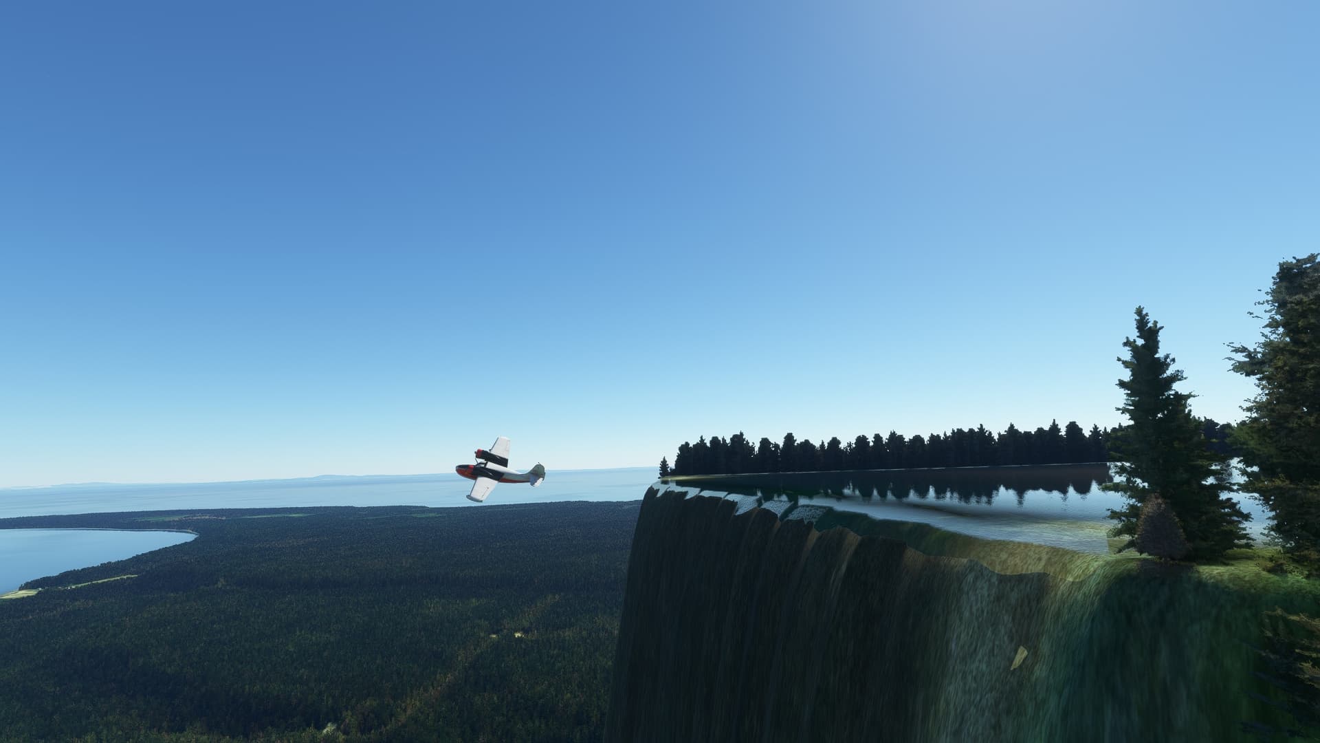
I just spent a few minutes exploring it. It’s actually quite pretty. It’s like a huge natural aqueduct. It goes all the way from the lake in the north, where there’s a dam, to the St. Lawrence River in the South. I landed on the lake. It looks like when the river was created, they used the altitude of the top of the dam for the river.

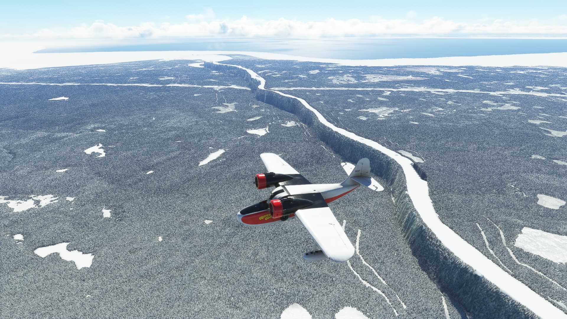
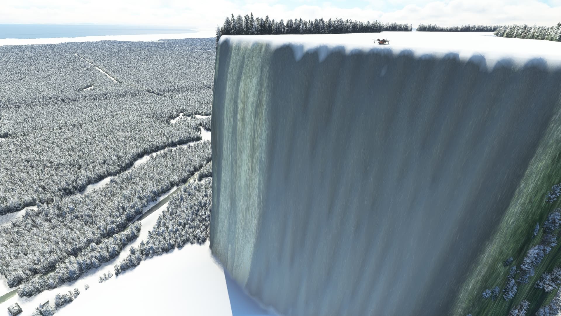
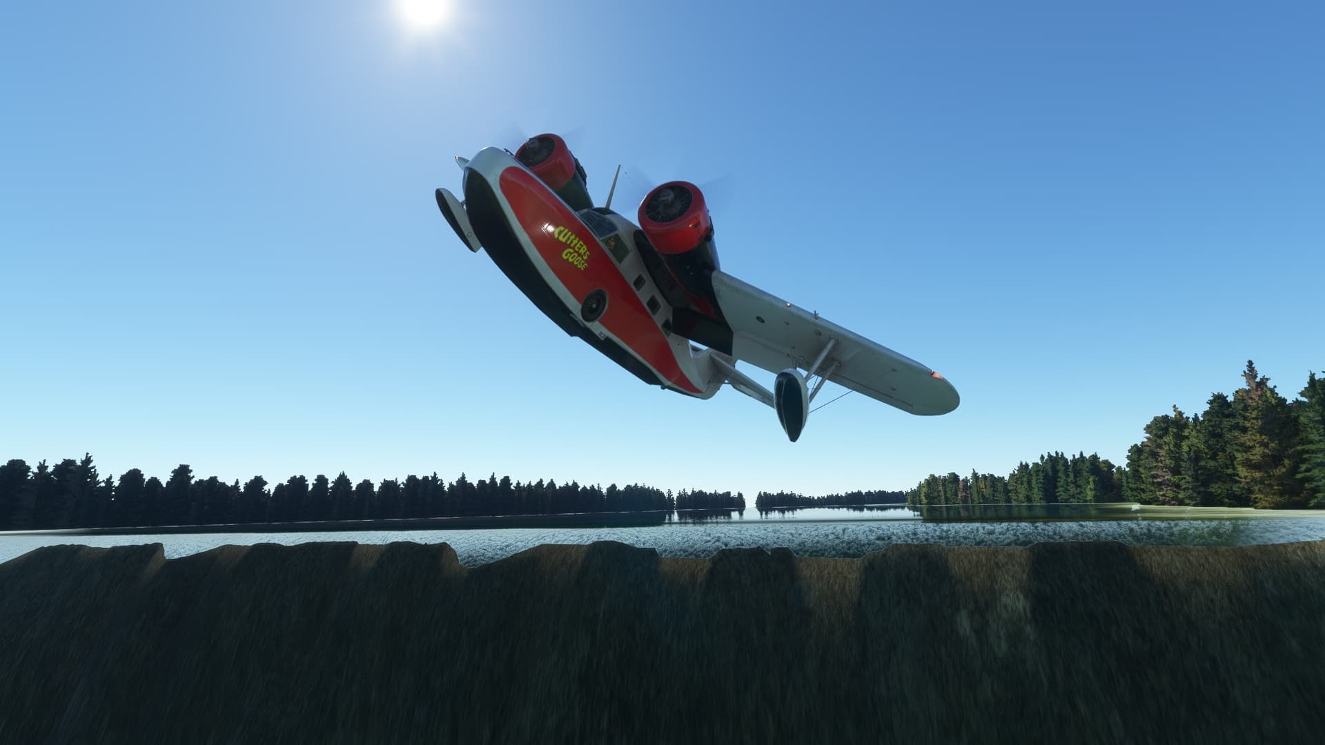
A couple more pictures. These are taken at the southern end, near the town of Betsiamites. That’s my Grumman Goose at the top of the ice cliff. You can land on the ice in winter, and you can (if you have an amphibious aircraft) land in the water in summer.

Shouldn‘t you have used a Dragon Rapid to overfly it?

1 Like

LOL! Yeah, maybe.

Taking off from the edge (summer or winter) is a blast.

And you can perch on the very edge, then full throttle and dive off and recover before hitting the ground!

1 Like

We’re in trouble if you see this