Nearly all of us are quite sure, that Google maps is more exact and better than Bing Maps, which comes from Microsoft and is used therefore by FS2020.
But Bing maps has some outdated images which sometimes are very disturbing:
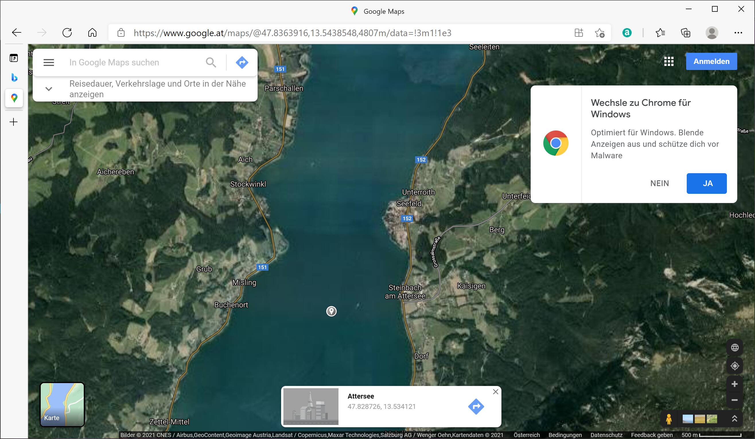
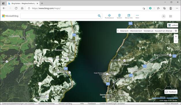
In Austria there is a lake called Attersee. It is liked by people for bathing an you easily have over 30 degrees Celsius in summer. When you fly over it you find SNOW around it. I have checked: This is, what is shown on Bing maps. I have found some othger places where Bing maps also show snow. This is ok when it is on higher mountains, but not around a lake where you bath in summer.
Compared to google maps, you find no snow. The upper one is Google, the other picture is Bing.
What is Asobo going to do . Snow in summer is frustrating !
Update of the imagery. Normally that‘s done in the world updates, so we might have to wait for an Austria update. Some people have reported that the imagery in areas that weren‘t part of a world update were updated as well. I personally haven‘t seen this so I can‘t say for sure if that is the case.
You realize that there is no implementation of seasons yet in the sim?
And how gathering the imagery of maps is working? They will not give you a set of maps for every season. Sometimes the planes doing that shots flew in spring et voila, there was snow… Nothing you can do about that!
There are seasons . Search for Bijan studio 4cseasins. I have purchased them. Very good work. But they mainly work with trees. Bijan seems to have found a method to colorize the ground as well. But he does IT by Hand. And it is not his job. Snow in Summer is OK at a height above 3000 meters, but not below.
Question of priorities. I am happy with some snow here and there, as long as there is a map existing with an appropriate resolution. In some areas of the world (asia/south america) you will find sometimes not much more then height data and a few structural elements but no imagery. Nearly as bad as the fake maps of Xplane…
Same sort of discrepancy on coastline: the area where I live has long beaches. Some pictures are taken in summer, some during “off touristic seaon”. Result is that somewhere there are rows of big umbrellas, others are free. And this occurs on Googlemaps too. I think that this is something we have to forgive to both picture providers and simulator programmers…
I just flew over Sierra Leone, tropical region in Africa, and on the smooth hills there, in the middle of the forest, there are white stains. Clearly very low level clouds typical of tropical areas occurring even in clear days. No way to get rid of them in the aerial photos.
It’s not only snow. Also a lot of ‘backroads’ which become lakes or dry lakes which are full of water. Some deserts are ‘green’ instead of brown and rocky.. I think it will take years to update this all.
For instance there is still the construction of breaking down the old stadium just before LAX, while the new stadium in real life is already finished. It’s not that the real stadium should already have been in MSFS, but the bing map should have been update to build the stadium at least
Both Bing and Google Maps constantly update their photo imagary but the world is a big place and I imagine some countries and cities are prioritised. They also periodically update their satellites and hardware so I guess we should all take comfort in the fact that the later our favourite places get updated the better they will be … well supposedly
Just took a flight over BAKU to see the Olympic stadium where Wales are about to play Switzerland (Come on Wales!!) and was presented with a series of square reservoirs where the stadium should be. The stadium was built in 2015. Just how old is the Satellite imagery in FS 2020?