…it looks fine! THIS is what I want in the game. Why is it not doing this? Why is it still generating ugly bedcover quilt pattern?
Sidenote
Im aware that in some parts of the world Bing Map is very poor quality but in this case its actually good - but still the game wont stream it.
The world updates also include aerial imagery, which is almost always better quality than satellite imagery.
I’m a bit out of my depth here, but it’s also my understanding that the further away you get from the equator, you will find that lesser quality satellite imagery is available. Canada for example has notoriously awful satellite imagery coverage. Not only do you have to contend with snow and ice and clouds you have a limited time during the year when the sun is high enough in the sky to provide adequate lighting.
Any reason other than blending and color matching between different imagery sets for not using the Bing Maps imagery database directly? Namely, doesn’t that mean the snapshot of Bing Maps is a whole separate file store of several petabytes in addition to the current Bing Maps? Is it some sort of stability concern, or do MSFS and normal users of Bing Maps have enough traffic to affect each other’s bandwidth? Might be a good question for a Dev Q&A or something…
The tree positions and some of the scenery is generated from the satellite images, and extracting that data is slow and can’t be done in realtime client-side.
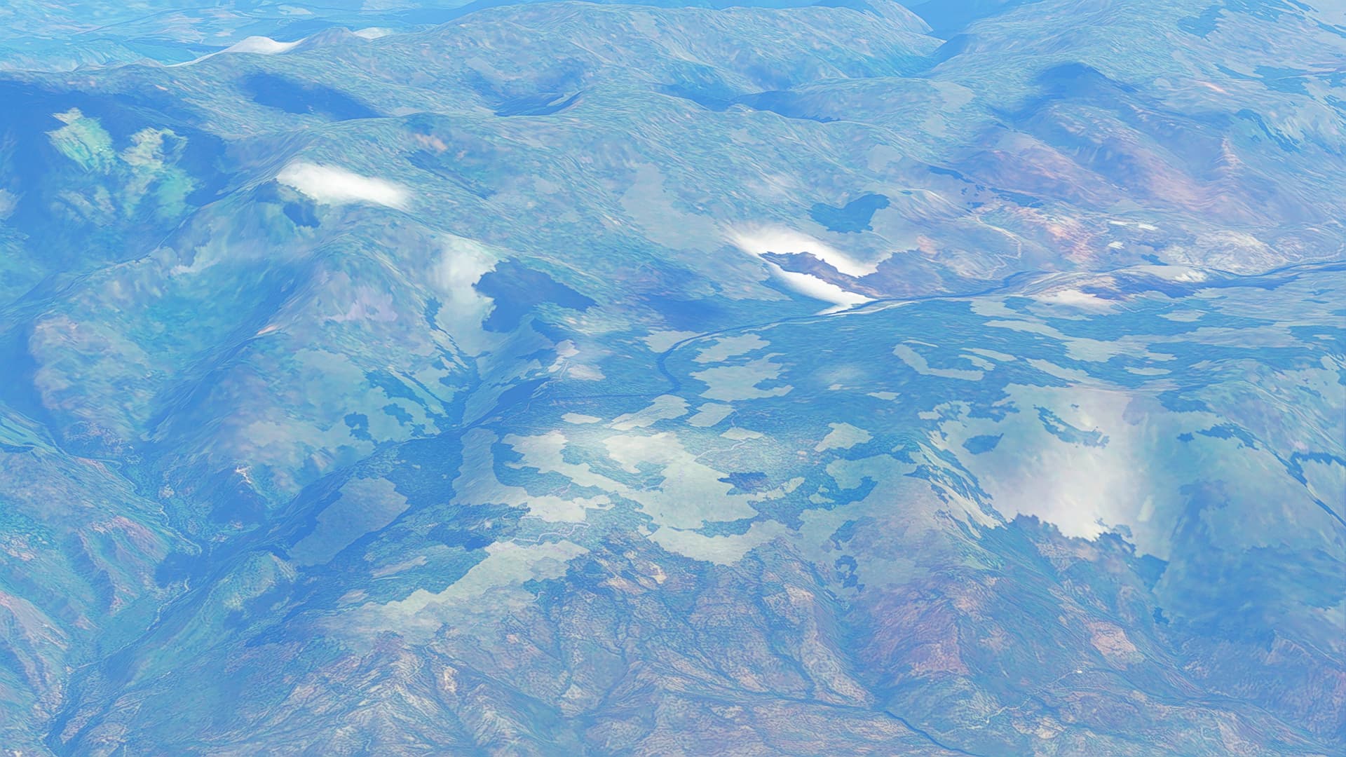
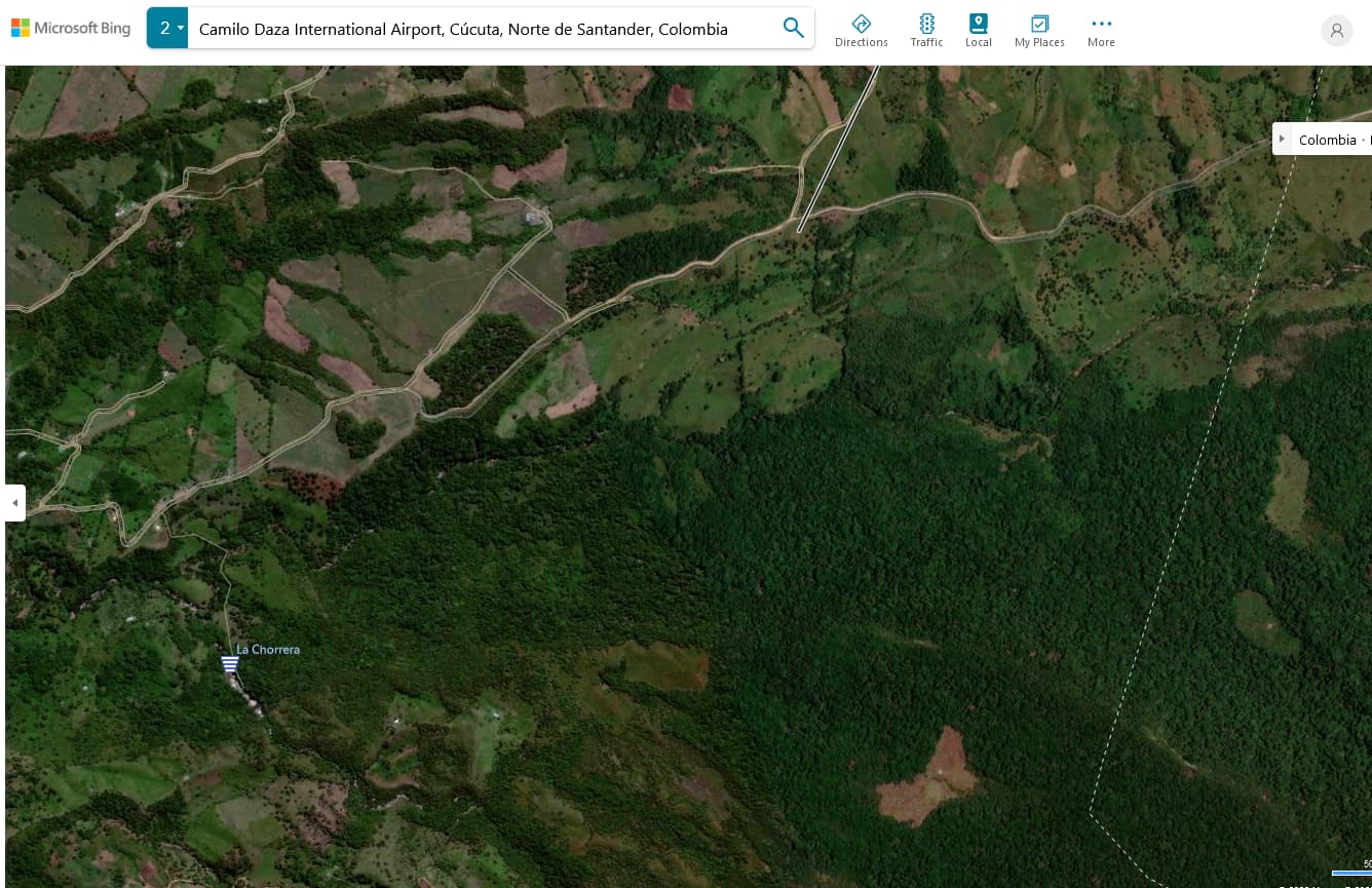
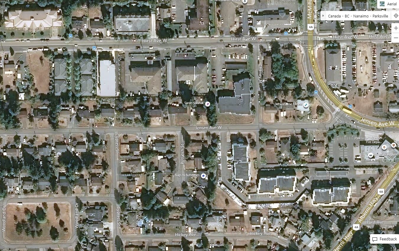
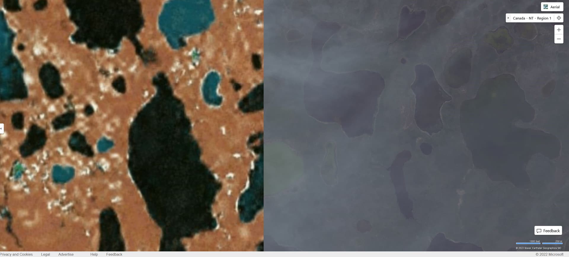
Generally, populated areas aren’t so bad as more attention is given to getting decent, unobstructed satellite imagery, but step off the beaten path a bit and it can vary greatly. This is 300kms NE of Parksville, it is a mishmash of low and high quality imagery and cloud cover.
You are 100$ correct. The flight I did - it felt like I was in FS2004 not MSFS.
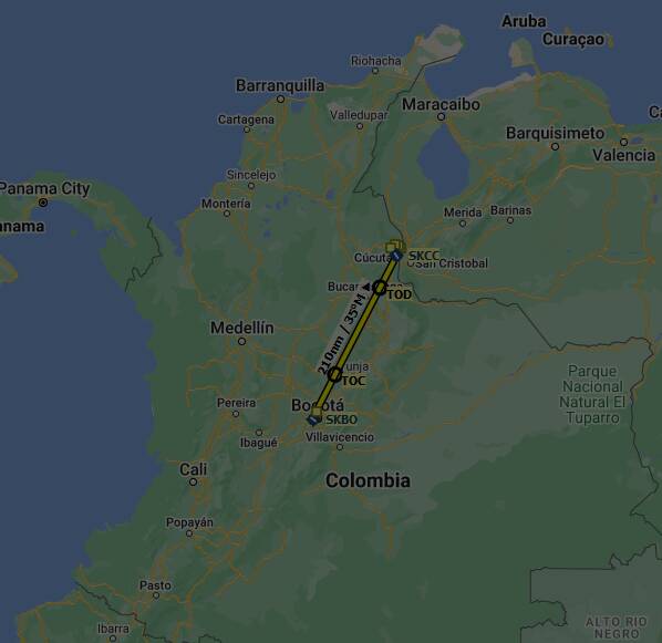
A real pity because IRL it is a fantastic part of the world. I saw documentaries of flights over Colombia and also low flights along the coast. We cannot enjoy this in the game and I feel it will be many many years before we can.
Will just forget about South America in the game. Wonder what other parts of the world are this bad.
Just to add something on top, there are also restricted areas Bing is somehow not allowed to display.
This is something leading to such areas too when it comes to military areas and airfields in Europe. In these cases one may also see offline textures usually.
Yes but not just military, they have to get permission of the relevant government. Btw MS have recently sent up high res satellites that can see through clouds and smog with little loss in fidelity … I don’t expect MSFS2020 to be first in the queue but I hope someday it will surpass Google Earth.
And by relevant governments I mean it could be political suicide if recent high res images of ehem e.g. ‘crop selection’ and deforestation etc. were exposed to the world’s public.
To answer your question, the team is very aware that South America is pretty poor, and there is a line asking to get it fixed and making it better is on the development road map to get fixed eventually (I forget if they’ve given a date for at least some fixing).
As noted above, the earth is huge, and processing Bing Maps data for MSFS is an extremely time consuming process, so they can only do “small” areas at time. They tend to prioritize fixing areas where they have the best data. Unfortunately for you, there’s not as much data available for the southern hemisphere as there is a lot less population and land mass in the southern vs the north, so there’s just not as much good commercially availble data compared to the northern hemisphere. But, as I noted, it is on the roadmap to improve it.
I’ve deleted the ~60GB fs-base-cgl package and have yet to notice any issues, but it still makes me wonder what will happen when I visit these areas mentioned.
But it´s not “FPS-friendly” enough. “FPS is everything”!
Woe to those who dare dreaming of enhancing graphics quality to the next level, with mountains that look like thanks to real high polygon mesh scenery and other eye candy.
FPS might fall from 60 to unplayable 50 or so.
The whole internet would became a meltdown pot about “how uplayable Flight Sim has become.” “I run everything on medium and 8k and suddently I have unplayable 59 FPS stuttering! BADLY OPTIMIZED!! Worst sim ever!” would appear in all forums, YouTube, literally everywhere.
No one dares enhancing the graphics since “FPS, FPS, FPS, FPS, 144FPS, 200 FPS, FPS above everything, I cannot play lower than 256 FPS!” has become the new god and supreme ruler of gaming since 2017 or so