Due to the fact Google is not in Flightsim business we have to live with that. I can’t imagine Microsoft will buy google integration having Bing in the portfolio. And neither the other way around google is giving one of its core technologies to Microsoft. Only with ads at skyscrapers or billboards all over the place. ![]()
1 Like
Hello everybody …
Do we have a list of the cities built with photogrammetry in the simulator?
This has been asked since day 1 basically. And while I am not aware of any “in-game solution” what you can do is open the “Maps” (?) application which comes default with Windows 10 (yes, such an app does exist ;)).
In that app there is the option (somewhere - can’t remember myself, and am “away from Windows” right now) to list all cities with photogrammetric data. While that list is not necessarily 1:1 what is available in FS2020 it is certainly a “superset” and hence a good guideline.
1 Like
Well, its a matter of investment and market share, the bing maps team is about 10x smaller than the google map team. Google maps have been commercially savvy for several years whilst Microsoft has been pushing for this initiative for a while, with a much smaller budget. Having MSFS as a customer is a really good thing as the exposure and use will multiple, this somehow puts Bing on the map of other businesses, who knows if tomorrow companies may pay for having billboards, or promos for visiting sites, countries and states promoting turism using the platform and MSFS (specially now that they have the xbox community), who knows as at the end of the day, the bigger the audience, the bigger the demand for better quality. I hope this pushes the investment in Bing maps and its team, to get a better scenary for us each day.
Big kudos for the MSFS team in betting to create a sim around this data, lets not forget that they have been the first ones to do this, creating the most inmersive scenery of all time. A lot to improve for sure but is a team that has broken the previous standard.
Happy flying everybody!
3 Likes
Thank you.
Your suggestion is correct.
The maps application has the option of displaying a list with cities in 3D.
This is what we talked about
3 Likes
Here as well
2 Likes
Hi Everyone,
Fly at San Diago Int KSAN Airport.
You will see many ships docked with large trees growing on them.
Here is a photo.
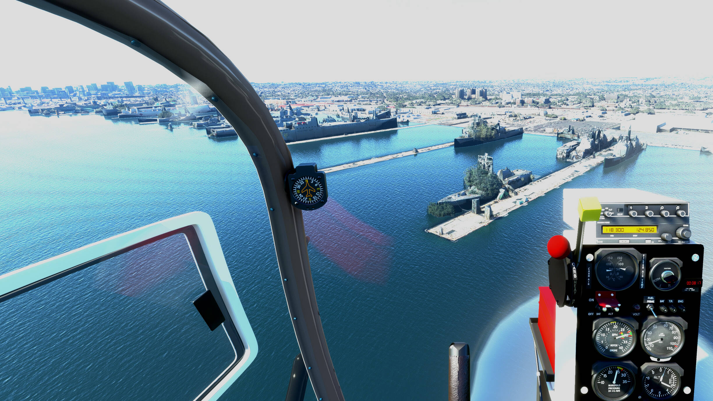
There is nothing wrong with that: the Navy is doing some larger “camouflage exercise”. Or they’re celebrating Xmas, who knows… all very top secret stuff they’re doing…
4 Likes
Lol. Comedy gold!
They really do need to tweak the algorithms which place tree’s and foliage.
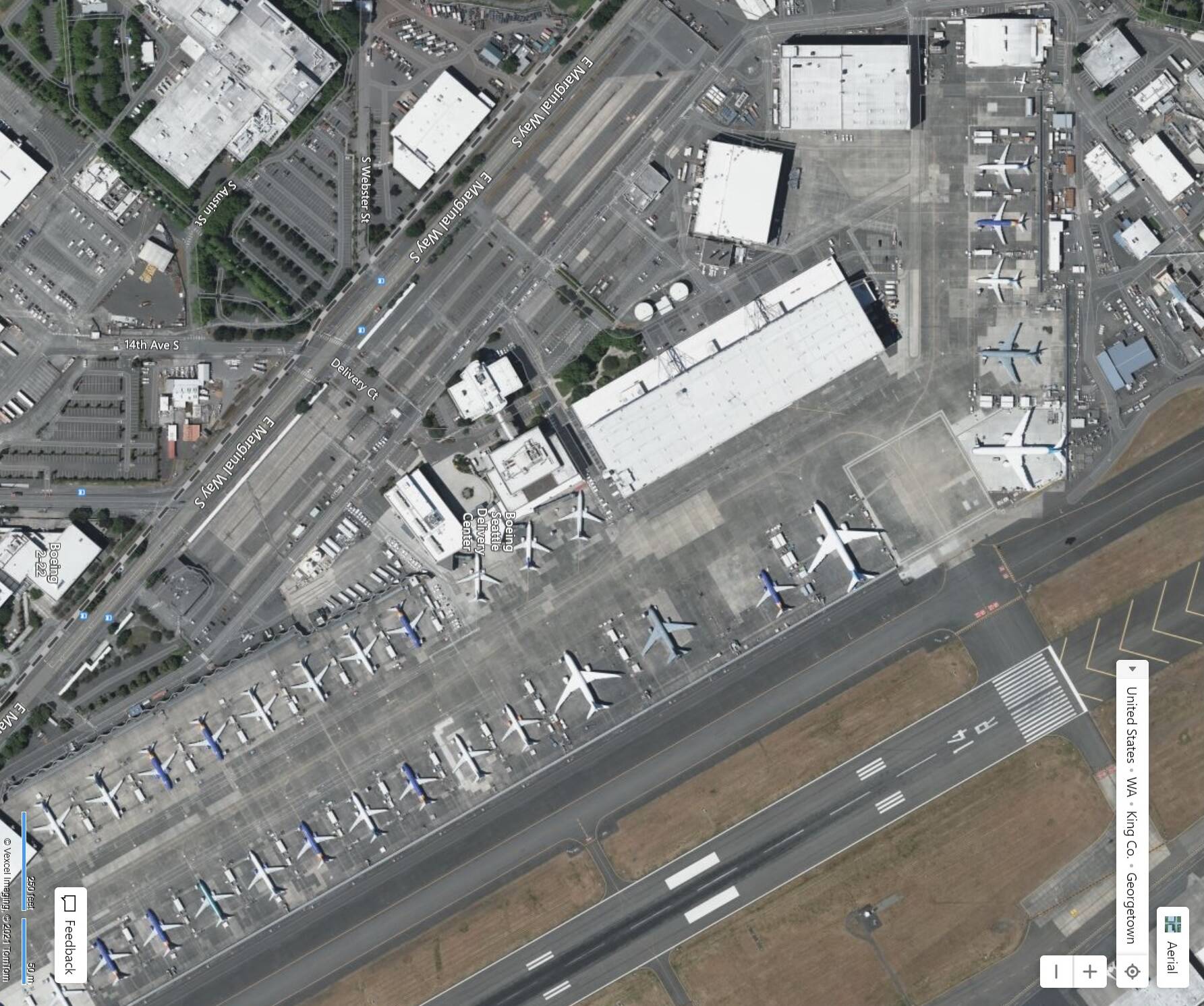
I realize that Photogrammetry is a limitation for the software due to Microsoft’s need to bolster their Flagging Bing brand, But it appears they are not using Bing Maps for certain areas. This is Bing Maps Seattle Delivery Center (on KBFI)
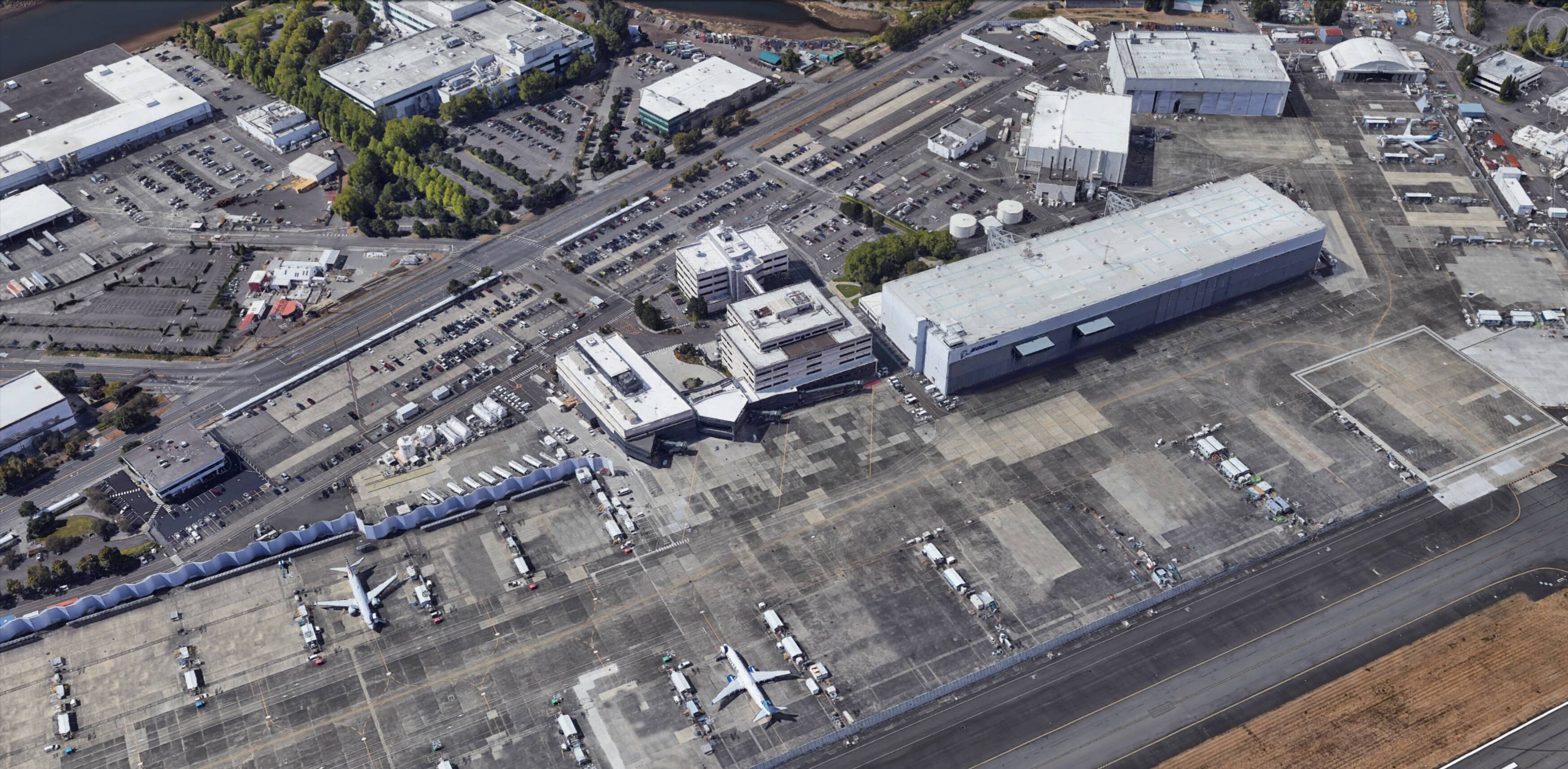
This is Google Earth - approximating the angle of the MSFS Screen Shot coming up
Finally this is the screenshot I took I took (from my Savage Grravel - which is an amazing aircraft!)
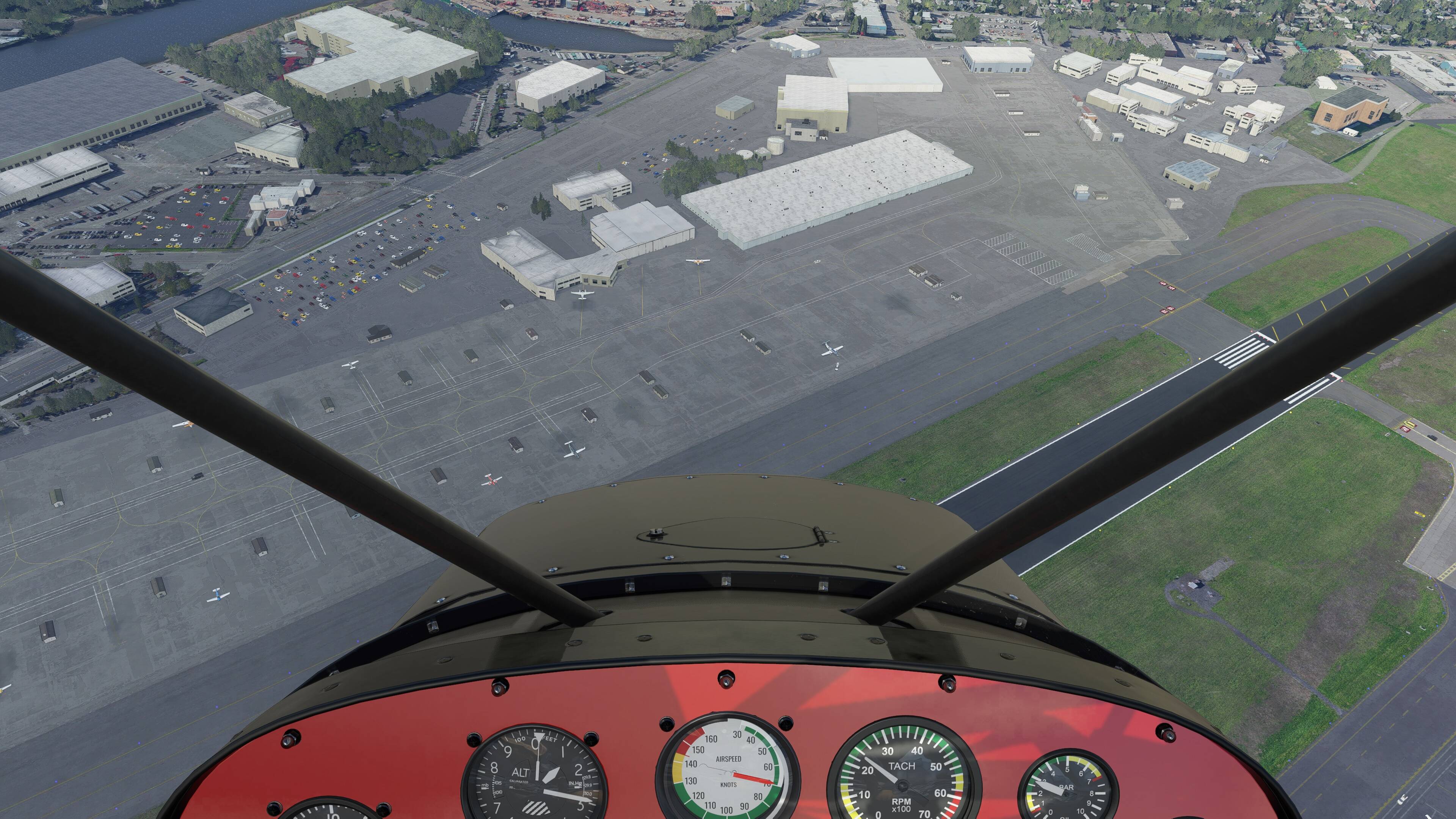
You can see elevation is bad from the start - and there is no checkerboard on the north side of the B52 hanger (3-390 Highbay) the scale seems off. Try fitting a 747 in the hanger? It might barely be tall enough for a 172 (if equipped with smaller tires)
You would think that this area being in Seattle, and near Microsoft and one to the highest volume deliverer of commercial airplanes would get a little bit of love
1 Like
My vote is to ditch photogrammetry totally!
http://www.migman.com/sw/ms-fs-2020/photogrammetry.php
All it takes is one click and it‘s disabled.
5 Likes
But my experience has been that if you turn PG off:
- it doesn’t substitute autogen at the same level as is present in non-PG areas
- the hand created 3D models also disappear
1 Like
Ok, I wasn‘t aware of that. That‘s weird. I personally have mixed feelings about PG as well. Sometimes it looks great and sometimes it‘s a complete mess. But all in all I think it‘s an innovative tech that should not be abandoned as it has a lot of potential. Also, many people seem to like it.
1 Like
Don’t even think about it
3 Likes
Yes, they do.
PG in some areas doesn’t look so great if you get too low, but from 1000 feet or higher it’s OK. In the RW you wouldn’t be flying over it any lower anyway.
I do get the feeling that sometimes it looks better than others and suspect that high loads on the MS servers at certain times might be the cause.
I also have a lot of freeware PG on disk and the quality varies, but clearly that is not related to server speeds.
For me, just having PG takes the sim to the next level and I hope we will see much more and much better quality PG in the future. I I have never considered for one minute to turn it off.
2 Likes
To me the biggest issue I have with PG is that every city looks overly grey. If you look and compare real aerial photography you will notice a lot more colours and shadows. Much of the browns, blues and white have gone missing.
My hope is that with DX12 they can add in more colour, shadows and reflections that you see from buildings while flying. Some of those glass buildings are amazing to see.
Please get rid of the drab grey cities
6 Likes
+1 for this!