Cannot Find Blarney Castle In Ireland

Yeah, sorry if I’m over-simplifying or over-explaining, it’s just hard to know someone’s level of comfort with all this so I’m trying to be thorough. I overlooked your experience with XP11 so that’s all good.

If you click on the point of interest on the map it will give you co ordinates in the top right, eg

Unfortunately it seems you can’t copy them, you’ll have to transfer them manually.

In Bing Maps, you can right-click at any location, and at the bottom of the menu you should see the lat/long, and a hand “Copy” button:

image

The Win10 Bing Maps app. works a little differently. If you right-click and drop a pin, you will see the co-ordinates at the top left, which can be highlighted, and copied into the clipboard.

image

You can then paste this into the search box, and add them as your destination, arrival, or click Add to use as part of your flight plan.

image

OK, I did as directed using St. Andrews Castle, located in the MS Community Folder. GPS appeared in t he upper right hand corner as 40 degrees 09’ 28,.34" N 76 degrees 36" 35.59 W. Set as departure and nothing that looks like the castle was there. Found these on the web - 56° 20’ 6.194" N 2° 48’ 22.835" W.
Which is correct.

I tried the Bing Map and and could not copy those to the search box.

Sorry to be so dense here.

In my screenshot two posts up, you can see the co-ordinates which closely match the ‘correct’ ones in your post, so I don’t know what you are doing wrong.

On Bing maps I had to right click, click ‘Copy’ and then also CTRL + C. Don’t know if that is normal.

No worries. Look at my second image. You should see the co-ordinates there, with numbers beginning 43, and -79.

That box appears when you right click in Bing Maps, the Win10 app not the website, and drop a pin. You can drag the mouse over those two numbers then CTRL+C that into the clipboard, then Ctrl+V into MSFS.

I see that the coordinates in your post come close to what I found on the Web. I will try those. But this begs a question. I have names of the points of interest in my community folder. I have looked at the data in the five folders for St. Andrews Castle and there is no evidence of coordinates. The JSON files can be opened with Notepad.

  1. I don’t think there is any way for me to plan a route for these POIs except by looking them up on the WEB, and creating POIs in LNM.
  2. I have to assume that the sim gets it location info either from the custom or from the PLN file I create with LNM.
  3. Don’t see how Bing maps work at all for the custom option as all of the sites listed in my community folder are on the Bing Maps.

The beat goes on,

You don’t need to use LNM at all if you don’t want to. What I suggested works. You find on Bing, or Google, the location, drop a pin or whatever method the mapping tool in question uses to generate the lat/long, then paste those numbers in to the search box. You will see it appear as a little pin. Click on that, and it will move to that location on the map. A menu will be there where you can click “Add”, to add that location to your flight plan.

Yeah, as @hobanagerik says, it might be best to focus on one method for the moment. Why don’t you try this exercise, and we can get to LNM etc later?

Go to the World Map Screen and select Dundee EGPN as your starting (FROM) airport and select Crail EG0A as your destination (TO) airport. Then, under the picture of the plane, select IFR (Low altitude airways).

Now look at the first POI we can see to the east - Broughty Castle. If you click on it, you can see the option to ADD it to the route:

This results in the POI being added, as so:

Now do the same for St Andrew’s - click on the POI and select ADD:

Now you have a flight plan that includes both castles. Click FLY and you should be good to go.

Can you try this before doing anything else with LNM, Bing etc?

Let us know how you get on!

IIRC you do not get the option to “Add” a waypoint until you have a departure, and arrival set.

OK, I took off from Dundee and pretty much east until a got a pointer to Broughty, followed it and found it. I never found St. Andrews, got a series of pointers. log, li, lag and finally ended up at the destination airport. I never got a pointer to follow for St. Andrews. I tried following a course based on the compass rose trying to approximate the path that would lead me to the st. Andrews pointer. But I did create the the flight plan. I do like LNM because I can follow the flight plan.

1 Like

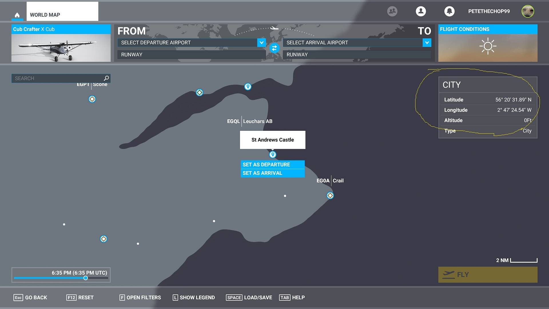
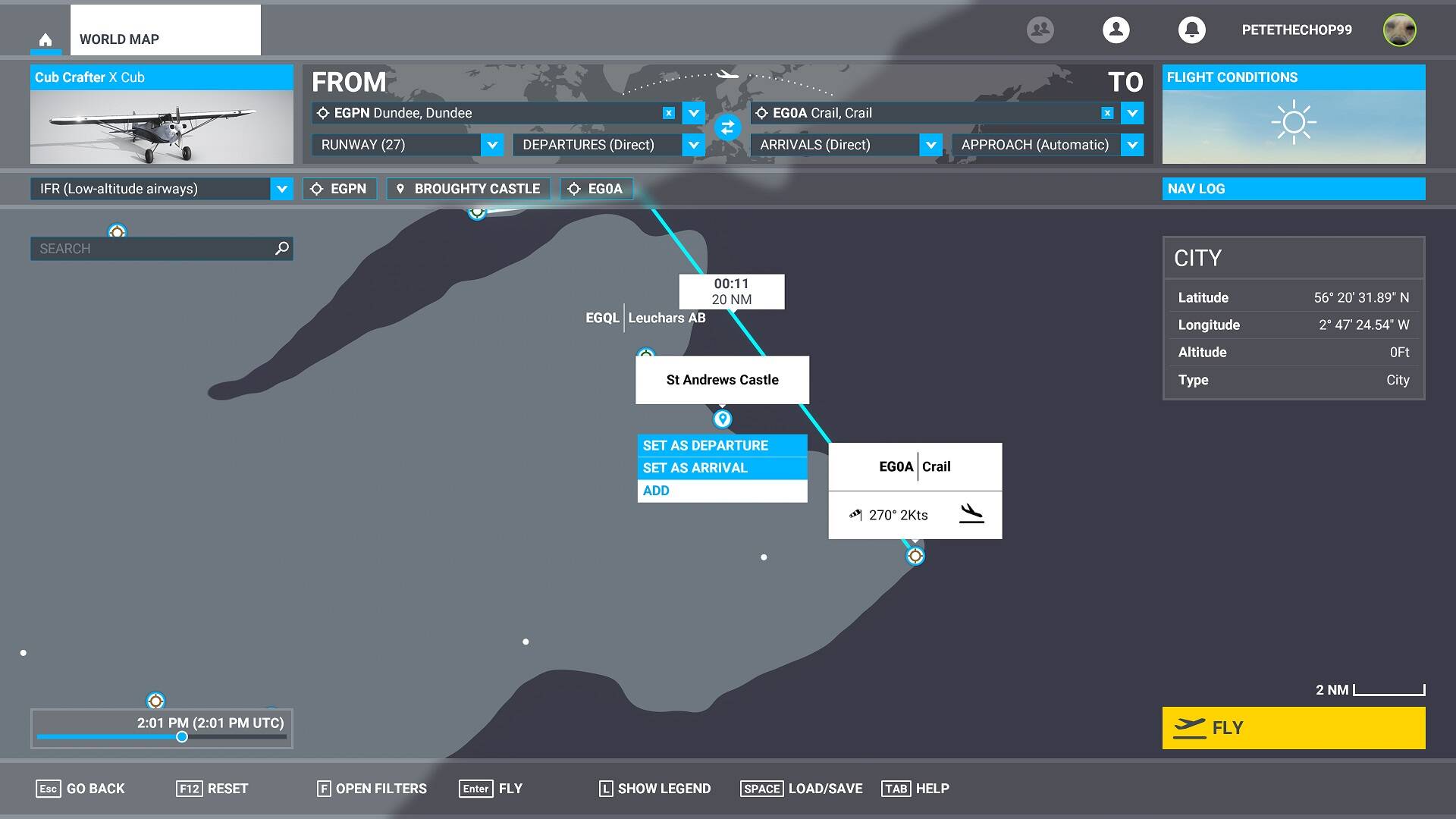
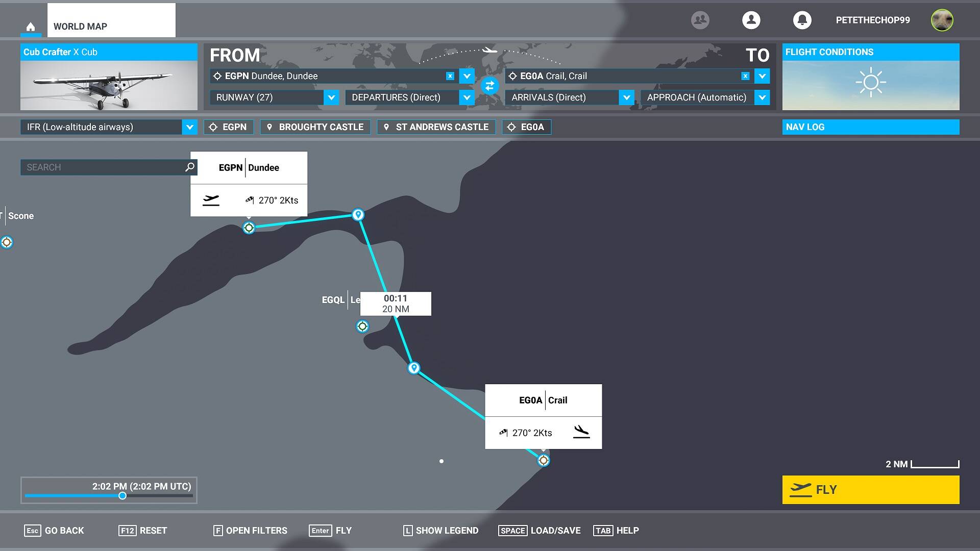
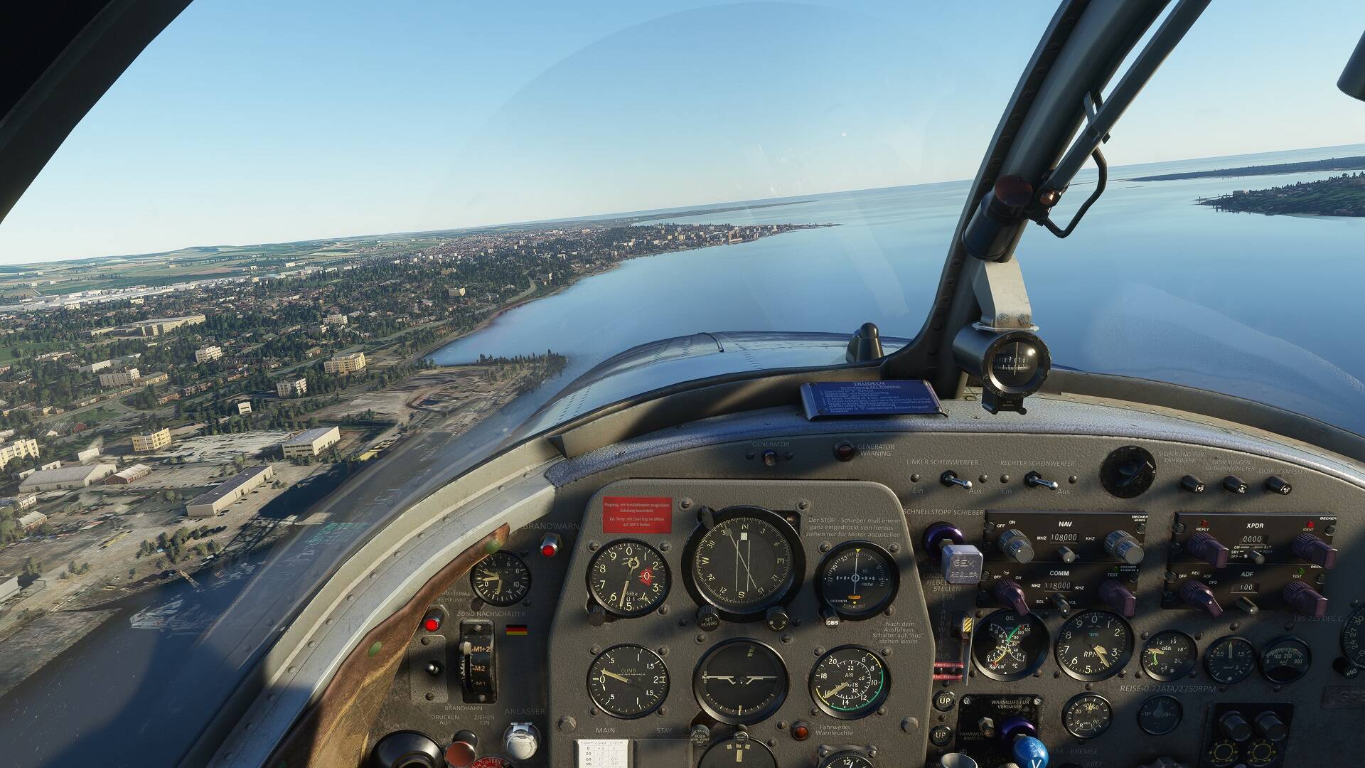
Great! Dunno what happened with St Andrews but we’ll overlook that for now :slight_smile:

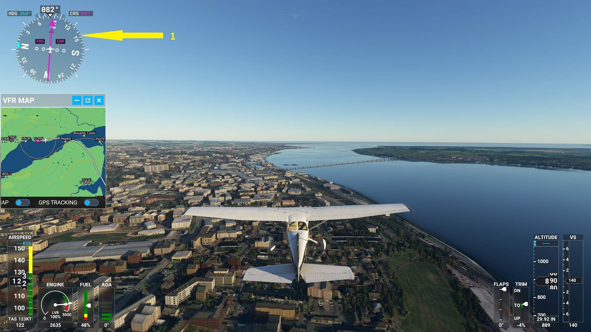
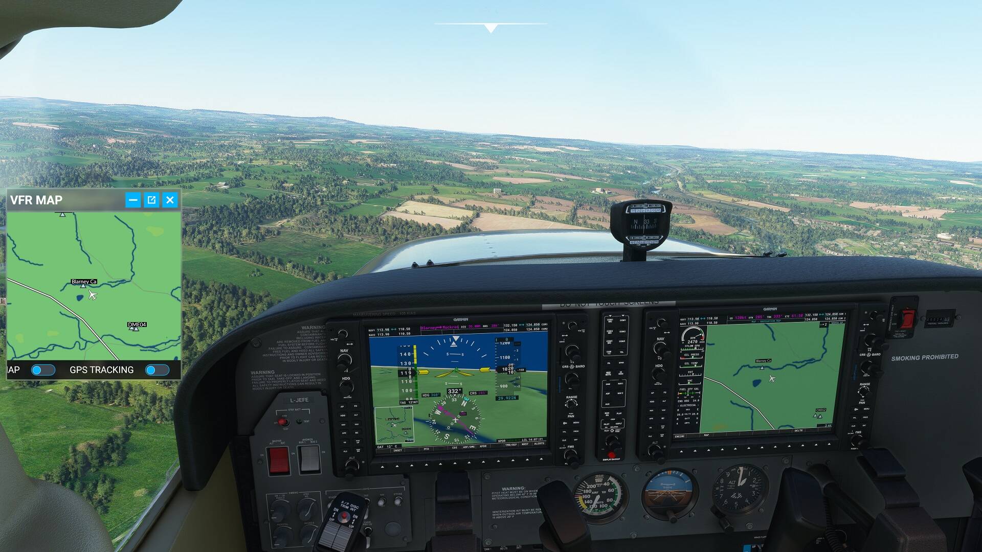
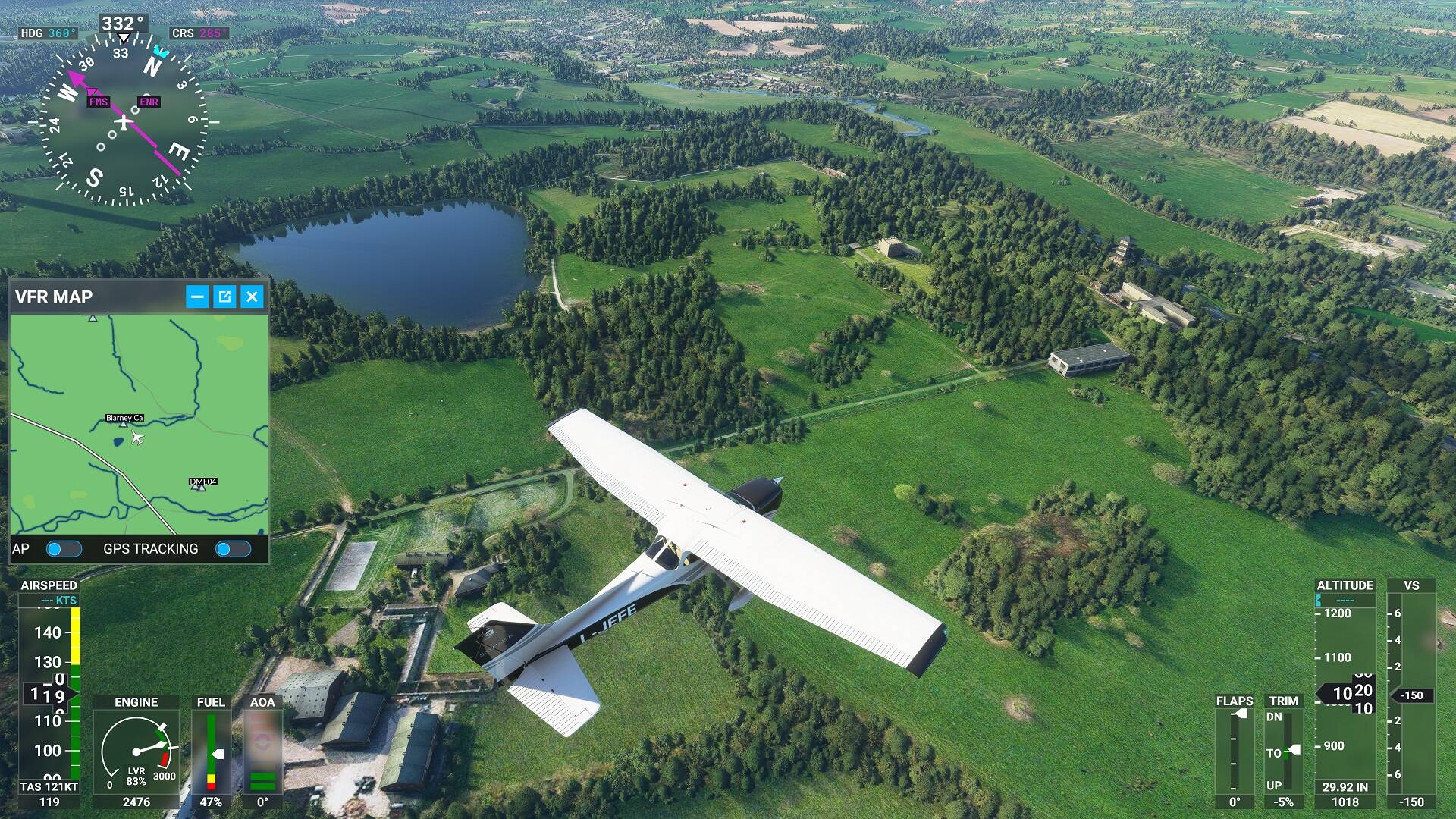
That is the most basic way to create a flight plan, I just wanted to deal with that up front. If you have GPS on your plane it should point the magenta line on the compass towards the next waypoint.

So the next thing is to do it in LNM and import to Flight Sim, then you can fly it and follow on LNM.

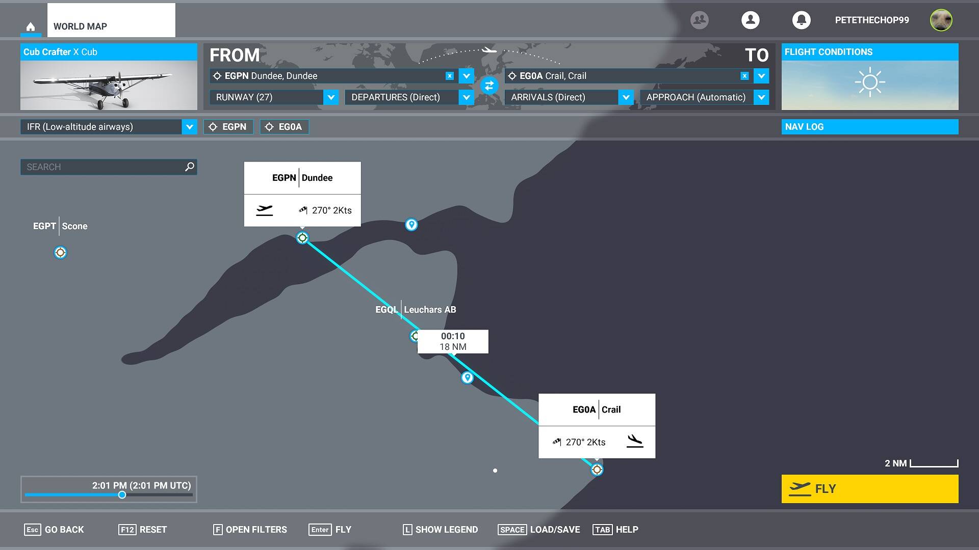
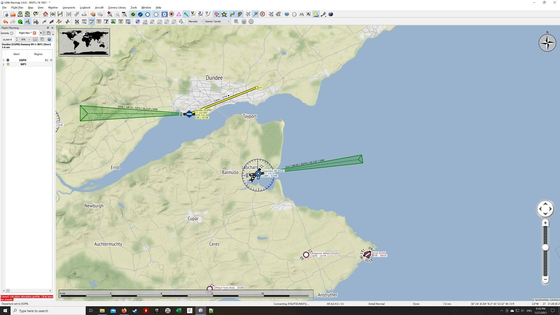
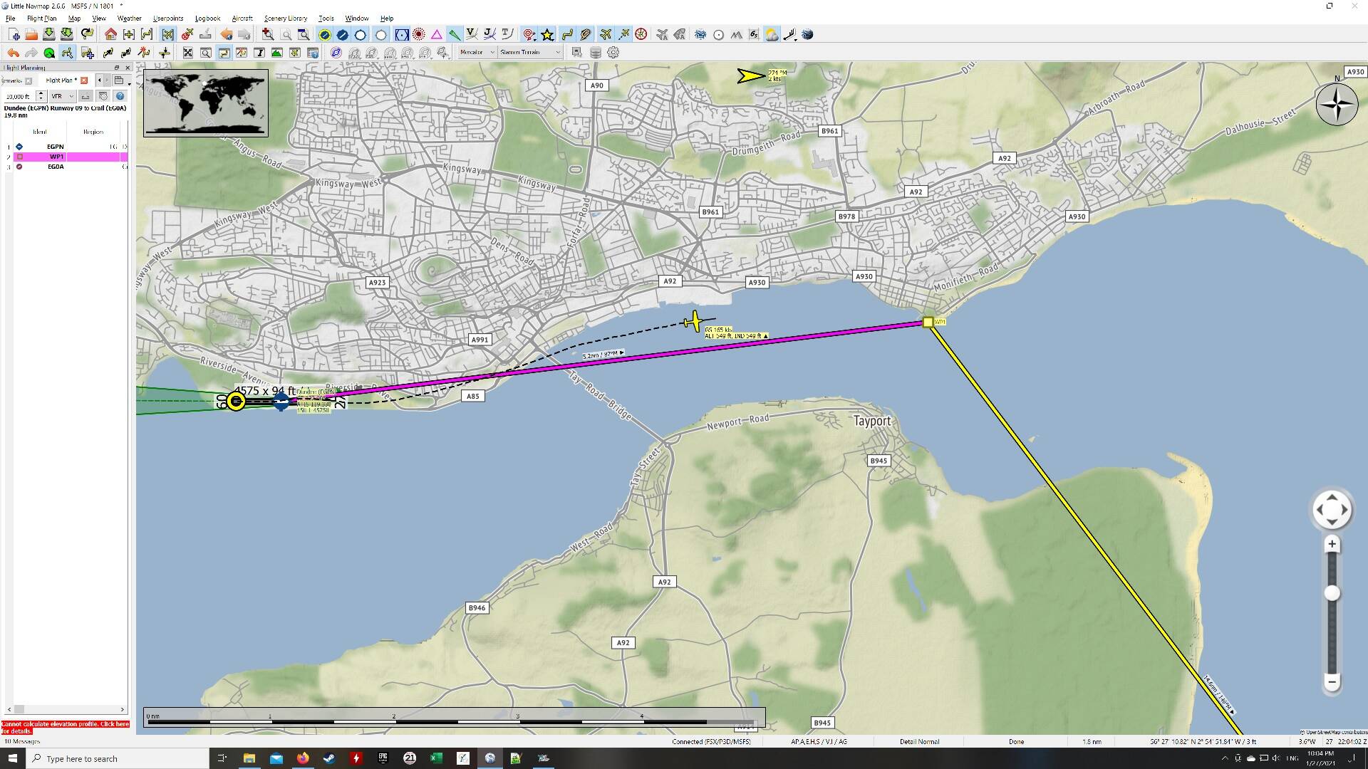
First open LNM and set Dundee as your starting airport (bear with me here - you can click on the screenshots below to make them bigger for clarity):

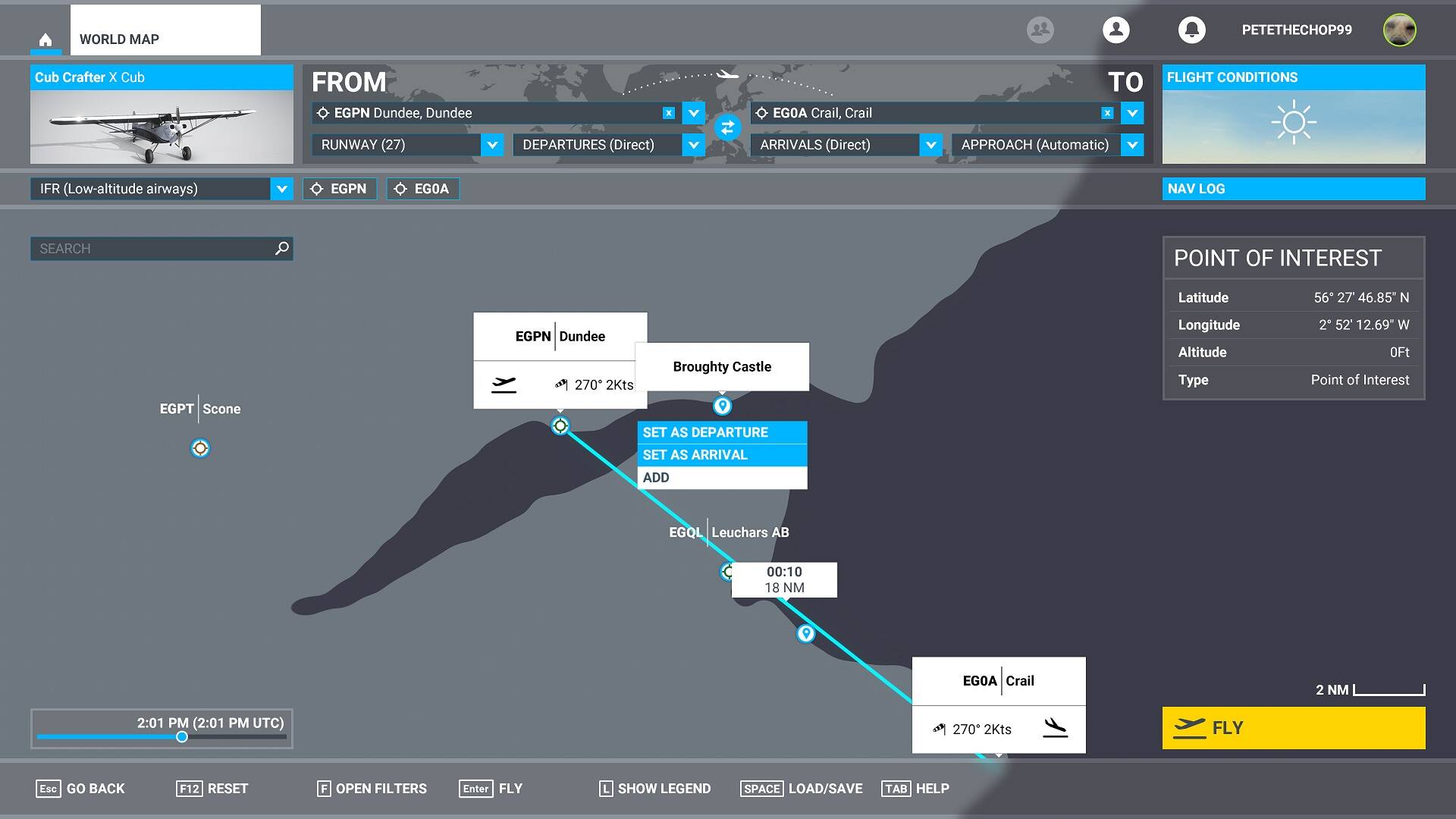
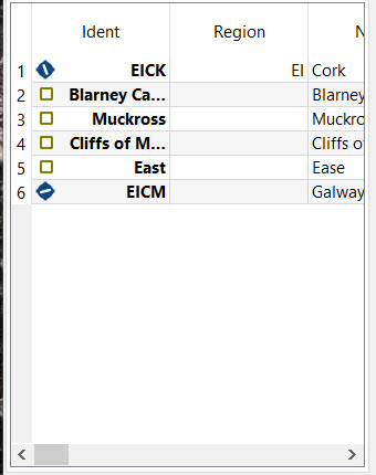
Then, you know Broughty Castle is to the east somewhere, so pick a position to the east and set your Waypoint 1 (via Append Waypoint in the drop down):

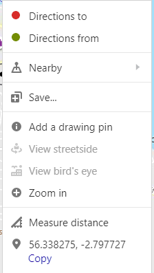
Now open Bing Maps and find Broughty Castle for real. Right Click on it and you get:

Click on Copy. For me, that brings up CTRL + C so do that also (I’m over-explaining but just in case, press the CTRL key and the C key together to copy the text):

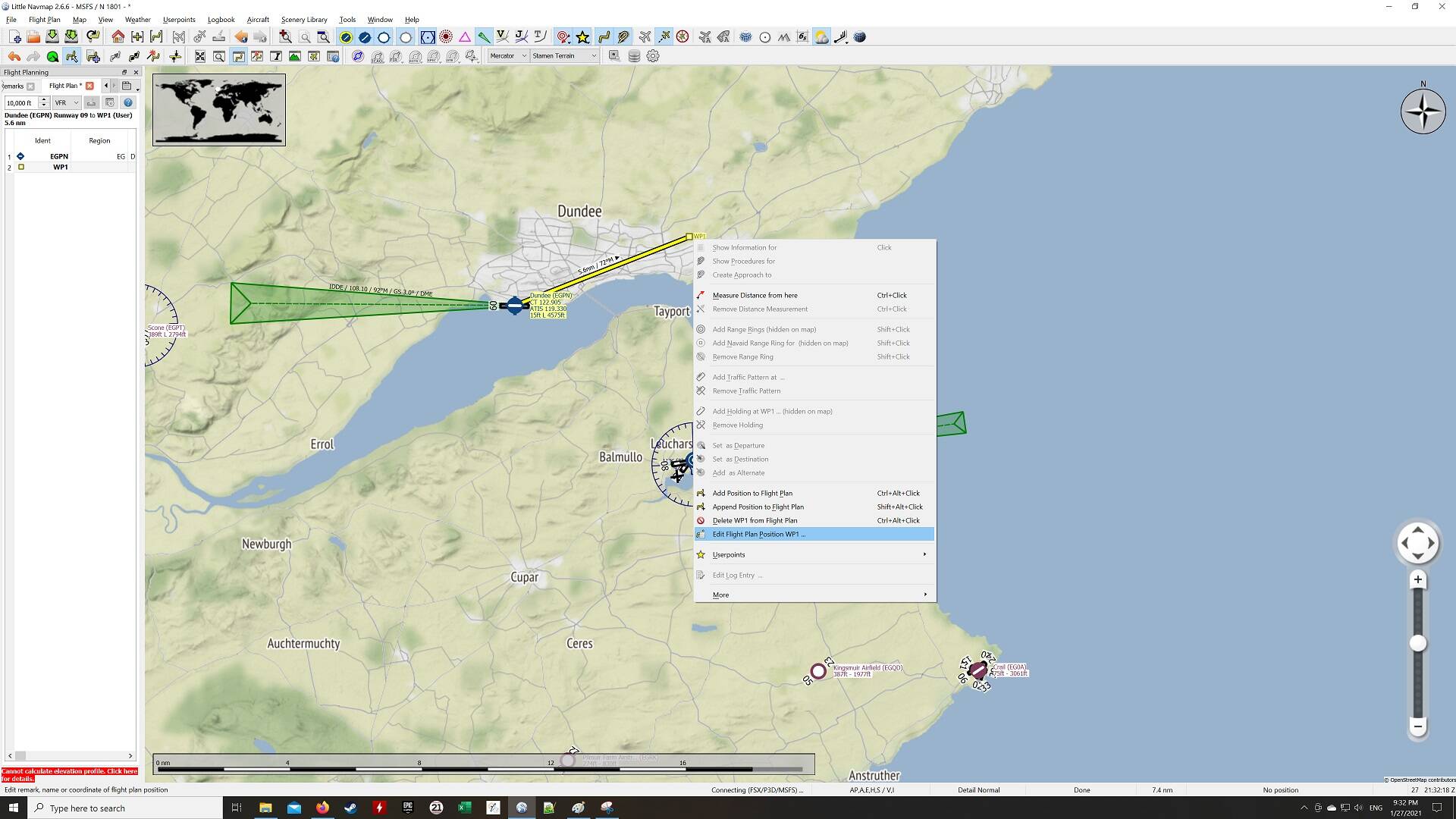
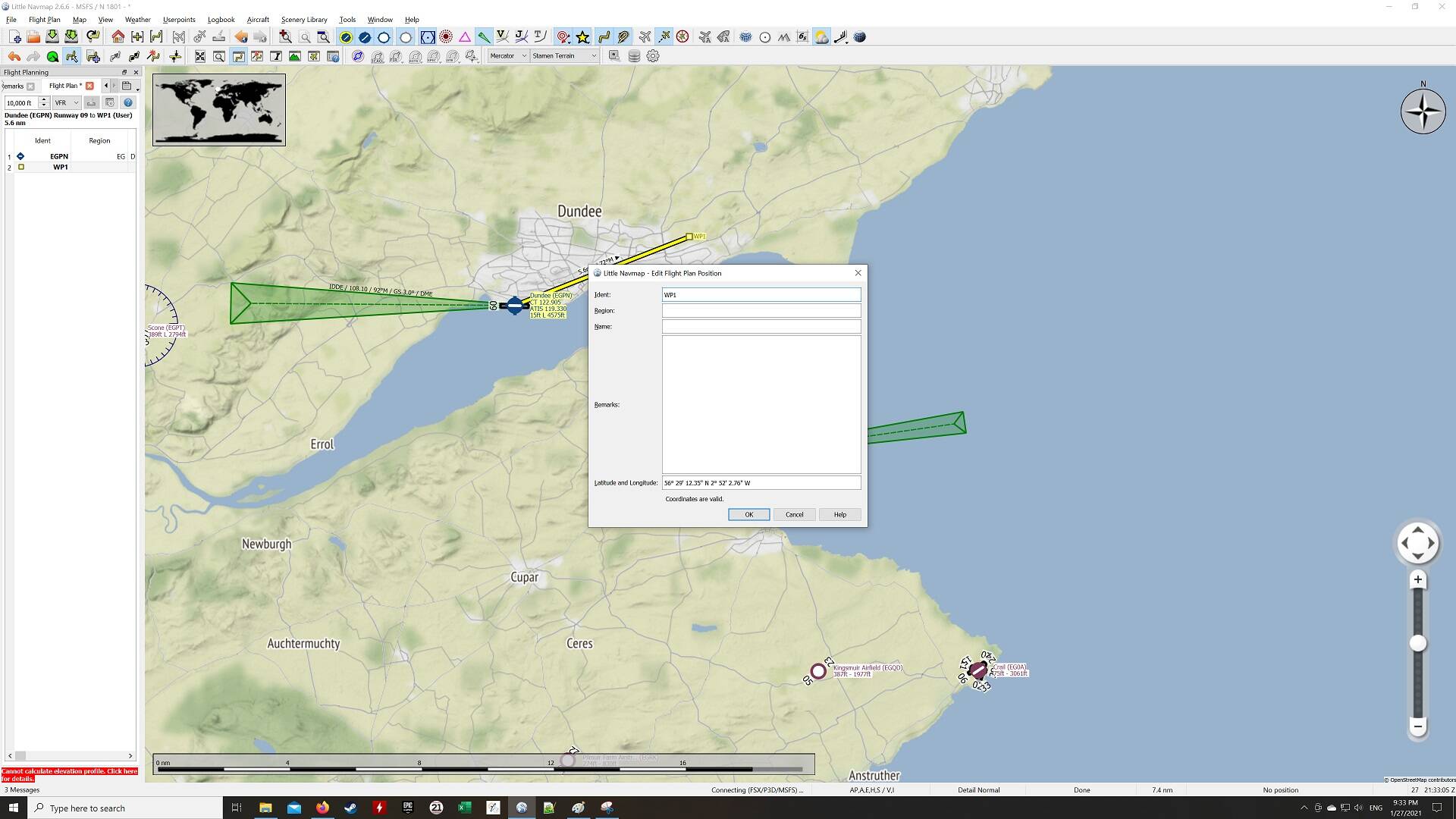
Now the co-ordinates are in your clipboard. Go back to LNM and Select Waypoint 1 by right-clicking. See the option that says Edit Flight Plan Position? Select that:

It opens a co-ordinate window:

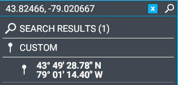
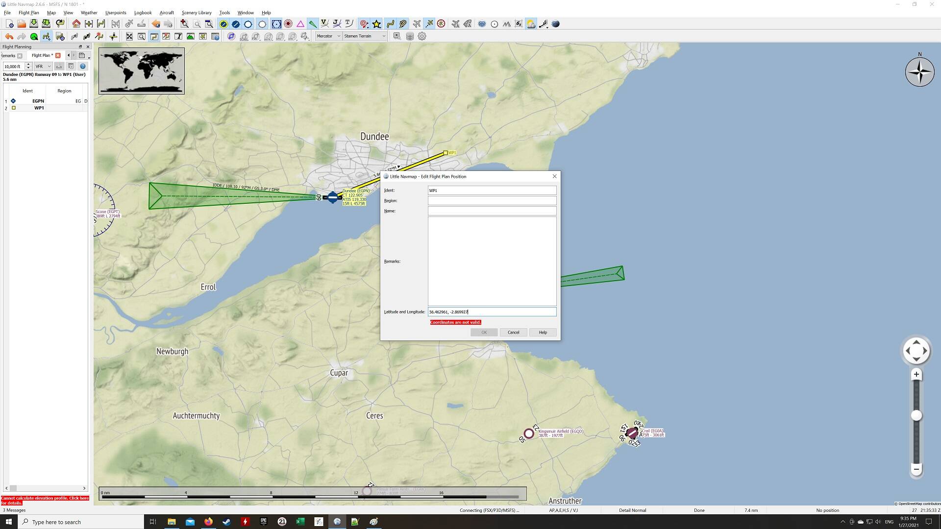
Paste in your co-ordinates. Notice it says they are not valid:

Just remove the comma in the middle of the two co-ordinates:

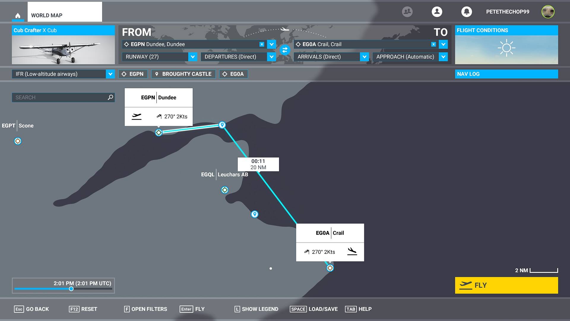
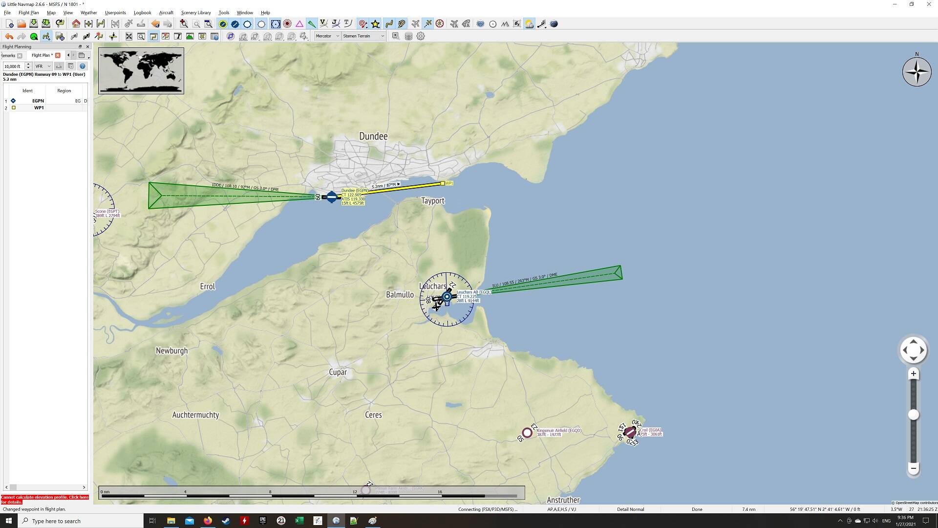
Press OK and you will see your Waypoint move to the position of the co-ordinates:

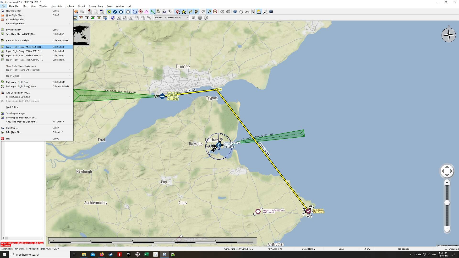
Now do the same for St Andrews. I just ended the trip at Crail here, because it would be six more screenshots otherwise. But do the same thing - create the waypoint, look up the co-ordinates, and put them in for St Andrews:

Now save your Flight Plan by choosing the menu path shown (Export as MSFS 2020 PLN):

Choose the path and Save

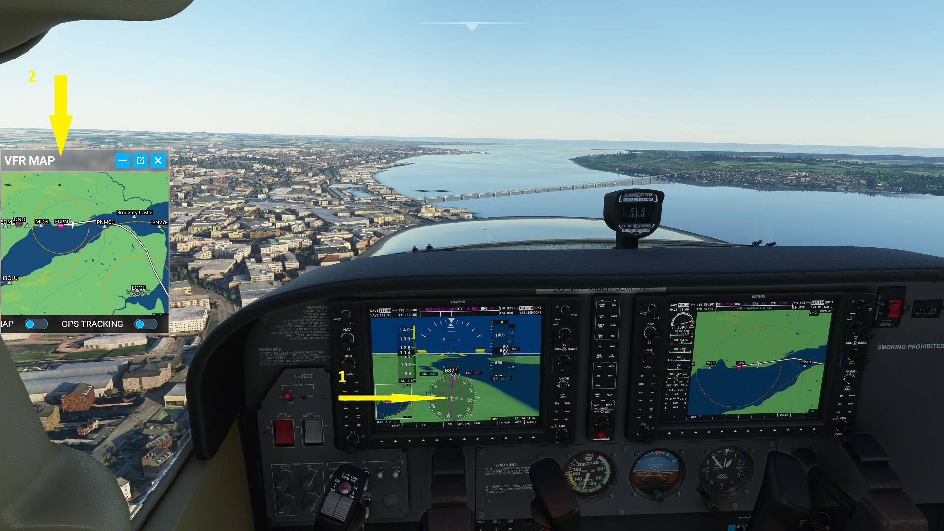
Now open up Flight Sim and load your plan (World Map → LOAD/SAVE) :

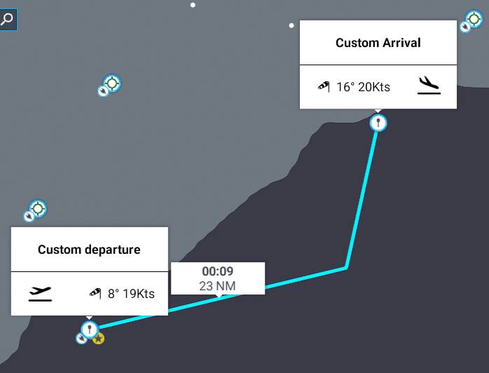
It loads in as a flight plan which you can fly:

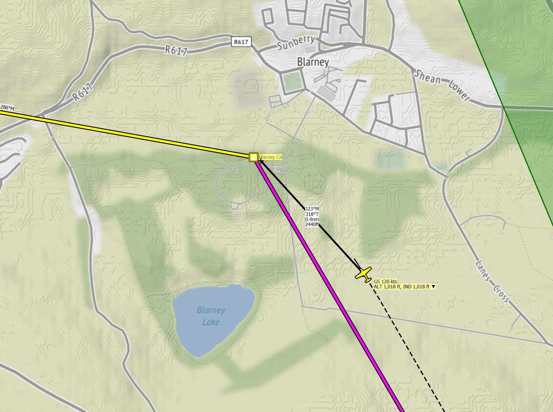
And if you keep Little Nav Map open when flying, it will track your flight, as you say:

Hope this helps - can you try it yourself? Try and get St Andrews in there. Remember to press the CTRL and C keys together to Copy the Co-ordinates.

Let us know if you’re struggling with any of this! Thanks.

2 Likes

Thanks, you are very gracious.

Their is a box under the plane with two choices I chose VFR the second time I tried ant flew the plan successfully finding both castles. I will try LNM tomorrow and let you know how that worked out. Making progress and thanks again.

1 Like

OK, I have created flight plans with LNM basically by getting coordinates from the WEB by querying the name of the object I am interested in, getting the coordinates, using Edit Flight Plan, creating a POI, naming it, updating the POI coordinates. Next I bend the flight line to include the new POIs I have created on the map using this method.

I then just take off from the departure airport using the magenta line in LNM to fly to the first POI. When I am almost there the POI disappears and I don’t see the POI. I have even circled around at low altitude looking for the POI but don’t find it.

I have been using Google maps.

Please disregard last post. I tried it with Bing and your suggestions. I worked - got the same result as when I tried it by creating a flight plan within the sim. Thanks for that.

I can get Google Maps in LNM. Is there a way to integrate Bing Maps into LNM as it might make flight planning a bit easier?

1 Like

Glad to hear it’s coming together a little better. We’re at the limits of my knowledge of these things so I’m not sure I have satisfactory answers from now on :wink:

  1. I don’t see why Google maps and Bing Maps should behave differently here (though obviously I don’t know for sure); I would advise you to tinker aroound with Google Maps/LNM a little more and see if you can get better results.

  2. When you say a POI, and the POI disappears, are you talking about the Waypoint in LNM, or the waypoint in Flight Sim, or the disc-like graphic that shows you POIs in Flight Sim (with distance to it etc)? I have these turned off as I like finding stuff on my own.

  3. One of your original questions was how to find the GPS co-ordinates from the scenery files. I agree this would be handy, but I had a look and it doesn’t look like it would be easy to identify and extract that data from the files.

  4. I saw a post on why Alex (LNM developer) didn’t want to integrate Bing Maps with LNM, but I can’t find it right now. He basically said, Google Maps is better so why would you want Bing Maps? This brings us back to Point 1 above.

  5. What plane do you usually fly in the sim? I’m sure you know that if you have a GPS-enabled plane, there is also a magenta line on the compass in your plane that points to the next waypoint. You can also press the ‘V’ key to see your plane on the map, following the route. (Press V again to hide it). Finally, pressing ‘N’ brings up a Nav Log which shows you compass bearing, distance and how long it will take to get to your waypoint. It is helpful, especially the map, and you wouldn’t have to switch out to LNM every time.

Anyway I’m sure you’re on top of all that and I’m just mentioning it in case you hadn’t considered it for some reason.

  1. When you have had your fill of POIs, have you considered doing any of the Bush Trips included with the sim? These are very good ways of challenging you and honing your navigation skills. Something to think about!

Greetings,

  1. I tried it with Bing because of your suggestions to use bing. It worked just fine - your instructions were just fine.
  2. I don’t turn these off as I am working on my skills to fly my Cessna 1000 quickly until I get within 2 miles of the POI so I can drop down as low as possible to get a good look.
  3. I guess it would be a bit easier but it is not a show stopper. What is annoying to me is that I cannot see the folder/file structure of the sim. I am used to understanding the file structure of applications I am using - not big deal right now.
  4. I saw the same post and the Google maps look just fine.
  5. Right now I am flying the Cessna 1000 and I do get the magenta line when I have LNM connected so I can watch the flight line. Don’t really have to but I got into the habit. One thing I notice is sometimes the plane shown in LNM is pointed in the wrong direction which I can fix by changing the departure runway but it is a bother. Can I use the heading bug to point the plane in the right direction before take off or just hope I select the runway that best suits the direction I am going to fly to for my first POI.

I don’t understand your reply to number 5.

  1. My obsession to POIs has to do with my study of history.

I really appreciate all your help but I think if you can clear up point 5, I can move on to other skills.

Hello,

Ok, just to clear up point 5; I’m assuming you are using the Cessna 172 (G1000). The G1000 bit refers to the Garmin Global Positioning System that is installed.

Which allows you to track your flight. In interior view the arrows point at (1) the magenta line on your compass which tells you what direction to fly in. And (2) by pressing V you can track your flight in a mini-map which shows the plane flying along it just like LNM. So when you hit your waypoint over Broughty Castle, the magenta line will swing around to the south to show you that you need to turn that way. It is a bit ‘looser’ or the route is somewhat ‘rounded off’ as you can see. Click to make the screenshots bigger.

And in Exterior view it’s a bit clearer:

As regards the runway thing, I don’t think much can be done there apart from manually changing, as you say. I suspect the issue is that the Sim always wants you to take off into the wind and so it positions you on the appropriate runway. This is apparently how it is done in real life. And the prevailing wind is from the south west in that part of the world, so that’s why it mostly puts you on the runway pointing away from your flight path. That’s my theory anyway.

Hello petethechop99,

As I said previously I was able to fly the plan I created under your tutelage - worked great. I created a flight plan in Ireland that goes from Cork to Galway flying by a few POIs that I created using your guidance. The first POI is about 6 miles Cork airport and the pointer appears and I track the flight both visually following the pointer and using the LNM magenta line. When I get about 2 miles from the POIs the pointer disappears and I cannot find the first POI. The magenta line for the first leg disappears and a magenta line appears with the heading and pointer to the next POI.

I followed your directions. This is the flight plan not-Encrypted.

IFR Cork (EICK) to Galway (EICM).pln (2.3 KB)

2021-02-03_17-24-24

Can you shed some light on this.

BTW, What is your name, mine is Henry

One More,

I have downloaded a group of folders in a path Local Cache > Community. Do these represent attractions that are available to me to put in flight plans. How do I use them with LNM?

Hi Henry (my name is Pete, btw), I hope you are well.

Yep, you’re absolutely right; the flight plan moves onto the next leg of the flight when you approach the POI. That’s weird, I guess they want you to ‘round off the corner’ of the flight plan, while still telling you you have ‘reached’ the waypoint?

Nice plan, by the way. I loaded it up and tested, and it behaves exactly how you said. I paused it at the exact moment the magenta line changed direction. As you can see from the VFR map, I’m not quite at the POI:

Looking at external view, you are quite close though. (EDIT) The castle is the Japanese Pagoda thing at 2 o’clock, which is what the game has interpreted it as :slight_smile:

And LNM bears that out; you are short:

But (slightly) good news - I measured it and you’re only 0.4 of a nautical mile away:

So it’s not 100% precise, but it’s not too bad, really. I haven’t been able to find anything online about this (because the search terms are too common, basically), so I don’t know if that’s how it works in real life or is a bug or what. Maybe someone who knows about these things will weigh in.

Regarding your Community Folder contents. I assume that you can tell what you have downloaded, so the onus is probably on you to find out the co-ordinates and create a plan in LNM.

The other alternative is look for the POIs in the World Map screen and create your flight plan in Flight Simulator, i.e. the very first method we discussed a few posts back. Remember you can always create a flight plan in Flight Simulator, save it, and then import that flight plan into LNM, if you want to follow it in there too. That way, you have the best of both worlds.