As a simmer who flies mainly GA aircraft it would be nice if both the planner and the EFB would show charts for flights, at the very least airport diagrams and approach plates. I can’t be the only one thinking this is a big gap.
1 Like
Especially when flying GA / VFR, I find Navigraph to be significantly better than the new stock maps. Don’t get me wrong, it’s nice to have a default offering that will suit most people and provides a lot for IFR. It is not really suited for serious VFR flying currently, as many airspaces (in Europe) are missing. Let alone all those aerodromes that are not covered by LIDO. Navigraph remains a great alternative with much better true-to-live coverage.
2 Likes
Both the web planner and EFB planner app show all of the charts that LIDO has. If the airport does not have charts, then they are not available from the provider.
For GA VFR the Lido charts are not useful. We need for small airfields traffic pattern and we need all airspaces (controlled, restricted …) to avoid penalties in carrer mode. Now you get penalty for flying in restricted airspace but you don’t see in the EFB. You can plan your flight with flight planner, but you can not import in EFB during carrer missions..
The information are in the flight planner, so I don’t understand why the same information is not integrated in the EFB?
1 Like
I suggest going with Navigraph. I pretty much only fly GA and I find it quite valuable. They provide VFR and IFR charts. Worth noting I pretty much only fly in the US.
Indeed, the Navigraph integration into the new EFB is in beta currently and it provides roughly the same feature set as before. If you’re using MSFS 2024 to follow real-life practices, there is no other way than Navigraph. It’s the same data that powers ForeFlight.
I still hope for many improvements to the Navigraph offering. For once, track-up or heading-up would be great in addition to north-up. Maybe they can even integrate their various layers into the new EFB map to chose as different options. I think the new flight planning in the EFB is sufficient for my needs, but I want Navigraph VFR maps, aerodrome info (frequencies, etc.) and charts. I personally, don’t use Simbrief, so I am hoping for a deeper integration into MSFS2024’s EFB in the future. Time will tell…
This data is actually not part of any AIRAC, so cannot be provided.
Hmm, airspaces should already be shown on the EFB moving map. Do you have an example of an airspace that isn’t shown, that you have selected for that type of airspace to be shown in the map layers options?
The only option here would be to download VFR charts yourself from the AIP, unfortunately there isn’t an option to upload files to the EFB and apparently it isn’t possible for the EFB to display PDFs so maybe other file formats could be made an option? It is quite easy to convert PDFs into images online for example.
1 Like
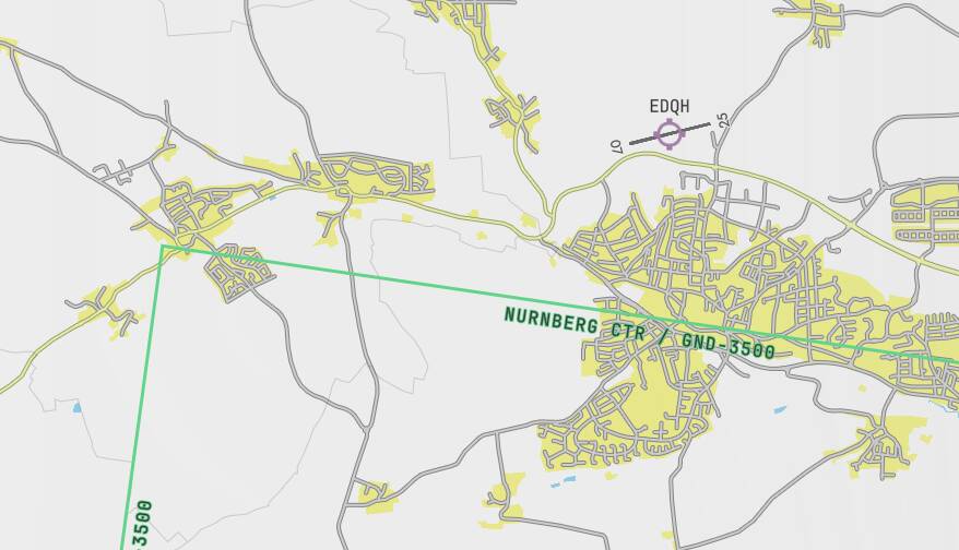
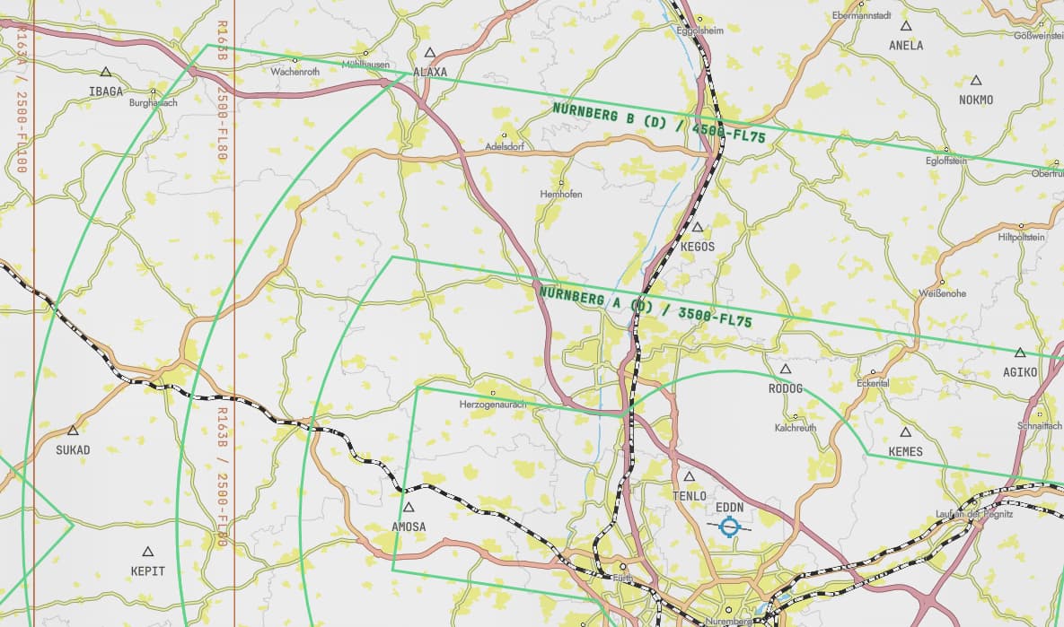
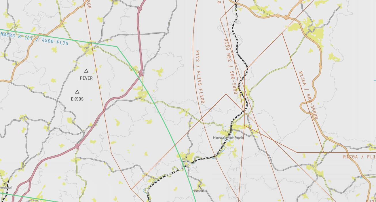
The information in the EFB about airspaces is absolut useless. There are a lot off small blue lines which are representing the border of airspaces, but there are zero information about the kind of airspace (C, D , restricted…) also with no information about height and so on.

this picture is from openflightmaps.org - you can clearly see the difference. There are information of the kind of airspace with information of height and for small airfields the traffic pattern is included.
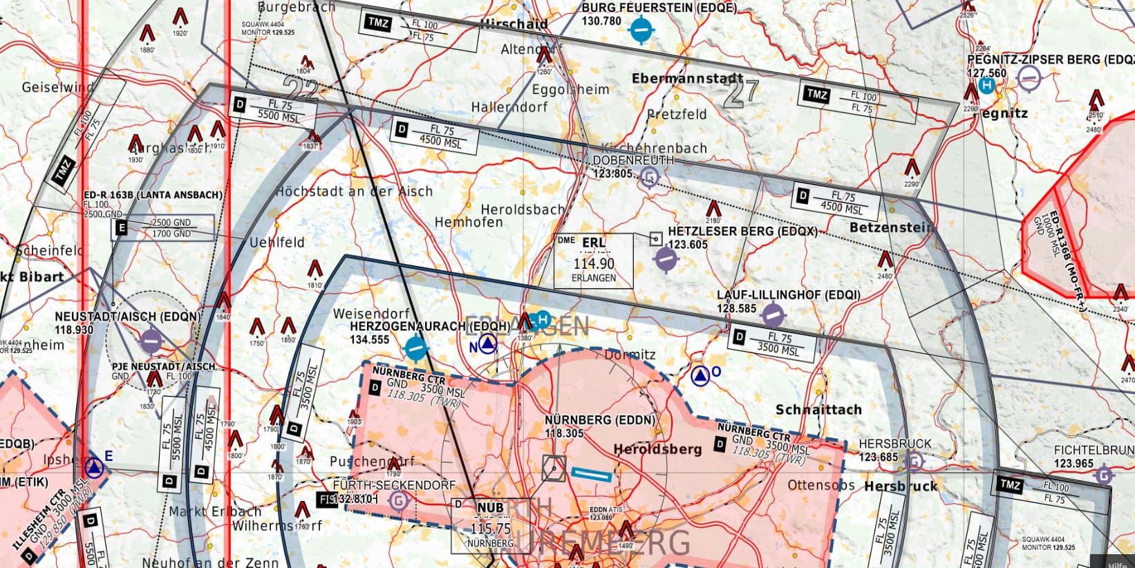

The minimum information in the EFB should be clearly to see the kind of airspace and the height and clearly to see the border not only a weak small blue line.
In the https://planner.flightsimulator.com/ the information is better, so why this better information is not in the EFB?
1 Like
We are limited by the drawing performance of the Coherent framework in the EFB and HTML Canvas. Unfortunately this means we can’t draw as much on the map as we can on the web version, which can use WebGL, while Coherent in-sim cannot.
This this not limitation due to trying to fit into console performance budgets, before anyone asks. ![]() Even PC will get huge FPS reductions with larger canvas draw loads.
Even PC will get huge FPS reductions with larger canvas draw loads.
If we were to attempt to draw everything the web planner can draw (roads, airspace labels, cities, weather, airways, etc), we’d get about 5 FPS doing it, unfortunately.
That being said, we do draw the airspace areas, and use a consistent line style for each airspace class, so you should be able to tell at a glance which kind of airspace it is.
Okay, I can understand the performance reasons. Then it would at least be nice to get information about the airspace (type, altitude) when you click into the airspace. Would this be possible?
It would also be nice to be able to display your own PDF (e.g. AIP of airfields).
But the most important thing is to make it usable in VR, because I am only play in VR ![]()