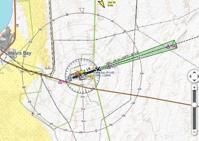
I just landed at Walvis Bay in Namibia (FYWB) and I see that in the sim and on Littnavmap there is a cross at the start of runway 27. ATC was telling me to line up for 09 but I wanted to land with the ILS so I landed on 27 anyway and got told off, but I’m wondering if the cross meant that landing on 27 was prohibited, in which case why is there an ILS on 27 and not on 09? Any clues?
X indicates a runway is closed or not in use…
the reasons can vary for that but landing on a closed runway will get you a letter from the FAA if I recall correctly (IRL)
Probably not, if you’re landing in Namibia.
right - aircraft landing and taking off on the same runway in opposite directions is hardly the way to enjoy a long career in aviation though. Even in Namibia.
But why is the ILS active on a closed runway? A mistake in the game?
There are many runways worldwide in FS2020 with crosses. In real life the airports or runways I came across are not closed. So my best guess, an error in FS.
might as well put this here for those who might not know what all the airport demarcation lines represent. It does not include the (X) designation but all else is here
12 Runway Markings and Signs Explained By An Actual Pilot (century-of-flight.net)
this one is FAA and DOES include the (X) designation
Aeronautical Information Manual - AIM - Airport Marking Aids and Signs (faa.gov)
of course in a flight sim you can ignore runway demarcation lines - you can ignore runways altogether and land anywhere. No harm, no foul as they say.
but if you want to practice how you play ( I was a hockey coach for many years) you’ll want to observe the rules - down to their spirit or intention.
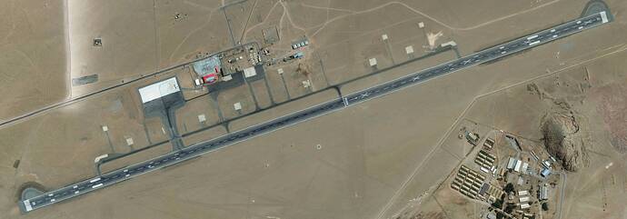
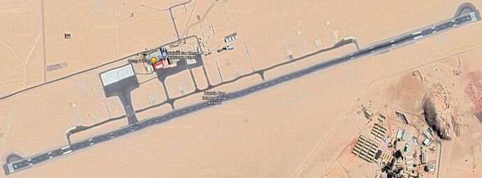
The airports are autogenerated based on whatever snapshot in time happens to be on Bing Maps aerial imagery. So a temporary closure could become more or less permanent unless Bing is updated or somebody manually fixed it. The runway in this case is indeed X’ed out on Bing:
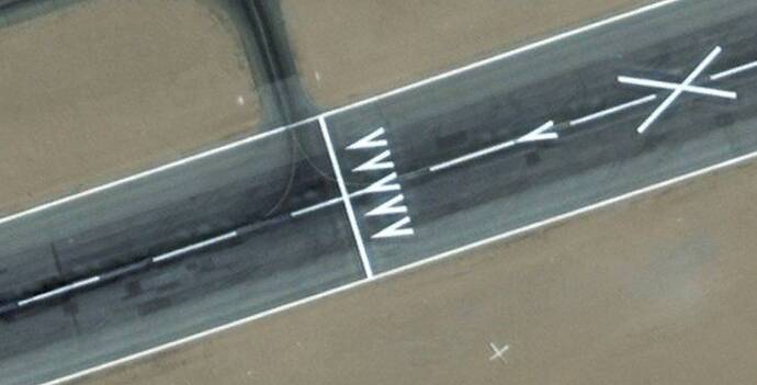
But only half of it is:
So I’m assuming you can still land on 27, just the latter half of it?
there is no 27 painted on that end of the remaining runway…so I would think not.
since the X’s are painted along that half of the runway at regular intervals, only runway 9 is open.
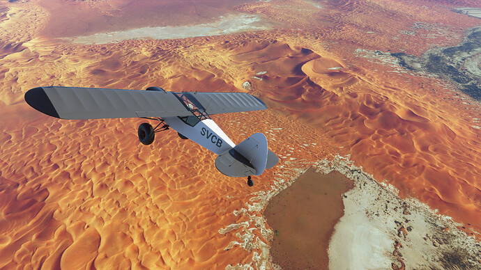
Thanks for all the info folks. The scenery along the Skeleton Coast in Namibia is quiet amazing, well worth exploring.
Thanks, I’ll put that on the list for sure. I’ve read about how stunning the landscape is there.
I’m still wandering the Sahara in southern Algeria and Libya, which I also highly recommend:
ok - but there is no ‘hold short’ line at that end of the taxiway - only at the other end. That seems to indicate only the rwy 9 end is open for TO and one might assume based on the other demarcations that that already applies to landings …but you have a point. LOL - I should have opened the image to see the closeup view. My eyes are not what they used to be.
If I were approaching this field and were not already familiar with it first hand, I would either land on rwy 9 or -if the wind was a factor - go elsewhere to land. 27 appears closed to me and I would not split that hair - Namibia or no
You’re wrong in this case, and @SkipTalbot is correct. There are many runways out there where a portion of the runway has been closed. He showed you an image proving the runway is open and you stuck by your guns… Why?
And why would you be flying into an airport without having read the NOTAM’s?
Granted, the latest NOTAMs put ILS RWY27 in test mode and not for operational use (it’s been that way since at least 2004). But, RWY27 is wide open and the full length has been available since 2007 when construction was completed. And Google Earth shows it to be open.
Why would 09 be open but not 27? That makes no sense, unless there was an obstruction at that end.
Another example where MSFS has closed a runway that is actually in general use is runway 00-18 at KLEB. I just landed there about a month ago. That runway is quite active.
MSFS imaging is obviously out of date for FYWB. Can’t really blame MS/ASOBO though, half the world’s simulator websites claim the runways are 7000 feet instead of 11000 for example.
As said by FlyingsCool5650, Google is also OK, although the runway is a bit squiggly 
That’s not necessary. Just a friendly discussion.
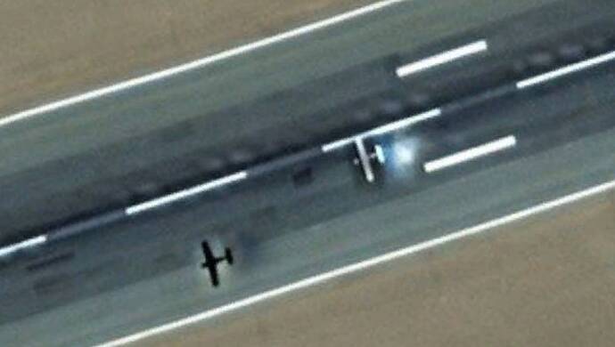
I’m not further provoking an argument, but it looks like somebody is actually using 27 in the Bing imagery lol:
One of those instances where Bing Maps has higher quality imagery than Google. I found lots of spots in Africa like this actually, maybe because Bing has a newer imagery set. These remote African deserts perhaps were some of the last places to be added or updated, and are benefitting from newer tech as a result.
@FlyingsCool5650 - it’s just a conversation… and it really isn’t important in the context of a flight sim forum or anywhere whether people agree with me or not.
If we’re talking about the real world, NOTAMS aside - I would personally prefer not to land on a closed - X’d out runway. or half runway, not without direct first-hand knowledge of the reason and general practice. That’s all - everyone can do as they please, as always.
I’ve been exploring places I’ll never fly in real life, lately the Nile in Egypt.
Spawning on the runway at Abul Simbel I couldn’t help but notice the huge cross right in front of the aircraft. On returning to land I was given the same runway complete with approach lighting and runway lighting and Crosses all the way along its length. Right next tö it is a parallel runway with the same lighting but no crosses, but ATC seems not to use it😯
This again shows how hard it is to get airports right at any point in time, especially the smaller ones. Airports change all the time, runways are repaired, etc. Looking at the bing map for Abul Simbel HEBL, there were major works going on at the time the picture was taken. Hey, this is a simu… hmm, game. This is all part of the fun  By looking up the location, you learn a lot…
