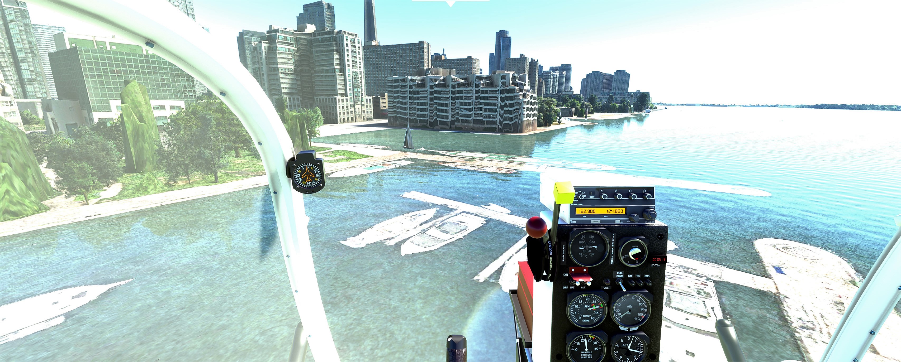
CYTZ - Boats under water plus disfigured buildings and trees.


1 Like
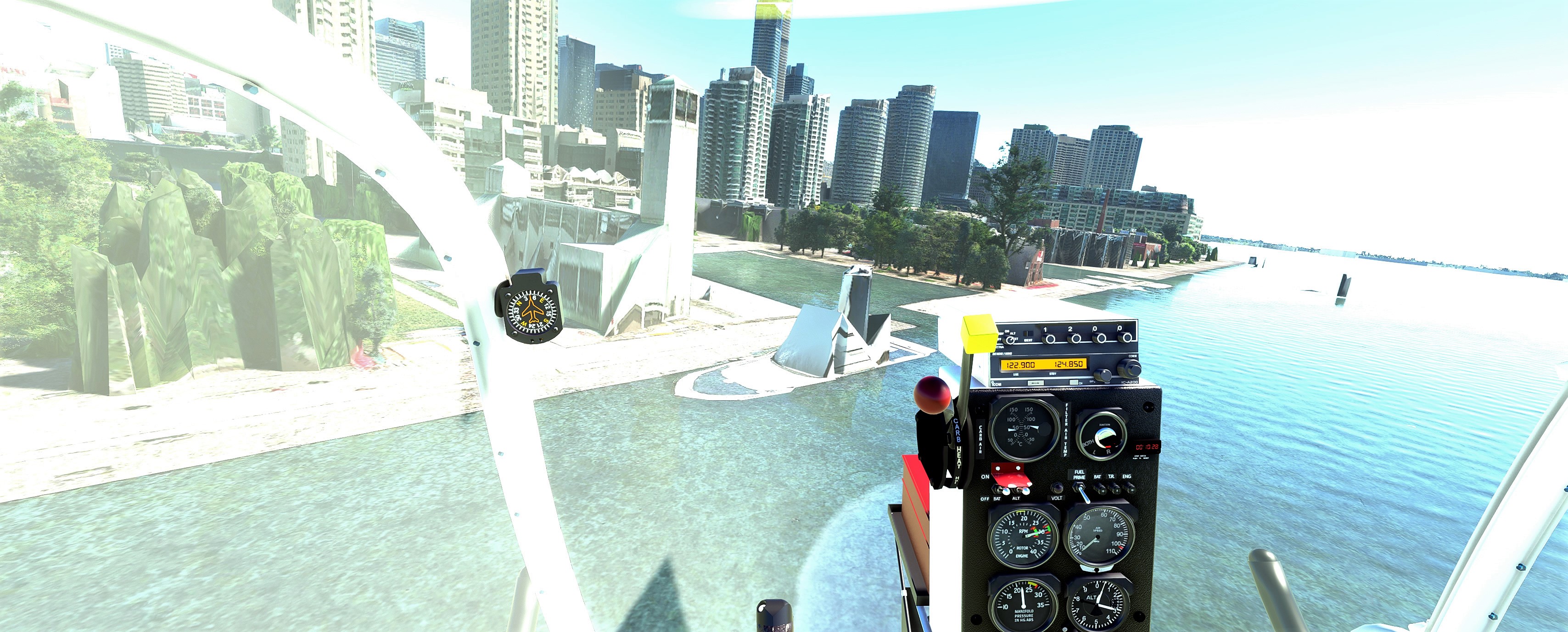
This isn’t really unique to CYTZ. Marinas and shipyards look like that everywhere in the sim when using the default data.
Ditto for trees. That’s bad photogrammetry data where whatever AI is used can’t discern between trees and buildings and renders them as oddly shaped green buildings.
1 Like
I have been flying around the world on MSFS and CYTZ is the worst in the entire sim.
Since update 5, I have not seen boats under water at other locations around the world.
Also I have not seen distorted buildings or trees either.
There is no AI boat traffic at CYTZ.
it’s not unique to CYTZ or SU5
2 Likes
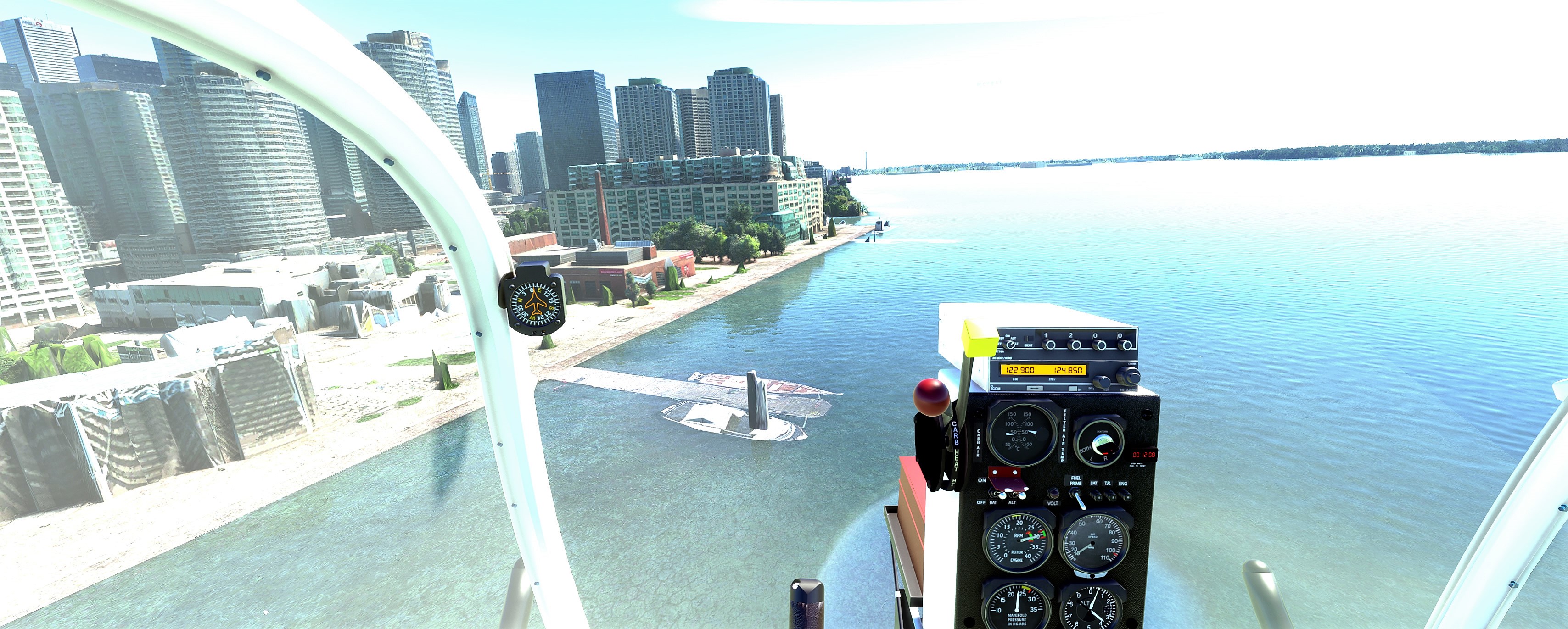
Correct. Its been like this since launch. Half of the Boise Bench is under water, the New York Canal looks like the Mississippi, with cars driving through it.
The Payette and Snake Rivers run half way up the mountain and the river bed is interpreted as a road in places. Black Shark AI works very well expect for where there is water, or large vertical landscapes, then it goes a little rouge and doesn’t really know what to do.
Everywhere I fly with a small water ways has wild / odd renderings. Irrigation canals are pretty wild to see what the AI does with… Very common to see a Mile of a massive river, followed by road, followed by “close” to real water way etc…
Summary: The AI can’t handle water / Land boundaries at all right now, been this way since day one.
Yes I noticed that the seacat in the isle of man had sunk 
Yep, totally normal, everywhere in the world, except handmade sceneries.
Maybe one day the AI can handle the marinas particularities.
I don’t know where you’ve been, but this is exactly what it looks like at pretty much any marina anywhere in the world in MSFS and has been since launch. Ditto for the tree issue. This has nothing to do with SU5 at all. The only exceptions will be for hand-crafted scenery.You need to visit more marinas. Share screen shots of those. You’ll see they’re no worse than the areas around Toronto.
You can also disable the photogrammetry. When you’re close of the buildings, it’s look better, even if the buildings are not the real ones, in that case.
For AI boats, you can buy a product of Seafront simulation or try the freeware traffic of AI Global ships V1.
Disabling PG will make buildings look better in the sense that they’re properly 3D modelled items, but they’re all generic and not really accurate to the area. Some people are ok with this. Some people would prefer photo accurate areas. This also fixes the issues with the blocky tree buildings.
It does nothing for underwater marinas and boats though. Those are there permanently, as they’re part of the satellite imagery used to texture the shoreline. It would likely take a significant improvement in the Blackshark AI to recognize those items as what they are and replace them with models.
And I also strongly recommend the AI Global Ships mod. That makes the waters look far more alive.
1 Like
I have purchased Seafront Simulations software and it is absolutely fantastic.
Flying MSFS in realistic mode is the only way I fly.
My helicopter settings are on realistic mode.
I only fly in realistic weather mode and since update 5 this is now really amazing.
This is the only way I fly.
Photo geometry is bad because Bing Maps was abandoned many years ago.
The landscapes around the world have been developed far beyond what Bing Maps is currently showing.
This is a significant problem for MSFS.
Some one at Microsoft needs to desperately bring Bing Maps up to date.
Go to your nearest airport to where you live and fly around places you visit frequently and you will see what I am speaking about.
Bing Maps also needs its zoom desperately updated.
If you compare Google Maps to Bing Maps, there’s an obvious disparity there in terms of high res imagery, photogrammetry, etc. That’s not really surprising considering Google have a 10+ year head start on the competition. While others were lauging at them for doing this “useless stuff”, they were busy putting systems in place to make this happen. Once it became obvious there was value in what they were doing, competition (Bing) jumped on board.
Bing isn’t abandoned. In some cases, it even has newer data than Google. My local area around CYGK is a few years old in Google and not terribly high resolution. The satellite imagery in Bing is from last year and of excellent resolution.
Now in the sim, the world imagery hasn’t been updated since launch. It’s not real-time updating with what’s on Bing. The exception being areas they touched in world updates. My local area shows stupid low res satellite imagery from Bing that goes back to almost a decade old in some areas.
MSFS team had to go outside of Bing to acquire a lot of data for world updates. Bing’s data was just not good enough, so they had to resort to other parties to provide the data, which was then incorporated into Bing as well.
But overall, I don’t think anyone will argue than when comparing Google and Bing (in all aspects), Bing is a clearly inferior product.
That’s right, Bing is behind Google, for sure. But, to have detailed buildings so close, we will have to wait for Street View ! I don’t know how much petabytes it could take !
And how many servers acting on global warming  …
…
Most Islands that I fly the scenery is looks good at this time and the weather is amazing as I fly the helicopter up the mountain, around the mountain and down the mountain the the effects of the cross winds affecting the helicopter is absolutely realistic.
I was just flying at the Graciosa Island LPGR and the weather is overcast and mysterious.
There are no boats but WOW!!! it is just amazingly beautiful and it will get better as MSFS continues to be developed.
I have a vibration system on my helicopter simulator and MSFS duplicates the helicopter vibrations perfectly.
The load forces on the helicopter blades from the winds duplicated on my vibration system is just incredible!
Its is absolutely incredible!
1 Like
Welcome to the mysterious world of MSFS !
It will be even more mysterious after the bugs of the next update  !
!
1 Like
I said the weather was mysterious because it is a little windy and stormy over cast at Graciosa Island LPGR right now.
I really love flying in real weather mode in MSFS.
Once, the weather was strange : the clouds were low but undefined, more like a grey haze with the sun rays going through and a light rain.
So, I jumped into the Sim and it was the same, perfectly the same…
Fly safe  !
!
I was one of the unlucky folks who had broken live weather (as in no weather at all unless I chose a preset) for a long time. I lost my weather back in one of the November updates, and the issue was only found and fixed back in SU4 I think??? In any case, for me, it’s live weather or bust. Some people swear by Unreal or REX. I tried Unreal, but didn’t like it. Didn’t look natural to me. I think Live Weather just looks far more natural. Accuracy can be hit or miss, especially with the ATIS and doesn’t always match real world METARs, but ■■■■, it’s good enough for me.
Don’t mean to go off-topic, but I saw the Seafront Simulations software and decided to get it. But to get it requires ORBX Central, which I have downloaded and installed.
My question, I have bought a ton of ORBX stuff through the Marketplace, is there any way to have ORBX Central see what I already have installed through Marketplace?
Nope. Even though they’re the same add-ons, they’re seen as separate due to being from a different store. Much like MSFS purchases from Steam don’t get carried over to Xbox.
1 Like